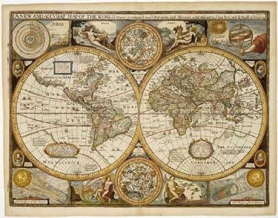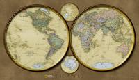
Historische wereldkaart Wereld antiek 1651 90,5 x 69 cm | Freytag & Berndt

0
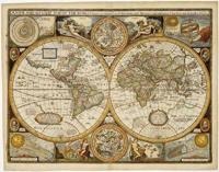
Historische wereldkaart uit het jaar 1651. Deze papieren wereldkaart wordt geleverd in een stevige plastic koker.    The map is marked with the names of countries, major cities and ports of the time, along with the charted seas and islands. The exceptions are the extreme north of America, and Australia, which is alluded to as 'Psittacorum Regio or...

Verkopers met dit product

Verkoper
Bezorging
Prijs
DeZwerver.nl logo
DeZwerver.nl
5,95
22,95

Anderen bekeken ook

Historische wereldkaart Wereld antiek 1651 90,5 x 69 cm | Freytag & Berndt
Historische wereldkaart uit het jaar 1651. Deze papieren wereldkaart wordt geleverd in een stevige plastic koker.    The map is marked with the names of countries, major cities and ports of the time, along with the charted seas and islands. The exceptions are the extreme north of America, and Australia, which is alluded to as 'Psittacorum Regio or the Country of Parrots, soo called from ye extreaordinary and almost incredible bignes of those birds there'.   Surrounding the map are many interesting insets: the celestial hemispheres are shown, along with their  constellations; two diagrams explain pictorially how solar and lunar eclipses occur; 'A Figure of the Sphere' and 'The Heavens and Elements' occupy the top corners; and portraits of four notable explorers including Magellan and Drake are also shown.
22,95
Historische Kaart 14 - 18 Map of Verdun (Battlefield map) | Eerste Wereld Oorlog | Pen and Sword publications
Comprehensive mapping for the Battle of Verdun 1916 and a sizable part of the early days of the Meuse-Argonne Offensive 1918. Clearly produced in full color, with different types of feature in different colors, all supported by two comprehensive keys. For many years the Holts have provided tourers to the battlefields with excellent mapping for the Ypres Salient and the Somme. This map of the Verdun/Meuse area fills one of the many gaps in the coverage of the Western Front. This map of the Verdun battlefield is in the same style, using a color coded system to distinguish the different types of features. It includes some 300 locations of memorials, cemeteries, significant remnants of the battle terrain, remaining fortifications, trenches, the destroyed villages and other vestiges of the war. On the reverse there is a cut out and enlarged section of the Verdun battlefield in particular - the most visited part of the area, which provides greater detail. This section includes the Ossuary…
9,95
Historische Kaart Verdun - Eerste Wereldoorlog | War travel
Themakaart over de geschiedenis van de Eerste Wereldoorlog in en rond Verdun. Met gedetailleerde inzetten van Verdun, Argonne en Saint-Michel. Aandacht voor monumenten, musea, vestingen, loopgraven en kerkhoven.  Mooi kleurgebruik, veel detail en heel gedetailleerd. Gedrukt op stone-paper, dat gaat echt veel langer mee.   Van de uitgever Discover Verdun and its surroundings. This double-sided printed map shows the locations of cemeteries, monuments, forts, trenches and museums in and around Verdun. The map is printed on Stone Paper, 100% water-repellent, very durable in use and paper-free. Folded size 12.5 * 25 cm, unfolded 70 * 100 cm.   Discover 10 destroyed villages, 66 World War I cemeteries (37 French, 28 German and 1 American), 30 fortresses, 40 monuments, 16 trenches and 10 World War I museums using this highly detailed map.   The map is divided into 4 sections:   The city of Verdun. Visit the underground Citadelle, the beautiful Victory Monument, the old town in Vauban style a…
15,-
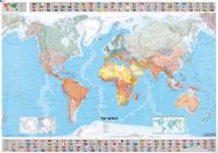
Wereldkaart 01 The World - Wereld, 144 x 100 cm | Michelin
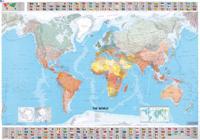
Mooie wereldkaart met duidelijke staatkundige weergave van de bekende kaartenmaker Michelin. Met aan de boven en onderkant de vlaggen van landen.   Beautifully colored Michelin world map. Highlights the flags of each country and includes population, surface area and density. Scale 1:28,000,000 - 1cm = 285 km . Laminated for durable use.   The Michelin political wall map of the world is updated annually to ensure current representation and comprehensive coverage, including physical and climatic features. Detailed and uncluttered, the map reflects Michelin's superior cartographic standard and complements any office, home, or school setting. Statistical information is included in the map boundaries, along with flags of the world.     Afmeting 100 cm (h) bij 144 cm (b).
18,95
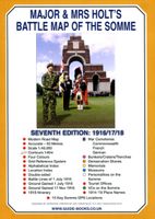
Historische Kaart Major & Mrs Holt's Battle Map of The Somme | Pen and Sword publications
This is the only map available that shows the exact locations of 300 memorials and places of interest on the battlefields of the Somme   This Sixth Edition also covers the American and Canadian areas between Amiens and Montdidier.    It is double sided in four colours with an overall view on one side and a detailed view on the other, both showing battle lines and ORBAT information   There are detailed alphabetical and thematic indexes to all 300 points.   Size - The map measures 19.5 inches (49cm) by 28 inches (71cm). It is printed in four colours and is double sided on firm glossy paper.   On one side at a scale of 1:70,000 is shown the whole of the Somme battle area from Bullecourt in the north to Amiens in the south and from Doullens in the west to Pyronne in the east. Also on this side are the colour coded indexes and the map of the 1918 sector from Villers Bretonneux to Cantigny.   On the other side at a scale of 1:40,000 the battle area mostly, but not exclusively, associat…
9,95
Wereldkaart 02 The World - Wereld | Michelin
Mooie wereldkaart met duidelijke staatkundige weergave van de bekende kaartenmaker Michelin. Met aan de boven en onderkant de vlaggen van landen. Geplastificeerde versie! Beautifully colored Michelin world map. Highlights the flags of each country and includes population, surface area and density. Scale 1:28,000,000 - 1cm = 285 km . Laminated for durable use. The Michelin political wall map of the world is updated annually to ensure current representation and comprehensive coverage, including physical and climatic features. Detailed and uncluttered, the map reflects Michelin's superior cartographic standard and complements any office, home, or school setting. Statistical information is included in the map boundaries, along with flags of the world.
27,95

Klanten-reviews van Historische wereldkaart Wereld antiek 1651 90,5 x 69 cm | Freytag & Berndt

Er zijn nog geen beoordelingen voor dit productBen jij de eerste die een review plaatst?

Meer over Historische wereldkaart Wereld antiek 1651 90,5 x 69 cm | Freytag & Berndt

Productomschrijving

Historische wereldkaart uit het jaar 1651. Deze papieren wereldkaart wordt geleverd in een stevige plastic koker.    The map is marked with the names of countries, major cities and ports of the time, along with the charted seas and islands. The exceptions are the extreme north of America, and Australia, which is alluded to as 'Psittacorum Regio or the Country of Parrots, soo called from ye extreaordinary and almost incredible bignes of those birds there'.   Surrounding the map are many interesting insets: the celestial hemispheres are shown, along with their  constellations; two diagrams explain pictorially how solar and lunar eclipses occur; 'A Figure of the Sphere' and 'The Heavens and Elements' occupy the top corners; and portraits of four notable explorers including Magellan and Drake are also shown.

Productinformatie

    Verken gerelateerde categorieën

    Webshop.nl maakt gebruik van cookies. Ga je verder op onze website, ga dan akkoord met het plaatsen van cookies en de verwerking van deze data door ons en vermelde partners.