Productomschrijving
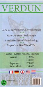
Themakaart over de geschiedenis van de Eerste Wereldoorlog in en rond Verdun. Met gedetailleerde inzetten van Verdun, Argonne en Saint-Michel. Aandacht voor monumenten, musea, vestingen, loopgraven en kerkhoven. Mooi kleurgebruik, veel detail en heel gedetailleerd. Gedrukt op stone-paper, dat gaat echt veel langer mee. Van de uitgever Discover Verdun and its surroundings. This double-sided printed map shows the locations of cemeteries, monuments, forts, trenches and museums in and around Verdun. The map is printed on Stone Paper, 100% water-repellent, very durable in use and paper-free. Folded size 12.5 * 25 cm, unfolded 70 * 100 cm. Discover 10 destroyed villages, 66 World War I cemeteries (37 French, 28 German and 1 American), 30 fortresses, 40 monuments, 16 trenches and 10 World War I museums using this highly detailed map. The map is divided into 4 sections: The city of Verdun. Visit the underground Citadelle, the beautiful Victory Monument, the old town in Vauban style and the old cathedral. The Argonne, the area west of Verdun, is home to many sights from the First World War. Discover the trench systems and the remains of mine battles (underground battles with heavy explosives), many First World War cemeteries and ossuaries. The Americans fought a heavy battle here in 1918 and the largest American military cemetery in Europe is located here. The well-known area east of Verdun, the red square, where the exhausting battle of Verdun was fought. discover the destroyed villages, the forts and bunkers, trenches, the Ossuaire Douaumont with the remains of 130,000 soldiers and the beautiful Memorial Verdun museum. Saint-Mihiel, south of Verdun, is often forgotten but is home to very well-preserved trenches and beautiful monuments. Visit the imposing American monument of Montsec or the trenches so close together that the German and French/American could throw hand grenades at each other.

