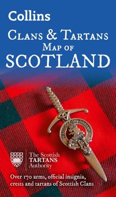
Historische Kaart Scotland Clans and Tartans Map | Collins

0
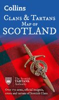
Prachtige kaart van Schotland waarin duideljk wordt welke cland er zijn geweest en nog zijn. Met een mooi overzicht van alle Tartans (Stoffen) die er aan gekoppeld zijn.    Discover Scotland with this authoritative guide to clans, tartans, and their origins. These popular maps are highly detailed, showing hundreds of arms, official insignia, crest...

Verkopers met dit product

Verkoper
Bezorging
Prijs
DeZwerver.nl logo
DeZwerver.nl
2,95
12,95

Anderen bekeken ook

Historische Kaart Scotland Clans and Tartans Map | Collins
Prachtige kaart van Schotland waarin duideljk wordt welke cland er zijn geweest en nog zijn. Met een mooi overzicht van alle Tartans (Stoffen) die er aan gekoppeld zijn.    Discover Scotland with this authoritative guide to clans, tartans, and their origins. These popular maps are highly detailed, showing hundreds of arms, official insignia, crests, and tartans of the Scottish clans. This beautifully illustrated map is both decorative and informative.   This map includes: Two double-sided, full-colour maps of ScotlandMore than 170 arms, the official insignia of clan chiefs, crest badges, and the locations of their ancient territories around the time of King James VIMore than 240 tartans with corresponding clan/ family names, alphabetically arranged for easy look-upAdditional information about the history of the clans and their tartans The map is ideal for those those with an interest in Scottish heraldry, clans and family history. Other titles in the series include:* Castles Map of Sc…
12,95
Wegenkaart - landkaart Castles map of Scotland - Schotland kastelen | Collins
Kaart waarop meer dan 700 kastelen in Schotland staan aangegeven. Discover Scotland's ancient monuments and castles. Explore Scotland’s ancient monuments with this pictorial map featuring over 700 castles and fortified houses. Includes an easy-to-use index listing visitor information and an attractive selection of photographs.   The map includes: • Over 700 castles and fortications • Index comprises map references, the age and type of each castle, public access details, Historic Scotland and National Trust for Scotland ownership, notable grounds and gardens, telephone numbers and websites • Highlights Scotland’s finest castles, castellated mansions and also the best castles for children • Attractive photographs of a selection of castles, together with a brief account of their history • A brief history of Scottish castles and information on architectural types and periods of construction • Internet links and suggested reading for further information   Scotland is a country …
13,95
Ik ben 18+
Wegenkaart - landkaart Whisky map of Scotland | Collins
Wegenkaart met meer dan 100 distilleerderijen en whisky gerelateerde locaties.   Discover where Scotland’s national drink is produced. All of Scotland’s operational whisky distilleries and whisky-related places of interest located on one map. Also includes an easy-to-use index listing visitor facilities, contact details and websites. The map includes:   • Over 100 distilleries and whisky-related places of interest • Insert map of malt whisky areas • A photographic guide to how whisky is made • Selection of labels of blended Scotch whisky brands • Did you know? Section with interesting facts • World maps of main export markets • Index lists visitor facilities, telephone numbers and websites   Scotch whisky is unique among national drinks – synonymous with Scotland, it cannot be produced elsewhere in the world.   Other titles in the series: Castles Map of Scotland, Tartans Map of Scotland, Scotland of Old Clans Map  
13,95
Wegenkaart - landkaart Touring Map of Scotland - Schotland | Collins
Best-selling map of Scotland. More than 1,000 places of tourist interest plotted and named on the map. The features have been plotted onto an up-to-date and attractive Collins map of Scotland.   A clear, easy to follow road map with colour classified roads. Ideal for tourists with hundreds of distinctive tourist symbols and tourist information centres all shown.   This map includes: • The whole of Scotland on a double sided sheet at 5 miles to 1 inch • Over 25 categories of tourist information shown on the map including youth hostels, picnic sites and ferries as well as the more obvious tourist sites such as castles, wildlife parks and museums • Detailed town centre maps of Edinburgh, Glasgow, Aberdeen, Dundee, Inverness and Perth • New places of interest including Japanese Garden (near Dollar), Macallan Distillery Centre, Moat Brae (Dumfries) and Scottish Submarine Centre (Helensburgh) • Road updates include the new Dalry bypass, Maybole bypass under construction, A9 dualling section…
9,95
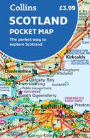
Wegenkaart - landkaart Pocket Map Scotland | Collins
Handy little full colour map of Scotland. Excellent value and very detailed for its size. Double-sided folded map with the Central Belt, southern Scotland and northern England on one side and northern Scotland including Orkney and Shetland on the reverse.   This map features:* Clear mapping at a scale of 8.7 miles to 1 inch* National Tourist Routes showing best routes through the most scenic areas* Top 100 places of interest* Park and Ride locations* Ideal companion to a sat-nav - it enables route planning and route sense-checking Essential for those planning a trip or who want an inexpensive and easy-to-use back up for a sat-nav.
7,95
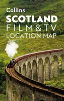
Wegenkaart - landkaart Pocket Map Scotland Film and TV Location Map | Collins
Full-colour, handy guide to more than 60 of the most popular film and TV locations in Scotland. Striking images and detailed descriptions allow for a comprehensive guide to Scotland's most recognisable filming sites in a convenient, travel-sized guide. Follow the journeys your favourite characters undertook from Hogwarts to Gotham City, Skyfall to Lallybroch, as this guide covers the best Scotland has to offer Hollywood and Bollywood.   This map features: Full coverage of the road, stations, and streets of ScotlandScenic images and detailed descriptions of famous filming locationsLocations include: Harry Potter, James Bond, The Da Vinci Code, Still Game, Outlander, Good Omens, and The CrownIdeal companion to a sat-nav - it enables route planning and route sense-checking  
7,95
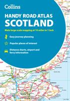
Wegenatlas Collins Handy Road Atlas Scotland | A5-Formaat | Collins
Discover new places with handy road atlases from Collins. Your ideal companion for navigating around Scotland. It has extremely clear, route planning maps of Scotland, detailed city plans of the major cities and towns and fits neatly into your glovebox, briefcase or bag. Main features Clear, attractive route planning maps of the whole of Scotland supported by comprehensive, fully indexed city centre street maps of Aberdeen, Dundee, Edinburgh, Glasgow, Inverness and Perth. Scale of main maps: 1:625,000 (9.9 miles to 1 inch). Also includes * Places of tourist interest are highlighted * Attractive layer colouring showing land height * Road network fully classified and colour coded * Detailed street mapping of Edinburgh, including the Royal Mile with all its attractions clearly marked, Leith and Holyrood Park * Detailed street mapping of Glasgow, including the West End, city centre and M74 extension * Detailed street mapping of Aberdeen, including the bypass * Street maps, with i…
12,95
Spoorwegenkaart Schotland - Scotland Central and South Rail and Road | ITMB
Een degelijke kaart met aanduidingen van o.a. spoorlijnen, nationale parken, vliegveld, benzinepomp, dirt-roads en kleine plattegrond van hoofdstad. Als overzichtskaart goed te gebruiken. This is another new ITMB title and extends our sectional coverage of the UK northwards from the southernmost border at Gretna Green through the densely-populated Glasgow/Edinburgh/Stirling conurbation to the highlands. The reason for this sectional map is to provide additional space to show 25% more detail than our map of all of Scotland can provide. The north of Scotland is my favourite part of the country, but there isn’t much there except heather and single-lane tracks across treeless moors. The South, like it or not, is where most of Scotland’s four million people live and where most of the castles, palaces, battlefields, parks, and touristic attractions are located. The map also shows the ferry routes to the outer islands of Arran and Mull, and the most poignant battlefield I’ve ever visited, Cu…
13,95
Reisgids Scotland the Best | Collins
The true Scot's insider's guide to the very best Scotland has to offer. Fully revised and updated in Peter Irvine’s own unique style, the 14th edition includes more than 2,000 recommendations for every type of adventure.   Trusted for 30 years, this fully comprehensive and independent guide to Scotland gives you only the very best recommendations, whatever your budget.   Discover stunning scenery, landscapes and historical highlights Find the best coastal walks, city strolls and sight-seeing spots Eat at the best local cafés and regional restaurants Great advice on where to sleep, from wild camping to boutique hotels Explore the true culture of Scotland and discover local, hidden gems Peter Irvine is your personal guide to the very best of Scotland. From the streets of Edinburgh to the Western Isles, he’s visited, rated and remarked on the must-see highlights of Scotland. The 14th edition is the perfect travel companion, complete with essential information including websites, phone nu…
24,95
Historische Kaart Major & Mrs Holt's Battle Map of The Somme | Pen and Sword publications
This is the only map available that shows the exact locations of 300 memorials and places of interest on the battlefields of the Somme   This Sixth Edition also covers the American and Canadian areas between Amiens and Montdidier.    It is double sided in four colours with an overall view on one side and a detailed view on the other, both showing battle lines and ORBAT information   There are detailed alphabetical and thematic indexes to all 300 points.   Size - The map measures 19.5 inches (49cm) by 28 inches (71cm). It is printed in four colours and is double sided on firm glossy paper.   On one side at a scale of 1:70,000 is shown the whole of the Somme battle area from Bullecourt in the north to Amiens in the south and from Doullens in the west to Pyronne in the east. Also on this side are the colour coded indexes and the map of the 1918 sector from Villers Bretonneux to Cantigny.   On the other side at a scale of 1:40,000 the battle area mostly, but not exclusively, associat…
9,95

Klanten-reviews van Historische Kaart Scotland Clans and Tartans Map | Collins

Er zijn nog geen beoordelingen voor dit productBen jij de eerste die een review plaatst?

Meer over Historische Kaart Scotland Clans and Tartans Map | Collins

Productomschrijving

Prachtige kaart van Schotland waarin duideljk wordt welke cland er zijn geweest en nog zijn. Met een mooi overzicht van alle Tartans (Stoffen) die er aan gekoppeld zijn.    Discover Scotland with this authoritative guide to clans, tartans, and their origins. These popular maps are highly detailed, showing hundreds of arms, official insignia, crests, and tartans of the Scottish clans. This beautifully illustrated map is both decorative and informative.   This map includes: Two double-sided, full-colour maps of ScotlandMore than 170 arms, the official insignia of clan chiefs, crest badges, and the locations of their ancient territories around the time of King James VIMore than 240 tartans with corresponding clan/ family names, alphabetically arranged for easy look-upAdditional information about the history of the clans and their tartans The map is ideal for those those with an interest in Scottish heraldry, clans and family history. Other titles in the series include:* Castles Map of Scotland (99780007508532)* Whiskey Map of Scotland (9780008368319)d of Old Clans Map

Productinformatie

    Verken gerelateerde categorieën

    Webshop.nl maakt gebruik van cookies. Ga je verder op onze website, ga dan akkoord met het plaatsen van cookies en de verwerking van deze data door ons en vermelde partners.