Historische Kaart Major & Mrs Holt's Battle Map of The Normandy D-Day Landing Beaches | Pen and Sword publications

0
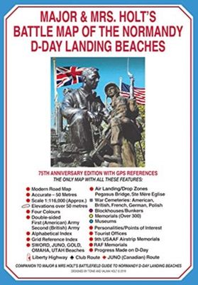
This is the only detailed battle map of the D-Day Beaches area that shows the locations of 400 memorials   The map is double sided showing the US beaches on one side and the British and Canadian on the other   It is in full colour with detailed thematic and alphabetical indexes making it easy to find what you are looking for.   Landing force detai...

Verkopers met dit product

Verkoper
Bezorging
Prijs
DeZwerver.nl logo
DeZwerver.nl
2,95
9,95

Anderen bekeken ook

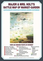
Historische Kaart Major & Mrs Holt's Battle Map of Market Garden | Pen and Sword publications
This is the only map of its kind devised and created by Major and Mrs Holt and is used by many guides   It shows the locations of 300 memorials and war cemeteries over THE WHOLE OPERATION MARKET-GARDEN AREA   It shows the progress of the battle from Leopoldsburg to  Eindhoven, Nijmegen, Arnhem and Oosterbeek overlaid on modern roads   In four colours, double sided and with 10 inset maps it shows all drop and landing zones   Suitable for navigation by car, bicycle or foot   Size - The map measures 19.5 inches (49cm) by 28 inches (71cm). It is printed in four colours and is on firm glossy paper.   On one side at a scale of 1:180,000 is shown the whole of the Market Garden corridor of operations from Arnhem in the north to Leopoldsburg in the south and from Vught in the west to Overloon in the east. See below for details of the other side.   What is Marked on the Map   This map is quite unique and no other exists that shows the Market Garden Corridor in such detail. Over 230 memor…
9,95
Historische Kaart Major & Mrs Holt's Battle Map of The Somme | Pen and Sword publications
This is the only map available that shows the exact locations of 300 memorials and places of interest on the battlefields of the Somme   This Sixth Edition also covers the American and Canadian areas between Amiens and Montdidier.    It is double sided in four colours with an overall view on one side and a detailed view on the other, both showing battle lines and ORBAT information   There are detailed alphabetical and thematic indexes to all 300 points.   Size - The map measures 19.5 inches (49cm) by 28 inches (71cm). It is printed in four colours and is double sided on firm glossy paper.   On one side at a scale of 1:70,000 is shown the whole of the Somme battle area from Bullecourt in the north to Amiens in the south and from Doullens in the west to Pyronne in the east. Also on this side are the colour coded indexes and the map of the 1918 sector from Villers Bretonneux to Cantigny.   On the other side at a scale of 1:40,000 the battle area mostly, but not exclusively, associat…
9,95
Reisgids Major & Mrs Holt's Definitive Battlefield Guide to the D-Day Normandy Landing Beaches | Pen and Sword publications
Already the best-selling English-language guide to the area, universally known as THE BIBLE, this is the 75th anniversary, completely revised, up-to-date, much expanded edition of the DEFINITIVE GUIDE TO THE D-DAY NORMANDY LANDING BEACHES. The third in the Holts' important series of Battlefield Guides (following the Somme and the Ypres Salient) it employs the same, highly acclaimed formula. Once again the cold facts are interlaced with anecdotes of bravery, humour, sadness and humanity. This new edition now contains: All the landing Beaches: JUNO, SWORD, GOLD, OMAHA, UTAH All the Airborne Operations: British and American Two Approach Routes; Six timed and measured Itineraries 21 in-text Itinerary maps, Battle maps & Diagrams Approx 400 recommended sites within the D-Day planned area of advance, all with photos, each with Latitude & Longitude references (New for this Edition) Over 400 coloured pictures, 352 pages Memorials / Museums / Batteries / Bunkers / Landing fields Allied and …
23,95
Reisgids D-Day Landings - Normandie | Bradt Travel Guides
Published to commemorate the 80th anniversary of the military mission that changed World War II, D-Day Landings: a Travel Guide to Normandy's Beaches and Battlegrounds is Bradt's new guidebook to visiting beaches, memorials, museums, battlefields and other sites associated with D-Day and the Battle of Normandy (Operation Overlord). A simple-to-follow, portable guide for independent travellers, it includes maps and driving instructions to help visitors go back in time to explore World War II history. Written by two experienced travel writers who, between them, are experts in France and military history, D-Day Landings is designed for visitors who want to see all or part of Normandy. Covering the ground from the D-Day landing beaches (Sword, Juno, Gold, Omaha and Utah) up to the Falaise Gap and Cherbourg, it encompasses both every major site and a host of smaller, less well-known locations - venturing well beyond the coast to include sites associated with the capture of Cherbourg (D+20)…
14,95
Historische Kaart 14 - 18 Map of Verdun (Battlefield map) | Eerste Wereld Oorlog | Pen and Sword publications
Comprehensive mapping for the Battle of Verdun 1916 and a sizable part of the early days of the Meuse-Argonne Offensive 1918. Clearly produced in full color, with different types of feature in different colors, all supported by two comprehensive keys. For many years the Holts have provided tourers to the battlefields with excellent mapping for the Ypres Salient and the Somme. This map of the Verdun/Meuse area fills one of the many gaps in the coverage of the Western Front. This map of the Verdun battlefield is in the same style, using a color coded system to distinguish the different types of features. It includes some 300 locations of memorials, cemeteries, significant remnants of the battle terrain, remaining fortifications, trenches, the destroyed villages and other vestiges of the war. On the reverse there is a cut out and enlarged section of the Verdun battlefield in particular - the most visited part of the area, which provides greater detail. This section includes the Ossuary…
9,95
Wandelkaart - Topografische kaart OL15 OS Explorer Map Purbeck and South Dorset | Ordnance Survey
Gaze back through 185 million years of history as you explore the Jurassic Coast or go wildlife spotting in the South Dorset countryside. Sweeping golden beaches and spectacular cliff scenery await you on the Purbeck Peninsula as the South West Coast Path takes you from Chesil Beach to Europe’s largest natural bay at Poole.   - Hunt for fossils and dinosaur tracks on the unique Jurassic Coast beaches of Kimmeridge Bay, Lulworth Cove and the iconic sweeping shingle ridge of Chesil Beach - Discover the world-famous Sandbanks Beach in Poole, climb Europe’s largest Iron Age hillfort at Maiden Castle and relax in sunny Weymouth, home of the sailing at London 2012 - Explore the Purbeck Peninsula with its chalk cliffs, the magnificent ruin of Corfe Castle, Victorian pier at Swanage and Brownsea Island Een van de beste detailkaarten die er op de wereld gemaakt worden: zeer gedetailleerd, prachtig helder kleurgebruik, veel topografische aspecten en - zeer belangrijk - allerlei toeristische …
19,50
Wandelkaart - Topografische kaart 15 OS Explorer Map | Active Purbeck and South Dorset / Poole | Ordnance Survey
Gaze back through 185 million years of history as you explore the Jurassic Coast or go wildlife spotting in the South Dorset countryside. Sweeping golden beaches and spectacular cliff scenery await you on the Purbeck Peninsula as the South West Coast Path takes you from Chesil Beach to Europe’s largest natural bay at Poole.   - Hunt for fossils and dinosaur tracks on the unique Jurassic Coast beaches of Kimmeridge Bay, Lulworth Cove and the iconic sweeping shingle ridge of Chesil Beach - Discover the world-famous Sandbanks Beach in Poole, climb Europe’s largest Iron Age hillfort at Maiden Castle and relax in sunny Weymouth, home of the sailing at London 2012 - Explore the Purbeck Peninsula with its chalk cliffs, the magnificent ruin of Corfe Castle, Victorian pier at Swanage and Brownsea Island Een van de beste detailkaarten die er op de wereld gemaakt worden: zeer gedetailleerd, prachtig helder kleurgebruik, veel topografische aspecten en - zeer belangrijk - allerlei toeristische en …
25,95
Wegenkaart - landkaart Tahiti - French Polynesia | ITMB
Anyone who has visited Tahiti retains fond memories of a wonderful Polynesian paradise. This map shows the major islands of French Polynesia as a series of large insets on Side 1. An overall inset map showing the many islands is also shown, but for showing detail, one must expand the individual islands. The largest one is the volcanic Tahiti Nui, with the capital city of Pape’ete (or Papeete in English), for which a detailed inset map is included. Most visitors stay in the vicinity of Papeete, along the coast. We show several popular resorts. There is a good circular road around the island’s shoreline, but no roads in the interior. The island is joined to another, called Tahiti Iti, or Little Tahiti, and roads extend partway around this less-developed part of the combined island. Most of the other islands are rarely visited, although they have resorts, beaches, and a lifestyle of their own. Names like Huahine, Riatea, Tahaa, and Maiao may not be as familiar as they should be, but all …
14,95
Wegenkaart - landkaart 3024 Adventure Map Cambodia - Cambodja | National Geographic
Mooie, heldere kaart van Cambodja,  gedrukt op scheurvast en watervast papier. National Geographic's Cambodia Adventure Map is designed to meet the needs of adventure travelers with its durability and detailed, accurate information. This map includes the locations of cities and towns with a user-friendly index, a clearly marked road network complete with distances and designations for roads/highways, plus secondary routes for those seeking to explore off the beaten path. Adventure Maps differ from a traditional road map because of the specialty content they include. Each map contains hundreds of diverse and unique recreational, ecological, cultural, and historic destinations — outside of the major tourist hubs. National Geographic Adventure Maps are the perfect companion to a guidebook, yet far easier to pack!   Cambodia is perhaps best know to international travelers as the home of the Angkor empire for six hundred years. Angkor Wat and Angkor Thom are part of the vast temple complex…
17,50
Wandelkaart - Topografische kaart 149 OS Explorer Map Sittingbourne, Faversham | Ordnance Survey
Explore the serene Isle of Sheppey and follow the Saxon Shore Way to discover the towns of Sittingbourne and Faversham. Further inland, the Kent Downs – an Area of Outstanding Natural Beauty – are beckoning.  Sail, kayak, fly kites or just relax on the sandy and pebbled beaches of Sheppey, or go birdwatching at the Swale National Nature Reserve  Discover Faversham, home of Britain’s oldest brewer and nearby Oare Gunpowder Works Country Park, where gunpowder was manufactured for the battles of Trafalgar and Waterloo  Walk, ramble or cycle along the Saxon Shore Way through Faversham and Sittingbourne, or head inland to the North Downs Way, a National Trail Met zijn 4cm voor 1 km (2 ½ cm voor 1 mijl) schaal, is de OS Explorer kaartenserie de ideale en meest gedetailleerde kaartenreeks voor mensen die graag outdoor-activiteiten zoals fietsen, wandelen, paardrijden, klimmen en watersporten. Deze kaart is nog gedetailleerder dan de 'gewone' Landranger maps. Voor- en achterzijde bedrukt! …
19,50

Klanten-reviews van Historische Kaart Major & Mrs Holt's Battle Map of The Normandy D-Day Landing Beaches | Pen and Sword publications

Er zijn nog geen beoordelingen voor dit productBen jij de eerste die een review plaatst?

Meer over Historische Kaart Major & Mrs Holt's Battle Map of The Normandy D-Day Landing Beaches | Pen and Sword publications

Productomschrijving

This is the only detailed battle map of the D-Day Beaches area that shows the locations of 400 memorials   The map is double sided showing the US beaches on one side and the British and Canadian on the other   It is in full colour with detailed thematic and alphabetical indexes making it easy to find what you are looking for.   Landing force details and battle lines are overlaid onto a grid of modern roads.   Size - The map measures 19.5 inches (49cm) by 28 inches (71cm).  It is printed in four colours and is on firm glossy paper.   On one side at a scale of 1:116,000 are shown The British Landing Beaches from Bayeux in the west to Ouistreham (covering GOLD,JUNO and SWORD) plus the 6th BR AB DZs from Pegasus Bridge to Dives.   On the other side at a scale of 1:116,000 are shown the US AE DZs around Ste Mere Eglise and Ste Marie du Mont and the US Landing Beaches, UTAH and OMAHA.   The Falaise Gap   There is also a small boxed section showing the area of Falaise and the locations of the major memorials that mark the actions at the Falaise Gap.   What is Marked on the Map   On both sides is a base map showing modern roads, thus making navigation simple.   The locations of the following are marked with colour coded lollipops as follows -   colour coded map index


Verken gerelateerde categorieën

Webshop.nl maakt gebruik van cookies. Ga je verder op onze website, ga dan akkoord met het plaatsen van cookies en de verwerking van deze data door ons en vermelde partners.