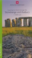
Historische Kaart Exploring the World Heritage Site - Stonehenge and Avebury | English Heritage

0
The Stonehenge and Avebury World Heritage Site is internationally important for its outstanding prehistoric monuments. Stonehenge is the most architecturally sophisticated prehistoric stone circle in the world, while Avebury is the largest. Around them lie numerous other monuments and sites, which demonstrate over 2,000 years of continuous use. To...

Verkopers met dit product

Verkoper
Bezorging
Prijs
DeZwerver.nl logo
DeZwerver.nl
2,95
14,95

Anderen bekeken ook

Historische Kaart Exploring the World Heritage Site - Stonehenge and Avebury | English Heritage
The Stonehenge and Avebury World Heritage Site is internationally important for its outstanding prehistoric monuments. Stonehenge is the most architecturally sophisticated prehistoric stone circle in the world, while Avebury is the largest. Around them lie numerous other monuments and sites, which demonstrate over 2,000 years of continuous use. Together they form a unique prehistoric landscape. There is no better way to learn about an experience the monuments than to go out and explore the World Heritage Site on foot. This map is ideal for walkers and others wishing to explore the fascinating landscape of the two areas of the World Heritage Site. The map uses an Ordnance Survey 1:10,000 base and draws upon information from the English Heritage Archive and recent archaeological investigations. With Stonehenge on one side and Avebury on the other, the map shows and describes both visible and hidden remains, with information about where you can find out more. The map is divided into two …
14,95
Historische Kaart An Archaeological Map of Hadrian's Wall | English Heritage
It was more than just a wall: it was a whole military zone designed to control movement across the northern frontier of the Roman province of Britannia. Great earthwork barriers survive, along with the remains of forts and temporary camps; watch-towers and fortified gates; civilian settlements, temples, cemeteries, bath-houses, roads and bridges. Stretching across the spine of England from the North-East coast to the Irish Sea, the line of the frontier extends for over 100 miles through every type of landscape: from the streets of urban Tyneside, through arable fields; along the crags of the wild Whin Sill; to the sands of the Solway, and down the coast of Cumbria. Drawing upon the extensive expertise and unrivalled archives of English Heritage, and those of its partners, this map depicts the fruits of modern archaeological research: in field survey, geophysics, excavation, and the analysis of aerial photographs. Using Ordnance Survey 1:25,000 data - the ideal scale for walkers - this…
14,95
Reisgids Heritage Weekends | Bradt Travel Guides
History and heritage are among Britain’s greatest passions. Travel writers and historians Helen and Neil Matthews have selected 52 places that are wonderful examples of natural, architectural, industrial or cultural heritage. Some are neglected or under-rated and deserve more attention. Others are famous locations waiting to be enjoyed from new perspectives. Heritage Weekends is here to help you explore and indulge your passion for Britain’s past: from the Prehistoric era, through ancient, medieval, Tudor, Regency and Victorian times to the 20th century. With their inspirational guide you’ll meet some of our greatest creative geniuses, monarchs and heroes, eccentrics and legends, giants and saints. And you’ll find everything from the world’s most famous map to a vision of Hell!   As well as detailed descriptions of the sites, Heritage Weekends includes suggested itineraries, directions and top tips for accommodation and eating out. England, Wales, Scotland, Jersey and the Isle of Man …
23,95
Wandelkaart - Topografische kaart 130 OS Explorer Map Salisbury & Stonehenge | Ordnance Survey
Met zijn 4cm voor 1 km (2 ½ cm voor 1 mijl) schaal, is de OS Explorer kaartenserie de ideale en meest gedetailleerde kaartenreeks voor mensen die graag outdoor-activiteiten zoals fietsen, wandelen, paardrijden, klimmen en watersporten. Deze kaart is nog gedetailleerder dan de 'gewone' Landranger maps. Voor- en achterzijde bedrukt! Zeker op de moors en andere natuurgebieden van onschatbare waarden met echt alle aspecten van het landschap op de kaart ingetekend. Zeer goede detailkaart met topografische ondergrond. Hierop zijn toeristische symbolen van bezienswaardigheden ingetekend, daarnaast staan bijvoorbeeld campings en jeugdherbergen vermeld en - voor wandelaars het belangrijkst - alle right of way paden en Lange afstands Wandelpaden zijn er op te vinden. De ideale kaart voor het wandelen in Engeland, Wales of Schotland. These highly detailed maps show all the administrative boundaries, settlements as small as isolated farms, the road network down to unfenced roads and country track…
19,50
Wandelkaart - Topografische kaart 130 OS Explorer Map | Active Salisburry / Stonehenge | Ordnance Survey
Met zijn 4cm voor 1 km (2 ½ cm voor 1 mijl) schaal, is de OS Explorer kaartenserie de ideale en meest gedetailleerde kaartenreeks voor mensen die graag outdoor-activiteiten zoals fietsen, wandelen, paardrijden, klimmen en watersporten.   Deze kaart is nog gedetailleerder dan de 'gewone' Landranger maps. Voor- en achterzijde bedrukt! Zeker op de moors en andere natuurgebieden van onschatbare waarden met echt alle aspecten van het landschap op de kaart ingetekend. Zeer goede detailkaart met topografische ondergrond. Hierop zijn toeristische symbolen van bezienswaardigheden ingetekend, daarnaast staan bijvoorbeeld campings en jeugdherbergen vermeld en - voor wandelaars het belangrijkst - alle right of way paden en Lange afstands Wandelpaden zijn er op te vinden. De ideale kaart voor het wandelen in Engeland, Wales of Schotland.   These highly detailed maps show all the administrative boundaries, settlements as small as isolated farms, the road network down to unfenced roads and country t…
25,95
Caribbean Cultural Heritage and the Nation (Paperback)
Centuries of intense migrations have deeply impacted expressions of cultural heritage on the ABC islands: Aruba, Bonaire, and Curaçao. This volume queries how cultural heritage on these Dutch Caribbean islands relates to the work of nation-building and nation-branding. How does the imagining of a shared political “we” relate to images deliberately produced to market these islands to a world of capital? The contributing authors in this volume address this leading question in their essays that describe and analyze the expressions of the ABC islands. In doing so, they compare and contrast nation-building and branding on the ABC islands to similar practices taking place in the wider Caribbean. The expressions of cultural heritage discussed range from the importance of sports, music, literature, and visual arts to those related to the political economy of tourism, the work of museums, the question of reparations, and the politics and policies affecting the Caribbean Diasporas in the North
50,-
Reisverhaal Walking the Great North Line | Robert Twigger
Robert Twigger, poet and travel author, was in search of a new way up England when he stumbled across the Great North Line. From Christchurch on the South Coast to Old Sarum to Stonehenge, to Avebury, to Notgrove barrow, to Meon Hill in the midlands, to Thor's Cave, to Arbor Low stone circle, to Mam Tor, to Ilkley in Yorkshire and its three stone circles and the Swastika Stone, to several forts and camps in Northumberland to Lindisfarne (plus about thirty more sites en route). A single dead straight line following 1 degree 50 West up Britain. No other north-south straight line goes through so many ancient sites of such significance. Was it just a suggestive coincidence or were they built intentionally? Twigger walks the line, which takes him through Birmingham, Halifax and Consett as well as Salisbury Plain, the Peak district, and the Yorkshire moors. With a planning schedule that focused more on reading about shamanism and beat poetry than hardening his feet up, he sets off ever hope…
14,95
Fietsgids England North - South Cycle Route | EOS Cycling Holidays Ltd
This guidebook allows you to cycle from the Scottish border across England to the Isle of Wight, all via continuous traffic-calmed routes. The book also features the best of the North Sea Cycle Route and offers full north-south route directions, high-profile maps, visitor information, accommodation listings and a code to obtain GPS-tracks of the routes. The route has full connectivity with Newcastle, Hull and Portsmouth international ferry ports and train stations in Berwick upon Tweed, Newcastle, Hull, York, Leicester, Oxford and Portsmouth. The total route is over 750 miles (1200 kilometers) long.   Starting from the north in Berwick upon Tweed, the route takes touring cyclists via Lindisfarne Holy Island and five historic remote Northumberland castles. In Newcastle you can cycle via the famous Angel of the North to remains of Hadrian's Wall. The route heads south via World Heritage site Durham and the extraordinary River Tees Transporter Bridge into North York Moors National Park. …
29,95
Wandelgids 100 outstanding British Walks | Ordnance Survey
Beschrijving van de 100 mooiste Pathfinder wandelingen in Engeland, Wales en Schotland. Uitstekende beschrijving van de route met een zeer duidelijke topografische kaart waarop de route is ingetekend.  This magnificent compendium of outstanding British walks brings together the finest selection of Pathfinder Walks in Britain s officially designated places of scenic beauty and historic interest: National Parks, Areas of Outstanding Natural Beauty, National Scenic Areas, Heritage Coast, National Trails and UNESCO World Heritage Sites. There are 100 walking gems in this collection, recommended by a group of experienced authors and guides. The walks span a range of distances and degrees of challenge and are organised by region with coverage across England, Wales and Scotland. 100 Outstanding British Walks is lavishly illustrated with stunning landscape photography and informative introductions to each of the walks. It is designed to be enjoyed at home, while the OS Maps app provides the p…
27,95

Klanten-reviews van Historische Kaart Exploring the World Heritage Site - Stonehenge and Avebury | English Heritage

Er zijn nog geen beoordelingen voor dit productBen jij de eerste die een review plaatst?

Meer over Historische Kaart Exploring the World Heritage Site - Stonehenge and Avebury | English Heritage

Productomschrijving

The Stonehenge and Avebury World Heritage Site is internationally important for its outstanding prehistoric monuments. Stonehenge is the most architecturally sophisticated prehistoric stone circle in the world, while Avebury is the largest. Around them lie numerous other monuments and sites, which demonstrate over 2,000 years of continuous use. Together they form a unique prehistoric landscape. There is no better way to learn about an experience the monuments than to go out and explore the World Heritage Site on foot. This map is ideal for walkers and others wishing to explore the fascinating landscape of the two areas of the World Heritage Site. The map uses an Ordnance Survey 1:10,000 base and draws upon information from the English Heritage Archive and recent archaeological investigations. With Stonehenge on one side and Avebury on the other, the map shows and describes both visible and hidden remains, with information about where you can find out more. The map is divided into two parts on a durable double sided waterproof sheet.

Productinformatie

    Verken gerelateerde categorieën

    Webshop.nl maakt gebruik van cookies. Ga je verder op onze website, ga dan akkoord met het plaatsen van cookies en de verwerking van deze data door ons en vermelde partners.