webshop.nl
Categorieën
  Sluiten

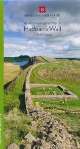
Historische Kaart An Archaeological Map of Hadrian's Wall | English Heritage

It was more than just a wall: it was a whole military zone designed to control movement across the northern frontier of the Roman province of Britannia. Great earthwork barriers survive, along with the remains of forts and temporary camps; watch-towers and fortified gates; civilian settlements, temples, cemeteries, bath-houses, roads and bridges. S...
14,95

Webshops met dit product

Webshop
Bezorging
Prijs

Anderen bekeken ook

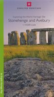
Historische Kaart Exploring the World Heritage Site - Stonehenge and Avebury | English Heritage
The Stonehenge and Avebury World Heritage Site is internationally important for its outstanding prehistoric monuments. Stonehenge is the most architecturally sophisticated prehistoric stone circle in the world, while Avebury is the largest. Around them lie numerous other monuments and sites, which demonstrate over 2,000 years of continuous use. Together they form a unique prehistoric landscape. There is no better way to learn about an experience the monuments than to go out and explore the World Heritage Site on foot. This map is ideal for walkers and others wishing to explore the fascinating landscape of the two areas of the World Heritage Site. The map uses an Ordnance Survey 1:10,000 base and draws upon information from the English Heritage Archive and recent archaeological investigations. With Stonehenge on one side and Avebury on the other, the map shows and describes both visible and hidden remains, with information about where you can find out more. The map is divided into two p…
14,95
Wandelkaart Adventure Atlas Hadrian's Wall Path | A-Z Map Company
AZ heeft de meest gedetailleerde wandelkaarten van het Hadrian's Wall Path gebundeld in een atlasje. Daardoor is het heel handig qua formaat. De kaarten zelf zijn perfect voor het wandelen. Schaal 1:25.000 The A-Z Adventure Series of maps combines the best of OS and A-Z, creating the perfect companion for walkers, off-road cyclists, horse riders and anyone wishing to explore the great outdoors. Hadrian's Wall Path is a National Trail which follows the line of Hadrian's Wall from coast-to-coast. The 84 mile (135km) path weaves through beautiful countryside, encountering historic remains of Roman forts and milecastles, splendid bridges, views from the Whin Sill escarpment and Solway salt marshes. Starting in Wallsend in Newcastle and ending in Bowness-on-Solway, the route on the map is clearly highlighted in yellow with mileage markers added to guage distances when planning sections of the walk to enjoy. This official National Trail Map of Hadrian's Wall Path features 38 pages of continu…
12,95
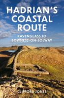
Wandelgids Hadrian's coastal route | The History Press
Dit is meer een reisgids dan een wandelgids: de kaarten zijn slechts schetsmatig, een wandelkaart er bij is wel zo handig! Hadrian's Wall, running from Wallsend to Bowness, is a much visited attraction and an iconic landmark with over 200 years of serious research behind it. The Western Frontier has had barely 70 but through the efforts of a small band of archaeologists and the Hadrian's Wall Heritage Trust Ltd this is gradually changing. The frontier route followed in this guide, running from Ravenglass to Bowness on Solway, is punctuated by Roman forts, the visible remains of a frontier of watchtowers, mileforts and manned bases. ‘Be part of history, walk a frontier lost for over fifteen hundred years.’The Western Hadrianic Frontier of the Roman Empire is little known by the general public. Until recently the frontier was viewed as merely a series of forts with a fluid means of defence and administration between them, and the public was understandably drawn to the physical remains of…
18,50
Wandelkaart National Trail Map Hadrian's Wall Path | Collins
Overzichtskaart op vrij grove schaal van deze LAW Lange Afstands Wandeling in Engeland. Let op: je kunt er niet op lopen. Wel met veel informatie op de kaart, goed ingetekend, een route-schema op de achterzijde en een beschrijving van een aantal bezienswaardigheden.  Perfect guide and map for planning your adventure along Hadrian’s Wall.   Highlights of this Planning Map include:   More than 20 highlighted places of interest with detailed descriptions and attractive photographs, including: the Vindolanda archaeological site, Chester’s Roman fort, and Steel Rigg viewpoint. A comprehensive index to more than 400 cities, towns and villages A clear, visible route plotted across the map Advice on safety and security when travelling along the route, as well as the countryside code and the code of conduct Part of the National Trail network, this long-distance footpath covers 84 miles (135 km) along the line of Hadrian's Wall from coast-to-coast. Starting in Wallsend in Newcastle and ending in…
11,50
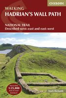
Wandelgids Hadrian's Wall Path | Cicerone
Meest duidelijke wandelgids van de route: veel details in kaarten en informatie, beide kanten op beschreven! The essential guidebook to walking the 84-mile Hadrian’s Wall Path. One of the UK's most visited National Trails, it runs the length of the Roman Wall from Bowness-on-Solway in Cumbria to Wallsend, Newcastle.   Begun in AD122 and stretching from the River Tyne to the Solway Firth, Hadrian’s Wall was a massive feat of engineering and is the best preserved frontier from the classical Roman Empire. Today it is a World Heritage Site, with iconic scenery and fascinating archaeological remains like Birdoswald, Housesteads and Vindolanda, giving a glimpse into Roman life and power. The trail is presented here in 10 stages, with suggestions for five and eight-day itineraries. It is suitable for beginners, although a reasonable level of fitness is required if doing it as a multi-day trek. The route is described both west to east and east to west, and the guidebook also features extension…
24,95
Historische Kaart Scotland Clans and Tartans Map | Collins
Prachtige kaart van Schotland waarin duideljk wordt welke cland er zijn geweest en nog zijn. Met een mooi overzicht van alle Tartans (Stoffen) die er aan gekoppeld zijn.    Discover Scotland with this authoritative guide to clans, tartans, and their origins. These popular maps are highly detailed, showing hundreds of arms, official insignia, crests, and tartans of the Scottish clans. This beautifully illustrated map is both decorative and informative.   This map includes: Two double-sided, full-colour maps of ScotlandMore than 170 arms, the official insignia of clan chiefs, crest badges, and the locations of their ancient territories around the time of King James VIMore than 240 tartans with corresponding clan/ family names, alphabetically arranged for easy look-upAdditional information about the history of the clans and their tartans The map is ideal for those those with an interest in Scottish heraldry, clans and family history. Other titles in the series include:* Castles Map of Sco…
8,50
Wandelatlas 5 Adventure Atlas South West Coast Path - Dorset | A-Z Map Company
AZ heeft de meest gedetailleerde wandelkaarten van delen van het South West Coast Path  gebundeld in een atlasje. Daardoor is het heel handig qua formaat. De kaarten zelf zijn perfect voor het wandelen. Schaal 1:25.000 The A-Z Adventure series features the accuracy and quality of OS Explorer mapping in a convenient book, complete with index.   The A-Z Adventure series is an innovative concept that utilises Ordnance Survey Explorer mapping in a book, therefore eliminating the need to fold and re-fold a large sheet map to the desired area. OS Explorer is Ordnance Survey's most detailed mapping at a scale of 1:25 000, showing public rights of way, open access land, national parks, tourist information, car parks, public houses and camping and caravan sites.   Unlike the original OS sheets, this A-Z Adventure Atlas includes a comprehensive index to towns, villages, hamlets and locations, natural features, nature reserves, car parks and youth hostels, making it easy to find the required loca…
12,95
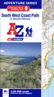
Wandelatlas 4 Adventure Atlas South West Coast Path South Devon | A-Z Map Company
AZ heeft de meest gedetailleerde wandelkaarten van delen van het South West Coast Path  gebundeld in een atlasje. Daardoor is het heel handig qua formaat. De kaarten zelf zijn perfect voor het wandelen. Schaal 1:25.000 The A-Z Adventure series features the accuracy and quality of OS 1:25000 mapping in a convenient book, complete with index.   The A-Z Adventure series is an innovative concept that utilizes Ordnance Survey 1:25000 mapping in a book, therefore eliminating the need to fold and re-fold a large sheet map to the desired area. OS 1:25000 is Ordnance Survey's most detailed mapping, showing public rights of way, open access land, national parks, tourist Information, car parks, public houses and camping and caravan sites.   Unlike the original OS sheets, this A-Z Adventure Atlas includes a comprehensive index to towns, villages, hamlets and locations, natural features, nature reserves, car parks and youth hostels, making it easy to find the required location quickly. Each index e…
12,95
Fietskaart Cycling guides Dartmoor - South Devon | Goldeneye
Dartmoor. One of England’s greater National Parks; the Forest of Dartmoor covers 365 square miles and contains the highest ground in England south of the Peak District. On its desolate moorland tracks the wanderer can believe they are further from a public road than anywhere in the country, but on the fringes lush valleys lead down on every side to thick woodland, green vegetation and picturesque villages. Dartmoor is well known for its wildlife - attractive herds of ponies, seemingly wild but in fact individually owned, foxes, badgers and otters - also the occasional adder. Fallow, roe and Sitka deer can often be seen, but the red deer of Exmoor have never penetrated the area. Buzzards, kestrels and various Birds of Prey are frequently seen, as well as the wheatear, while crows, ravens and the skylark are fairly commonplace. The Moor abounds in prehistoric remains. There are also many deserted medieval villages with remains of the traditional ‘longhouse’ buildings. For centuries tin m…
12,95
Historische Kaart Tartans Map of Scotland | Collins
Discover Scotland with this authoritative guide to tartans and their origins. This popular touring map has a huge amount of detail with over 1,000 places of tourist interest plotted and named on the map. The features have been plotted onto an up-to-date and attractive Collins map of Scotland.   A clear, easy to follow road map with colour classified roads. Ideal for tourists with hundreds of distinctive tourist symbols and tourist information centres all shown. This map includes:* The whole of Scotland on a double sided sheet at 5 miles to 1 inch* Over 25 categories of tourist information shown on the map including youth hostels, picnic sites and ferries as well as the more obvious tourist sites such as castles, wildlife parks and museums* Detailed town centre maps of Edinburgh, Glasgow, Aberdeen, Dundee, Inverness and Perth* Distances on the map along major routes Scale: 1:316,800 (5 miles to 1 inch).   There is a comprehensive index to both place names and places of tourist interest.
8,50

Klanten-reviews van Historische Kaart An Archaeological Map of Hadrian's Wall | English Heritage

Er zijn nog geen beoordelingen voor dit productBen jij de eerste die een review plaatst?

Meer over Historische Kaart An Archaeological Map of Hadrian's Wall | English Heritage

Productomschrijving

It was more than just a wall: it was a whole military zone designed to control movement across the northern frontier of the Roman province of Britannia. Great earthwork barriers survive, along with the remains of forts and temporary camps; watch-towers and fortified gates; civilian settlements, temples, cemeteries, bath-houses, roads and bridges. Stretching across the spine of England from the North-East coast to the Irish Sea, the line of the frontier extends for over 100 miles through every type of landscape: from the streets of urban Tyneside, through arable fields; along the crags of the wild Whin Sill; to the sands of the Solway, and down the coast of Cumbria. Drawing upon the extensive expertise and unrivalled archives of English Heritage, and those of its partners, this map depicts the fruits of modern archaeological research: in field survey, geophysics, excavation, and the analysis of aerial photographs. Using Ordnance Survey 1:25,000 data - the ideal scale for walkers - this revised new map shows with great clarity all the elements of Hadrian s Wall, and distinguishes between those features that are visible and those that have been levelled through time. A brief text explains the remains on the ground, and how to use the map to find them including the museums and the best places to visit. This World Heritage Site is now more accessible than ever before, so see the landscape through new eyes."
Webshop.nl maakt gebruik van cookies. Ga je verder op onze website, ga dan akkoord met het plaatsen van cookies en de verwerking van deze data door ons en vermelde partners.