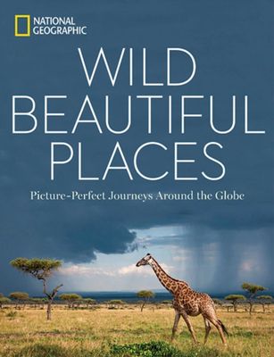
Fotoboek Wild, Beautiful Places | National Geographic

0
National Geographic photography captures the world's most remote, exotic places in this visually stunning travel book full of scenic wonders to experience. Highlighting 50 of Earth's most pristine, scenic locales, this beautiful book is illustrated with stunning images, coupled with accessible, engaging descriptions and practical travel informatio...

Verkopers met dit product

Verkoper
Bezorging
Prijs
DeZwerver.nl logo
DeZwerver.nl
2,95
29,95

Anderen bekeken ook

Fotoboek America the Beautiful | National Geographic
"America the Beautiful' showcases the stunning spaces closest to our nation's heart--from the woods in the Great Appalachian Valley that Davy Crockett once called home to the breathtaking sweep of California's Big Sur coast to the wilds of Alaska. It also celebrates the people who have made this country what it is, featuring a wide range of images including the Arikara Nation in the early 1900s and scientists preparing for travel to Mars on a Hawaiian island. Culled from National Geographic's vaunted photo archives, spanning a period of more than 130 years, this provocative collection depicts the splendor of this great nation as only National Geographic can, with a dramatic combination of modern and historical imagery--from the creation of architectural icons like the Golden Gate Bridge and Lady Liberty to the last of the country's wild places preserved in our national parks. 0With a structure inspired by the original song "America the Beautiful," this book recognizes what makes our n…
47,50
Wegenkaart - landkaart 3400 Adventure Map Argentina - Argentinië | National Geographic
Wegenkaart van Argentinië met vermelding van veel bezienswaardigheden, nationale parken en attrakties. Watervast en scheurvast. Juist door deze vermeldingen onderscheidt de kaart zich van andere wegenkaarten. National Geographic's Argentina Adventure Map is designed to meet the unique needs of adventure travelers—detailed, durable, and accurate. Argentina includes the locations of thousands of major cities and towns with an index for easily locating them, plus a clearly marked road network complete with distances and designations for major highways, limited access highways, minor roads, and more.   What sets National Geographic Adventure Maps apart from traditional road maps are the hundreds of points-of-interest that highlight the diverse, unique, and exotic destinations within Argentina including national parks and preserves, World Heritage sites, archeological sites, churches of interest, scenic viewpoints, natural points of interest, and important travel aids like airports, airstr…
17,50
Wegenkaart - landkaart 3303 Adventure Map Ireland - Ierland | National Geographic
Wegenkaart van Ierland met vermelding van veel bezienswaardigheden, nationale parken en attrakties. Watervast en scheurvast. Juist door deze vermeldingen onderscheidt de kaart zich van andere wegenkaarten. National Geographic's Ireland Adventure Map is designed to meet the unique needs of adventure travelers—detailed, durable, and accurate. Ireland includes the locations of thousands of major cities and towns with an index for easily locating them, plus a clearly marked road network complete with distances and designations for major highways, limited access highways and more.   What sets National Geographic Adventure Maps apart from traditional road maps are the hundreds of points-of-interest that highlight the diverse, unique, and exotic destinations within Ireland including national parks and preserves, World Heritage sites, castles, archeological sites, monuments, scenic viewpoints, beaches, natural points of interest, and important travel aids like airports, airstrips, rail lines,…
17,50
Wegenkaart - landkaart 3126 Southeast United States | National Geographic
Mooie kaart van de bekende kaartenmaker National Geographic. Veel details door kleurgebruik. De wegen zijn met kleuren verdeeld in drukke en minder drukke, de wegnummers zijn goed terug te vinden. De kaart onderscheidt zich van andere series door de hoeveelheid topografische details als counties, plaatsnamen en waterwegen en het bevat een register waarin het eenvoudig zoeken is. Daarnaast is de kaart gedrukt op scheur- en watervast papier. The United States Southeast Adventure Map will guide you through the diverse landscapes of this remarkable region, from the white sand beaches of Florida, to the barrier islands of North Carolina, through the coastal plains and rolling piedmont regions, and into the stunning Blue Ridge Mountains of Virginia, West Virginia, North Carolina, Tennessee and Georgia. Great Smoky Mountains and Shenandoah National Parks straddle the ridge of the Appalachian Mountains and stand in dramatic contrast to the sawgrass marshlands of Everglades National Park and t…
17,50
Wegenkaart - landkaart 3402 Adventure Map Chile - Chili | National Geographic
Wegenkaart van Chili met vermelding van veel bezienswaardigheden, nationale parken en attrakties. Watervast en scheurvast. Juist door deze vermeldingen onderscheidt de kaart zich van andere wegenkaarten.   National Geographic's Chile Adventure Map is designed to meet the unique needs of adventure travelers—detailed, durable, and accurate. Chile includes the locations of thousands of major cities and towns with an index for easily locating them, plus a clearly marked road network complete with distances and designations for major highways, toll roads, limited access highways and more.   What sets National Geographic Adventure Maps apart from traditional road maps are the hundreds of points-of-interest that highlight the diverse, unique, and exotic destinations within Chile including National Parks and Preserves, World Heritage Sites, Archeological sites, ski areas, beaches, waterfalls, natural points of interest and important travel aids like airports, airstrips, rail lines, lighthouse…
17,50
Wegenkaart - landkaart Sierra Nevada | National Geographic
&; Waterproof &; Tear-Resistant &; Travel Map   National Geographic's Sierra Nevada Destination Map strikes the perfect balance between map and guidebook and is an ideal resource for touring the rugged landscape of this culturally and geographically unique region of California and Nevada.   The front side of the print map reveals a detailed map of the region stretching from the Oregon border to California's Eldorado National Forest, bordered by the Sacramento Valley to the west and Nevada's Great Basin to the east. Modoc, Shasta-Trinity, Lassen, Plumas, and Humbolt-Toiyabe National Forests are also included on the map. The map features a comprehensive road network including scenic byways as well as areas of interest such as Indian Reservations, National Parks and Monuments, and Recreation Areas. Trails, historic sites, museums, cultural centers, scenic areas, state parks and other points of interest are also included. In addition, the map features beautiful photographs and inform…
17,50
Reisgids Oregon | Insight Guides
This Insight Guide is a lavishly illustrated inspirational travel guide to Oregon and a beautiful souvenir of your trip. Perfect for travellers looking for a deeper dive into the destination's history and culture, it's ideal to inspire and help you plan your travels. With its great selection of places to see and colourful magazine-style layout, this Oregon guidebook is just the tool you need to accompany you before or during your trip.   Whether it's deciding when to go, choosing what to see or creating a travel plan to cover key places like Downtown Portland and Albany, it will answer all the questions you might have along the way. It will also help guide you when you'll be exploring Crater Lake National Park or discovering the Cascade Mountains on the ground. Our Oregon travel guide was fully-updated post-COVID-19.   The Insight Guide Oregon covers: Portland and around, Oregon Coast, Mt. Hood and Columbia River Gorge, Eastern Oregon, Central Oregon, Southern Oregon, Willamette Valle…
23,95
Wegenkaart - landkaart 3120 Rocky Mountains | National Geographic
Mooie kaart van de bekende kaartenmaker National Geographic. Veel details door kleurgebruik. De wegen zijn met kleuren verdeeld in drukke en minder drukke, de wegnummers zijn goed terug te vinden. De kaart onderscheidt zich van andere series door de hoeveelheid topografische details als counties, plaatsnamen en waterwegen en het bevat een register waarin het eenvoudig zoeken is. Daarnaast is de kaart gedrukt op scheur- en watervast papier. The United States Rocky Mountains Adventure Map will guide you through one of the most rugged and scenic regions in North America. Colorado, Utah, Wyoming, and Montana contain Yellowstone, Grand Teton, Glacier, Zion, Arches, Capitol Reef, Canyonlands, Mesa Verde, and Rocky Mountain National Parks along with dozens of magnificent National Monuments, Forests, and Wilderness Areas, the Continental Divide, and America’s greatest skiing, rafting, and climbing destinations. The map includes the cities of Denver, Salt Lake City, and Missoula, and Cheyenne …
17,50
Wegenkaart - landkaart 3118 Pacific Northwest | National Geographic
Mooie kaart van de bekende kaartenmaker National Geographic. Veel details door kleurgebruik. De wegen zijn met kleuren verdeeld in drukke en minder drukke, de wegnummers zijn goed terug te vinden. De kaart onderscheidt zich van andere series door de hoeveelheid topografische details als counties, plaatsnamen en waterwegen en het bevat een register waarin het eenvoudig zoeken is. Daarnaast is de kaart gedrukt op scheur- en watervast papier. The United States Pacific Northwest Adventure Map will guide you through one of the most stunning regions in North America. The states of Washington, Oregon and Idaho contain Olympic, Mt. Rainier, Crater Lake, and North Cascades National Parks, Mt. Saint Helens and Mount Hood volcanoes, Columbia River Gorge, and dozens of magnificent National Monuments, Forests, and Wilderness Areas. The map includes the cities of Seattle, Portland, Boise, Spokane, and Eugene as well as Puget Sound and the spectacular Pacific coastline of Washington and Oregon. It c…
17,50
Wegenkaart - landkaart 3125 Southeastern Plains and Gulf coast | National Geographic
Mooie kaart van de bekende kaartenmaker National Geographic. Veel details door kleurgebruik. De wegen zijn met kleuren verdeeld in drukke en minder drukke, de wegnummers zijn goed terug te vinden. De kaart onderscheidt zich van andere series door de hoeveelheid topografische details als counties, plaatsnamen en waterwegen en het bevat een register waarin het eenvoudig zoeken is. Daarnaast is de kaart gedrukt op scheur- en watervast papier.   The Southeastern Plains and Gulf Coast Adventure Map will guide you through the southern Mississippi River basin from the midwestern states of Illinois and Indiana through Missouri, Kentucky, Tennessee, Arkansas to the Gulf Coast states of Louisiana, Mississippi, Alabama, and the pan handle of Florida. The names of cities in this region of the country recall the classics of jazz, blues, and country music, which were born in rivers, bayous, fields, and farms of this scenic and storied region. The map includes the cities of Indianapolis, Nashville, …
17,50

Klanten-reviews van Fotoboek Wild, Beautiful Places | National Geographic

Er zijn nog geen beoordelingen voor dit productBen jij de eerste die een review plaatst?

Meer over Fotoboek Wild, Beautiful Places | National Geographic

Productomschrijving

National Geographic photography captures the world's most remote, exotic places in this visually stunning travel book full of scenic wonders to experience. Highlighting 50 of Earth's most pristine, scenic locales, this beautiful book is illustrated with stunning images, coupled with accessible, engaging descriptions and practical travel information. The book covers everything from otherworldly, secluded valleys to far-flung, soaring mountain ranges. National Geographic photographers share some of their favorite shots from around the world and explain how they got them, and historical photos culled from National Geographic's hallowed image archive highlight old Society explorations in rugged, distant locations, and give a glimpse into the bygone days of these exotic places.

Productinformatie

    Verken gerelateerde categorieën

    Webshop.nl maakt gebruik van cookies. Ga je verder op onze website, ga dan akkoord met het plaatsen van cookies en de verwerking van deze data door ons en vermelde partners.