Fotoboek From the Air - Ireland's Wild Atlantic Way | O'Brien Press

0
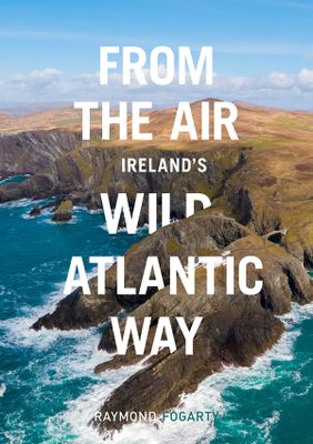
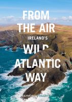
The Wild Atlantic Way covers 2500km, passing through an incredible variety of landscapes - from the verdant forests of Cork to the lunar landscape of the Burren, from rugged headlands and wild mountainsides to lazy rivers and brooding castles. Raymond Fogarty's spectacular drone photography brings a new and thrilling aerial perspective to one of t...

Verkopers met dit product

Webshop
Bezorging
Prijs
DeZwerver.nl logo
DeZwerver.nl
niet bekend
10,95

Anderen bekeken ook

Fotoboek Ireland's Wild Atlantic Way | O'Brien Press
Take a photographic journey down Ireland's Atlantic coast from Donegal in the north to Cork in the south. This beautiful book showcases the west coast in all its wild beauty: dramatic views, abundant nature and wildlife, lighthouses, harbours and quaint seaside villages, as well as heritage, history and people. The Wild Atlantic Way is a fully-signposted route along the west coast of Ireland that brings the visitor to some of Ireland's most spectacular scenery and liveliest towns: from surfing in Rossknowlagh to birdwatching at the magnificent cliffs of Moher, from the boats in Galway Bay to traditional music in Doolin, from dolphins in Kerry to castles in Cork there's something for everyone on the wild west coast. Over 200 wonderful photographs. Maps showing each section of the Wild Atlantic Way: Donegal-Mayo, Mayo-Clare, Clare-Kerry, Kerry to Cork. 'a sumptuous book in which the magnificent colour photographs speak for themselves' Books Ireland on Ireland's Coast
15,95
Reisgids Towns on the Wild Atlantic Way | O'Brien Press
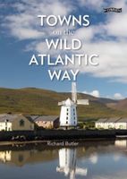
From the drama of Donegal to the beauty of west Cork, the 2,500km Wild Atlantic Way is one of the world's greatest tourist routes. The unique towns along the way are the perfect bases from which to explore Ireland's spectacular west coast. Learn all about them - from the historic city of Galway to the copper-mining village of Allihies - as well as the routes and sights nearby. Illustrated throughout with beautiful photographs and handy maps.
16,50
Reisgids Ireland's Wild Atlantic Way - Ierland | The Collins Press
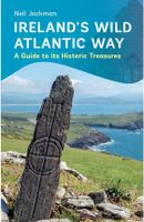
Deze boeiende en praktische gids is een essentiële metgezel voor elke ontdekkingsreiziger die dieper wil graven en dit spectaculaire landschap wil ontdekken.   Boasting ancient tombs, atmospheric castles and sacred retreats, the Wild Atlantic Way is alive with treasures to explore.   Beginning in Kinsale, Neil Jackman guides us northwards to visit his top 100 heritage sites. From 350-million-year-old footprints on Valentia Island to vestiges of the more recent past like the cottage of 1916 revolutionary Patrick Pearse, you will discover the stories behind the dramatic scenery.   Here is everything you need to know about the history of iconic landscapes like the Cliffs of Moher and the Ring of Kerry, as well as lesser-known delights like the monastic site at Reask in County Kerry and the Doonfeeny Standing Stone in County Mayo. For those who want to get off the beaten track, there are trips to islands like Scattery, Inishmurray and, of course, the breathtaking Skellig Michael.   This…
24,95
Reisgids Wild Ruins | Wild Things Publishing
Discover and explore Britain’s extraordinary history through its most beautiful lost ruins. From crag-top castles to crumbling houses in ancient forests, and ivy-encrusted relics of industry to sacred places long since returned to nature. Including over 250 ruins and 28 maps.   By Dave Hamilton, author of the Self Sufficient-ish Bible. With a foreword by Sir Tony Robinson from Channel Four’s Time Team.   • Britain’s first guidebook to Britain’s ruins • Detailed instructions on how to visit and gain access to over 250 hidden, wild or lesser known places (28 maps) • Stunning photography • Wide family appeal – cuts across generations and brings history alive – also appeals to walkers and history buffs • Best for lists and itineraries, including for families, explorers, nature lovers, foragers, campers and days out, sunset views, legends   Includes the best:   • Ancient Ruins – Earthworks and Standing Stones • Abandoned villages and settlements. • Mines and quarries – Copper M…
25,95
Wandelgids Ireland's Wild Atlantic Way | The Collins Press
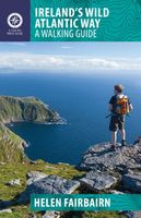
Duidelijke wandelgids van dit specifieke deel van Ierland. Goede praktische informatie en zeker voor de GPS wandelaar handig met vermelde waypoints. Kaarten zijn schetsmatig, maar er wordt verwezen naar de benodigde topografische kaarten van Ierland.  The Wild Atlantic Way follows the magnificent west coast of Ireland, passing golden beaches, thrusting headlands and soaring sea cliffs. Renowned walking-guide author Helen Fairbairn explores the best walking routes of the region, recommending trips to uninhabited islands, coastal mountains and much more. Routes vary from two to six hours, and are illustrated with colour photos and detailed maps. Whatever your level of expertise, this comprehensive guide is all you need to discover the real wonders of the Wild Atlantic Way.
22,50
Wandelgids The Burren & the Aran Islands | The Collins Press
Duidelijke wandelgids van dit specifieke deel van Ierland. Goede praktische informatie en zeker voor de GPS wandelaar handig met vermelde waypoints. Kaarten zijn schetsmatig, maar er wordt verwezen naar de benodigde topografische kaarten van Ierland.  The Burren and the Aran Islands, with their unique combination of flora, fauna and landscape, are explored by large numbers of walkers annually. This is a revised guide to some of the best walking routes in the region, with lucid descriptions and additional information to enhance the walkers' enjoyment and appreciation of the place. From the rugged interior to spectacular coastal scenery, from challenging upland walks to shorter road and waterside excursions, this selection has something for everyone. Every part of the region is covered. Walks vary from two-hour strolls to the longer Burren Way, a six-hour walk from Lisdoonvarna to Ballyvaughan.   The author has put his considerable experience and detailed knowledge of the area to great …
22,50
Fotoboek Ireland's Islands | O'Brien Press
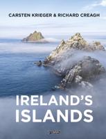
Hardcover fotoboek met mooie foto's en begeleidende teksten van de beeldschone Ierse eilanden. Take a photographic journey around Ireland's coast and explore the landscape, history, heritage and wildlife of the offshore islands. Photographers Carsten Krieger and Richard Creagh have a deep love for and knowledge of these special places. From rugged cliffs thronged with seabirds to tranquil bays, and from quiet strands to bustling villages, their words and images bring to life the uniqueness of these small, sea-locked worlds. Over 200 magnificent colour photographs of Sherkin Island * Cape Clear * Bere Island * Dursey Island * The Skelligs * Valentia The Blaskets * Aran Islands * Inishbofin * Inishturk * Caher * Clare Island * Achill Arranmore * Tory Island * Rathlin * Dalkey Island * Ireland's Eye * The Saltees 'a sumptuous book in which the magnificent colour photographs speak for themselves' Books Ireland on Ireland's Coast
31,95
Wandelgids Thames Path | Trailblazer Guides
This book follows the Thames Path National Trail from the river's source in Gloucestershire to the Thames Barrier in London. Officially 184 miles (294km) in length (although the actual distance you walk will depend on a number of decisions you make en route), the path meanders, accompanied by its watery muse, through pristine and tranquil countryside, past historic sites and buildings, via pub, lock, weir, and the occasional scattering of waterfowl, to a city, once the fulcrum of an empire, and now the heart of modern day England. The river, responsible for the metropolis' very being, tells tales, inspires artists, accommodates swans, geese, and water voles, reflects the silhouettes of red kites and kingfishers, provides employment, entices adventure, and allows time for carefree pilgrims to procrastinate and think. Following its banks is a grand way to go for a ramble. The path begins, as the river does, in a meadow in the Cotswolds; its upper reaches lonely and wild, the meadows and…
19,95
Reisgids Wild Guide Scotland - Schotland | Wild Things Publishing
Prachtige reisgids van Schotland waarbij nadrukkelijk de natuur en buitensportmogelijkheden worden uitgelicht. Met kaarten en wat praktische informatie. A new compendium of adventures, from the best-selling Wild Guide series (winner of travel guidebook of the Year 2015), now released for Scotland – Europe’s best adventure travel and wilderness destination. Discover magical mountains and secret glens with shimmering lochs and hidden waterfalls, perfect for a summer swim. Explore lost ruins and castles, watch sea-bird colonies on dramatic cliffs or walk barefoot on white-sand beaches lapped by turquoise waters. Wild camp in flower-covered dunes and retreat to ancient inns with roaring fires and even warmer welcomes. In this inspiring compendium you will find the best of Scotland’s unspoiled Highlands and Islands. Featuring stunning photography and engaging travel writing, this is the perfect guide for those seeking a wild adventure.   New from the award-winning Wild Guide series, with …
26,50
Reisgids Northumberland | Sacristy Press
Northumberland, one of the most sparsely-populated counties in England, with unique features like the Holy Island of Lindisfarne and Hadrian’s Wall, was also a crucible of European civilization and remains a treasury of culture. Giving birth to railways worldwide through George Stephenson, it saw the beginnings of hydraulics, hydro-electricity and turbines and, with Joseph Swan, witnessed the earliest light from electric incandescent lamps; it was a laboratory of invention. Northumberland has, however, changed dramatically over the course of the last century: deep coal-mining, shipbuilding and much heavy engineering have gone, but new industries have flowered. So, the largest man-made lake in northwest Europe, lying within the largest man-made forest is set within the north west of the county, bringing water in abundance and supporting entirely new leisure and tourist activities. The lower Tyne has been transformed both architecturally, and culturally. This unique guide to England’s m…
41,50

Klanten-reviews van Fotoboek From the Air - Ireland's Wild Atlantic Way | O'Brien Press

Er zijn nog geen beoordelingen voor dit productBen jij de eerste die een review plaatst?

Meer over Fotoboek From the Air - Ireland's Wild Atlantic Way | O'Brien Press

Productomschrijving

The Wild Atlantic Way covers 2500km, passing through an incredible variety of landscapes - from the verdant forests of Cork to the lunar landscape of the Burren, from rugged headlands and wild mountainsides to lazy rivers and brooding castles.

Raymond Fogarty's spectacular drone photography brings a new and thrilling aerial perspective to one of the world's longest coastal touring routes.

Ireland's west coast is blessed with many examples of days gone by - where Iron Age forts, medieval castles, abbey ruins and round towers add to a special sense of timelessness. This will give you a taste of what's to be found; it's a record of a six-week adventure of one man and his camera drone.

Verken gerelateerde categorieën

Webshop.nl maakt gebruik van cookies. Ga je verder op onze website, ga dan akkoord met het plaatsen van cookies en de verwerking van deze data door ons en vermelde partners.