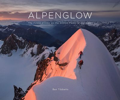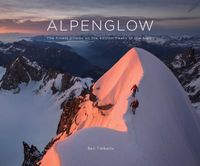
Fotoboek Alpenglow - The Finest Climbs on the 4000m Peaks of the Alps | Benn Tibbetts

0
ALPENGLOW takes the reader through a journey of personal adventure, immersive art and breathtaking scenery, combining inspiration with detailed local knowledge. Climbing the 4000m peaks of the Alps is one of the great and enduring challenges in mountaineering. It is a project that requires endurance, courage, skill, and humility.   Whether you are...

Verkopers met dit product

Verkoper
Bezorging
Prijs
DeZwerver.nl logo
DeZwerver.nl
2,95
72,95

Anderen bekeken ook

Fotoboek Alpenglow - The Finest Climbs on the 4000m Peaks of the Alps | Benn Tibbetts
ALPENGLOW takes the reader through a journey of personal adventure, immersive art and breathtaking scenery, combining inspiration with detailed local knowledge. Climbing the 4000m peaks of the Alps is one of the great and enduring challenges in mountaineering. It is a project that requires endurance, courage, skill, and humility.   Whether you are a lover of mountain landscapes, an aspiring alpinist, or already a veteran of many adventures, this book will provide a wealth of original and inspiring material to help with planning future excursions or simply immersing yourself in the beauty of the high mountain   Drawings The photography in the book is matched by a series of finely wrought pencil drawings. Several of these are available as luxury prints to complement the book.   Finsteraarhorn pencil drawing (12 x 8 cm) example   The drawings for this project are usually smaller than a typical postcard. Each one is based on photographs and made with finely-sharpened pencils whilst…
72,95
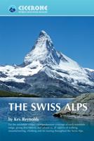
Wandelgids The Swiss Alps | Cicerone
  The Swiss Alps are home to the highest and most spectacular mountains in Western Europe. This stunning guidebook describes each mountain area throughout Switzerland – the peaks, passes, valleys and bases – to help you identify the best destinations to plan your trip.   Questions such as ‘Where to walk, climb or ski?’, ‘What multi-day treks are available’ and ‘Where do they go?’, ‘Where are the mountain huts, what are their facilities, which peaks do they serve?’ And where are the most suitable valley bases?’ – all these and more are addressed in detail in this essential guidebook.   The Swiss Alps does not give detailed route directions but information is given about all the guides and maps available for every region.   The Swiss Alps by Kev Reynolds is the third book in Cicerone’s World Mountain Ranges series, which include The Pyrenees and Scotland.   descriptions of all the Swiss Alps, area-by-area from the Chablais Alps in the south west to the Silvretta in the north east classi…
34,95
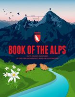
Reisinspiratieboek - Reisboek Book of the Alps | Marmota Maps
The Book of the Alps  the great illustrated book about the Alps.290 pages with over 1000 illustrations, graphics, and maps on geography, sports, history, culture, climate, environment and much more. Understand the Alps like never before.Created in cooperation with the Alpine clubs of Germany, Austria, and South Tyrol. CONTENTS The Book of the Alps has 46 chapters in seven subject areas: Geography   Flora and Fauna   Climate and Environment    Alpinism   Mountain Sports   Society and Economy   Arts and Culture   GEOGRAPHY Geological Formation Ice Age Mountains Valleys Mountain Passes Lakes and Rivers Glaciers The Alps are unique. How did they form and evolve? How do glaciers, passes, valleys, lakes, and rivers shape the landscape? Answers to these and many more questions can be found in the geography chapter.   FLORA AND FAUNA Biodiversity Plants Forests Animals National Parks The Alpine environment is fascinating. Alpine flowers such as the edelweiss and Alpine anima…
44,95
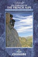
Wandelgids - Klimgids - Klettersteiggids Via Ferratas of the French Alps | Cicerone
This guidebook covers 66 varied via ferratas in the French Alps. The routes are spread over six areas: Geneva and the Northern Alps, Chambéry, Tarentaise and Maurienne valleys, Grenoble and Briançon, amid the Mont Blanc, Vanoise and Queyras ranges. Difficulty ranges from easy, protected routes through to exposed, technical challenges. With some of the most beautiful scenery in the world, the French Alps have long been a popular destination for a wide range of outdoor activities. In recent years, the region has seen the arrival of a growing number of via ferrata routes.   Via ferrata climbing – using fixed cables, bridges and ladders to explore terrain that is normally only accessible to experienced rock climbers – combines elements of scrambling, mountaineering and rock climbing, yet is a very distinct pursuit. Increasingly popular, recent years have seen a surge in the number of routes being established in these iconic mountains.   The routes in this guidebook range from straightforw…
25,95
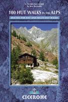
Wandelgids 100 Hut Walks In The Alps | Cicerone
This guidebook has route descriptions for 100 day walks to suit alpine walkers of all abilities, with suggestions for some hut-to-hut tours. These routes take you through breathtaking scenery in the Maritime Alps, Julian Alps, Gran Paradiso, the Turnitzer Alps, Bernese Oberland, the Kitzbuheler Alps and the Dolomites of South Tirol. Extending in huge arc of more than 1000km (620 miles) from the Mediterranean coast near Nice to the low, wooded foothills outside Vienna, the Alps display the full gamut of mountain landscape features. All of the routes in this guide have been specially selected to show the amazing diversity of this wonderful mountain chain.   There are walks to suit every taste: gentle and undemanding, long and tough, and everything in between. Most of the routes avoid climbing of a technical nature except the odd scramble aided by a fixed rope. Glacier crossings where crevasses lurk for the unwary have also been avoided in the main, although just a small handful of walks…
22,95
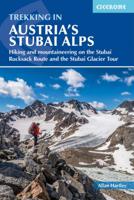
Wandelgids Trekking in the Stubaier Alps | Cicerone
Uitstekende wandelgids van Cicerone over de Stubaier Alpen, waarbij de nadruk ligt op een tweetal meerdaagse routes: Huttentochten voor een gemiddelde en wat meer gevorderde wandelaar. Goede praktische informatie, kaartmateriaal beperkt. Aanbevolen wandelkaarten bij deze gids Schaal 1:25.000 Wandelkaart 31/1 Alpenvereinskarte Stubaier Alpen - Hochstubai Wandelkaart 31/2 Alpenvereinskarte Stubaier Alpen - Sellrain Of schaal 1:50.000 Wandelkaart 83 Stubaier Alpen Kompass A guidebook to three hut-to-hut treks in Austria’s Stubai Alps: the 79km Stubai Rucksack Route, the 60km Stubai Glacier Tour – plus a South Tirol extension, and the 67km Gschnitztal Runde Tour. Whereas the rucksack route requires only good fitness and mountain walking experience, the glacier tour involves glacier crossings. The Stubai Rucksack Route is presented in 9 stages, the Stubai Glacier Tour in 7 (with the extension bringing it to 11) and the Gschnitzal Runde Tour in 7.   Also included are optional ascents of nei…
24,95
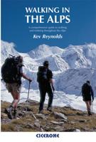
Wandelgids Walking in the Alps | Cicerone
Geweldig overzichtswerk van prachtige wandelroutes in de Alpen. Suggests many routes, and covers the range from the Maritime Alps of southern France to the Julian Alps of Slovenia. Walks vary from undemanding to long and tough, and everything in between. Walking is unquestionably the best method of exploring, and it is the mountain walker for whom journeys in the Alps reveal some of the finest views, the greatest contrasts. This book then is a definitive guide to the many thousands of possible routes, with a geographical span that ranges from the Maritime Alps of southern France to the Julians of Slovenia, from Italy's Gran Paradiso to the little-known Turnitzer Alps of eastern Austria, from the ice-bound giants of the Bernese Oberland to the green rolling Kitzbuheler Alps and the bizarre towers of the Dolomites of South Tirol, showing the amazing diversity of this wonderful mountain chain. There are walks to suit every taste: gentle and undemanding, long and tough, and everything in …
33,95
Wandelgids Trekking in the Silvretta and Ratikon Alps | Cicerone
Aanbevolen wandelkaarten bij deze gids: Schaal 1:60.000 Wandelkaart 14 Unterengadin | Kümmerly & Frey Wandelkaart 13 Davos - Arosa | Kümmerly & Frey Of schaal 1:25.000 Wandelkaart 26 Alpenvereinskarte Silvrettagruppe This guide describes three treks, between 5 and 8 days, in the Silvretta and Rätikon Alps starting near Klosters, and 12 half-day hut-to-hut routes. These contrasting ranges form a line on the borders of Switzerland, Austria and Liechtenstein. The Tour of the Silvretta, the Prättigauer Höhenweg and the Rätikon Höhenweg. Straddling the borders of Austria, Switzerland and Liechtenstein, the limestone Rätikon Alps reach into the snow-bound and glacier-hung Silvretta Alps to provide a richly diverse series of landscapes. The Tour of the Silvretta, the Prättigauer Höhenweg and the Rätikon Höhenweg, all within easy reach of Klosters, have been devised to help trekkers explore the best of the region. Given sifficient time they can also be combined to create a continuous 2-week t…
25,95
Wandelgids Trekking in the Alps | Cicerone
All the rich scenic diversity for which the Alps are renowned is celebrated here, while the 20 treks described include well-known classics as well as newly-created multi-day routes. The eight talented writers and photographers brought together to produce this book are among the most experienced of Alpine trekkers. Between them they have explored every corner of Europe’s premier mountain range, written dozens of guides and, in some cases, led trekking holidays there in order to share their enthusiasm for the Alps with other walkers. And that is the prime motivation for Trekking in the Alps – an inspiration and a celebration of the very best of these mountains. Best-known treks Tour of Mont Blanc; Tour of the Matterhorn; Tour of Monte Rosa; Walker’s Haute Route; Tour of the Jungfrau Region; Tour of the Vanoise; Dolomites AV 1 & 2 Longer trans-Alpine treks GR5 (Lake Geneva to Nice); Eastern Alps E5; Italian Alps GTA; Traverse of the Slovenian Alps For the Alpine adventurer Alpine Pass Ro…
28,95
Johan De Wilde. Hands of time (Paperback)
Five years on and the acclaimed Hands of Time has a sequel entitled Hands of Time - Plein été. The second part is an overview of drawings and other works from the period 2012 to 2017 and follows on seamlessly from the first. Johan De Wilde's work seems if ever that is possible, to have become even more intense and his drawing style to explore new layers. The drawings can be seen as the work of a human printer (man created the computer in his own image). They are built up like paintings: a labor-intensive process, layer upon layer of horizontal and vertical lines interwoven with a form, a figure. It is as if he is drawing the canvas on which he paints with his pencils. Johan De Wilde draws real-time on a scale of 1:1. While his and our time slip by, lines appear, which is another reason why almost every drawing is given the title History + a number. Vita brevis, ars longa.
39,90

Klanten-reviews van Fotoboek Alpenglow - The Finest Climbs on the 4000m Peaks of the Alps | Benn Tibbetts

Er zijn nog geen beoordelingen voor dit productBen jij de eerste die een review plaatst?

Meer over Fotoboek Alpenglow - The Finest Climbs on the 4000m Peaks of the Alps | Benn Tibbetts

Productomschrijving

ALPENGLOW takes the reader through a journey of personal adventure, immersive art and breathtaking scenery, combining inspiration with detailed local knowledge. Climbing the 4000m peaks of the Alps is one of the great and enduring challenges in mountaineering. It is a project that requires endurance, courage, skill, and humility.   Whether you are a lover of mountain landscapes, an aspiring alpinist, or already a veteran of many adventures, this book will provide a wealth of original and inspiring material to help with planning future excursions or simply immersing yourself in the beauty of the high mountain   Drawings The photography in the book is matched by a series of finely wrought pencil drawings. Several of these are available as luxury prints to complement the book.   Finsteraarhorn pencil drawing (12 x 8 cm) example   The drawings for this project are usually smaller than a typical postcard. Each one is based on photographs and made with finely-sharpened pencils whilst looking through a magnifying glass.   I usually start each layer of detail from one side and work steadily to the other to avoid smudging the fragile image with my hands. I rarely use an eraser as once the marks are made they are too small and fragile to modify. Each drawing takes between 2 and 10 weeks to complete.
  • Climbs on all 82 of the 4000m summits of the Alps
  • Unique PENCIL DRAWINGS 
  • ACTION PHOTOS of every route 
  • Exquisite LANDSCAPE IMAGES of each mountain 
  • The author has climbed each route 
  • TOPO DESCRIPTIONS and details of optimal climbing conditions 
  • 50 routes – 320 pages, 30×25 cm, 2.2kg
  • 190 photos and 25 drawings


Productinformatie

    Verken gerelateerde categorieën

    Webshop.nl maakt gebruik van cookies. Ga je verder op onze website, ga dan akkoord met het plaatsen van cookies en de verwerking van deze data door ons en vermelde partners.