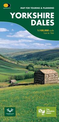
Fietskaart Yorkshire Dales Touring / Nidderdale Area of NB | Harvey Maps

0
This map provides a colourful overview of the Dales - famous Swaledale, Wensleydale, Wharfedale & Nidderdale. Colour shading makes it easy to pick out the hills & dales. Driveable roads are shown & steep hills marked. There is an introduction to each area, street plans of towns & lots of information on places to visit....

Verkopers met dit product

Verkoper
Bezorging
Prijs
DeZwerver.nl logo
DeZwerver.nl
2,95
13,50

Anderen bekeken ook

Nieuw
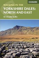
Wandelgids The Yorkshire Dales - Walking in the North and East | Cicerone
This guidebook contains 43 circular day walks in the north and east Yorkshire Dales. It explores the dales, hills and moors between Kirkby Stephen and Pateley Bridge. Walking ranges from gentle three-mile strolls to more strenuous day-long rambles across the Howgills, Wensleydale, Swaledale, Nidderdale, Mallerstang and Coverdale   In this guidebook, 43 circular walks, ranging from 3-mile strolls to full-day adventures are explored in the northern and eastern Dales. Few areas in England are as appealing as the Yorkshire Dales and this volume of a two-part guide provides walkers with a comprehensive walking guide to the whole of the region.     Each valley has a character and history of its own and this guide covers the varied fell and dale landscapes of the Howgills, Mallerstang, Swaledale, Wensleydale, Coverdale and Nidderdale. Spectacular waterfalls, dramatic gorges, expansive heather moors, rich woodlands and colourful flower meadows are just some of the natural delights encountered…
19,95
Wandelgids Yorkshire Dales | Pocket Mountains
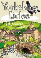
Handige compacte wandelgids met 40 dagwandelingen. Deze gids bevat kleine kaartjes en leuke uitgebreide informatie over wat er langs de route te zien is. Goede wandelkaarten zijn echter we noodzakelijk voor deze tochten: de Ordnance Survey explorer maps of Landanger maps zijn zeer geschikt.     The Yorkshire Dales combine a wild limestone landscape of high rolling moorland gouged by dramatic caves and cascading waterfalls with peaceful farmland carpeted in wildflowers and dotted with ruined abbeys, ancient stone walls and barns, and timeless villages waiting to be discovered.The 40 moderate walks in this collection from award winning publisher Pocket Mountains highlight the very best the area has to offer and include adventures in Wharfedale, Malhamdale, Nidderdale, Ribblesdale, Wensleydale, Swaledale and Dentdale. Many routes make use of sections of established long-distance trails such as the Pennine Way and the Dales Way.  
10,95
Nieuw
Wandelkaart Yorkshire Dales Zuid Oost | Harvey Maps
HARVEY launch innovative new series: Ultramap XT40. 16 titles featuring in Trail magazine through spring 2016. 40 years experience have gone into HARVEY's most creative new series. The Ultramap covers a large area yet is small enough to slip in a pocket. The Ultramap is fully detailed genuine original HARVEY mapping. The Ultramap is tough and 100% waterproof. Use it without a map case, whatever the weather! To provide the biggest area on the smallest lightest sheet, the Ultramap is printed double sided. The ingenious folding pattern allows you to open the Ultramap directly to any part and either side of the sheet. The two sides are aligned, so when you reach the edge of the Ultramap sheet you simply flip it over without re-folding. There's an overlap as well so you can map read continuously. The magic scale of 1:40,000 enables the Ultramap to provide all the detail you would expect to find on a large scale walking map including rights of way and boundaries. Actual size 73mm x 152mm. P…
19,50
Nieuw
Fietskaart Yorkshire Dales for Cyclists | Harvey Maps
The area covered by this new 100% waterproof map provides fabulous opportunities from gentle routes in the valleys to some challenging climbs over the moorland that separates them. It is no surprise that this area formed the central part of stage one of the Tour de France in 2014. Many top riders already train in the area with its quiet roads and fantastic variety of routes. Cycling is a lovely way to explore either as part of a visit or a touring holiday. You can devise routes of your own or use the information on the website of Cycling the Dales at www.cyclethedales.org.uk to help you find a route right for you. Main points at a glance. Whole of the Yorkshire Dales, 100% Waterproof, New XT100 paper, Tough and hard wearing, Fits easily in a jersey pocket, Weighs only 31 gms, Bike shops and cycle hire shown, Long distance cycle routes and challenging climbs highlighted, GPS compatible, Places of interest, Tourist information including cafes and pubs.
16,55
Nieuw
Wandelgids Walking in the Yorkshire Dales: South and West | Cicerone
Veelzijdige wandelgids van een deel van de Yorkshire Dales, goede kaarten en beschrijvingen en veel keuze uit een behoorlijk aantal wandelingen. Part of a two-book set, this guidebook describes 44 walks in the southern and western Yorkshire Dales, including the famous 23 mile Three Peaks circuit over Pen-y-Ghent, Whernside and Ingleborough. The other, mostly circular routes of 3½ to 13 miles cover the scenic region between Sedbergh, Kirkby Lonsdale, Settle, Skipton and Grassington. The Yorkshire Dales need little introduction: their picturesque scenery and hundreds of miles of footpaths, tracks and bridleways have been attracting walkers for decades. Part of a two-volume set, this guidebook presents over 40 routes in the south and west of the National Park, with bases including Sedburgh, Malham, Grassington, Skipton, Settle and Kirkby Lonsdale. The walks cover the valleys of Wharfedale, Littondale, Malhamdale, Ribblesdale and Dentdale – each with its own distinctive landscape and char…
19,95

Klanten-reviews van Fietskaart Yorkshire Dales Touring / Nidderdale Area of NB | Harvey Maps

Er zijn nog geen beoordelingen voor dit productBen jij de eerste die een review plaatst?

Meer over Fietskaart Yorkshire Dales Touring / Nidderdale Area of NB | Harvey Maps

Productomschrijving

This map provides a colourful overview of the Dales - famous Swaledale, Wensleydale, Wharfedale & Nidderdale. Colour shading makes it easy to pick out the hills & dales. Driveable roads are shown & steep hills marked. There is an introduction to each area, street plans of towns & lots of information on places to visit.

Verken gerelateerde categorieën

Webshop.nl maakt gebruik van cookies. Ga je verder op onze website, ga dan akkoord met het plaatsen van cookies en de verwerking van deze data door ons en vermelde partners.