webshop.nl
Categorieën
  Sluiten

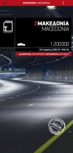
Fietskaart - Wegenkaart - landkaart 2 Touring Map Centraal (grieks) Macedonië | Terrain maps

Landkaart van een deel van Griekenland met zeer veel plaatsen, kleine wegen, hoogtelijnen en toeristische informatie in symbolen aangegeven, met plaatsnamenregister - schaal 1:200.000. De kaart wordt veel gebruikt door fietsers vanwege de mate van detail, is watervast en GPS-geschikt.   Detailed and updated map of Macedonia including, naturally, t...
13,50

Webshops met dit product

Webshop
Bezorging
Prijs

Anderen bekeken ook

Fietskaart - Wegenkaart - landkaart 1 Touring Map Thracië - Thrace en oostelijk (grieks) Macedonië - Griekenland | Terrain maps
Landkaart van een deel van Griekenland met zeer veel plaatsen, kleine wegen, hoogtelijnen en toeristische informatie in symbolen aangegeven, met plaatsnamenregister - schaal 1:200.000. De kaart wordt veel gebruikt door fietsers vanwege de mate van detail, is watervast en GPS-geschikt.   Detailed and updated map of Thrace including eastern Macedonia, as well as the islands of Samothrace and Thasos. It uses G.I.S. (Geographical Information Systems) technology and the WGS84 reference system, supplemented by a ΕΓΣΑ87 grid.    Like all of TERRAIN’s large maps, the map of Epirus is printed on Polyart, which is extremely durable against folding and unfolding, does not rip, and is 100% waterproof.    Based on field research completed in 2013, this map features all the newest national motorways, their interchanges, toll stations and Motorway Service Stations, as well as Egnatia motorway, its interchanges and vertical axes, and the border crossings.    Also depicted are the region’s touri…
13,50
Fietskaart - Wegenkaart - landkaart 3 Touring Map Epirus en westelijk (grieks) Macedonié - Griekenland | Terrain maps
Landkaart van een deel van Griekenland met zeer veel plaatsen, kleine wegen, hoogtelijnen en toeristische informatie in symbolen aangegeven, met plaatsnamenregister - schaal 1:200.000. De kaart wordt veel gebruikt door fietsers vanwege de mate van detail, is watervast en GPS-geschikt.   Detailed and updated map of Epirus including a large part of western Macedonia, as well as the islands of Corfu, Paxi, Antipaxi, Erikoussa, Mathraki and Othoni. It uses G.I.S. (Geographical Information Systems) technology and the WGS84 reference system, supplemented by a ΕΓΣΑ87 grid.    Like all of TERRAIN’s large maps, the map of Epirus is printed on Polyart, which is extremely durable against folding and unfolding, does not rip, and is 100% waterproof.    Based on field research completed in 2013, this map features all the newest national motorways, their interchanges, toll stations and Motorway Service Stations, as well as Egnatia motorway, its interchanges and vertical axes, and the border cros…
13,50
Wegenkaart - landkaart Griekenland - Greece | Terrain maps
Overzichtelijke wegenkaart van heel Grieklenland. Tweezijdig, gedrukt op waterafstotend en scheurvast papier. Met wegnummerng, mooie route-aanduiding, stranden, afstanden tussen steden en dorpen. Daarnaast ook tweetalig uitgevoerd. Detailed and updated map of Greece using G.I.S. (Geographical Information Systems) technology and the WGS84 reference system, and supplemented by a ΕΓΣΑ87 grid.    Like all of TERRAIN’s large maps, the map of Greece is printed on Polyart, which is extremely durable against folding and unfolding, does not rip, and is 100% waterproof.    Based on field research completed in 2013, this map features all the newest national motorways and their interchanges, toll stations and Motorway Service Stations.    Also depicted are Greece’s most important sights, as well as archaeological sites, castles, monasteries, National Parks and scenic routes worth exploring.    The map comes in a very practical clear double sleeve. One side contains the removable map, the other a r…
13,50
Wegenkaart - landkaart Vorarlberg | Freytag & Berndt
Gedetailleerde wegenkaart van een deel van Oostenrijk. Deze kaart is bijzonder duidelijk leesbaar en door de schaal met veel details als campings, berghutten, hoofdwandelroutes en alle berijdbare wegen en plaatsen. Met register. Top 10 Tips" Map in a series of detailed road maps at 1:150,000 from Freytag & Berndt, covering popular tourist regions of Italy and highlighting each area's top 10 sights, all with brief descriptions in the accompanying booklets which also provide street plan(s) of main town(s) in the region.   Relief is portrayed by hill-shading without distracting from other detail. Road network shows minor roads and selected cart tracks, and includes information indispensable for happy holiday driving: motorway service stations and motels, gradients on steep roads, restricted entry for cars or caravans and seasonal closures, routes not recommended for caravans, scenic roads and special tourist routes, etc. Railways, cable cars, and ferry connections also shown, as well as s…
14,95
Wegenkaart - landkaart Niederösterreich | Freytag & Berndt
Uitstekende overzichtskaart, tweezijdig, met register, met veel details, alle berijdbare wegen etc.    Top 10 Tips" Map in a series of detailed road maps at 1:150,000 from Freytag & Berndt, covering popular tourist regions of Italy and highlighting each area's top 10 sights, all with brief descriptions in the accompanying booklets which also provide street plan(s) of main town(s) in the region.   Relief is portrayed by hill-shading without distracting from other detail. Road network shows minor roads and selected cart tracks, and includes information indispensable for happy holiday driving: motorway service stations and motels, gradients on steep roads, restricted entry for cars or caravans and seasonal closures, routes not recommended for caravans, scenic roads and special tourist routes, etc. Railways, cable cars, and ferry connections also shown, as well as selected long--distance hiking trails.   Picturesque towns are highlighted and 10 selected places of interest are prominently m…
14,95
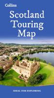
Wegenkaart - landkaart Touring Map of Scotland - Schotland | Collins
Best-selling map of Scotland. More than 1,000 places of tourist interest plotted and named on the map. The features have been plotted onto an up-to-date and attractive Collins map of Scotland.   A clear, easy to follow road map with colour classified roads. Ideal for tourists with hundreds of distinctive tourist symbols and tourist information centres all shown.   This map includes: • The whole of Scotland on a double sided sheet at 5 miles to 1 inch • Over 25 categories of tourist information shown on the map including youth hostels, picnic sites and ferries as well as the more obvious tourist sites such as castles, wildlife parks and museums • Detailed town centre maps of Edinburgh, Glasgow, Aberdeen, Dundee, Inverness and Perth • New places of interest including Japanese Garden (near Dollar), Macallan Distillery Centre, Moat Brae (Dumfries) and Scottish Submarine Centre (Helensburgh) • Road updates include the new Dalry bypass, Maybole bypass under construction, A9 dualling sections…
9,95
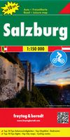
Wegenkaart - landkaart Salzburg - Salzburgerland | Freytag & Berndt
Uitstekende overzichtskaart, tweezijdig, met register, met veel details, alle berijdbare wegen etc.    Top 10 Tips" Map in a series of detailed road maps at 1:150,000 from Freytag & Berndt, covering popular tourist regions and highlighting each area's top 10 sights, all with brief descriptions in the accompanying booklets which also provide street plan(s) of main town(s) in the region.   Relief is portrayed by hill-shading without distracting from other detail. Road network shows minor roads and selected cart tracks, and includes information indispensable for happy holiday driving: motorway service stations and motels, gradients on steep roads, restricted entry for cars or caravans and seasonal closures, routes not recommended for caravans, scenic roads and special tourist routes, etc. Railways, cable cars, and ferry connections also shown, as well as selected long--distance hiking trails.   Picturesque towns are highlighted and 10 selected places of interest are prominently marked and…
14,95
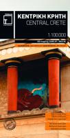
Wandelkaart - Fietskaart - Wegenkaart - landkaart 449 Central Crete - Kreta centraal | Terrain maps
Gedetailleerde wegenkaart en wandelkaart met alle kleine wegen, wandelpaden, hoogtelijnen en toeristische informatie aangegeven. Alle tekst is tweetalig in Engels en Grieks en de waterproof kaart is geschikt voor gebruik met GPS. Terrain’s map of Central Crete provides travelers with everything they need:  Scale of 100.000, which attributes all the information with clarity and in detail.  Map data processed within a GIS environment, resulting in great accuracy.  Double coordinate system, WGS 84 and ΕΓΣΑ 87, completely compatible with GPS.  It is printed on Polyart material, making it totally waterproof and rip-proof. You can fold it and unfold it a hundred times, fold it in irregular ways, dunk it in the sea or leave it out in the rain. This map is indestructible!  Clear symbols, easily readable fonts, rich colors and excellent arrangement of every element make the map extremely friendly to the user.  Unique wealth of information. Every village, every road (including their distan…
12,50
Wegenkaart - landkaart Kärnten - Karinthië | Freytag & Berndt
Gedetailleerde wegenkaart van een deel van Oostenrijk. Deze kaart is bijzonder duidelijk leesbaar en door de schaal met veel details als campings, berghutten, hoofdwandelroutes en alle berijdbare wegen en plaatsen. Met register. Uitstekende overzichtskaart, tweezijdig, met register, met veel details, alle berijdbare wegen etc.    Top 10 Tips" Map in a series of detailed road maps at 1:150,000 from Freytag & Berndt, covering popular tourist regions of Italy and highlighting each area's top 10 sights, all with brief descriptions in the accompanying booklets which also provide street plan(s) of main town(s) in the region.   Relief is portrayed by hill-shading without distracting from other detail. Road network shows minor roads and selected cart tracks, and includes information indispensable for happy holiday driving: motorway service stations and motels, gradients on steep roads, restricted entry for cars or caravans and seasonal closures, routes not recommended for caravans, scenic road…
14,95
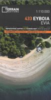
Wegenkaart - landkaart - Fietskaart 433 Touring Map Evia | Terrain maps
Gedetailleerde wegenkaart en wandelkaart met alle kleine wegen, wandelpaden, hoogtelijnen en toeristische informatie aangegeven. Alle tekst is tweetalig in Engels en Grieks en de waterproof kaart is geschikt voor gebruik met GPS. Terrain’s map of Evia with everything you need:    Scale of 110.000, which attributes all the information with clarity and in detail.  Map data processed within a GIS environment, resulting in great accuracy.  Double coordinate system, WGS 84 and ΕΓΣΑ 87, completely compatible with GPS.  It is printed on Polyart material, making it totally waterproof and rip-proof. You can fold it and unfold it a hundred times, fold it in irregular ways, dunk it in the sea or leave it out in the rain. This map is indestructible!  Clear symbols, easily readable fonts, rich colors and excellent arrangement of every element make the map extremely friendly to the user.  Unique wealth of information. Every village, every road (including their distance in km), every sight, every bea…
12,50

Klanten-reviews van Fietskaart - Wegenkaart - landkaart 2 Touring Map Centraal (grieks) Macedonië | Terrain maps

Er zijn nog geen beoordelingen voor dit productBen jij de eerste die een review plaatst?

Meer over Fietskaart - Wegenkaart - landkaart 2 Touring Map Centraal (grieks) Macedonië | Terrain maps

Productomschrijving

Landkaart van een deel van Griekenland met zeer veel plaatsen, kleine wegen, hoogtelijnen en toeristische informatie in symbolen aangegeven, met plaatsnamenregister - schaal 1:200.000. De kaart wordt veel gebruikt door fietsers vanwege de mate van detail, is watervast en GPS-geschikt.   Detailed and updated map of Macedonia including, naturally, the popular tourist region of Halkidiki and Mount Athos. It uses G.I.S. (Geographical Information Systems) technology and the WGS84 reference system, supplemented by a ΕΓΣΑ87 grid.    Like all of TERRAIN’s large maps, the map of Macedonia is printed on Polyart, which is extremely durable against folding and unfolding, does not rip, and is 100% waterproof.    Based on field research completed in 2013, this map features all the newest national motorways, their interchanges, toll stations and Motorway Service Stations, as well as Egnatia motorway, its interchanges and vertical axes, and the border crossings.    Also depicted are the region’s tourist attractions, archaeological sites, castles, monasteries, National Parks, caves open to visitors, scenic routes worth exploring, campsites, gas stations, vineyards under Protected Designation of Origin and wineries open to the public. In mountainous regions the ski resorts, mountain refuges and main trails are illustrated.    Presentation of the road network is exceptionally detailed and complete to reflect the scale of the map, and it is arranged in six categories. The map comes in a very practical clear double sleeve. One side contains the removable map, the other a removable booklet with the alphabetical index of cities, villages, archaeological sites and monasteries.  
Webshop.nl maakt gebruik van cookies. Ga je verder op onze website, ga dan akkoord met het plaatsen van cookies en de verwerking van deze data door ons en vermelde partners.