webshop.nl
Categorieën
  Sluiten

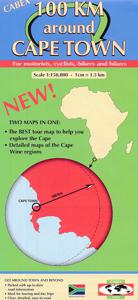
Fietskaart - Wegenkaart - landkaart 100 km around Cape Town - Kaapstad | Cabex Maps

Prima detailkaart van de Kaapregio t/m een straal van 100 km landinwaarts vanuit Kaapstad gerekend,  scheur en watervast materiaal. Duidelijke cartografie met goed onderscheid in de kwaliteit der wegen , veel toeristische informatie en op de achterzijde van de kaart een detalikaart van het wijngebied rond Stellenbosch en aanrijroutes van de belangr...
19,95

Webshops met dit product

Webshop
Bezorging
Prijs

Anderen bekeken ook

Wegenkaart - landkaart Cape Town & Garden Route Southern Africa - Kaapstad & Garden Route: Zuidelijk Afrika | ITMB
Een degelijke wegenkaart met aanduidingen van o.a. nationale parken, vliegveld, benzinepomp, dirt-roads. Als overzichtskaart goed te gebruiken. Lan and I travelled South Africa’s southern coastal route, known as the Garden Route a few years ago and found it fascinating. Shutdowns during the Covid upsurges in 2020 allowed Lan enough time to concentrate on producing an excellent map of Cape Town on tear-resistant Stone paper, covering the city in excellent detail, and a second full-sized map on the reverse side covering that portion of the country known as Cape Province; essentially, from Cape Town north to the Namibian border, east to the Transkei, and north to Potchefstroom. This encompasses the wine districts of Stellenbosch, the lovely towns of George and Knysna on the south coast, historic Port Elizabeth, the very interesting Transkei homeland, all of Lesotho, and the arid interior regions that resonate with history – Graaff Reinet, Bloemfontein, Kimberley, and Upington. One not-to-…
13,95
Wegenkaart - landkaart 01 Kaapstad - Cape Town and Surrounding Attractions | MapStudio
Het overzicht is soms misschien een beetje onduidelijk. maar de details in de inzetten en delen van de kaart zijn prima en voldoen goed voor het rondrijden met een eigen auto. Double-sided map, with a general road map on one side, plus numerous street plans and descriptions of four special routes on the reverse. The main map covers an area within reach as day trips from Cape Town, extending east to Swellendam and north to Langebaan. Road classification includes unsurfaced roads, intermediate driving distances on main and secondary roads, toll routes with gates, and mountain passes. Railways are shown with local stations. An impression of relief is provided by elevation tinting (perhaps somewhat confusing for regular map users - the higher the altitude, the greener the colour!), spot heights for main peaks, and names of mountain ranges. Nature and forest reserves, plus salt pans and marshes are indicated. Symbols mark local airfields, historical sites, caravan parks, many wine estates, …
16,95
Wegenkaart - landkaart South Pacific Cruising & Samoa | ITMB
Een overzichtskaart van de zuidelijke Stille Oceaan met de cruise routes tussen de verschillende eilanden aangegeven. Op de achterzijde een overzichtskaart van Samoa This is a new venture for ITMB. Cruising is a rapidly-growing segment of the travel industry, experiencing double-digit growth rates annually. Obviously, this is a thriving market. In conjunction with several cruise ship lines, we have prepared a map of the South Pacific Ocean, which extends southwards from Hawai'i to the southern tip of New Zealand and eastwards from central Australia/Papua New Guinea to the Pitcairn Islands. Thus, it does not include the popular South East Asia and China coast routes. We think this has to change at a time when 25,000,000 people are travelling by cruise ships. At the same time, we must keep coverage area relevant for those end users of the artwork. Even at 1:12M, most of the area covered is water, with island countries such as Fiji, Tonga, Kiribati, Tahiti, and the Cook Islands being visi…
13,95
Wegenkaart - landkaart Mexico Central & Mexico City | ITMB
Goede wegenkaart met duidelijk kleurgebruik. Het betreft een deel van Mexico met op de achterkant een stadsplattegrond van het centrale deel van Mexico City. MC is the largest city in the Western Hemisphere, with a population of 28,000,000 (or twice as big as New York City!). It would be impractical to portray the entire urban area on one map and have it make sense, so we show the portion of greatest interest to visitors, from the Chapultepec Zoological Park in the west to the incredibly busy Tapo Bus Terminal in the east, and from the railway station in the north to the southern east-west motorway just south of the main hospital complex. Much of MC’s touristic interest is concentrated in the Zona Rosa, Reforma, and Zocalo segments of the city centre, and these are shown in detail, noting hotels, major restaurants, shopping areas, and points of interest.   The map also includes inset maps of the San Angel area just north of the university, an inset map of the greater Mexico City Federa…
13,95
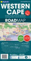
Wegenkaart - landkaart 10 Western Cape Road Map | MapStudio
Road map of the Western Cape Province with an enlargement for the Cape Peninsula and 27 street plans of the central areas in main towns. The map is annotated numerous places of interest, vineyards, etc. GPS coordinates are provides for main road junctions. This new edition Western Cape Road Map covers the whole of the Western Cape. It features easy-to-read full colour maps with GPS co-ordinates. The map provides tourist-friendly text, highlights places of interest and lists accommodation information. This map is perfect for scenic drives and includes information boxes on activities of interest.   Coverage includes the Garden Route & Route 62, South Western Cape, Winelands and Overberg, West Coast Flower Region and Little Karoo. The map features small detailed street plans of Cape Town CBD, Montagu, Barrydale, Ladismith, Oudtshoorn, Mossel Bay, Knysna, Plettenberg Bay, Humansdorp, George, Stellenbosch, Franschhoek, Paarl, Wellington, Hermanus, Swellendam, Robertson, Ceres, Tulbagh, Lang…
16,95
Wegenkaart - landkaart Bonaire | Kasprowski Maps
Bijzonder gedetailleerde kaart (1:40000) van alleen het eiland Bonaire. Zowel de wegen als ook de wandelpaden staan er op vermeld. Stranden, interessante plekken en bovendien de meeste duikplakken staan met diepte helder weergegeven op de kaart. Met stadsplattegrond van Kralendijk. The most up-to-date and only complete road map of Bonaire ( Scale 1 : 28 000 ), as well as the Kralendijk urban area, spanning from Santa Barbara Crowns, through the airport, to Punt Vierkant (Scale 1 : 15 000). An inset of Rincon (Scale 1 : 12 000) is also included. All maps and insets come with thorough street indexes.   All of the official diving sites around Bonaire and Klein Bonaire are displayed, most of them with their GPS locations, as recorded by STINAPA, the island's official conservation foundation.   The map shows all the island's known roads and streets with their names, as well as an extensive set of biking routes and kayaking trails.   The map is sold folded, measuring 5 1/4" x 9 5/8" ( 13.5 c…
16,95
Wegenkaart - landkaart - Fietskaart Clare (Ierland) | Xploreit Maps
Mooie geplastificeerde en scheurvaste kaart van de County Clare met index. Along with all of County Clare, parts of Counties Limerick, Kerry, Tipperary, Galway (including the famous Aran Islands) are shown on this map. World famous tourist destinations such as the Cliffs of Moher and the Burren are highlighted as are hundreds local beauty spots and heritage sites. Since the map is printed on a double-sided sheet and at a scale of 1:80 000, it is been possible to include a large area that is equivalent to approximately 7 Ordnance Survey Discovery Maps. However the map is easy to read and is not cluttered with unnecessary detail. The sample also includes the beach at Fanore, the Caher valley and the famous Corkscrew Hill viewpoint. Antiquities and historic locations such as Lismacsheedy ring fort, Newtown castle (which has a local walking trail) and Rathborney church are shown. Walking Routes All the waymarked ways in Clare and parts of others in Galway, Limerick and Tipperary are shown:…
23,50
Wegenkaart - landkaart Sierra Nevada | National Geographic
&; Waterproof &; Tear-Resistant &; Travel Map   National Geographic's Sierra Nevada Destination Map strikes the perfect balance between map and guidebook and is an ideal resource for touring the rugged landscape of this culturally and geographically unique region of California and Nevada.   The front side of the print map reveals a detailed map of the region stretching from the Oregon border to California's Eldorado National Forest, bordered by the Sacramento Valley to the west and Nevada's Great Basin to the east. Modoc, Shasta-Trinity, Lassen, Plumas, and Humbolt-Toiyabe National Forests are also included on the map. The map features a comprehensive road network including scenic byways as well as areas of interest such as Indian Reservations, National Parks and Monuments, and Recreation Areas. Trails, historic sites, museums, cultural centers, scenic areas, state parks and other points of interest are also included. In addition, the map features beautiful photographs and informat…
17,50
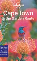
Reisgids Cape Town & Garden Route - Kaapstad | Lonely Planet
De perfecte reisgids voor zowel de georganiseerde als de zelfstandige reiziger. Naast een algemene inleiding van de stad vol met praktische informatie over hoe je er het beste kunt reizen: slapen, eten, vervoer, excursies ... alles kun je er in vinden. Engelstalig. Lonely Planet Lonely Planet’s Cape Town & the Garden Route is your passport to the most relevant, up-to-date advice on what to see and skip, and what hidden discoveries await you. Soak in the view from the summit of Table Mountain, take a boat to Robben Island for an insight into the country’s history, and explore the beaches, forests and verdant mountains along the majestic Garden Route – all with your trusted travel companion. Get to the heart of Cape Town and begin your journey now!   Inside Lonely Planet’s Cape Town & the Garden Route:   Colour maps and images throughout Highlights and itineraries help you tailor your trip to your personal needs and interests Insider tips to save time and money and get around lik…
19,95
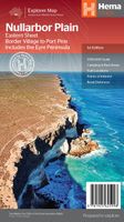
Wegenkaart - landkaart Explorer Map Nullarbor Plain - Eastern Map | Hema Maps
This map is part of Hema's new Nullarbor Plain Map Series (East and West) and covers Border Village to Port Pirie including the Eyre Peninsula.    Truly one of the worlds great adventure drives, Australia's semi-arid Nullarbor Plain stretches some 1,256 kilometres (781 miles) via the Eyre Highway and links the cities of Adelaide and Perth (or vice versa depending on your direction). The length of this journey is so large we needed to stretch it over two maps; East from Port Pirie to Border Village in South Australia and the Western sheet from Border Village to Kalgoorlie.    While all the key sites and facilities along the Eyre Highway are listed this map allows you to broaden your horizon and consider some of the other attractions off the Highway, including; the various Nullarbor caves, iconic beaches across the Great Australian Bight and thousands of kilometres of 4WD tracks (including Googs Track), all field-checked by the Hema Map Patrol for superior accuracy.   This map combines H…
15,95

Klanten-reviews van Fietskaart - Wegenkaart - landkaart 100 km around Cape Town - Kaapstad | Cabex Maps

Er zijn nog geen beoordelingen voor dit productBen jij de eerste die een review plaatst?

Meer over Fietskaart - Wegenkaart - landkaart 100 km around Cape Town - Kaapstad | Cabex Maps

Productomschrijving

Prima detailkaart van de Kaapregio t/m een straal van 100 km landinwaarts vanuit Kaapstad gerekend,  scheur en watervast materiaal. Duidelijke cartografie met goed onderscheid in de kwaliteit der wegen , veel toeristische informatie en op de achterzijde van de kaart een detalikaart van het wijngebied rond Stellenbosch en aanrijroutes van de belangrijkste plaatsen. Cape Town 100 KM around 1 : 150.000 for biking and hiking. This map provides the traveler with a perfectly scaled perspective of the city and surrounding areas - from the Cape Winelands to the East, to the wheat country towards the North (Swartland) and the sea resorts of Kleinmond, Hermanus and Gansbaai to the South-East. Comprehensive road details make this map suitable for motorists, as well as cyclists, bikers - and even hikers.  While all known access roads to farms are included, some may not be accessible to the general public without prior consent from the owner. All known nature conservation areas have been included
Webshop.nl maakt gebruik van cookies. Ga je verder op onze website, ga dan akkoord met het plaatsen van cookies en de verwerking van deze data door ons en vermelde partners.