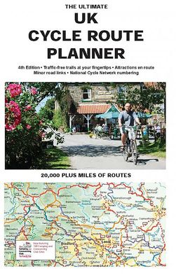
Fietskaart The Ultimate UK Cycle Route Planner | Excellent Books

0
Fully updated and revised 4th edition for 2022 with an increased sheet size. One of the best selling UK cycle publications giving an overview of all the main signed UK cycle routes - the only publication that has all these together on one single map. New clearer map design for 2022 including canal towpaths plus new section on bikepacking and long...

Verkopers met dit product

Verkoper
Bezorging
Prijs
DeZwerver.nl logo
DeZwerver.nl
2,95
16,95

Anderen bekeken ook

Fietsgids C2C Guide Sea to sea by bike | Excellent Books
Fietsgids van de sea-to-sea route, van kust naar kust door het noorden van Engeland. Van Workington/Whitehaven naar Sunderland/Tynemouth. Met deelkaartjes en hoogteprofielen, boordevol praktische informatie van accomodatie tot fietswinkels onderweg. A completely new, fully updated edition of the best selling guide to the UK's premier long distance cycle route - around 140 miles of superb scenery, from the Irish Sea to the North Sea, taking in the Lake District and the Northern Pennines on the way.    As part of Sustrans' National Cycle Network, the C2C uses mainly traffic-free paths and minor roads and is fully signed and waymarked. It is completed by thousands of cyclists every year.   This is the complete guide, including detailed 1:50,000 maps of all route options, directions, what to see and do, accommodation, places to eat and much more. The guidebook covers the route from Whitehaven or Workington to Sunderland or Newcastle.   Author Richard Peace has written and photograph…
15,50
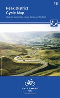
Fietskaart 18 Cycle Maps UK Peak District | Cordee
Een nieuwe fietskaarten serie van Groot-Brittannië. Gedrukt op scheur- en watervast papier en mooi handzaam klein formaat. Deze kaarten zijn met name heel goed om de Lange Afstands Fietsroutes (LF) te fietsen, het National Cycle Network staat duideljk ingetekend. Daarnaast vind je op de kaart veel praktische informatie als fietsenmakers, campings, jeugdherbergen en supermarkt.  The next map in the Cycle Maps UK series covers the Peak District and the surrounding cities of Manchester, Leeds, Derby and Sheffield.   The maps are all produced at a scale of 1:100 000 showing important features including the National cycle Network. Sections on road, off road and traffic free are all shown in differing colours along with their route number. Other roads and their classification are shown enabling you to link rides or explore sections and discover new routes at home or further afield.   Facilities such as toilets, pubs, accommodation, bike shops, repair stations and railway stations are all sh…
12,95
Fietskaart 14 Cycling guides Suffolk | Goldeneye
To be confronted with the variety and complexity of the cycling routes, trails and paths in Suffolk can be a bewildering experience.  For it appears that the Suffolk County Council and the three District Councils are all trying hard to promote their areas. This is indeed encouraging for the growth of cycling, but it can be confusing.  Our purpose is to provide clear, easy to use and easy to follow, cycling maps, and to illustrate these in a comprehensive form.    Suffolk must be one of the most charming of counties to explore by bicycle. When Al Churcher delivered his routes to us at Goldeneye we couldn’t keep him quiet, such was his enthusiasm and wonder at Suffolk’s country lanes and byways. He has cycled all over the UK, Canada, Mallorca, New Zealand and Sicily, but Suffolk remained a firm favourite.    The inland scenery is not spectacular for the county’s main glory lies with its attractive villages; the local architecture jealously preserved from modern depredation. There is an …
15,95
Fietskaart 02 Cycling guides Cotswolds cycling | Goldeneye
Fietskaart van Cotswold met ondermeer 28 ingetekende rondritten en veel toeristische informatie. Explore the Cotswolds by bike with this laminated, waterproof Cotswolds map. With 28 circular, clearly-marked routes this easy-to-use map will help you discover the best of the Cotswolds along the quietest country lanes. The Cotswolds are ideal for the touring cyclist and day-tripper.   They represent England at her very best. Long, winding lanes connect beautiful villages with excellent pubs and friendly tearooms. The landscape you cycle through is rich in imagery; rolling hills, dry-stone walls, lazy trickling trout streams and quaint, undisturbed hamlets.   Our Cotswold Cycling Country Lanes map includes:* Traffic-free family cycling trails - including the Stroud Valley Cycle Trail, The Oxford Waterway and the Forest of Dean Family Trail with recommendations on where to park. * National Cycle Network routes - the linked series of traffic-free paths and traffic-calmed roads being de…
15,95
Fietskaart 24 Cycle Maps UK Edinburgh - Central Southern Scotland | Cordee
Een nieuwe fietskaarten serie van Groot-Brittannië. Gedrukt op scheur- en watervast papier en mooi handzaam klein formaat. Deze kaarten zijn met name heel goed om de Lange Afstands Fietsroutes (LF) te fietsen, het National Cycle Network staat duideljk ingetekend. Daarnaast vind je op de kaart veel praktische informatie als fietsenmakers, campings, jeugdherbergen en supermarkt.  The next map in the Cycle Maps UK series covers the city of Edinburgh and the area to the south.   The maps are all produced at a scale of 1:100 000 showing important features including the National cycle Network. Sections on road, off road and traffic free are all shown in differing colours along with their route number. Other roads and their classification are shown enabling you to link rides or explore sections and discover new routes at home or further afield.   Facilities such as toilets, pubs, accommodation, bike shops, repair stations and railway stations are all shown. The mapping also has relief shadin…
12,95
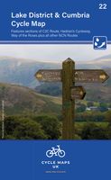
Fietskaart 22 Cycle Maps UK Lake District and Cumbria | Cordee
Een nieuwe fietskaarten serie van Groot-Brittannië. Gedrukt op scheur- en watervast papier en mooi handzaam klein formaat. Deze kaarten zijn met name heel goed om de Lange Afstands Fietsroutes (LF) te fietsen, het National Cycle Network staat duideljk ingetekend. Daarnaast vind je op de kaart veel praktische informatie als fietsenmakers, campings, jeugdherbergen en supermarkt.  The next map in the all-new Cycle Maps UK series. This covers The Lake District, Cumbria and all the way down to Lancaster.   The maps are all produced at a scale of 1:100 000 showing important features including the National cycle Network. Sections on road, off road and traffic free are all shown in differing colours along with their route number. Other roads and their classification are shown enabling you to link rides or explore sections and discover new routes at home or further afield.   Facilities such as toilets, pubs, accommodation, bike shops, repair stations and railway stations are all shown. The map…
12,95
Fietskaart 06 Cycle Maps UK London and Essex | Cordee
Een nieuwe fietskaarten serie van Groot-Brittannië. Gedrukt op scheur- en watervast papier en mooi handzaam klein formaat. Deze kaarten zijn met name heel goed om de Lange Afstands Fietsroutes (LF) te fietsen, het National Cycle Network staat duideljk ingetekend. Daarnaast vind je op de kaart veel praktische informatie als fietsenmakers, campings, jeugdherbergen en supermarkt.  Second in a new series of cycle maps covering the whole country. The London and Essex map covers from Uxbridge in the west to Harwich in the east. As far north as Luton and Halstead and as far south as Canterbury and Leatherhead.   The maps are all produced at a scale of 1:100 000 showing important features including the National cycle Network. Sections on road, off road and traffic free are all shown in differing colours along with their route number. Other roads and their classification are shown enabling you to link rides or explore sections and discover new routes at home or further afield.   Facilities suc…
12,95
Fietskaart Sandstone Way - Northumberland Cycle Route Map | Northern Heritage Services
The Sandstone Way is a 120-mile mountain biking route between Berwick upon Tweed and Hexham that runs along the sandstone ridge in North Northumberland, linking numerous sandstone crags and outcrops. From one end of Northumberland to the other, the Sandstone Way traverses an ever-changing landscape which is rich in history, geology and iconic scenery.   Both Hexham and Berwick upon Tweed are served by rail. Between these two towns, the route passes through numerous villages and small communities including Wooler, Rothbury and Bellingham. It has been designed to safely cross rivers, main roads and railways.   The Sandstone Way is designed for mountain bikers and as much of the route as possible is off-road. It will appeal to riders of all abilities and most will take 3 or 4 days to complete it. The ‘fit and the fast’ could possibly ride the route in 2 days but in all probability, most would wish they had taken 3 days. Almost certainly a few mountain bikers will try to ride the whole ro…
16,50
Fietskaart 6/8 Vestlige Jylland - West Jutland (Denemarken) | Scanmaps
Eindelijk een fietskaartenserie van Denemarken. Gedrukt op scheur- en watervastpapier, met een schaal van 1:100.000, zijn het zeer overzichtelijke fietskaarten. De basis is de 1:100.000 topografische kaart waarop de nationale, regionale en lokale fietsroutes op zijn ingetekend. Op de achterzijde staat informatie over fietstransport met het openbaar vervoer. Gewone fietspaden en toeristische informatie zoals campings en fietsenmakers staan er echter niet op vermeld.    Deze kaarten hebben dan ook vooral zin voor de bestaande fietsroutes. Echter aangezien er verder niet veel is aan detailkaarten met dit soort informatie, zijn deze kaarten wel degelijk bijzonder nuttig voor de fietser in Denemarken. Cycle map of Western Jutland   Although the west coast of Denmark is known for its particullar fresh winds along the coast, there are plenty of cycling routes to try - also further inland. So this map is for both the sea lovers and those who want to ride along the fields.   For a better …
24,95
Fietskaart 04 Cycle Maps UK South Downs and The New Forest | Cordee
Een nieuwe fietskaarten serie van Groot-Brittannië. Gedrukt op scheur- en watervast papier en mooi handzaam klein formaat. Deze kaarten zijn met name heel goed om de Lange Afstands Fietsroutes (LF) te fietsen, het National Cycle Network staat duideljk ingetekend. Daarnaast vind je op de kaart veel praktische informatie als fietsenmakers, campings, jeugdherbergen en supermarkt.  Map 4 covers the South Downs, The New Forest and the Isle of Wight. The coverage stretches as far north as Reigate Aldershot and Andover.   The maps are all produced at a scale of 1:100 000 showing important features including the National cycle Network. Sections on road, off road and traffic free are all shown in differing colours along with their route number. Other roads and their classification are shown enabling you to link rides or explore sections and discover new routes at home or further afield.   Facilities such as toilets, pubs, accommodation, bike shops, repair stations and railway stations are all …
12,95

Klanten-reviews van Fietskaart The Ultimate UK Cycle Route Planner | Excellent Books

Er zijn nog geen beoordelingen voor dit productBen jij de eerste die een review plaatst?

Meer over Fietskaart The Ultimate UK Cycle Route Planner | Excellent Books

Productomschrijving

Fully updated and revised 4th edition for 2022 with an increased sheet size. One of the best selling UK cycle publications giving an overview of all the main signed UK cycle routes - the only publication that has all these together on one single map. New clearer map design for 2022 including canal towpaths plus new section on bikepacking and long-distance off-road trails such as the Great North Way and King Alfred's Way.   Author Richard Peace has written and photographed more than 30 cycling titles as well as being a contributor to numerous cycling magazines and websites including Cycle (the official Cycle UK magazine), Road.cc, ebiketips and Freewheeling France websites.


Productinformatie

    Verken gerelateerde categorieën

    Webshop.nl maakt gebruik van cookies. Ga je verder op onze website, ga dan akkoord met het plaatsen van cookies en de verwerking van deze data door ons en vermelde partners.