Opruiming - Fietskaart The Sperrins Region | Sustrans

0
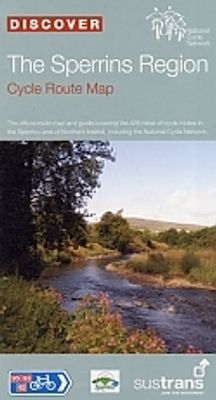
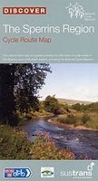
De officiële fietskaart van Sustrans in het natuurgebied De Sperrins. Duidelijk aangegeven fietsroutes op autovrije paden en rustige landschapswegen. Makkelijk leesbaar, gedetailleerde stadsplattegronden, extra achtergrondinformatie en waterbestendig hoesje. The Official Sustrans route map and guide covering the 428 miles of cycle routes in the Sp...

Verkopers met dit product

Verkoper
Bezorging
Prijs

Anderen bekeken ook

Fietskaart Cycle Map The Bay Cycle Way | Sustrans
Het is niet een heel overzichtelijke kaart, het zijn juist blokken van een deel van de route waarop deze staat ingetekend. Daarin juist wel heel goed met handige stedenkaarten en route profielen. Eigenlijk voor de route als zodanig onmisbaar, je mist alleen het overzicht een beetje.   This is the official map for the Bay Cycle Way route, an 81 mile (130km) coastal cycle route around Morecambe Bay in the north west of England, and winner of the Visitor Experience Award - Lancashire Tourism Awards 2015. This relatively flat route hugs the spectacular coastline of Morecambe Bay along quiet roads, greenways, canal towpaths and promenades, offering breath taking scenery from Walney Island near Barrow right round to Glasson Dock south of Lancaster. The route looks out over the Irish Sea and is ideal for spotting terns, curlew, knot, oystercatcher and even grey seals.   This full colour map based on Ordnance Survey data shows clearly mapped cycle routes on traffic-free paths, quiet lanes …
14,95
Fietskaart Cycle Map Pennine Cycleway South | Sustrans
The official route map for the 136-mile (219km) southern part of the Pennine Cycleway on National Cycle Network Route 68 from Derby to Settle.   This linear map shows the route and immediate surrounding area over a series of separate map panels. The full colour map based on Ordnance Survey data shows clearly mapped cycle routes on traffic-free paths, quiet lanes and roads, with easy to read contours, route profiles and mile markers. Also features detailed inset maps for the major towns and cities, tourist info and cycle shop and hire information, and other local routes.   The southern half of the Pennine Cycleway is a beautiful, yet challenging ride which takes you through the dramatic scenery of the Peak District and the South Pennines. The route takes you from the bustling railway city of Derby to the historic town of Settle, taking in the famous spa town of Buxton and the lovely Yorkshire town of Holmfirth, renowned location of the TV classic “Last of the Summer Wine”.   This secti…
13,50
Fietskaart Cycle Route Map Lôn Las Cymru North | Sustrans
Het is niet een heel overzichtelijke kaart, het zijn juist blokken van een deel van de route waarop deze staat ingetekend. Daarin juist wel heel goed met handige stedenkaarten en route profielen. Eigenlijk voor de route als zodanig onmisbaar, je mist alleen het overzicht een beetje. This linear map shows the northern section of the Lon Las Cymru route and surrounding area over a series of separate map panels.   The route connects Holyhead and Anglesey to Llanidloes in the Wye Valley, the heart of Wales, using minor roads, railway paths, forestry tracks and ancient coach roads. There are some tough challenges as the route crosses the Snowdonia National Park and the range of the Cambrian Mountains.    This full colour map based on Ordnance Survey data shows clearly mapped cycle routes on traffic-free paths, quiet lanes and roads, with easy to read contours and route profiles. Also features detailed inset maps for the major towns and cities and tourist information.   National Cycle Netwo…
16,95
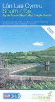
Fietskaart Cycle Route Map Lôn Las Cymru South | Sustrans
Het is niet een heel overzichtelijke kaart, het zijn juist blokken van een deel van de route waarop deze staat ingetekend. Daarin juist wel heel goed met handige stedenkaarten en route profielen. Eigenlijk voor de route als zodanig onmisbaar, je mist alleen het overzicht een beetje. This linear map shows the southern half of the stunning Lon Las Cymru route and surrounding area over a series of separate map panels.   The route connects Llanidloes in the heart of Wales to the attractive finishing points of Cardiff or Chepstow, with two route options via Hay on Wye to Abergavenny and Chepstow via a taste of the Black Mountains, or along the largely traffic-free Taff Trail from Brecon to Cardiff via Merthyr Tydfil.   This full colour map based on Ordnance Survey data shows clearly mapped cycle routes on traffic-free paths, quiet lanes and roads, with easy to read contours and route profiles. Also features detailed inset maps for the major towns and cities and tourist information.   Natio…
16,95
Opruiming - Fietsgids Cycling in Amsterdam and the Netherlands | EOS Cycling Holidays Ltd
OUDE DRUK   There is no happier cyclist than a Dutch cyclist. This is not only because The Netherlands is mainly flat, but also because the Dutch enjoy the most extensive cycle network in the world. With our guidebook, we present you the very best routes in the cyclist’s paradise!   Amsterdam is famous for its cyclists and with our guidebook you’ll cycle on those routes the locals love themselves. Whether you are a novice cyclist, want to give children a safe and fun cycling experience, want to do some serious mileage or want to embark on a study trip to experience the Dutch cycling infrastructure, our second and fully revised edition of our book caters for all!   Our book Cycling in Amsterdam and The Netherlands – The very best routes in the cyclist’s paradise features 1,064 kms (656 miles) of routes, so you can truly have up to three weeks of cycling fun; the perfect companion for one or multiple excellent cycling holidays!   The routes in the book have full connectivity with all…
8,95
Fietskaart ADFC Regionalkarte Ostwestfalen | BVA BikeMedia
Gedetailleerde fietskaart van populaire regio's in Duitsland: Ostwestfalen Von Minden bis Paderborn, vom Osnabrücker Land bis zur Weser Für Sportliche: Teutoburger Wald, Wiehengebirge, Weserbergland, Eggegebirge Für Genussradler: die Münsterländer Bucht und der Weserradweg   - Ideaal voor dagtochten en weekendtrips - Met suggesties voor dagtochten - Weerbestendig en scheurvast papier  - Zeer gedetailleerde kaart met vermelding van verkeersdrukte, het type wegdek, hoogtelijnen en de hellingen dmv 1 of 2 pijlen - GPX tracks voor thematische routes, fietsroutes en tour suggesties online te downloaden   Official card of the ADFC General German Bicycle Club e.V. The ideal map for planning and carrying out day and weekend bike tours. On a large area of up to 70 x 100 kilometres you will find everything cyclists need. Routes, day tour suggestions, attractions, leisure information and much more. Optimal orientation * clearly designed * easy to handle * all signposted bike paths as well as …
12,95
Fietskaart The Ultimate UK Cycle Route Planner | Excellent Books
Fully updated and revised 4th edition for 2022 with an increased sheet size. One of the best selling UK cycle publications giving an overview of all the main signed UK cycle routes - the only publication that has all these together on one single map. New clearer map design for 2022 including canal towpaths plus new section on bikepacking and long-distance off-road trails such as the Great North Way and King Alfred's Way.   Author Richard Peace has written and photographed more than 30 cycling titles as well as being a contributor to numerous cycling magazines and websites including Cycle (the official Cycle UK magazine), Road.cc, ebiketips and Freewheeling France websites.  
16,95

Klanten-reviews van Opruiming - Fietskaart The Sperrins Region | Sustrans

Er zijn nog geen beoordelingen voor dit productBen jij de eerste die een review plaatst?

Meer over Opruiming - Fietskaart The Sperrins Region | Sustrans

Productomschrijving

De officiële fietskaart van Sustrans in het natuurgebied De Sperrins.

Duidelijk aangegeven fietsroutes op autovrije paden en rustige landschapswegen. Makkelijk leesbaar, gedetailleerde stadsplattegronden, extra achtergrondinformatie en waterbestendig hoesje.

The Official Sustrans route map and guide covering the 428 miles of cycle routes in the Sperrins area of Northern Ireland, including the National Cycle Network. CTB812

Productinformatie

    Verken gerelateerde categorieën

    Webshop.nl maakt gebruik van cookies. Ga je verder op onze website, ga dan akkoord met het plaatsen van cookies en de verwerking van deze data door ons en vermelde partners.