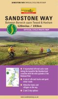
Fietskaart Sandstone Way - Northumberland Cycle Route Map | Northern Heritage Services

0
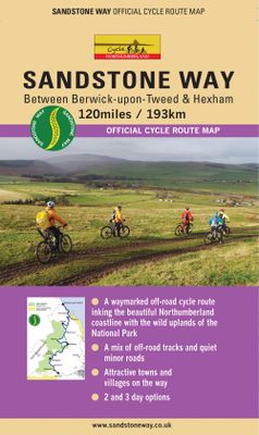
The Sandstone Way is a 120-mile mountain biking route between Berwick upon Tweed and Hexham that runs along the sandstone ridge in North Northumberland, linking numerous sandstone crags and outcrops. From one end of Northumberland to the other, the Sandstone Way traverses an ever-changing landscape which is rich in history, geology and iconic scen...

Verkopers met dit product

Verkoper
Bezorging
Prijs
DeZwerver.nl logo
DeZwerver.nl
2,95
16,50

Anderen bekeken ook

Fietskaart Sandstone Way - Northumberland Cycle Route Map | Northern Heritage Services
The Sandstone Way is a 120-mile mountain biking route between Berwick upon Tweed and Hexham that runs along the sandstone ridge in North Northumberland, linking numerous sandstone crags and outcrops. From one end of Northumberland to the other, the Sandstone Way traverses an ever-changing landscape which is rich in history, geology and iconic scenery.   Both Hexham and Berwick upon Tweed are served by rail. Between these two towns, the route passes through numerous villages and small communities including Wooler, Rothbury and Bellingham. It has been designed to safely cross rivers, main roads and railways.   The Sandstone Way is designed for mountain bikers and as much of the route as possible is off-road. It will appeal to riders of all abilities and most will take 3 or 4 days to complete it. The ‘fit and the fast’ could possibly ride the route in 2 days but in all probability, most would wish they had taken 3 days. Almost certainly a few mountain bikers will try to ride the whole ro…
16,50
Fietskaart Cycle Touring Map of Northumberland | Northern Heritage Services
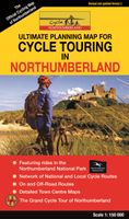
The official planner for recreational cycling and cycle touring in Northumberland and beyond. Version 3 printed 2020.   Comprehensive list of promoted long distance cycle routes including: Coast and Castles Cycle Route, Pennine Cycleway, Hadrian’s Cycleway, Reivers Cycle Route, Sandstone Way and the C2C (Sea to Sea Cycle Route).   429 miles/851kms of long-distance cycle routes, including the 234 miles/377kms Grand Cycle Tour of Northumberland.   Revised and updated December 2020 - Recommended link routes between signed long distance routes.   Recommended road alternatives to avoid off-road sections of the National Cycle Network.   Comprehensive list of Local Day Rides; all available for sale or download at www.cyclenorthumberland.org.uk   Inset map featuring connections to and from Tyneside and main line stations and international ferry connections.   Mountain bike trails in Kielder Water & Forest Park.
14,95
Wandelgids The Reivers Way - Walking Through Historic Northumberland | Cicerone
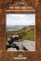
A guide to walking The Reivers Way, through Northumberland, northern England, from Corbridge to Alnmouth for 150 miles (240km) through the wildest parts of Northumberland - the North Pennines, Hadrian’s Wall, Tynedale, Redesdale, the Simonside Hills, Coquetdale and the Cheviot Hills. Includes a national park, AONBs and a fine heritage coast. Activities walking, backpacking, trekking, bird-watching (Farne Islands)Seasons spring can be the most attractive time; in summer accommodation needs to be booked ahead but ferries will be running to the Farne Islands; weather is less reliable in the autumn; in winter some accommodation providers will be closed and walking may be harder (in deep snow or after prolonged rain)Centres Newcastle-upon-Tyne, Corbridge, Rothbury, Bamburgh, Alnwick, AlnmouthDifficulty walking is straightforward but sometimes remote and not specifically waymarked so navigation skills are required; terrain is varied; the route is described in 9 day stages but experienced lo…
15,50
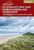
Wandelgids St Oswald's Way and Northumberland Coast Path | Cicerone
This guidebook describes the St Oswald's Way and Northumberland Coast Paths, both long-distance trails through Northumberland. St Oswald's Way (156km, 97 miles) begins in Heavenfield and traverses parts of Northumberland National Park and visits Hadrian's Wall, the Simonside Hills and the beautiful Coquet Valley, before continuing up the coast to Lindisfarne (Holy Island). The Northumberland Coast Path (100km, 62 miles) takes in the whole of the Northumberland Coast AONB with its breathtaking coastal scenery and birdlife.   Both trails converge on Holy Island, with the Coast Path continuing up to Berwick-upon-Tweed. Each trail can be walked in a week. The guide includes practical advice on when to go and what to take, and information on the region, its weather, wildlife, history and heritage.   Detailed route descriptions and clear, step-by-step instructions are accompanied by 1:50K OS mapping. Public transport options and accommodation listings are also given. Described as the cradle…
23,95
Wandelgids Northumberland | Ordnance Survey
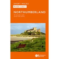
Explore the castles and coast of Northumberland from Dunstanburgh to Hadrian’s Wall with ten walks suitable for all ages and abilities. Discover England’s most northerly county from the North Sea coast to the North Pennines on hand-picked, leisurely rambles for the whole family.   Northumberland Short Walks Made Easy include:   - Circle dramatic Bamburgh Castle, looking out to the Farne Islands from wildlife-rich dunes, and see the grave of lifeboat heroine Grace Darling - Enjoy the tranquility of secluded Wooler Common with its wealth of wildlife and ancient remains on the edge of the Cheviots - Start at picturesque Craster and follow the coast path to Dunstanburgh Castle, a rugged ruin perched on a rocky, wave-battered headland - Ramble the shores of Kielder Water, spot nesting ospreys and stumble upon the fascinating artworks in the forest - Follow Hadrian’s Wall from Cawfields near Haltwhistle to see the iconic Roman structure close up, with stunning views in both directions - Str…
10,95
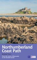
Wandelgids Northumberland Coast Path | Aurum Press
Goede beschrijving van de aantrekkelijke route. Kaartmateriaal van Ordnance Survey - de Engelse topografische dienst op een schaal van 1:25.000. Praktische info voor overnachten ed. niet altijd uitgebreid, maar die is op de site van de Ramblers (de engelse wandelorganisatie) te vinden. The Northumberland coastline stretches from the outskirts of Newcastle up to the Scottish border at Berwick-upon-Tweed – a popular holiday destination for its wild and sweeping landscape of endless beaches of pale sand, succession of spectacular castles like Bamburgh and Dunstanburgh, congenial resorts like Alnmouth, and unique offshore attractions like Holy Island and the Farne Islands. Now, Roland Tarr’s new Trail Guide maps out the walker’s route along the entire coast, starting from the centre of Newcastle and including an extension beyond Berwick to the seabird crags of St Abb’s Head.   Along the way the guide covers the remarkable industrial heritage of this coastline – the coalmining town of Ashi…
20,95
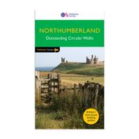
Wandelgids 087 Pathfinder Guides Northumberland | Ordnance Survey
Pathfinder® Guide to Northumberland, featuring 28 outstanding walks designed for a range of abilities covering 180 miles of walking.   Features:   28 guided walks for a range of abilities Large detailed Ordnance Survey map extracts Key information such as parking and type of terrain GPS waypoints for each route Weather-resistant book cover Durable rounded corners   This new guide to Northumberland has ten brand-new Pathfinder walks across the county. There are new short walks at Berwick-upon-Tweed, Almouth and Bellingham. There are new half-day walks in the Coquet Valley at Felton, in the Humbleton Hills from Wooler, exploring the countryside south of the River Tyne from Hexham, and taking you along the scenic Wansbeck Valley to Morpeth from Bothal. And there are new longer walks in Hulne Park, Alnwick; along the coast and inland from Bamburgh; and a lengthy but hugely enjoyable ramble in a circuit from Druridge Bay to Warkworth and a return via Amble along the Northumberl…
18,50
Wandelgids Walking in Northumberland | Cicerone
De wandelgidsen van Cicerone zijn toonaangevend als het gaat om kwaliteit en de hoeveelheid verschillende bestemmingen. De routes zijn helder en duidelijk beschreven, kaartmateriaal is veelal van de topografische dienst op schaal 1:50.000 en de praktische informatie is bondig maar zeer relevant.    A guidebook to 36 walks exploring Northumberland, including the national park, coast, Cheviots, North Pennines and Kielder. The walks cover a wide variety of terrain and include full days on the hills and coast and shorter walks at lower levels, so there is something for everyone. The walks are graded (although none present any technical difficulties) and accessible from bases such as Alnwick, Rothbury and Hexham.   They range from 7 to 21km (4–13 miles) and can be enjoyed in 2–7 hours. 1:50,000 OS maps included for each walkHighlights include Hadrian's Wall, Lindisfarne Priory, The Cheviot, Berwick and Bamburgh and Dunstanburgh CastlesNotes on refreshments and public transportBackground…
20,95
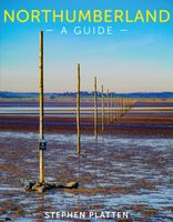
Reisgids Northumberland | Sacristy Press
Northumberland, one of the most sparsely-populated counties in England, with unique features like the Holy Island of Lindisfarne and Hadrian’s Wall, was also a crucible of European civilization and remains a treasury of culture. Giving birth to railways worldwide through George Stephenson, it saw the beginnings of hydraulics, hydro-electricity and turbines and, with Joseph Swan, witnessed the earliest light from electric incandescent lamps; it was a laboratory of invention. Northumberland has, however, changed dramatically over the course of the last century: deep coal-mining, shipbuilding and much heavy engineering have gone, but new industries have flowered. So, the largest man-made lake in northwest Europe, lying within the largest man-made forest is set within the north west of the county, bringing water in abundance and supporting entirely new leisure and tourist activities. The lower Tyne has been transformed both architecturally, and culturally. This unique guide to England’s m…
41,50
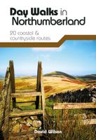
Wandelgids Day Walks in Northumberland | Vertebrate Publishing
Day Walks in Northumberlandfeatures 20 routes between 7.6 and 14.5 miles (12.2km and 23.3km) in length, spread across the coast and the countryside of Northumberland and suitable for hillwalkers of all abilities. Researched and written by local walking guide David Wilson, this book covers the best that this varied county has to offer. Walk over sand dunes and past castles at Bamburgh and Dunstanburgh, discover the history of Roman Britain at Hadrian's Wall, explore the industrial heritage around the River South Tyne and follow the Pilgrim's Way to Lindisfarne. Together with stunning photography, each route features Ordnance Survey 1:25,000 maps, easy-to-follow directions, details of distance and navigation information, and refreshment stops and local information.
20,95

Klanten-reviews van Fietskaart Sandstone Way - Northumberland Cycle Route Map | Northern Heritage Services

Er zijn nog geen beoordelingen voor dit productBen jij de eerste die een review plaatst?

Meer over Fietskaart Sandstone Way - Northumberland Cycle Route Map | Northern Heritage Services

Productomschrijving

The Sandstone Way is a 120-mile mountain biking route between Berwick upon Tweed and Hexham that runs along the sandstone ridge in North Northumberland, linking numerous sandstone crags and outcrops. From one end of Northumberland to the other, the Sandstone Way traverses an ever-changing landscape which is rich in history, geology and iconic scenery.   Both Hexham and Berwick upon Tweed are served by rail. Between these two towns, the route passes through numerous villages and small communities including Wooler, Rothbury and Bellingham. It has been designed to safely cross rivers, main roads and railways.   The Sandstone Way is designed for mountain bikers and as much of the route as possible is off-road. It will appeal to riders of all abilities and most will take 3 or 4 days to complete it. The ‘fit and the fast’ could possibly ride the route in 2 days but in all probability, most would wish they had taken 3 days. Almost certainly a few mountain bikers will try to ride the whole route in a day!   The Sandstone Way uses suitable existing Public Rights of Way including an interesting mix of double-width dirt tracks, sections of singletrack, unsurfaced lanes and bridleways of all types as well as byways and little known Unclassified County Roads (UCRs). Inevitably, these lovely route types are linked with sections of quiet minor roads and surfaced country lanes.   The Sandstone Way is clearly waymarked with a distinctive green logo roundel. Ten optional loops are also offered to appeal to ‘day riders’ who wish to cycle back to their starting point or map-read their way along more challenging alternatives to the waymarked route.   The Sandstone Way really is an adventure and we believe everyone who cycles this very enjoyable journey will have a most rewarding experience traversing the length of Northumberland - one of England’s best-kept secrets. Please visit the www.sandstoneway.co.uk for more information.

Productinformatie

    Verken gerelateerde categorieën

    Webshop.nl maakt gebruik van cookies. Ga je verder op onze website, ga dan akkoord met het plaatsen van cookies en de verwerking van deze data door ons en vermelde partners.