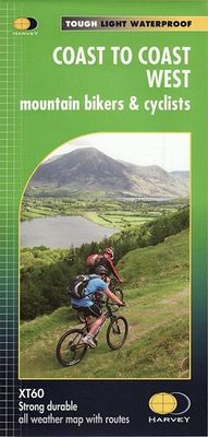
Fietskaart mountainbike Coast to Coast WEST | Harvey Maps

0
Deze kaart toont het westelijke deel van de route tussen St Bees/Ravenglass en Kirkby Stephen/Aysgarth via Ambleside/Windermere. Er zijn meerdere alternatieve routes ingetekend op een duidelijke topografische ondergrond.   De kaart is dubbelzijdig en gedrukt op water- en scheurvast materiaal.   The Coast to Coast route is covered in two maps. The...

Verkopers met dit product

Verkoper
Bezorging
Prijs
DeZwerver.nl logo
DeZwerver.nl
2,95
28,50

Anderen bekeken ook

Fietskaart mountainbike Coast to Coast WEST | Harvey Maps
Deze kaart toont het westelijke deel van de route tussen St Bees/Ravenglass en Kirkby Stephen/Aysgarth via Ambleside/Windermere. Er zijn meerdere alternatieve routes ingetekend op een duidelijke topografische ondergrond.   De kaart is dubbelzijdig en gedrukt op water- en scheurvast materiaal.   The Coast to Coast route is covered in two maps. The traverse from Coast to Coast is approximately 200 miles. There is no single definitive route. These maps suggest two main alternatives, St Bees to Robin Hoods Bay (devised by Tim Woodcock) or Ravenglass to Ravenscar (devised by Pedal North).    The XT60 new generation of tough polyethylene maps are a leap forward in technical excellence. They are tough, durable, light and 100% waterproof virtually indestructible in normal use.They are light to carry and compact not the great bulky package you get with a laminated map.   Covers from St Bees to Kirkby Stephen.  
28,50
Fietskaart mountainbike Coast to Coast OOST | Harvey Maps
Deze kaart toont het oostelijke deel van de route tussen Kirkby Stephen/Aysgarth en Robin Hood's Bay/Ravenscar via Richmond/Osmotherley. Er zijn meerdere alternatieve routes ingetekend op een duidelijke topografische ondergrond.   De kaart is dubbelzijdig en gedrukt op water- en scheurvast materiaal.   The Coast to Coast route is covered in two maps. The traverse from Coast to Coast is approximately 200 miles. There is no single definitive route. These maps suggest two main alternatives, St Bees to Robin Hoods Bay (devised by Tim Woodcock) or Ravenglass to Ravenscar (devised by Pedal North).    The XT60 new generation of tough polyethylene maps are a leap forward in technical excellence. They are tough, durable, light and 100% waterproof virtually indestructible in normal use.They are light to carry and compact not the great bulky package you get with a laminated map.   Covers from Kirkby Stephen to Robin Hoods Bay.
28,50
Wandelkaart Coast to Coast | Harvey Maps
Een bijzonder handige kaart van dit lange-afstands-wandelpad. Op waterafstotend papier met veel details. Het enige dat je eigenlijk een beetje mist is een overzicht. Verder uitstekend en voldoende voor de route. Leap forward in technical excellence. Tough, light and 100% wateproof Compact and light - the map itself weighs just 60gms - a third of the weight of a laminated map, and much less bulky. And you can fold or refold it time and again, or stuff it in your back pocket and it won't fall to pieces.Shows the 96 mile western half of the route on one sheet. Covers the section from St Bees to Keld. Includes alternative routes. This map is bio-degradable Information on finding accommodation, camping, food. Directions to the start. Also Ranger Service contact numbers and enlargements of towns/villages showing facilities available and tips on weather and clothing Detailed mapping, full legend. National Grid - can be used with GPS. 1:40,000 scale. Waterproof. Supplied in clear plastic pock…
28,50
Wandelkaart 1 South West Coast Path 1 | Harvey Maps
Een bijzonder handige kaart voor een deel van dit lange-afstands-wandelpad (Minehead tot St Ives) van het in totaal maar liefst 1014 km lange South West Coast Path. Op waterafstotend papier met veel details, uitstekend en voldoende voor dit deel van de route. De totale route bestaat uit 3 kaarten.  Ideal map for walkers on Britiain's longest and one of its most popular National Trails. It runs along the coast of Somerset, Cornwall, Devon, and Dorset from Minehead round via Land's End to Poole. It includes all 95 miles of the World Heritage site known as the Jurassic Coast. 3 HARVEY maps will cover the whole 630-mile route. Each map covers a section of the Path suitable for 16 days of walking. Map 1 covers the Path from the start at Minehead to St Ives   This map is bio-degradable   Information on finding accommodation, camping, food. Directions to the start. Also Ranger Service contact numbers and enlargements of towns/villages showing facilities available and tips on weather and clot…
25,95
Wandelkaart 3 South West Coast Path 3 | Harvey Maps
Een bijzonder handige kaart voor een deel van dit lange-afstands-wandelpad (Minehead tot St Ives) van het in totaal maar liefst 1014 km lange South West Coast Path. Op waterafstotend papier met veel details, uitstekend en voldoende voor dit deel van de route. De totale route bestaat uit 3 kaarten.    The South West Coast path is a 1014km (630mile) long distance path and the longest National Trail in England. The path stretches from Minehead in Somerset to Poole in Dorset. - This updated Trail Map covers the third and final section of the South West Coast Path from Plymouth to Poole Harbour which is 339km (211 miles).   - Includes the Jurassic Coast World Heritage Site and Durdle Door, the famous sea arch in Dorset. - The entire route on 3 sheets. This is map 3 of 3, a good two weeks? walking on one map.   - The XT40 is based on original HARVEY mapping with all the detail a walker would expect on a map at 1:40,000 scale. - Clear and easy to read mapping which is uncluttered by inf…
25,95
Wandelkaart Northumberland Coast Path and Berwickshire Coastal Path | Harvey Maps
Mooie, duidelijke kaart van de Northumberland Coast Path en het vervolg daarop de Berwickshire Coastal Path in Noord-Engeland en Schotland. Geplastificeerd met veel extra informatie en uitsnedes van de route.    The Northumberland Coast Path stretches for 103km (64m) from Cresswell in the south to Berwick-upon-Tweed in the north. The Berwickshire Coastal Path stretches for 48km (28m) and continues this route from Berwick-upon-Tweed to Cockburnspath. These routes are part of the North Sea Trail and offer some of the finest coastal walking in the country with rugged coastline, stunning cliff scenery and panoramic views.   XT40 - These maps are a leap forward in technical excellence. They are tough, durable, light and 100% waterproof - virtually indestructible in normal use.   They are light to carry, and compact - not the great bulky package you get with a laminated map.   The map is detailed, with the routes clearly marked. It also contains general information, useful telephone numbers…
25,95
Wandelkaart Peddars Way & Norfolk Coast Path | Harvey Maps
Mooie, duidelijke kaart van de Peddars Way  in het oosten van Engeland. Geplastificeerd met veel extra informatie en uitsnedes van de route.   The Peddars Way and Norfolk Coast Path is considered by many to be one of the most accessible National Trails, making it a perfect trail for first time long-distance walkers, or one for the winter months due to Norfolk’s dry climate.   Linking the forests and heathland of the Brecks with the coast, Peddars Way is steeped in ancient legend. It offers a wonderfully remote-feeling adventure with some spectacular historic sites to visit along the way.   The Norfolk Coast Path is a beautiful walk among sand dunes, marshes and Nature Reserves. It goes through the North Norfolk Area of Oustanding Natural Beauty and has some of the best birdwatching in the UK.   Combining both Peddars Way and the Norfolk Coast Path is a moderate long-distance walk that takes most people 7-10 days to complete but can be easily broken into shorter walks.   This map cover…
25,95
Wandelgids Coast to Coast Walk, From St Bees to Robin Hood's Bay | Cicerone
De beschrijving van de klassieke kust naar kust wandeling in het noorden van Engeland. Een van de mooiste en meest afwisselende wandeltochten van heel Engeland. Inclusief gidsje met routekaarten van 1:25000 First devised by Alfred Wainwright, the Coast to Coast Walk has emerged as a favourite among long-distance walkers. The route stretches some 185 miles (296km) from St Bees, an historic seaside village on Cumbria's west coast to Robin Hood's Bay in North Yorkshire. It is suitable for most fit walkers and can be comfortably walked in around a fortnight.   This guidebook presents the full route from west to east in 13 stages of 10½-20¾ miles (16.8-33.2km), with summaries covering the opposite direction. Alongside step-by-step route description, 1:100,000 mapping and fascinating notes about points of interest along the way, a comprehensive trek planner offers a helpful overview of facilities on route, and full accommodation listings and useful contacts can be found in the appendices. T…
23,95
Wandelgids Coast to Coast the Wainwright Route | Rucksack Readers
Lange afstandswandelgids van de Coast to Coast wandeling. Wandelgids met kaarten en beschrijving. op waterbestendig papier, in spiraalbinding. This challenging walk of 184 miles (296 km) crosses the north of England from St Bees on the Cumbria coast to Robin Hood’s Bay on the North Sea. It passes through three National Parks – the Lake District, Yorkshire Dales and North York Moors – with splendidly varied scenery. Many walkers complete it within 12 to 16 days, although some divide it into two separate week-long walks.   Devised by the legendary Alfred Wainwright, the Coast to Coast is justly famous as England's most popular walk. It is waymarked, has plenty of accommodation and features welcoming pubs. Both its ends and two midpoints (Kirkby Stephen and Richmond) are accessible by public transport.   The new edition features many photographs by the award-winning landscape photographer Karen Frenkel. It also has freshly commissioned mapping, which appears on 25 of its 126 pages. It co…
22,50
Fietskaart Dartmoor | Harvey Maps
New map for cycling on Dartmoor and the surrounding area.   2 maps in one: one side mountain biking the other side for cycle touring   Tried and tested cycle routes   Side 1 is a detailed map of Dartmoor showing graded mountain bike routes. Covers the whole of the National Park. Scale 1:40,000   Side 2 for touring cycling shows the whole area from Exeter to Plymouth at 1:60,000 scale with recommended cycle-friendly routes shown.   All paths and tracks where cyclists have a legal or permitted right to ride are shown.   Routes have been graded and colour-coded by cyclists so that you can easily identify the paths that will suit your ability and mood   Produced in cooperation with the National Park Authority.   Includes cycling in the Tamar Valley and Haldon Forest Park  
26,95

Klanten-reviews van Fietskaart mountainbike Coast to Coast WEST | Harvey Maps

Er zijn nog geen beoordelingen voor dit productBen jij de eerste die een review plaatst?

Meer over Fietskaart mountainbike Coast to Coast WEST | Harvey Maps

Productomschrijving

Deze kaart toont het westelijke deel van de route tussen St Bees/Ravenglass en Kirkby Stephen/Aysgarth via Ambleside/Windermere. Er zijn meerdere alternatieve routes ingetekend op een duidelijke topografische ondergrond.   De kaart is dubbelzijdig en gedrukt op water- en scheurvast materiaal.   The Coast to Coast route is covered in two maps. The traverse from Coast to Coast is approximately 200 miles. There is no single definitive route. These maps suggest two main alternatives, St Bees to Robin Hoods Bay (devised by Tim Woodcock) or Ravenglass to Ravenscar (devised by Pedal North).    The XT60 new generation of tough polyethylene maps are a leap forward in technical excellence. They are tough, durable, light and 100% waterproof virtually indestructible in normal use.They are light to carry and compact not the great bulky package you get with a laminated map.   Covers from St Bees to Kirkby Stephen.


Productinformatie

    Verken gerelateerde categorieën

    Webshop.nl maakt gebruik van cookies. Ga je verder op onze website, ga dan akkoord met het plaatsen van cookies en de verwerking van deze data door ons en vermelde partners.