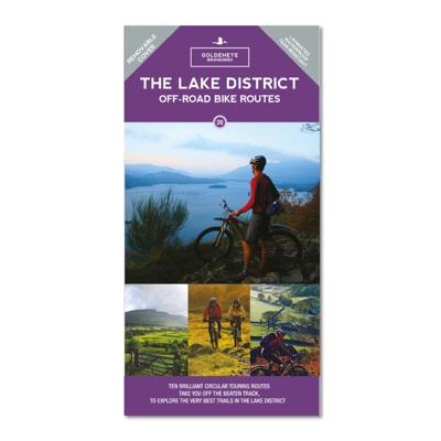
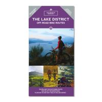
Fietskaart Lake District MTB map | Goldeneye

0

Verkopers met dit product

Verkoper
Bezorging
Prijs
DeZwerver.nl logo
DeZwerver.nl
2,95
14,95

Anderen bekeken ook

Fietskaart 08 Cycling guides Lake District | Goldeneye
Scheur- en watervast foetskaart van het Lake District met ingetekende fietsroutes. Our maps are double-sided, printed on an A2 sheet with a concertina fold. This allows for easy folding and folding, and an ease of access to the mapping. The material is rain and tear-resistant. Our early maps were designed at the scale of 2 miles to 1 inch/1:126,720. The later designs along with digitalisation are 1: 100,000. We were encouraged by the Cycle Touring Club to convert our cartography toward the cycle market (to replace the out-of-print Bartholomew series). As time and the series progressed we have added more data: The National Cycle Network routes, Regional Routes, and Traffic-Free Family Routes, as and when they are developed. These routes are in addition to the Circular Routes Goldeneye Commissioned at the outset of our publishing schedule. We are also adding to new editions; bike shops, cycle hire, and tea rooms, along with the tourist attractions already featured. Our plan is to make a…
12,95
Fietskaart Peak District | Goldeneye
The Peak District offers some of the best country lane cycling in Britain. The Tissington, Manifold and High Peak Trails are some of the longest converted railway tracks in the country and are a great way for families and inexperienced cyclists to enjoy traffic-free cycling.    • 11 Cycle Hire locations • 16 circular routes overprinted on map • National Cycle Network routes  68, 54 and 62 are illustrated,  and the Traffic-Free Family Cycling Trails: Carsington Water, Five Pits Trail, High Peak Trail, Kedleston Hall, Manifold Track, Middlewood Way, Monsal Trail, Rudyard Reservoir, Sett Valley Trail and Tissington Trail.
15,95
Reisgids The Lake District | Goldeneye
In this Lake District guide book, experienced UK travel writer and photographer William Fricker, provides his opinion on England's largest National Park. Offering a unique perspective on this well-travelled area of Britain, William reveals little-known corners of the Lake District that will delight and surprise. * Experience a full range of activities - from scenic walks and bike rides, to getting out on the water.   * Enjoy a wide range of interesting and quirky places to stay - from camp sites, to farmhouse B&Bs, to coastal inns and boutique hotels. * Immerse yourself in the best variety of eateries - from lake-view cafes, to country inns, to tearooms and restaurants. * Includes over 300 photographs and illustrations really bringing your trip to life before you've even left home.   Here is a refreshing and enlightening take on what the Lake District has to offer visitors and locals alike. All entries are chosen on merit, and what they have in common is that extra Something Special. …
23,95
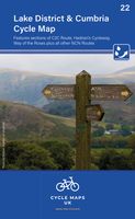
Fietskaart 3 Tour Map Lake District & Cumbria | Ordnance Survey
De Ordnance Survey Tour Maps met schaal 1:100.000 zijn uitstekend geschikt om zelf je fietsvakantie te plannen in Engeland. Ze laten alle alle grote en kleinere wegen zien. Bovendien staan de Routes van National Cycle Network ingetekend. Ook erg handig zijn de vermeldingen van campings, jeugdherbergen en andere accommodaties! Kortom de perfecte fietskaart! Daarnaast worden op de Tour Maps-serie de Langs Afstands Wandelroutes, Kust Wandel Routes en de National Trails aangegeven. Handig voor het overzicht voor het plannen van een meerdaagse wandelroute. Met stadsplattegronden van: Carlisle, Workington, Whitehaven, Barrow-in-Furness, Penrith, Windermere, Kendal, Ambleside, Cockermouth. Dorpen op de kaart: Carlisle, Workington, Whitehaven, Barrow-in-Furness, Penrith, Windermere, Kendal, Ambleside, Cockermouth, Maryport, Keswick, Patterdale, Coniston, St. Bees, Silloth, Annan, Gretna, Etheral, Longtown, Langwathby, Alston, Brough, Appleby-in-Westmorland, Kirkby Stephen, Kirkby Lonsdale, Se…
10,95
Wegenkaart - landkaart Visitors map Lake District | A-Z Map Company
Explore the whole region and area extending from Cockermouth and Penrith in the north to Ulverston and Grange-over-Sands in the south and from the M6 in the east to the coast in the west. Published at a clear 2.45 miles to 1 inch scale, this detailed visitors map of the Lake District includes primary route destinations and selected caravan and camping sites. Plus, there is detailed informative text for visitor attractions and places of interest.   There are also 12 town centre street maps of: Ambleside, Cockermouth, Coniston, Grange-over-Sands, Grasmere, Hawkshead, Kendal, Keswick, Penrith, Ulverston, Windermere and Bowness-on-Windermere. Each town centre map includes descriptive text and useful information about its visitor attractions and places of interest. Each town plan also has a separate index, while the main road map index lists towns, villages, hamlets and locations.   The 'Index to Places of Interest' lists tourist sites by feature type. For 2024, there is also now added ele…
12,50
Wegenkaart - landkaart National Park Pocket Map Lake District | Collins
Handige kleine kaart van dit Nationaal Park. De kaart geeft een goed en helder overzicht van het gebied met alle plaatsen, doorgaande wandelpaden (alhoewel grof van schaal), bezienswaardigheden etc. Met een register en aanvullende tekst onder de kaart is het een mooi overzicht wat je waar kunt gaan doen.   Handy little full colour map and guide of Lake District National Park. Detailed mapping and visitor information to the National Park along with a selection of photographs.   This small map with additional text and photographs gives a great overview of the Lake District National Park, and is the perfect companion for exploring this beautiful area of Northern England.   Clear, detailed mapping Key park, tourist and travel information Ideal for planning visits to the National Park Index to help locate and plan your trip
7,95

Klanten-reviews van Fietskaart Lake District MTB map | Goldeneye

Er zijn nog geen beoordelingen voor dit productBen jij de eerste die een review plaatst?

Meer over Fietskaart Lake District MTB map | Goldeneye

Verken gerelateerde categorieën

Webshop.nl maakt gebruik van cookies. Ga je verder op onze website, ga dan akkoord met het plaatsen van cookies en de verwerking van deze data door ons en vermelde partners.