webshop.nl
Categorieën
  Sluiten

Fietskaart La Palma | Supertrail Map

Fietskaart gebaseerd op de bekende Kompass kaarten. Met gekleurde mountainbike routes die duidelijk de moeilijkheid aangeven. Supertrail Maps© are based on topographic maps at a scale of 1:50 000/1:25 000 and provide all the -information required for planning and undertaking a mountain bike trip.   The technical difficulty for both the uphill and d...
18,95

Webshops met dit product

Webshop
Bezorging
Prijs

Anderen bekeken ook

Fietskaart 01 Cycling guides Cornwall | Goldeneye
Our maps are double-sided, printed on an A2 sheet with a concertina fold. This allows for easy folding and folding, and an ease of access to the mapping. The material is rain and tear-resistant. Our early maps were designed at the scale of 2 miles to 1 inch/1:126,720. The later designs along with digitalisation are 1: 100,000. We were encouraged by the Cycle Touring Club to convert our cartography toward the cycle market (to replace the out-of-print Bartholomew series). As time and the series progressed we have added more data: The National Cycle Network routes, Regional Routes, and Traffic-Free Family Routes, as and when they are developed. These routes are in addition to the Circular Routes Goldeneye Commissioned at the outset of our publishing schedule. We are also adding to new editions; bike shops, cycle hire, and tea rooms, along with the tourist attractions already featured. Our plan is to make available digital versions for cell phones and tablets and to update, on an annual ba…
15,95
Wandelkaart Tour & Trail La Palma | Discovery Walking Guides
Goede, scheur- en watervaste, wandelkaart van La Palma. Water-proof, split-proof, tear-proof, adventure-proof.  La Palma Tour & Trail Super-Durable Map is simply the toughest, most accurate, easy to read, easy to use map of the island you can buy at any price.  Super-Durable Maps now come with a 2 year adventurous use wear and tear guarantee, see Discovery Walking Guides website for details.    7th Edition of our La Palma Tour & Trail Super-Durable Map is a large 1:40,000 scale map, splitting the island into a North (Landscape view) and South (Portrait view) with a generous overlap, produces double sided map of 840mm by 600mm and folds to 235mm by 120mm. Our legendary 'Tour & Trail' level of detail ranges from major roads to secondary roads to minor roads to streets and camino rural narrow country roads, plus dirt roads and walking trails.  Altitude background colouring is designed to clearly show the altitude range when travelling across the island by car or on foot. 100 metre and 50 …
15,95
Fietskaart 10 Cycling guides North York Moors | Goldeneye
Scheur- en watervast foetskaart van de North York Moors  met ingetekende fietsroutes.   Our maps are double-sided, printed on an A2 sheet with a concertina fold. This allows for easy folding and folding, and an ease of access to the mapping. The material is rain and tear-resistant. Our early maps were designed at the scale of 2 miles to 1 inch/1:126,720. The later designs along with digitalisation are 1: 100,000. We were encouraged by the Cycle Touring Club to convert our cartography toward the cycle market (to replace the out-of-print Bartholomew series). As time and the series progressed we have added more data: The National Cycle Network routes, Regional Routes, and Traffic-Free Family Routes, as and when they are developed. These routes are in addition to the Circular Routes Goldeneye Commissioned at the outset of our publishing schedule. We are also adding to new editions; bike shops, cycle hire, and tea rooms, along with the tourist attractions already featured. Our plan is to ma…
14,95
Wandelkaart 13 Best of Lake Louise Map and Guide | Gem Trek Maps
Mooie, gedetailleerde kaart uit de serie van Gem Trek Hiking map-guides, van het gebied Lake Louise. Helder kleurgebruik en met de beste / mooiste wandelroutes, hikes, fietsroutes, autoroutes en interessante plaatsen erop aangegeven. This map is designed for people who only plan to be in the Lake Louise area for one to three days, and want to know what the highlights are and how to find them.   On the front is a 1:35,000-scale detailed topographic map of the Lake Louise area, including the network of trails around Lake Louise Village, as well as those up at the Chateau Lake Louise.   Included on the front are trail descriptions of six classic hikes, including the Lake Louise Lakeshore Trail, the Saddleback and Fairview Mountain and hikes to the rustic teahouses at Lake Agnes and Plain of the Six Glaciers. As well as highlights, each trail has a difficulty rating, trail distance, elevation gain and an approximate time to allow.   On the back of the map are descriptions of must-see sight…
13,95
Wandelkaart Tour & Trail La Gomera & El Hierro | Discovery Walking Guides
Super gedetailleerde kaart van het hele eiland. Met heel veel wandelroutes, al dan niet gemarkeerd. Quite simply La Gomera and El Hierro Tour & Trail Super-Durable Maps are the most detailed, accurate, toughest, easy to read, large scale maps of La Gomera and El Hierro that you can buy. Our map sheet is 840mm by 680mm. On the cover side you get the latest 35k scale 8th edition La Gomera Tour & Trail Super-Durable Map by David Brawn.   On the reverse side is our 35k scale 1st edition El Hierro Tour & Trail Super-Durable Map by Jan Kostura. Both maps are produced to our 'Tour & Trail' level of detail ranging from major roads to secondary roads to minor roads to streets and camino rural narrow country roads, plus dirt roads and walking trails. Walking trails are specially highlighted, GR (Gran Recorido trails in green) and Walk La Gomera (in red), making them easier to identify on the maps and easier to find on the ground.   Altitude background colouring is designed to clearly show t…
15,95
Fietskaart Cycling guides Exmoor - North Devon | Goldeneye
Scheur- en watervast foetskaart van Exmoor en Noord Devon met ingetekende fietsroutes.   Our maps are double-sided, printed on an A2 sheet with a concertina fold. This allows for easy folding and folding, and an ease of access to the mapping. The material is rain and tear-resistant. Our early maps were designed at the scale of 2 miles to 1 inch/1:126,720. The later designs along with digitalisation are 1: 100,000. We were encouraged by the Cycle Touring Club to convert our cartography toward the cycle market (to replace the out-of-print Bartholomew series). As time and the series progressed we have added more data: The National Cycle Network routes, Regional Routes, and Traffic-Free Family Routes, as and when they are developed. These routes are in addition to the Circular Routes Goldeneye Commissioned at the outset of our publishing schedule. We are also adding to new editions; bike shops, cycle hire, and tea rooms, along with the tourist attractions already featured. Our plan is to m…
12,95
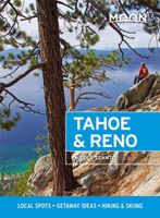
Reisgids Tahoe and Reno | Moon Travel Guides
De Amerikaanse uitgever Moon is een vergelijkbare gids met uitgever Lonely Planet > veel praktische informatie met veel diepgang! Het feit dat het een Amerikaanse uitgever is, maken deze gidsen zeer aantrekkelijk voor de staten afzonderlijk. De Lonely Planet haalt dat nivo niet! From the glittering lake and trail-lined mountains to Old West towns and artsy urban centers, experience the best of this adventurous region with Moon Tahoe & Reno. Inside you'll find:*Flexible itineraries, including a week-long Lake Tahoe road trip, long weekends for both winter and summer, and the one-week best of Tahoe and Reno*Strategic advice for hikers, skiers, beach bums, families with kids, foodies and brewery lovers, and more*The best hikes in Tahoe: Find your adventure, from challenging mountain treks to serene meadow walks, with trail descriptions, difficulty ratings, and detailed trail maps*Outdoor adventures for any season: Hit the slopes and get the first tracks through snow-covered pines or spark…
19,95
Fietskaart 14 Cycling guides Suffolk | Goldeneye
To be confronted with the variety and complexity of the cycling routes, trails and paths in Suffolk can be a bewildering experience.  For it appears that the Suffolk County Council and the three District Councils are all trying hard to promote their areas. This is indeed encouraging for the growth of cycling, but it can be confusing.  Our purpose is to provide clear, easy to use and easy to follow, cycling maps, and to illustrate these in a comprehensive form.    Suffolk must be one of the most charming of counties to explore by bicycle. When Al Churcher delivered his routes to us at Goldeneye we couldn’t keep him quiet, such was his enthusiasm and wonder at Suffolk’s country lanes and byways. He has cycled all over the UK, Canada, Mallorca, New Zealand and Sicily, but Suffolk remained a firm favourite.    The inland scenery is not spectacular for the county’s main glory lies with its attractive villages; the local architecture jealously preserved from modern depredation. There is an a…
15,95
Reisgids Moon Great Smoky Mountains National Park | Moon Travel Guides
From majestic mountaintops to lush forests and untouched wilderness, experience the best of the Smokies with Moon Great Smoky Mountains National Park. Inside you'll find: Flexible itineraries: Unique and adventure-packed ideas ranging from one day in the park to a week-long trip The best hikes in the Great Smokies: Detailed hike descriptions with mileage, duration, elevation gains, and difficulty ratings, plus individual trail maps and options for backpackers Experience the outdoors: Cruise along Newfound Gap Road for epic views from scenic overlooks and watch "smoky" mists rise up through the valleys. Spot local wildlife like 700-pound elk, black bears, and vast herds of white-tailed deer. Savor the refreshing solitude of a night camping under the stars or enjoy a twinkling light show from Elkmont's synchronous fireflies. Trek a segment of the Appalachian Trail, wander through remnants of the region's historic settlements, or try your hand at fly-fishing Take a break: Unwind …
16,95
Reisgids Drive & Hike Appalachian Trail | Moon Travel Guides
Whether you're stopping for a day trek or taking a weekend getaway, hit the road and hit the legendary trail with Moon Drive & Hike Appalachian Trail. Make your escape on shorter trips from major cities or drive the entire three-week route from Georgia to Maine Find your hike along the Appalachian Trail with detailed trail descriptions, mileage, difficulty ratings, and tips for picking the right section of the trail for you Discover adventures off the trail: Immerse yourself in the spirit of colorful trail towns, peep the changing leaves in the Berkshires, and cruise the sun-dappled Skyline Drive. Kick back after a day hike at a microbrewery in Asheville, dig in to southern barbecue (hey, you've earned it), or unwind in the coffee shops and art galleries of a hip New England hamlet Take it from avid hiker Timothy Malcolm, who shares his insight on the best views, waterfalls, mountains, and (of course!) breweries Full-color photos, strategic itineraries, easy-to-use maps and site-t…
27,95

Klanten-reviews van Fietskaart La Palma | Supertrail Map

Er zijn nog geen beoordelingen voor dit productBen jij de eerste die een review plaatst?

Meer over Fietskaart La Palma | Supertrail Map

Productomschrijving

Fietskaart gebaseerd op de bekende Kompass kaarten. Met gekleurde mountainbike routes die duidelijk de moeilijkheid aangeven. Supertrail Maps© are based on topographic maps at a scale of 1:50 000/1:25 000 and provide all the -information required for planning and undertaking a mountain bike trip.   The technical difficulty for both the uphill and downhill directions is colour-coded on a rating from one to five.   The routes in this map are for informational purposes only and do not constitute a recommendation of which routes to take. Supertrail maps only indicate the accessible trails within a region and assess the technical difficulty of individual trail sections. The condition of the trails is subject to ongoing change, so it is essential to check difficulty ratings at the locations (see advice under „Important Information“). Mountain bike tours should be planned in accordance with participants’ fitness level, biking ability and the prevailing weather conditions. When planning a route, current legal provisions and regulations must be considered. Anyone biking on a single trail does so entirely at their own risk – the publisher assumes no liability in this respect.   All the trails on this map have been biked and rated by specially trained authors. The difficulty ratings are consistent across all Supertrail Maps©. A difficulty rating always relates to an entire trail section. It should be noted that any trail section could contain short passages of greater or lesser difficulty than that expressed by the overall rating.
Webshop.nl maakt gebruik van cookies. Ga je verder op onze website, ga dan akkoord met het plaatsen van cookies en de verwerking van deze data door ons en vermelde partners.