webshop.nl
Categorieën
  Sluiten

Meer Sustrans

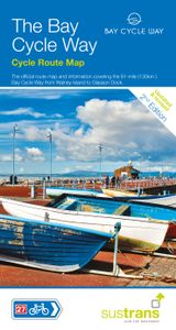
Fietskaart Cycle Map The Bay Cycle Way | Sustrans

Het is niet een heel overzichtelijke kaart, het zijn juist blokken van een deel van de route waarop deze staat ingetekend. Daarin juist wel heel goed met handige stedenkaarten en route profielen. Eigenlijk voor de route als zodanig onmisbaar, je mist alleen het overzicht een beetje.   This is the official map for the Bay Cycle Way route, an 81 mil...
14,95

Webshops met dit product

Webshop
Bezorging
Prijs

Anderen bekeken ook

Fietskaart Cycle Map The Bay Cycle Way | Sustrans
Het is niet een heel overzichtelijke kaart, het zijn juist blokken van een deel van de route waarop deze staat ingetekend. Daarin juist wel heel goed met handige stedenkaarten en route profielen. Eigenlijk voor de route als zodanig onmisbaar, je mist alleen het overzicht een beetje.   This is the official map for the Bay Cycle Way route, an 81 mile (130km) coastal cycle route around Morecambe Bay in the north west of England, and winner of the Visitor Experience Award - Lancashire Tourism Awards 2015. This relatively flat route hugs the spectacular coastline of Morecambe Bay along quiet roads, greenways, canal towpaths and promenades, offering breath taking scenery from Walney Island near Barrow right round to Glasson Dock south of Lancaster. The route looks out over the Irish Sea and is ideal for spotting terns, curlew, knot, oystercatcher and even grey seals.   This full colour map based on Ordnance Survey data shows clearly mapped cycle routes on traffic-free paths, quiet lanes a…
14,95
Fietskaart Cycle Map Pennine Cycleway South | Sustrans
The official route map for the 136-mile (219km) southern part of the Pennine Cycleway on National Cycle Network Route 68 from Derby to Settle.   This linear map shows the route and immediate surrounding area over a series of separate map panels. The full colour map based on Ordnance Survey data shows clearly mapped cycle routes on traffic-free paths, quiet lanes and roads, with easy to read contours, route profiles and mile markers. Also features detailed inset maps for the major towns and cities, tourist info and cycle shop and hire information, and other local routes.   The southern half of the Pennine Cycleway is a beautiful, yet challenging ride which takes you through the dramatic scenery of the Peak District and the South Pennines. The route takes you from the bustling railway city of Derby to the historic town of Settle, taking in the famous spa town of Buxton and the lovely Yorkshire town of Holmfirth, renowned location of the TV classic “Last of the Summer Wine”.   This sectio…
13,50
Fietskaart Cycle Route Map Lôn Las Cymru South | Sustrans
Het is niet een heel overzichtelijke kaart, het zijn juist blokken van een deel van de route waarop deze staat ingetekend. Daarin juist wel heel goed met handige stedenkaarten en route profielen. Eigenlijk voor de route als zodanig onmisbaar, je mist alleen het overzicht een beetje. This linear map shows the southern half of the stunning Lon Las Cymru route and surrounding area over a series of separate map panels.   The route connects Llanidloes in the heart of Wales to the attractive finishing points of Cardiff or Chepstow, with two route options via Hay on Wye to Abergavenny and Chepstow via a taste of the Black Mountains, or along the largely traffic-free Taff Trail from Brecon to Cardiff via Merthyr Tydfil.   This full colour map based on Ordnance Survey data shows clearly mapped cycle routes on traffic-free paths, quiet lanes and roads, with easy to read contours and route profiles. Also features detailed inset maps for the major towns and cities and tourist information.   Nation…
16,95
Fietskaart Cycle Route Map Lôn Las Cymru North | Sustrans
Het is niet een heel overzichtelijke kaart, het zijn juist blokken van een deel van de route waarop deze staat ingetekend. Daarin juist wel heel goed met handige stedenkaarten en route profielen. Eigenlijk voor de route als zodanig onmisbaar, je mist alleen het overzicht een beetje. This linear map shows the northern section of the Lon Las Cymru route and surrounding area over a series of separate map panels.   The route connects Holyhead and Anglesey to Llanidloes in the Wye Valley, the heart of Wales, using minor roads, railway paths, forestry tracks and ancient coach roads. There are some tough challenges as the route crosses the Snowdonia National Park and the range of the Cambrian Mountains.    This full colour map based on Ordnance Survey data shows clearly mapped cycle routes on traffic-free paths, quiet lanes and roads, with easy to read contours and route profiles. Also features detailed inset maps for the major towns and cities and tourist information.   National Cycle Networ…
16,95
Fietsgids London - Land's End Cycle Route | EOS Cycling Holidays Ltd
The guidebook contains routes from both Dover and Harwich ferry ports to London. This makes it possible to cycle around the English Channel, when also using the Plymouth link. The Dover to London route takes you though the fruit orchards of Kent, historic Canterbury and the Medway estuary with its impressive castles.   The Harwich to London route provides pleasant countryside cycling in Essex and takes you through Roman Colchester. Cycling through the heart of London, our route manages to stay away from busy roads, the occasional busy junction crossing excepted. Most of the cycling takes place on towpaths along the River Thames with spectacular views to enjoy.   You will cycle under the Tower Bridge and you'll pass the London Eye, Big Ben, the Houses of Parliament and Buckingham Palace on the way. Greenwich Park, Hyde Park and Richmond Park all provide superb green traffic-free routes. Heading west you'll cycle by Windsor Park and Windsor Castle before making your way to the Aon & Kenn…
41,50
Fietskaart Cycle Map Pennine Cycleway South | Sustrans
The official route map for the 136-mile (219km) southern part of the Pennine Cycleway on National Cycle Network Route 68 from Derby to Settle.   This linear map shows the route and immediate surrounding area over a series of separate map panels. The full colour map based on Ordnance Survey data shows clearly mapped cycle routes on traffic-free paths, quiet lanes and roads, with easy to read contours, route profiles and mile markers. Also features detailed inset maps for the major towns and cities, tourist info and cycle shop and hire information, and other local routes.   The southern half of the Pennine Cycleway is a beautiful, yet challenging ride which takes you through the dramatic scenery of the Peak District and the South Pennines. The route takes you from the bustling railway city of Derby to the historic town of Settle, taking in the famous spa town of Buxton and the lovely Yorkshire town of Holmfirth, renowned location of the TV classic “Last of the Summer Wine”.   This sectio…
13,50
Fietsgids London - Land's End Cycle Route | EOS Cycling Holidays Ltd
The guidebook contains routes from both Dover and Harwich ferry ports to London. This makes it possible to cycle around the English Channel, when also using the Plymouth link. The Dover to London route takes you though the fruit orchards of Kent, historic Canterbury and the Medway estuary with its impressive castles.   The Harwich to London route provides pleasant countryside cycling in Essex and takes you through Roman Colchester. Cycling through the heart of London, our route manages to stay away from busy roads, the occasional busy junction crossing excepted. Most of the cycling takes place on towpaths along the River Thames with spectacular views to enjoy.   You will cycle under the Tower Bridge and you'll pass the London Eye, Big Ben, the Houses of Parliament and Buckingham Palace on the way. Greenwich Park, Hyde Park and Richmond Park all provide superb green traffic-free routes. Heading west you'll cycle by Windsor Park and Windsor Castle before making your way to the Aon & Kenn…
41,50
Fietskaart Cycle Route Map Lôn Las Cymru North | Sustrans
Het is niet een heel overzichtelijke kaart, het zijn juist blokken van een deel van de route waarop deze staat ingetekend. Daarin juist wel heel goed met handige stedenkaarten en route profielen. Eigenlijk voor de route als zodanig onmisbaar, je mist alleen het overzicht een beetje. This linear map shows the northern section of the Lon Las Cymru route and surrounding area over a series of separate map panels.   The route connects Holyhead and Anglesey to Llanidloes in the Wye Valley, the heart of Wales, using minor roads, railway paths, forestry tracks and ancient coach roads. There are some tough challenges as the route crosses the Snowdonia National Park and the range of the Cambrian Mountains.    This full colour map based on Ordnance Survey data shows clearly mapped cycle routes on traffic-free paths, quiet lanes and roads, with easy to read contours and route profiles. Also features detailed inset maps for the major towns and cities and tourist information.   National Cycle Networ…
16,95
Fietskaart 03 Tour Map Lake District & Cumbria | Ordnance Survey
De Ordnance Survey Tour Maps met schaal 1:100.000 zijn uitstekend geschikt om zelf je fietsvakantie te plannen in Engeland. Ze laten alle alle grote en kleinere wegen zien. Bovendien staan de Routes van National Cycle Network ingetekend. Ook erg handig zijn de vermeldingen van campings, jeugdherbergen en andere accommodaties! Kortom de perfecte fietskaart! Daarnaast worden op de Tour Maps-serie de Langs Afstands Wandelroutes, Kust Wandel Routes en de National Trails aangegeven. Handig voor het overzicht voor het plannen van een meerdaagse wandelroute. Met stadsplattegronden van: Carlisle, Workington, Whitehaven, Barrow-in-Furness, Penrith, Windermere, Kendal, Ambleside, Cockermouth. Dorpen op de kaart: Carlisle, Workington, Whitehaven, Barrow-in-Furness, Penrith, Windermere, Kendal, Ambleside, Cockermouth, Maryport, Keswick, Patterdale, Coniston, St. Bees, Silloth, Annan, Gretna, Etheral, Longtown, Langwathby, Alston, Brough, Appleby-in-Westmorland, Kirkby Stephen, Kirkby Lonsdale, Sed…
10,95

Klanten-reviews van Fietskaart Cycle Map The Bay Cycle Way | Sustrans

Er zijn nog geen beoordelingen voor dit productBen jij de eerste die een review plaatst?

Meer over Fietskaart Cycle Map The Bay Cycle Way | Sustrans

Productomschrijving

Het is niet een heel overzichtelijke kaart, het zijn juist blokken van een deel van de route waarop deze staat ingetekend. Daarin juist wel heel goed met handige stedenkaarten en route profielen. Eigenlijk voor de route als zodanig onmisbaar, je mist alleen het overzicht een beetje.   This is the official map for the Bay Cycle Way route, an 81 mile (130km) coastal cycle route around Morecambe Bay in the north west of England, and winner of the Visitor Experience Award - Lancashire Tourism Awards 2015. This relatively flat route hugs the spectacular coastline of Morecambe Bay along quiet roads, greenways, canal towpaths and promenades, offering breath taking scenery from Walney Island near Barrow right round to Glasson Dock south of Lancaster. The route looks out over the Irish Sea and is ideal for spotting terns, curlew, knot, oystercatcher and even grey seals.   This full colour map based on Ordnance Survey data shows clearly mapped cycle routes on traffic-free paths, quiet lanes and roads, with easy to read contours, route profile, and town inset maps, local Tourist Information Centres, bike shops and cycle hire details.   National Cycle Network routes covered:   National Route 700 between Walney Island near Barrow-in-Furness and Glasson Dock.   National Route 70 between Walney Island near Barrow-in-Furness and Sedgwick.   National Route 6 between Sedgwick and Galgate.   National Route 69 between Morecambe and Gressingham.

Productspecificaties

Artikelnummer(s)
Brand
Sustrans
Webshop.nl maakt gebruik van cookies. Ga je verder op onze website, ga dan akkoord met het plaatsen van cookies en de verwerking van deze data door ons en vermelde partners.