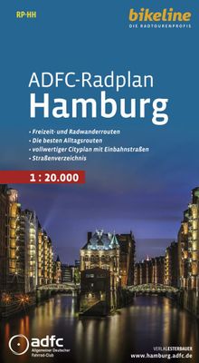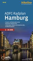
Fietskaart RP-HH Bikeline Radkarte ADFC radplan Hamburg | Esterbauer

0
Cycle paths and routes with information about surface and traffic density. Selected street names. Precise gradient and distance information. Selection of the most important tourist information. Waterproof and tear-resistant paper. Thoroughly researched and permanently updated.   With the cartographic route information you can start your trip confi...

Verkopers met dit product

Verkoper
Bezorging
Prijs
DeZwerver.nl logo
DeZwerver.nl
2,95
9,90

Anderen bekeken ook

Nieuw
Wegenatlas Traveller's Atlas Southern Africa - Zuidelijk Afrika | A3-Formaat | Ringband | Tracks4Africa
Deze atlas omvat tien landen in zuidelijk Afrika en is speciaal gericht op reizigers die zelf rijden. De betrokken landen zijn: Angola, Botswana, Lesotho, Malawi, Mozambique, Namibië, Zuid-Afrika, Swaziland, Zambia en Zimbabwe.   De Atlas bevat 223 kaartpagina's met hetzelfde vertrouwde kaartdetail waarvoor Tracks4Africa bekend is.   De wegenatlas is afgedrukt in A3 formaat, weegt 2750g, heeft een stevige omslag, spiraal gebonden en de pagina's zijn afgedrukt op dik papier.   Bigger coverage than ever before: 1:4m maps for Southern and Eastern Africa – ideal for macro planning. 1:1m maps for Southern Africa, covering the following countries: Angola, Botswana, eSwatini, Lesotho, Malawi, Mozambique, Namibia, South Africa, Zambia and Zimbabwe. 1:500k maps for South Africa, Malawi, most part of Zambia and the area around Moremi/Chobe in Botswana. Road coverage: This Atlas is designed for overland travel and compiled from the same data used on our famous GPS maps. Use it for trip p…
79,95
Nieuw
Fietsgids Bikeline Danube Bike Trail 5 (Engels - Donau Radweg) | Esterbauer
The fifth part of the Danube Bike Trail begins in Belgrade and ends in Romania on the Black Sea. With a total length of 2,845 kilometres, the Danube is Europe’s second longest river (after the Volga with 3,534 kilometres), and the only one on which kilometres are counted in reverse direction, starting with kilometer zero at the mouth and ending upstream at the source.   The total length of Part 5 of the Danube Bicycle Trail is about 1,400 kilometres. This does not include various side trips and alternative routes. The Danube Bike Trail is part of the Eurovelo-Route 6 and to a great extent identical.   This last part of the Danube Bike Trail mostly follows paved main roads and secondary roads, which you share with a variety of other traffic. It is not unusual in some parts of Bulgaria and Romania that you encounter more horse or mule carts, pedestrians or roaming sheep or geese than motorized traffic. In and around the larger cities, however, you can expect heavy traffic and you should…
15,50
Fietskaart Cycling guides Exmoor - North Devon | Goldeneye
Scheur- en watervast foetskaart van Exmoor en Noord Devon met ingetekende fietsroutes.   Our maps are double-sided, printed on an A2 sheet with a concertina fold. This allows for easy folding and folding, and an ease of access to the mapping. The material is rain and tear-resistant. Our early maps were designed at the scale of 2 miles to 1 inch/1:126,720. The later designs along with digitalisation are 1: 100,000. We were encouraged by the Cycle Touring Club to convert our cartography toward the cycle market (to replace the out-of-print Bartholomew series). As time and the series progressed we have added more data: The National Cycle Network routes, Regional Routes, and Traffic-Free Family Routes, as and when they are developed. These routes are in addition to the Circular Routes Goldeneye Commissioned at the outset of our publishing schedule. We are also adding to new editions; bike shops, cycle hire, and tea rooms, along with the tourist attractions already featured. Our plan is to …
12,95
Accommodatiegids - Campergids - Campinggids Botswana Self-Drive Guide | Tracks4Africa
De Self Drive Guide Botswana van Tracks4Africa is een uitgebreide gids met alle informatie voor mensen die zelf met een eigen of gehuurde auto door Botswana willen reizen. De gids bevat informatie over parken en routes, over overnachtingsmogelijkheden en campings, maar ook over de veiligheid, de beste reistijd, de planning, de keuze van welk vervoermiddel en de hulpmiddelen die vereist zijn. Zo vindt u bijvoorbeeld ook informatie over het huren van een 4x4 met tent op het dak en campingspullen, over de techniek van de auto, over voorbereiding, over navigatie, communicatie en vereiste documenten. De gids ziet er aantrekkelijk en overzichtelijk uit en bevat veel kaarten met routes en ook kleurenfoto's. De gids is groot van formaat : A4 !   This guide is specifically aimed at self-drive travellers. If you are a self-drive tourist, there are five things that you need to know when you are on the road:  1. Where to sleep.  2. Where to get fuel.  3. What to see and do.  4. Where to buy suppl…
52,50
Accommodatiegids Namibia Self-Drive Guide | Tracks4Africa
So, what is so special about the Tracks4Africa guide books? These are not guides written by armchair travellers or the personal experience of one person, but the combined experiences of a whole community of travellers. The T4A community travel far and wide – not by luxury bus or safari vehicle but on their own wheels. Sometimes they travel in groups and sometimes as lone rangers, but they always travel by motorbike, sedan or 4WD, therefore this guide is specifically aimed at self-drive travellers.   If you are a self-drive tourist, there are five things that you need to know when you are on the road: 1. Where to sleep. 2. Where to get fuel. 3. What to see and do. 4. Where to buy supplies. 5. Where to go in case of an emergency.   If you have the Tracks4Africa Self-Drive Guide as your travel companion, the answers to all these and many more questions will be at hand. If you are well prepared and well informed, you can really enjoy the unspoilt beauty of Africa! The Tracks4Afr…
52,50
Fietsgids Bikeline Baltic Sea Cycle Route - Iron curtain Trail 2 | Esterbauer
Praktische fietsgids voor een gedeelte van de Iron Curtain Trail, van Riga naar Lübeck. Met detailkaarten, ingetekende route, informatie over overnachten en fietsenmakers, zwaarte en hoogteprofiel. In spiraalbinding, Engelstalig.  The cycling guide contains all the information you need for your cycling vacation along the European Iron Curtain Trail between Riga and Lübeck: Precise maps, a detailed description of the route, a comprehensive list of overnight accommodation, numerous detail maps of cities and towns, and information about the most significant sights. And all that information comes with our bikeline pledge: The route described in this book has been tested and evaluated in person by the author! To assure that the book is as up-to-date as possible, we welcome corrections submitted by readers and local officials or businesses. We cannot, however, always check and confirm such changes before deadline. The maps The detail maps are produced in a scale of 1:85,000 (1 centimeter =…
19,50
Nieuw
Fietsgids Bikeline Cycling guide Provence | Esterbauer
Provence – The name alone sounds inviting to every traveller. The region’s wonderfully mild climate and many quiet paved roads makes it an ideal destination for bicycle tourists year round. Let yourself be enchanted by ancient towns and historic monasteries, by the scent from fields of rich lavender, the charm of tiny villages and French joie de vivre. Enjoy the contrasts presented by the peaceful expanses of the Camargue, with its glittering blue bays and herds of Camargue horses grazing in a landscape dotted with brilliantly white farmsteads. A refreshing plunge into the Mediterranean is just one of the many highlights of this bicycle tour. This Cycling Guide includes detailed maps of the countryside and of many cities and towns, precise route descriptions, information about historic and cultural sites as well as background information and a comprehensive list of overnight accommodations. The only thing this guide cannot provide is fine cycling weather, but we hope you find nothing …
13,50
Fietskaart Cycle Map Pennine Cycleway South | Sustrans
The official route map for the 136-mile (219km) southern part of the Pennine Cycleway on National Cycle Network Route 68 from Derby to Settle.   This linear map shows the route and immediate surrounding area over a series of separate map panels. The full colour map based on Ordnance Survey data shows clearly mapped cycle routes on traffic-free paths, quiet lanes and roads, with easy to read contours, route profiles and mile markers. Also features detailed inset maps for the major towns and cities, tourist info and cycle shop and hire information, and other local routes.   The southern half of the Pennine Cycleway is a beautiful, yet challenging ride which takes you through the dramatic scenery of the Peak District and the South Pennines. The route takes you from the bustling railway city of Derby to the historic town of Settle, taking in the famous spa town of Buxton and the lovely Yorkshire town of Holmfirth, renowned location of the TV classic “Last of the Summer Wine”.   This secti…
13,50
Wegenkaart - landkaart Costa Blanca Valencia | Marco Polo
Goede wegenkaart van een deel van Spanje,met schaal 1:200.000: meer details dan de Michelin wegenkaarten van Spanje. Deze kaarten hebben een register, een tabel met afstanden tussen steden, enkele centrumkaarten van de meest belangrijke steden, vermelding van o.a. campings aan de hand van symbolen alsmede de bezienswaardigheden. Ook benzinepompen worden bijvoorbeeld vermeld! The map boldly stresses main roads and motorways in strong colours and selected towns in large letters, but also shows minor roads and villages in considerable detail. Road information includes toll roads, traffic restrictions and seasonal closures, gradient marking for steep roads, scenic roads and special tourist routes, etc. Motorway services clearly indicate types of facilities available there. Railway network is shown with stations and includes tourist lines Picturesque towns or villages and sites worth visiting, including areas with interesting landscape, are given star rating, and other tourist information …
14,95
Nieuw
Wegenkaart - landkaart South Africa: Swartberg & Klein-Karoo | Slingsby Maps
All roads from National Highways to minor gravel roads are shown; the many classifications that indi- cate the quality of each road help you plan your route No less than 28 mountain passes are shown — all are public roads! Distances are clearly shown; comprehensive 4 x 4 information GPS coordinates in DD MM SS format are provided for every road-junction All tourism facilities and accommodation establishments are shown in the out-of-town areas; there are insets of the major towns The map links to our maps of the Baviaanskloof, the Garden Route, Overberg and the Tankwa-Karoo Additional info:   Swartberg and Klein-Karoo region on a contoured and GPS compatible, double-sided, waterproof and   tear-resistant map at 1:160,000 from Slingsby Maps, with excellent topographic detail and plenty of tourist information, including street plans of ten main towns.   The map provides a very detailed picture of this mountainous terrain, with altitude colouring, shading, con- tours at 20m intervals and …
29,95

Klanten-reviews van Fietskaart RP-HH Bikeline Radkarte ADFC radplan Hamburg | Esterbauer

Er zijn nog geen beoordelingen voor dit productBen jij de eerste die een review plaatst?

Meer over Fietskaart RP-HH Bikeline Radkarte ADFC radplan Hamburg | Esterbauer

Productomschrijving

Cycle paths and routes with information about surface and traffic density. Selected street names. Precise gradient and distance information. Selection of the most important tourist information. Waterproof and tear-resistant paper. Thoroughly researched and permanently updated.   With the cartographic route information you can start your trip confidently, because all the necessary information is already compiled for you: road surface (paved or unpaved), traffic density, hill slopes, distance information tourist infrastructure such as inns and lodging establishments, as well as the cultural and scenic attractions of the region.

Productinformatie

    Verken gerelateerde categorieën

    Webshop.nl maakt gebruik van cookies. Ga je verder op onze website, ga dan akkoord met het plaatsen van cookies en de verwerking van deze data door ons en vermelde partners.