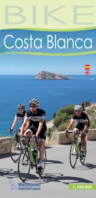
Fietskaart Bike Costa Blanca Noord | Editorial Alpina

0
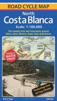
Handige geplastificeerde fietskaart van Costa Blanca Noord (tussen Denia en El Campello), met ingetekende routes, helder kaartbeeld en extra informatie aan de hand van symbolen.   Gebied: Jativa, Ontinyent, Agost, Benidorm.Javea, Gandia   This is a waterproof, folded map of Costa Blanca North. The scale is 1:100,000 and has English description.   ...

Verkopers met dit product

Verkoper
Bezorging
Prijs
DeZwerver.nl logo
DeZwerver.nl
2,95
12,50

Anderen bekeken ook

Fietskaart Bike Costa Blanca Noord | Editorial Alpina
Handige geplastificeerde fietskaart van Costa Blanca Noord (tussen Denia en El Campello), met ingetekende routes, helder kaartbeeld en extra informatie aan de hand van symbolen.   Gebied: Jativa, Ontinyent, Agost, Benidorm.Javea, Gandia   This is a waterproof, folded map of Costa Blanca North. The scale is 1:100,000 and has English description.    Bike shops are listed and bike-friendly taxi services. Other practical information includes average gradient symbols; routes graded for light/medium/heavy traffic; roads in bad repair; specific bike lanes; unpaved/dirt tracks. Suggested tours are highlighted, ranging from 36km to 110km, including height profiles.   Mountain bike routes are also marked on the map, most of which are unpaved and quite easy to follow.
12,50
Fietskaart 75 Bike Mallorca | Editorial Alpina
Handige geplastificeerde fietskaart van Mallorca, met ingetekende routes, helder kaartbeeld en extra informatie aan de hand van symbolen.   This is a waterproof, folded map to the cycling Mecca of Mallorca. The scale is 1:100,000 and has English description.    Bike shops are listed and bike-friendly taxi services. Other practical information includes average gradient symbols; routes graded for light/medium/heavy traffic; roads in bad repair; specific bike lanes; unpaved/dirt tracks. Suggested tours are highlighted, ranging from 36km to 110km, including height profiles.   Mountain bike routes are also marked on the map, most of which are unpaved and quite easy to follow.
9,95
Wandelkaart - Fietskaart 72 Noord Mallorca | Editorial Alpina
Formentor - Pinar - Ferrutx - Pollenca - Alcudia - Arta - Capdepera   Kaart met wandel-, MTB- en fietsroutes. Bijgevoegd is een boekje met in het Duits en Engels een korte beschrijving van een aantal van deze routes.   This is an area of great natural beauty, with protected areas - the Parque Natural de la Sierra Levante and the Natural Park of Albufereta.    The map includes the GR 221, all marked trails, mountain bike routes and bike paths, as well as location of all tourist services.
16,95
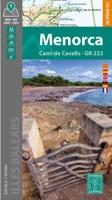
Fietskaart - Wandelkaart Menorca GR223 -Cami de Cavalls | Editorial Alpina
Zeer gedetailleerde wandelkaart en fietskaart (MTB)  van Menorca. Met ingetekende wandelroutes en andere informatie. Spaanstalig, maar uitstekende kaart. Met symbolen voor bijvoorbeeld campings en stranden   Met een gidsje in diverse talen met suggesties voor wandelen en fietsen, deels beschrijvingen.   Book Language: Spanish, English, German   •Hiking map and guidebook •Scale 1:50.000 •Equidistance contours: 20 m distance •Master contours: at 100 m •Shady relief •Compatible with GPS •Marked routes •Land use symbolized at three levels
17,95
Fietskaart Costa Blanca North | Active Maps Limited
A 100,000 scale detailed road cycle map for North Costa Blanca (the coastal zone and mountains around Denia, Xabia/Javea, Moraira, Calpe, Altea & Benidorm). Easy cycle route planning with road classifications, distance markers between key junctions, top climbs, spot heights and relief representation. Includes 11 classic route suggestions that pass through valleys, go high up into the mountains, visit unspoilt villages and towns and meander along the coast.   Features over 60 top climbs marked on the map with details of gradient, ascent and length (Coll de Rates, Port de Tudons, Confrides, Cumbre del Sol, Port de Bernia, Miserat, Vall d'Ebo, Coll de la Garga, and many more). Some of the key inland towns on the map include Tarbena, Castell de Castells, Xalo/Jalon, Pego, Villalonga, Sella, Guadalest, L'Orxa, Benifallim, Planes, Muro de Alcoy). The map is printed on tough and waterproof paper.
17,95
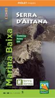
Wandelkaart Marina Baixa - Serra d'Aitana, Costa Blanca mountains west | Editorial Piolet
Heel nauwkeurige wandelkaart van een mooi wandelgebied net ten noorden van Benidorm. Dit is de west kaart van het gebied, de oostkant wordt gedekt door de kaart Serra de Bernia. De Spaanse uitgever Editorial Piolet maakt bijzonder gedetailleerde kaarten van deelgebieden in Spanje, geschikt voor wandelaars en MTB-ers. Van ouds her zijn ze begonnen in de regio rond Barcelona maar ze breiden steeds meer uit richting andere delen van Spanje,   De kaarten hebben een topografische ondergrond met hoogtelijnen, toppen, schaduwtekening bij bergruggen, wegen en dorpen, gehuchten en zelfs boerderijen. Daarbij hebben ze enkele wandelpaden gemarkeerd, met name de GR paden en de PR paden, de regionale lange-afstands paden. Andere wandelpaden staan wel ingetekend, maar met de gewone zwarte lijntjes in plaats van een opvallende kleur. Ook worden op bepaalde kaarten MTB routes weergegeven, maar dat is eerder een uitzondering dan een regel. Met symbolen zijn andere handige zaken aangeduid als campings,…
12,95
Wandelkaart - Fietskaart NP Torcal de Antequera | Editorial Penibetica
Een zeer uitgebreide wandel- en fietskaart van het nationale park Torcal of Antequera met een gidsje met beschreven wandelroutes van variërende lengte. Op de kaart worden hoogtelijnen, plaatselijke voorzieningen, wandel- en fietsroutesmeegenomen. GPS compatible.   two separate maps, both with a UTM grid and latitude/longitude margin ticks at 1' intervals, but no overprint for cycling routes. One map at 1:30,000 (68x77cm) is centred on the Laguna de Fuente de Piedra and extends to Alameda in the north-east to Campillos in the south west. A small inset shows the Lagunas de Archidona which lie further to the east. The other map at 1:25,000 (65x48cm) covers the Torcal de Antequera Natural Park and includes Villanueva de la Conception in the south and part of Antequera in the north. The booklet is in English.
12,95
Wandelkaart Cabo de Gata / Nijar | Editorial Alpina
Zeer gedetailleerde wandelkaart van een klein gebied. Met ingetekende wandelroutes en andere informatie. Spaanstalig, maar uitstekende kaart. Coordinaten zijn weergegeven, dus GPS compatible met UTM grid.    Op de topografische wandelkaart worden o.a. berghutten, campings aangeduid en hoogtelijnen, ingetekende wandelroutes en de GR paden (doorgaande langeafstandswandelpaden).  Cabo da Gata-Níjar Natural Park in an extensive and very popular series of walking maps from Editorial Alpina covering the Pyrenees, Catalonia and other selected hiking areas in Spain, including Picos de Europa, Sierra Nevada and parts of Andalucía, Majorca, etc. Scales vary from 1:50,000 to 1:10,000, with the majority of the titles at 1:25,000. The maps have contours, usually at 20m or 10m intervals, with additional hill shading and spot heights. An overprint highlights hiking trails, long-distance footpaths, campsites, mountain huts, refuges, etc. Many maps also show climbing sites, potholing caves, mountain b…
17,95

Klanten-reviews van Fietskaart Bike Costa Blanca Noord | Editorial Alpina

Er zijn nog geen beoordelingen voor dit productBen jij de eerste die een review plaatst?

Meer over Fietskaart Bike Costa Blanca Noord | Editorial Alpina

Productomschrijving

Handige geplastificeerde fietskaart van Costa Blanca Noord (tussen Denia en El Campello), met ingetekende routes, helder kaartbeeld en extra informatie aan de hand van symbolen.   Gebied: Jativa, Ontinyent, Agost, Benidorm.Javea, Gandia   This is a waterproof, folded map of Costa Blanca North. The scale is 1:100,000 and has English description.    Bike shops are listed and bike-friendly taxi services. Other practical information includes average gradient symbols; routes graded for light/medium/heavy traffic; roads in bad repair; specific bike lanes; unpaved/dirt tracks. Suggested tours are highlighted, ranging from 36km to 110km, including height profiles.   Mountain bike routes are also marked on the map, most of which are unpaved and quite easy to follow.

Productinformatie

    Verken gerelateerde categorieën

    Webshop.nl maakt gebruik van cookies. Ga je verder op onze website, ga dan akkoord met het plaatsen van cookies en de verwerking van deze data door ons en vermelde partners.