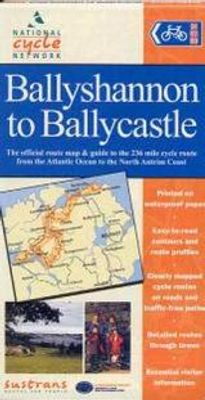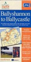
Fietskaart Ballyshannon to Ballycastle | Sustrans

0
Duidelijk aangegeven fietsroutes op autovrije paden en rustige landschapswegen. Makkelijk leesbaar, gedetailleerde stadsplattegronden, extra achtergrondinformatie en waterbestendig hoesje. In deelkaarten aangegeven en met stads- en dorpsplattegronden.The official route map & guide to the 236 mile cycle route from the Atlantic Ocean to the North Ant...

Verkopers met dit product

Verkoper
Bezorging
Prijs
DeZwerver.nl logo
DeZwerver.nl
niet bekend
2,95
11,75

Anderen bekeken ook

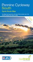
Fietskaart Cycle Map Pennine Cycleway South | Sustrans
The official route map for the 136-mile (219km) southern part of the Pennine Cycleway on National Cycle Network Route 68 from Derby to Settle.   This linear map shows the route and immediate surrounding area over a series of separate map panels. The full colour map based on Ordnance Survey data shows clearly mapped cycle routes on traffic-free paths, quiet lanes and roads, with easy to read contours, route profiles and mile markers. Also features detailed inset maps for the major towns and cities, tourist info and cycle shop and hire information, and other local routes.   The southern half of the Pennine Cycleway is a beautiful, yet challenging ride which takes you through the dramatic scenery of the Peak District and the South Pennines. The route takes you from the bustling railway city of Derby to the historic town of Settle, taking in the famous spa town of Buxton and the lovely Yorkshire town of Holmfirth, renowned location of the TV classic “Last of the Summer Wine”.   This secti…
13,50
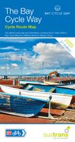
Fietskaart Cycle Map The Bay Cycle Way | Sustrans
Het is niet een heel overzichtelijke kaart, het zijn juist blokken van een deel van de route waarop deze staat ingetekend. Daarin juist wel heel goed met handige stedenkaarten en route profielen. Eigenlijk voor de route als zodanig onmisbaar, je mist alleen het overzicht een beetje.   This is the official map for the Bay Cycle Way route, an 81 mile (130km) coastal cycle route around Morecambe Bay in the north west of England, and winner of the Visitor Experience Award - Lancashire Tourism Awards 2015. This relatively flat route hugs the spectacular coastline of Morecambe Bay along quiet roads, greenways, canal towpaths and promenades, offering breath taking scenery from Walney Island near Barrow right round to Glasson Dock south of Lancaster. The route looks out over the Irish Sea and is ideal for spotting terns, curlew, knot, oystercatcher and even grey seals.   This full colour map based on Ordnance Survey data shows clearly mapped cycle routes on traffic-free paths, quiet lanes …
14,95
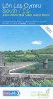
Fietskaart Cycle Route Map Lôn Las Cymru South | Sustrans
Het is niet een heel overzichtelijke kaart, het zijn juist blokken van een deel van de route waarop deze staat ingetekend. Daarin juist wel heel goed met handige stedenkaarten en route profielen. Eigenlijk voor de route als zodanig onmisbaar, je mist alleen het overzicht een beetje. This linear map shows the southern half of the stunning Lon Las Cymru route and surrounding area over a series of separate map panels.   The route connects Llanidloes in the heart of Wales to the attractive finishing points of Cardiff or Chepstow, with two route options via Hay on Wye to Abergavenny and Chepstow via a taste of the Black Mountains, or along the largely traffic-free Taff Trail from Brecon to Cardiff via Merthyr Tydfil.   This full colour map based on Ordnance Survey data shows clearly mapped cycle routes on traffic-free paths, quiet lanes and roads, with easy to read contours and route profiles. Also features detailed inset maps for the major towns and cities and tourist information.   Natio…
16,95
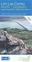
Fietskaart Cycle Route Map Lôn Las Cymru North | Sustrans
Het is niet een heel overzichtelijke kaart, het zijn juist blokken van een deel van de route waarop deze staat ingetekend. Daarin juist wel heel goed met handige stedenkaarten en route profielen. Eigenlijk voor de route als zodanig onmisbaar, je mist alleen het overzicht een beetje. This linear map shows the northern section of the Lon Las Cymru route and surrounding area over a series of separate map panels.   The route connects Holyhead and Anglesey to Llanidloes in the Wye Valley, the heart of Wales, using minor roads, railway paths, forestry tracks and ancient coach roads. There are some tough challenges as the route crosses the Snowdonia National Park and the range of the Cambrian Mountains.    This full colour map based on Ordnance Survey data shows clearly mapped cycle routes on traffic-free paths, quiet lanes and roads, with easy to read contours and route profiles. Also features detailed inset maps for the major towns and cities and tourist information.   National Cycle Netwo…
16,95
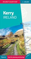
Wegenkaart - landkaart - Fietskaart Kerry (Ierland) | Xploreit Maps
Een nieuwe editie van de populaire Xploreit-kaart van County Kerry   Of u nu uw dagelijkse activiteiten wilt plannen of gewoon een snelle scan van uw huidige locatie nodig hebt, deze kaart is een uitstekende metgezel voor uw avonturen in County Kerry. Deze handige en informatieve tourkaart heeft al vele jaren duizenden bezoekers en inwoners naar de beste autoritten, fietsroutes, wandelingen en bezienswaardigheden in Kerry, 'The Kingdom', geleid. Deze opwindende nieuwe editie is volledig herzien en bijgewerkt. Het Kerry-gedeelte van de nieuwe langeafstands Euro Velo Atlantic Cycle Route is opgenomen, samen met de nieuwe groene routes, waaronder Listowel naar Abbeyfeale en Tralee naar Fenit. Topografie wordt weergegeven door hoogtekleuren met contouren op 30 m en er worden talrijke geografische kenmerken geïdentificeerd. Het wegennet omvat lokale wegen en paden met gemarkeerde schilderachtige wegen, waaronder het Kerry-gedeelte van de Wild Atlantic Way en relevante Discovery Points. Elk…
23,95
Fietskaart 1 Tour Map Cornwall | Ordnance Survey
Overzichtelijke, gedetailleerde kaart met veel toeristische informatie, waaronder campings en jeugdherbergen. Groot voordeel, naast de prima schaal, is dat de routes van het National Cycle Network duidelijk staan ingetekend. De kaarten laten alle grote en kleine wegen zien, wel zijn er ter vereenvoudiging andere - met name topografische details - weggelaten. Het is dus kiezen voor een groter gebied (deze kaarten) of een beduidend kleiner gebied met topografische kenmerken zonder ingetekende fietsroutes. (de Landranger 1:50.000 serie). Touring maps are based on counties or popular tourist areas, and are ideal for helping you to plan the quickest, shortest or most scenic route to your destination. These easy-to-read maps include essential tourist information to help you get the most from your trip. Met stadsplattegronden van: Bude, Launceston, Bodmin, Newquay, Truro, St. Austell, Looe, Padstow, Falmouth, Helston, Penzance und Hugh Town (auf den Scilly-Inseln). Dorpen op de kaart: Bude, …
10,95
Fietskaart 2 De sterkste fietskaart van Friesland | Buijten & Schipperheijn
Onverslijtbare fiets- en wandelkaart Friesland. Blijft leesbaar op de vouwen en is bestand tegen regen. Met fietsknooppunten, landelijke fietsroutes, streekpaden en law-routes. De kaart munt uit door tegelijk een rustig kaartbeeld en superieure topografische detaillering, reliëfklassen en landschapsinformatie zoals kerken, molens, forten en beschermde stads- en dorpsgezichten. Schaal 1:50.000. Via webcodes krijgt u informatie van alle veerdiensten, onderdakadressen en campings.
12,90
Fietskaart ADFC Regionalkarte Ostfriesland | BVA BikeMedia
Dit is de meest geschikte fietskaart wanneer u wat langer in één regio verblijft. De kaart is van de ADFC (Algemeine Deutsche Fahrrad Club). Echt alle relevante fietsinfo is op deze kaart terug te vinden. Zeer goede heldere, betrouwbare kaart met ingetekend alle bewegwijzerde routes * Zeer gedetailleerde kaart * Vermelding van verkeersdrukte * Vermelding van type wegdek * Hellingen worden aangegeven middels 1 of 2 pijlen * Hoogtelijnen aanwezig * Relevante info als fietsenmakers, campings, horeca etc..aanwezig * Geschikt voor verblijf in 1 bepaald gebied ADFC recommended topographic cycling maps of popular regions of Germany giving details of routes, volume of traffic so you can choose the calmest route, details of gradients, camp sites, & tourist information. With these maps you can work out a route to suit all tastes, whether for family or for mountain bikers. Von der niederländischen Grenze bis Oldenburg mit vielen Radfernwegen wie Deutscher Fehnroute, Ammerland Route, Tour de Frie…
12,95

Klanten-reviews van Fietskaart Ballyshannon to Ballycastle | Sustrans

Er zijn nog geen beoordelingen voor dit productBen jij de eerste die een review plaatst?

Meer over Fietskaart Ballyshannon to Ballycastle | Sustrans

Productomschrijving

Duidelijk aangegeven fietsroutes op autovrije paden en rustige landschapswegen. Makkelijk leesbaar, gedetailleerde stadsplattegronden, extra achtergrondinformatie en waterbestendig hoesje. In deelkaarten aangegeven en met stads- en dorpsplattegronden.

The official route map & guide to the 236 mile cycle route from the Atlantic Ocean to the North Antrim Coast.

Productinformatie

    Verken gerelateerde categorieën

    Webshop.nl maakt gebruik van cookies. Ga je verder op onze website, ga dan akkoord met het plaatsen van cookies en de verwerking van deze data door ons en vermelde partners.