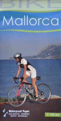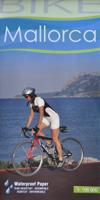
Fietskaart 75 Bike Mallorca | Editorial Alpina

0
Handige geplastificeerde fietskaart van Mallorca, met ingetekende routes, helder kaartbeeld en extra informatie aan de hand van symbolen.   This is a waterproof, folded map to the cycling Mecca of Mallorca. The scale is 1:100,000 and has English description.    Bike shops are listed and bike-friendly taxi services. Other practical information incl...

Verkopers met dit product

Verkoper
Bezorging
Prijs
DeZwerver.nl logo
DeZwerver.nl
2,95
9,95

Anderen bekeken ook

Fietskaart Bike Costa Blanca Noord | Editorial Alpina
Handige geplastificeerde fietskaart van Costa Blanca Noord (tussen Denia en El Campello), met ingetekende routes, helder kaartbeeld en extra informatie aan de hand van symbolen.   Gebied: Jativa, Ontinyent, Agost, Benidorm.Javea, Gandia   This is a waterproof, folded map of Costa Blanca North. The scale is 1:100,000 and has English description.    Bike shops are listed and bike-friendly taxi services. Other practical information includes average gradient symbols; routes graded for light/medium/heavy traffic; roads in bad repair; specific bike lanes; unpaved/dirt tracks. Suggested tours are highlighted, ranging from 36km to 110km, including height profiles.   Mountain bike routes are also marked on the map, most of which are unpaved and quite easy to follow.
12,50
Nieuw
Fietsgids Bikeline Danube Bike Trail 5 (Engels - Donau Radweg) | Esterbauer
The fifth part of the Danube Bike Trail begins in Belgrade and ends in Romania on the Black Sea. With a total length of 2,845 kilometres, the Danube is Europe’s second longest river (after the Volga with 3,534 kilometres), and the only one on which kilometres are counted in reverse direction, starting with kilometer zero at the mouth and ending upstream at the source.   The total length of Part 5 of the Danube Bicycle Trail is about 1,400 kilometres. This does not include various side trips and alternative routes. The Danube Bike Trail is part of the Eurovelo-Route 6 and to a great extent identical.   This last part of the Danube Bike Trail mostly follows paved main roads and secondary roads, which you share with a variety of other traffic. It is not unusual in some parts of Bulgaria and Romania that you encounter more horse or mule carts, pedestrians or roaming sheep or geese than motorized traffic. In and around the larger cities, however, you can expect heavy traffic and you should…
15,50
Fietskaart 14 Cycling guides Suffolk | Goldeneye
To be confronted with the variety and complexity of the cycling routes, trails and paths in Suffolk can be a bewildering experience.  For it appears that the Suffolk County Council and the three District Councils are all trying hard to promote their areas. This is indeed encouraging for the growth of cycling, but it can be confusing.  Our purpose is to provide clear, easy to use and easy to follow, cycling maps, and to illustrate these in a comprehensive form.    Suffolk must be one of the most charming of counties to explore by bicycle. When Al Churcher delivered his routes to us at Goldeneye we couldn’t keep him quiet, such was his enthusiasm and wonder at Suffolk’s country lanes and byways. He has cycled all over the UK, Canada, Mallorca, New Zealand and Sicily, but Suffolk remained a firm favourite.    The inland scenery is not spectacular for the county’s main glory lies with its attractive villages; the local architecture jealously preserved from modern depredation. There is an …
15,95
Wandelkaart Tour & Trail Mallorca - Tramuntana South | Discovery Walking Guides
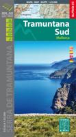
For your best adventures, use the best map. Water-proof, split-proof, tear-proof, adventure-proof. Mallorca's Tramuntana South Tour & Trail Super-Durable Map is simply the toughest, most accurate, easy-to-read, easy-to-use multi-purpose map that you can get.   Whether you plan to walk, or explore southern Tramuntana by car or the bus, this is the map for you. A large 960mm by 694mm double sided map sheet covers southern half of Serra de Tramuntana at 1:30,000 scale. This 8th edition sees a significant upgrade from the previous Mallorca North & Mountains Tour & Trail Map, as we have split Serra de Tramuntana in two halves to produce TWO much more detailed maps of larger scale, now also including all the popular tourist resorts on the southern coast.   This map covers a continuous area from Tramuntana's southern-most point Cap de Cala Figuera, including all the coastal resorts such as Magaluf, Santa Ponca and Peguera, with Port d'Andratx and Sa Dragonera islet also covered, all the way …
18,95
Fietskaart 01 Cycling guides Cornwall | Goldeneye
Our maps are double-sided, printed on an A2 sheet with a concertina fold. This allows for easy folding and folding, and an ease of access to the mapping. The material is rain and tear-resistant. Our early maps were designed at the scale of 2 miles to 1 inch/1:126,720. The later designs along with digitalisation are 1: 100,000. We were encouraged by the Cycle Touring Club to convert our cartography toward the cycle market (to replace the out-of-print Bartholomew series). As time and the series progressed we have added more data: The National Cycle Network routes, Regional Routes, and Traffic-Free Family Routes, as and when they are developed. These routes are in addition to the Circular Routes Goldeneye Commissioned at the outset of our publishing schedule. We are also adding to new editions; bike shops, cycle hire, and tea rooms, along with the tourist attractions already featured. Our plan is to make available digital versions for cell phones and tablets and to update, on an annual b…
15,95
Wandelkaart Tour & Trail Mallorca - Tramuntana North | Discovery Walking Guides
Let op: deze kaart dekt het noordelijke deel van Mallorca.   For your best adventures, use the best map. Water-proof, split-proof, tear-proof, adventure-proof. Mallorca's Tramuntana North Tour & Trail Super-Durable Map is simply the toughest, most accurate, easy-to-read, easy-to-use multi-purpose map that you can get.   Whether you plan to walk, or explore northern Tramuntana by car or the bus, this is the map for you. A large 960mm by 694mm double sided map sheet covers northern half of Serra de Tramuntana at 1:30,000 scale. This 8th edition sees a significant upgrade from the previous Mallorca North & Mountains Tour & Trail Map, as we have split Serra de Tramuntana in two halves to produce TWO much more detailed maps of larger scale.   This map covers a continuous area from Tramuntana's northern-most Cap de Formentor, including all the coastal resorts such as Port de Pollenca and Port d'Alcudia, all the way to Soller and Deia at the opposite end of the map (for the area from S…
18,95
Fietskaart 02 Cycling guides Cotswolds cycling | Goldeneye
Fietskaart van Cotswold met ondermeer 28 ingetekende rondritten en veel toeristische informatie. Explore the Cotswolds by bike with this laminated, waterproof Cotswolds map. With 28 circular, clearly-marked routes this easy-to-use map will help you discover the best of the Cotswolds along the quietest country lanes. The Cotswolds are ideal for the touring cyclist and day-tripper.   They represent England at her very best. Long, winding lanes connect beautiful villages with excellent pubs and friendly tearooms. The landscape you cycle through is rich in imagery; rolling hills, dry-stone walls, lazy trickling trout streams and quaint, undisturbed hamlets.   Our Cotswold Cycling Country Lanes map includes:* Traffic-free family cycling trails - including the Stroud Valley Cycle Trail, The Oxford Waterway and the Forest of Dean Family Trail with recommendations on where to park. * National Cycle Network routes - the linked series of traffic-free paths and traffic-calmed roads being de…
15,95
Wandelgids Mallorca | Sunflower books
Wandelgids: vele dagtochten worden degelijk beschreven met openbaar vervoer informatie, goede routebeschrijvingen en kaartmateriaal. Tevens enkele autotochten. Deze gids staat goed bekend! Engelstalig, want nederlandstalige is uitverkocht en niet meer leverbaar. The go-to Mallorca travel guide for over 30 years. Strap on your boots and discover Mallorca on foot with the Sunflower Mallorca travel guide. And on the days when your feet may have had enough, enjoy some spectacular scenery on one of our legendary car tours.   The Sunflower Mallorca guide is indispensable for hiking in Mallorca or seeing Mallorca by car. This was the first walking guide for Mallorca, the guide that won Sunflower the Sunday Times 'Oscar' for best travel guide - and eventually made the island one of the most popular walking areas in Europe.The author has lived on Mallorca for over 35 years and knows the island intimately. She has also been able to recheck most of the routes - as well as adding several new w…
23,95
Nieuw
Wandelkaart - Fietskaart 72 Noord Mallorca | Editorial Alpina
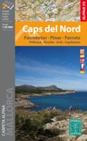
Formentor - Pinar - Ferrutx - Pollenca - Alcudia - Arta - Capdepera   Kaart met wandel-, MTB- en fietsroutes. Bijgevoegd is een boekje met in het Duits en Engels een korte beschrijving van een aantal van deze routes.   This is an area of great natural beauty, with protected areas - the Parque Natural de la Sierra Levante and the Natural Park of Albufereta.    The map includes the GR 221, all marked trails, mountain bike routes and bike paths, as well as location of all tourist services.
16,95
Nieuw
Fietskaart 152 Mallorca | Publicpress
Geplastificeerde fietskaart van Mallorca. Met ondermeer ingetekende routes, een overzicht van bezienswaardigheden, informatie over de Spaanse verkeersregels en fietsverhuur.    Mallorca ist ein echtes Radfahrerparadies mit zahlreichen Radstrecken, die als Rund- und Streckentouren mit verschiedenen Schwierigkeitsgraden auf die Mittelmeerinsel locken. Die viersprachige Karte informiert über Wissenswertes wie Helmpflicht, Art der Beschilderung sowie Sehenswürdigkeiten.   Discovering the island by bike is an ideal way of getting to know Mallorca well away from mass tourism. Besides listing the most interesting sights, the map gives information about spanish traffic rules, mountain-biking, bicycle transport and hire and more.
11,95

Klanten-reviews van Fietskaart 75 Bike Mallorca | Editorial Alpina

Er zijn nog geen beoordelingen voor dit productBen jij de eerste die een review plaatst?

Meer over Fietskaart 75 Bike Mallorca | Editorial Alpina

Productomschrijving

Handige geplastificeerde fietskaart van Mallorca, met ingetekende routes, helder kaartbeeld en extra informatie aan de hand van symbolen.   This is a waterproof, folded map to the cycling Mecca of Mallorca. The scale is 1:100,000 and has English description.    Bike shops are listed and bike-friendly taxi services. Other practical information includes average gradient symbols; routes graded for light/medium/heavy traffic; roads in bad repair; specific bike lanes; unpaved/dirt tracks. Suggested tours are highlighted, ranging from 36km to 110km, including height profiles.   Mountain bike routes are also marked on the map, most of which are unpaved and quite easy to follow.

Productinformatie

    Verken gerelateerde categorieën

    Webshop.nl maakt gebruik van cookies. Ga je verder op onze website, ga dan akkoord met het plaatsen van cookies en de verwerking van deze data door ons en vermelde partners.