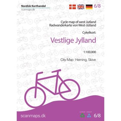
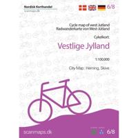
Fietskaart 6/8 Vestlige Jylland - West Jutland (Denemarken) | Scanmaps

0
Eindelijk een fietskaartenserie van Denemarken. Gedrukt op scheur- en watervastpapier, met een schaal van 1:100.000, zijn het zeer overzichtelijke fietskaarten. De basis is de 1:100.000 topografische kaart waarop de nationale, regionale en lokale fietsroutes op zijn ingetekend. Op de achterzijde staat informatie over fietstransport met het openbaa...

Verkopers met dit product

Verkoper
Bezorging
Prijs
DeZwerver.nl logo
DeZwerver.nl
2,95
24,95

Anderen bekeken ook

Fietskaart 5/8 Nordlige Jylland - Noordelijk Jutland | Scanmaps
Eindelijk een fietskaartenserie van Denemarken. Gedrukt op scheur- en watervastpapier, met een schaal van 1:100.000, zijn het zeer overzichtelijke fietskaarten. De basis is de 1:100.000 topografische kaart waarop de nationale, regionale en lokale fietsroutes op zijn ingetekend. Op de achterzijde staat informatie over fietstransport met het openbaar vervoer. Gewone fietspaden en toeristische informatie zoals campings en fietsenmakers staan er echter niet op vermeld.    Deze kaarten hebben dan ook vooral zin voor de bestaande fietsroutes. Echter aangezien er verder niet veel is aan detailkaarten met dit soort informatie, zijn deze kaarten wel degelijk bijzonder nuttig voor de fietser in Denemarken.   Cycle map of Nothern Jutland   Find your way to Skagen where the two seas meet, follow the Hærvejen (The old army road) and many other experiences with the bicycle map of Northern Jutland.   For a better overview and planning of your bicycle trip through Denmark, a full map of Denmark…
24,95
Fietskaart 4/8 Østlige Jylland - Oostelijk Jutland (Denemarken) | Scanmaps
Eindelijk een fietskaartenserie van Denemarken. Gedrukt op scheur- en watervastpapier, met een schaal van 1:100.000, zijn het zeer overzichtelijke fietskaarten. De basis is de 1:100.000 topografische kaart waarop de nationale, regionale en lokale fietsroutes op zijn ingetekend. Op de achterzijde staat informatie over fietstransport met het openbaar vervoer. Gewone fietspaden en toeristische informatie zoals campings en fietsenmakers staan er echter niet op vermeld.    Deze kaarten hebben dan ook vooral zin voor de bestaande fietsroutes. Echter aangezien er verder niet veel is aan detailkaarten met dit soort informatie, zijn deze kaarten wel degelijk bijzonder nuttig voor de fietser in Denemarken.   NOTE! Correction: After the publishing of the map, the National route 2 has had it course changes, due to a change in ferry line operations. In images see  correction sheet (A4).   With data from "Danish Geodata Agency", "Vejdirektoratet" and expert knowledge from consultants, we have de…
24,95
Fietskaart 1/8 Nordlige Sjaelland - Noord Zeeland (Denemarken) | Scanmaps
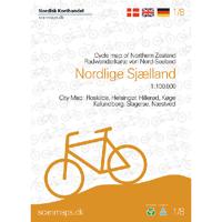
Eindelijk een fietskaartenserie van Denemarken. Gedrukt op scheur- en watervastpapier, met een schaal van 1:100.000, zijn het zeer overzichtelijke fietskaarten. De basis is de 1:100.000 topografische kaart waarop de nationale, regionale en lokale fietsroutes op zijn ingetekend. Op de achterzijde staat informatie over fietstransport met het openbaar vervoer. Gewone fietspaden en toeristische informatie zoals campings en fietsenmakers staan er echter niet op vermeld.    Deze kaarten hebben dan ook vooral zin voor de bestaande fietsroutes. Echter aangezien er verder niet veel is aan detailkaarten met dit soort informatie, zijn deze kaarten wel degelijk bijzonder nuttig voor de fietser in Denemarken.   Go on a bicycle tour in the Northern Zealand.   The map contains:   National cycle routes 2, 4, 6, 7 and 9   Supercycle routes 77, 82, 84, 91, 93, 94, 95, 97 and 99   Regional cycle routes 31, 32, 33, 36, 40 ,47, 50, 51, 52, 53, 54, 56, 57, 58, 60, 61, 62, 65, 67, 69, 73, 80, 84, …
24,95
Wegenkaart - landkaart Turistkort Danmark med Margueritruten + bykort - Margrietroute | Scanmaps
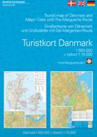
Nordisk Korthandel has published a new Tourist Map of Denmark and Major Cities with The Marguerite Route.   As a newly added feature the Tourist map of Denmark includes the scenic Marguerite Route.   The Marguerite route is a 3600 km long route through the danish landscape, and was opened in 1991 by Queen Margrethe of Denmark. The route runs through beautiful regions of Denmark, and in most places it is possible to cycle or walk along the route. Most of the route is situated on small roads, and therefore it is not the quickest or shortest way from point A to B, but instead it is an invitation to visit the many attractions, that you will find in Denmark. It runs through the danish mainland and is therefore not covering islands like Bornholm and Samsø. If you want to leave the mainland, you can find information, on ferry routes that depart from danish harbours, on the map.   The route uses the daisy flower as a symbol, and you will find it on the road signs, that are placed alongside th…
24,95
Fietskaart 02 Cycling guides Cotswolds cycling | Goldeneye
Fietskaart van Cotswold met ondermeer 28 ingetekende rondritten en veel toeristische informatie. Explore the Cotswolds by bike with this laminated, waterproof Cotswolds map. With 28 circular, clearly-marked routes this easy-to-use map will help you discover the best of the Cotswolds along the quietest country lanes. The Cotswolds are ideal for the touring cyclist and day-tripper.   They represent England at her very best. Long, winding lanes connect beautiful villages with excellent pubs and friendly tearooms. The landscape you cycle through is rich in imagery; rolling hills, dry-stone walls, lazy trickling trout streams and quaint, undisturbed hamlets.   Our Cotswold Cycling Country Lanes map includes:* Traffic-free family cycling trails - including the Stroud Valley Cycle Trail, The Oxford Waterway and the Forest of Dean Family Trail with recommendations on where to park. * National Cycle Network routes - the linked series of traffic-free paths and traffic-calmed roads being de…
15,95
Fietskaart 7/8 Sydlige Jylland - Zuid Jutland (Denemarken) | Scanmaps
Eindelijk een fietskaartenserie van Denemarken. Gedrukt op scheur- en watervastpapier, met een schaal van 1:100.000, zijn het zeer overzichtelijke fietskaarten. De basis is de 1:100.000 topografische kaart waarop de nationale, regionale en lokale fietsroutes op zijn ingetekend. Op de achterzijde staat informatie over fietstransport met het openbaar vervoer. Gewone fietspaden en toeristische informatie zoals campings en fietsenmakers staan er echter niet op vermeld.    Deze kaarten hebben dan ook vooral zin voor de bestaande fietsroutes. Echter aangezien er verder niet veel is aan detailkaarten met dit soort informatie, zijn deze kaarten wel degelijk bijzonder nuttig voor de fietser in Denemarken.   The map contains:  - National cycling routes 1, 3 , 4, 6 and 8  - Regional cycle routes 2, 4, 5, 6, 7, 8, 9, 10, 11, 12, 16, 21, 23, 32, 33, 34, 35, 36, 48, 51, 55 , 56, 57, 58, 62, 64, Jutland route and border route  - Local cycle routes 1, 2, 3, 4, 5, 6, 7, 8, 9, 10, 11, 12, 13, 14, 1…
24,95
Fietskaart 8/8 Bornholm (Denemarken) | Scanmaps
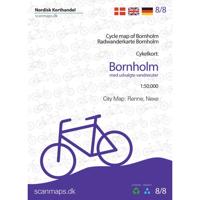
Eindelijk een fietskaartenserie van Denemarken. Gedrukt op scheur- en watervastpapier, met een schaal van 1:100.000, zijn het zeer overzichtelijke fietskaarten. De basis is de 1:100.000 topografische kaart waarop de nationale, regionale en lokale fietsroutes op zijn ingetekend. Op de achterzijde staat informatie over fietstransport met het openbaar vervoer. Gewone fietspaden en toeristische informatie zoals campings en fietsenmakers staan er echter niet op vermeld.    Deze kaarten hebben dan ook vooral zin voor de bestaande fietsroutes. Echter aangezien er verder niet veel is aan detailkaarten met dit soort informatie, zijn deze kaarten wel degelijk bijzonder nuttig voor de fietser in Denemarken.   With data from Geodatastyrelsen, Road Directorate and expertise from consultants, Nordisk Korthandel have compiled detailed cycling maps of the highest quality. The maps are printed on durable and waterproof material, perfect for a bike ride, and have a handy small format that fits in your…
24,95
Fietskaart Cycling guides Exmoor - North Devon | Goldeneye
Scheur- en watervast foetskaart van Exmoor en Noord Devon met ingetekende fietsroutes.   Our maps are double-sided, printed on an A2 sheet with a concertina fold. This allows for easy folding and folding, and an ease of access to the mapping. The material is rain and tear-resistant. Our early maps were designed at the scale of 2 miles to 1 inch/1:126,720. The later designs along with digitalisation are 1: 100,000. We were encouraged by the Cycle Touring Club to convert our cartography toward the cycle market (to replace the out-of-print Bartholomew series). As time and the series progressed we have added more data: The National Cycle Network routes, Regional Routes, and Traffic-Free Family Routes, as and when they are developed. These routes are in addition to the Circular Routes Goldeneye Commissioned at the outset of our publishing schedule. We are also adding to new editions; bike shops, cycle hire, and tea rooms, along with the tourist attractions already featured. Our plan is to …
12,95
Wegenkaart - landkaart - Fietskaart Cork (Ierland) | Xploreit Maps
Mooie geplastificeerde en scheurvaste kaart met index The Xploreit Map of County Cork includes all of Cork along with parts of counties Kerry, Limerick, Tipperary and Waterford. Cork's rich heritage of megalithic monuments, medieval churches and castles can instantly be identified. Noted sites such as Blarney Castle, St. Finbarr's Oratory at Gougane Barra and McCarthy's Bar in Castletownbere are featured in red text. Whether you want to explore Youghal's town walls in the east, savour the views from the footbridge at Mizen Head in the south-west or or imagine times past as you stroll around Mitchelstown's King's Square and Kingston College in the north it's easy to find your chosen destination. Showing a large array of golf courses, angling spots, sandy beaches for swimming and surfing, equestrian facilities, boating facilities, this map is an indispensable tool for visitors. Several scenic drives, cycle routes and waymarked walks are shown. The scale of the Cork map is 1:100,000. Wal…
23,95
Fietskaart Cycling guides Dartmoor - South Devon | Goldeneye
Dartmoor. One of England’s greater National Parks; the Forest of Dartmoor covers 365 square miles and contains the highest ground in England south of the Peak District. On its desolate moorland tracks the wanderer can believe they are further from a public road than anywhere in the country, but on the fringes lush valleys lead down on every side to thick woodland, green vegetation and picturesque villages. Dartmoor is well known for its wildlife - attractive herds of ponies, seemingly wild but in fact individually owned, foxes, badgers and otters - also the occasional adder. Fallow, roe and Sitka deer can often be seen, but the red deer of Exmoor have never penetrated the area. Buzzards, kestrels and various Birds of Prey are frequently seen, as well as the wheatear, while crows, ravens and the skylark are fairly commonplace. The Moor abounds in prehistoric remains. There are also many deserted medieval villages with remains of the traditional ‘longhouse’ buildings. For centuries tin …
12,95

Klanten-reviews van Fietskaart 6/8 Vestlige Jylland - West Jutland (Denemarken) | Scanmaps

Er zijn nog geen beoordelingen voor dit productBen jij de eerste die een review plaatst?

Meer over Fietskaart 6/8 Vestlige Jylland - West Jutland (Denemarken) | Scanmaps

Productomschrijving

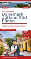
Eindelijk een fietskaartenserie van Denemarken. Gedrukt op scheur- en watervastpapier, met een schaal van 1:100.000, zijn het zeer overzichtelijke fietskaarten. De basis is de 1:100.000 topografische kaart waarop de nationale, regionale en lokale fietsroutes op zijn ingetekend. Op de achterzijde staat informatie over fietstransport met het openbaar vervoer. Gewone fietspaden en toeristische informatie zoals campings en fietsenmakers staan er echter niet op vermeld.    Deze kaarten hebben dan ook vooral zin voor de bestaande fietsroutes. Echter aangezien er verder niet veel is aan detailkaarten met dit soort informatie, zijn deze kaarten wel degelijk bijzonder nuttig voor de fietser in Denemarken. Cycle map of Western Jutland   Although the west coast of Denmark is known for its particullar fresh winds along the coast, there are plenty of cycling routes to try - also further inland. So this map is for both the sea lovers and those who want to ride along the fields.   For a better overview and planning of your bicycle trip through Denmark, a full map of Denmark in the scale 1:500.000 is avaible here: Cycle map of Denmark & Copenhagen   The map includes:   European Cycle Route: 12 (EuroVelo)   National cycle routes: 1, 2, 3, 4   Regional cycle routes: 7, 11, 16, 17, 18, 19, 20, 21, 24, 25, 28, 29, 30, 31, 32, 35, 36, 37, 38, 55, 56   Local cycle routes: 50, 51, 53, 81, 91, 118, 760, 800, 803, 805, 807 (Viborg) as well as Bakkeruten, Kystruten, Butiksruten (Fur), Faddersbøl, Reservatruten, Vandet Sø, Vangså ruten (Nationalpark Thy), Herborg-Videbæk, Skive Vestsalling jernbane and Sunds Sø   Panorama routes 408, 409, 410, 411 and 412     City map of: Herning and Skive.   The new route Kystsporet (Coastal trail), which runs along National Cycle Route 1 on the north-west coast from Blokhus in the north to Nørre Vorupør in the west, but takes detours along the way, is of interest to both cycling tourists and hikers with boots.   General information about overnight stays on bikes, bringing bikes on trains etc. Information and mapped locations for grocery stores, bike shops & mechanics, national attractions, tourist offices, campgrounds, tent sites, hostels, beaches and bike-friendly churches.   The legend and information is in Danish, German and English.   With map data from the Danish Agency for Data Supply and Efficiency, the Danish Road Directorate and with expert knowledge from consultants, we have put together a detailed cycling map of the highest quality.   The map is printed on the durable and waterproof stone paper - a material that can be easily folded and is completely unaffected by moisture and rain. The matt coating significantly improves the legibility of the map, unlike plastic-coated maps made of ordinary paper. Rock paper is a product based on lime and because it has no fibres, unlike ordinary paper, it can be folded without the same wear and tear. In addition, rock paper does not need to be bleached in production and does not require water unlike traditional paper.
 

Verken gerelateerde categorieën

Webshop.nl maakt gebruik van cookies. Ga je verder op onze website, ga dan akkoord met het plaatsen van cookies en de verwerking van deze data door ons en vermelde partners.