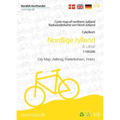
Fietskaart 5/8 Nordlige Jylland - Noordelijk Jutland | Scanmaps

0
Eindelijk een fietskaartenserie van Denemarken. Gedrukt op scheur- en watervastpapier, met een schaal van 1:100.000, zijn het zeer overzichtelijke fietskaarten. De basis is de 1:100.000 topografische kaart waarop de nationale, regionale en lokale fietsroutes op zijn ingetekend. Op de achterzijde staat informatie over fietstransport met het openbaa...

Verkopers met dit product

Verkoper
Bezorging
Prijs
DeZwerver.nl logo
DeZwerver.nl
2,95
24,95

Anderen bekeken ook

Nieuw
Fietskaart 6/8 Vestlige Jylland - West Jutland (Denemarken) | Scanmaps
Eindelijk een fietskaartenserie van Denemarken. Gedrukt op scheur- en watervastpapier, met een schaal van 1:100.000, zijn het zeer overzichtelijke fietskaarten. De basis is de 1:100.000 topografische kaart waarop de nationale, regionale en lokale fietsroutes op zijn ingetekend. Op de achterzijde staat informatie over fietstransport met het openbaar vervoer. Gewone fietspaden en toeristische informatie zoals campings en fietsenmakers staan er echter niet op vermeld.    Deze kaarten hebben dan ook vooral zin voor de bestaande fietsroutes. Echter aangezien er verder niet veel is aan detailkaarten met dit soort informatie, zijn deze kaarten wel degelijk bijzonder nuttig voor de fietser in Denemarken. Cycle map of Western Jutland   Although the west coast of Denmark is known for its particullar fresh winds along the coast, there are plenty of cycling routes to try - also further inland. So this map is for both the sea lovers and those who want to ride along the fields.   For a better …
24,95
Nieuw
Fietskaart 4/8 Østlige Jylland - Oostelijk Jutland (Denemarken) | Scanmaps
Eindelijk een fietskaartenserie van Denemarken. Gedrukt op scheur- en watervastpapier, met een schaal van 1:100.000, zijn het zeer overzichtelijke fietskaarten. De basis is de 1:100.000 topografische kaart waarop de nationale, regionale en lokale fietsroutes op zijn ingetekend. Op de achterzijde staat informatie over fietstransport met het openbaar vervoer. Gewone fietspaden en toeristische informatie zoals campings en fietsenmakers staan er echter niet op vermeld.    Deze kaarten hebben dan ook vooral zin voor de bestaande fietsroutes. Echter aangezien er verder niet veel is aan detailkaarten met dit soort informatie, zijn deze kaarten wel degelijk bijzonder nuttig voor de fietser in Denemarken.   NOTE! Correction: After the publishing of the map, the National route 2 has had it course changes, due to a change in ferry line operations. In images see  correction sheet (A4).   With data from "Danish Geodata Agency", "Vejdirektoratet" and expert knowledge from consultants, we have de…
24,95
Nieuw
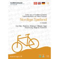
Fietskaart 1/8 Nordlige Sjaelland - Noord Zeeland (Denemarken) | Scanmaps
Eindelijk een fietskaartenserie van Denemarken. Gedrukt op scheur- en watervastpapier, met een schaal van 1:100.000, zijn het zeer overzichtelijke fietskaarten. De basis is de 1:100.000 topografische kaart waarop de nationale, regionale en lokale fietsroutes op zijn ingetekend. Op de achterzijde staat informatie over fietstransport met het openbaar vervoer. Gewone fietspaden en toeristische informatie zoals campings en fietsenmakers staan er echter niet op vermeld.    Deze kaarten hebben dan ook vooral zin voor de bestaande fietsroutes. Echter aangezien er verder niet veel is aan detailkaarten met dit soort informatie, zijn deze kaarten wel degelijk bijzonder nuttig voor de fietser in Denemarken.   Go on a bicycle tour in the Northern Zealand.   The map contains:   National cycle routes 2, 4, 6, 7 and 9   Supercycle routes 77, 82, 84, 91, 93, 94, 95, 97 and 99   Regional cycle routes 31, 32, 33, 36, 40 ,47, 50, 51, 52, 53, 54, 56, 57, 58, 60, 61, 62, 65, 67, 69, 73, 80, 84, …
24,95
Nieuw
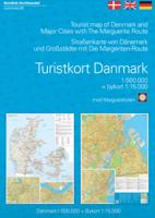
Wegenkaart - landkaart Turistkort Danmark med Margueritruten + bykort - Margrietroute | Scanmaps
Nordisk Korthandel has published a new Tourist Map of Denmark and Major Cities with The Marguerite Route.   As a newly added feature the Tourist map of Denmark includes the scenic Marguerite Route.   The Marguerite route is a 3600 km long route through the danish landscape, and was opened in 1991 by Queen Margrethe of Denmark. The route runs through beautiful regions of Denmark, and in most places it is possible to cycle or walk along the route. Most of the route is situated on small roads, and therefore it is not the quickest or shortest way from point A to B, but instead it is an invitation to visit the many attractions, that you will find in Denmark. It runs through the danish mainland and is therefore not covering islands like Bornholm and Samsø. If you want to leave the mainland, you can find information, on ferry routes that depart from danish harbours, on the map.   The route uses the daisy flower as a symbol, and you will find it on the road signs, that are placed alongside th…
24,95
Nieuw
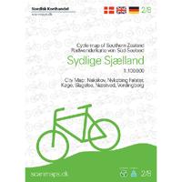
Fietskaart 2/8 Sydlige Sjælland, Møn, Lolland og Falster Cykelkort | Scanmaps
Eindelijk een fietskaartenserie van Denemarken. Gedrukt op scheur- en watervastpapier, met een schaal van 1:100.000, zijn het zeer overzichtelijke fietskaarten. De basis is de 1:100.000 topografische kaart waarop de nationale, regionale en lokale fietsroutes op zijn ingetekend. Op de achterzijde staat informatie over fietstransport met het openbaar vervoer. Gewone fietspaden en toeristische informatie zoals campings en fietsenmakers staan er echter niet op vermeld.    Deze kaarten hebben dan ook vooral zin voor de bestaande fietsroutes. Echter aangezien er verder niet veel is aan detailkaarten met dit soort informatie, zijn deze kaarten wel degelijk bijzonder nuttig voor de fietser in Denemarken.   Go on a bicycle tour in the southern Zealand.   The map contains:   National cycle routes 6, 7, 8 and 9   Regional cycle routes 35, 38, 40, 45, 49, 51, 54, 55, 56, 58, 60, 61, 85, 88, 89 and 90   Locale cycle routes Digterruten, Markruten, Røgbølle Sø, Sundruten, Søndersø and Holstedrute…
24,95
Nieuw
Fietskaart 7/8 Sydlige Jylland - Zuid Jutland (Denemarken) | Scanmaps
Eindelijk een fietskaartenserie van Denemarken. Gedrukt op scheur- en watervastpapier, met een schaal van 1:100.000, zijn het zeer overzichtelijke fietskaarten. De basis is de 1:100.000 topografische kaart waarop de nationale, regionale en lokale fietsroutes op zijn ingetekend. Op de achterzijde staat informatie over fietstransport met het openbaar vervoer. Gewone fietspaden en toeristische informatie zoals campings en fietsenmakers staan er echter niet op vermeld.    Deze kaarten hebben dan ook vooral zin voor de bestaande fietsroutes. Echter aangezien er verder niet veel is aan detailkaarten met dit soort informatie, zijn deze kaarten wel degelijk bijzonder nuttig voor de fietser in Denemarken.   The map contains:  - National cycling routes 1, 3 , 4, 6 and 8  - Regional cycle routes 2, 4, 5, 6, 7, 8, 9, 10, 11, 12, 16, 21, 23, 32, 33, 34, 35, 36, 48, 51, 55 , 56, 57, 58, 62, 64, Jutland route and border route  - Local cycle routes 1, 2, 3, 4, 5, 6, 7, 8, 9, 10, 11, 12, 13, 14, 1…
24,95
Nieuw
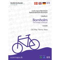
Fietskaart 8/8 Bornholm (Denemarken) | Scanmaps
Eindelijk een fietskaartenserie van Denemarken. Gedrukt op scheur- en watervastpapier, met een schaal van 1:100.000, zijn het zeer overzichtelijke fietskaarten. De basis is de 1:100.000 topografische kaart waarop de nationale, regionale en lokale fietsroutes op zijn ingetekend. Op de achterzijde staat informatie over fietstransport met het openbaar vervoer. Gewone fietspaden en toeristische informatie zoals campings en fietsenmakers staan er echter niet op vermeld.    Deze kaarten hebben dan ook vooral zin voor de bestaande fietsroutes. Echter aangezien er verder niet veel is aan detailkaarten met dit soort informatie, zijn deze kaarten wel degelijk bijzonder nuttig voor de fietser in Denemarken.   With data from Geodatastyrelsen, Road Directorate and expertise from consultants, Nordisk Korthandel have compiled detailed cycling maps of the highest quality. The maps are printed on durable and waterproof material, perfect for a bike ride, and have a handy small format that fits in your…
24,95
Fietskaart Cycling guides Exmoor - North Devon | Goldeneye
Scheur- en watervast foetskaart van Exmoor en Noord Devon met ingetekende fietsroutes.   Our maps are double-sided, printed on an A2 sheet with a concertina fold. This allows for easy folding and folding, and an ease of access to the mapping. The material is rain and tear-resistant. Our early maps were designed at the scale of 2 miles to 1 inch/1:126,720. The later designs along with digitalisation are 1: 100,000. We were encouraged by the Cycle Touring Club to convert our cartography toward the cycle market (to replace the out-of-print Bartholomew series). As time and the series progressed we have added more data: The National Cycle Network routes, Regional Routes, and Traffic-Free Family Routes, as and when they are developed. These routes are in addition to the Circular Routes Goldeneye Commissioned at the outset of our publishing schedule. We are also adding to new editions; bike shops, cycle hire, and tea rooms, along with the tourist attractions already featured. Our plan is to …
12,95
Fietskaart 14 Cycling guides Suffolk | Goldeneye
To be confronted with the variety and complexity of the cycling routes, trails and paths in Suffolk can be a bewildering experience.  For it appears that the Suffolk County Council and the three District Councils are all trying hard to promote their areas. This is indeed encouraging for the growth of cycling, but it can be confusing.  Our purpose is to provide clear, easy to use and easy to follow, cycling maps, and to illustrate these in a comprehensive form.    Suffolk must be one of the most charming of counties to explore by bicycle. When Al Churcher delivered his routes to us at Goldeneye we couldn’t keep him quiet, such was his enthusiasm and wonder at Suffolk’s country lanes and byways. He has cycled all over the UK, Canada, Mallorca, New Zealand and Sicily, but Suffolk remained a firm favourite.    The inland scenery is not spectacular for the county’s main glory lies with its attractive villages; the local architecture jealously preserved from modern depredation. There is an …
15,95
Reisgids Denmark - Denemarken | Lonely Planet
Lonely Planet Denemarken & Faeröer Eilanden – Complete reisgids Ontdek het beste van Denemarken en de Faeröer Eilanden met deze uitgebreide Lonely Planet-reisgids. Van smørrebrød in Kopenhagen tot wandelen in het Waddenzee Nationaal Park of creatief aan de slag in het LEGO House – deze gids helpt je bij het plannen van jouw ideale reis. 🧭 Wat vind je in deze gids? Volledige dekking van Denemarken en de Faeröer Eilanden Insider-tips voor eten, drinken, nachtleven, winkelen, festivals en accommodaties Bezoek iconen zoals het Nationalmuseum, Egeskov Slot en Refshaleøen Culturele achtergrondinformatie: van Vikinggeschiedenis tot moderne Deense designcultuur Uitneembare kaart van Kopenhagen en duidelijke regionale kaarten Praktische info over vervoer, geld, lokale etiquette, LGBTIQ+ reizen, toegankelijkheid en verantwoord reizen Of je nu door Jutland fietst, de Zuid-Zeelandse eilanden ontdekt of de ruige natuur van de Faeröer verkent – deze gids biedt alles voor ee…
24,95

Klanten-reviews van Fietskaart 5/8 Nordlige Jylland - Noordelijk Jutland | Scanmaps

Er zijn nog geen beoordelingen voor dit productBen jij de eerste die een review plaatst?

Meer over Fietskaart 5/8 Nordlige Jylland - Noordelijk Jutland | Scanmaps

Productomschrijving

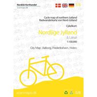
Eindelijk een fietskaartenserie van Denemarken. Gedrukt op scheur- en watervastpapier, met een schaal van 1:100.000, zijn het zeer overzichtelijke fietskaarten. De basis is de 1:100.000 topografische kaart waarop de nationale, regionale en lokale fietsroutes op zijn ingetekend. Op de achterzijde staat informatie over fietstransport met het openbaar vervoer. Gewone fietspaden en toeristische informatie zoals campings en fietsenmakers staan er echter niet op vermeld.    Deze kaarten hebben dan ook vooral zin voor de bestaande fietsroutes. Echter aangezien er verder niet veel is aan detailkaarten met dit soort informatie, zijn deze kaarten wel degelijk bijzonder nuttig voor de fietser in Denemarken.   Cycle map of Nothern Jutland   Find your way to Skagen where the two seas meet, follow the Hærvejen (The old army road) and many other experiences with the bicycle map of Northern Jutland.   For a better overview and planning of your bicycle trip through Denmark, a full map of Denmark in the scale 1:500.000 is avaible here: Cycle map of Denmark & Copenhagen   The map includes:   European Cycle Route: 12 (EuroVelo)   National cycle routes: 1, 2, 3, 5 and 12   Regional cycle routes: Coastal Trail, 3, 9, 17, 18, 19, 20, 21, 26, 27, 28, 29, 30, 32, 35, 36, 37, 38, 52, 54, 55, 56, 59, 60, 61, 62 and 63   Local cycle routes: L1, L8, L9, L10, L15, 100, 116, 117, 118, 120, 200, 500, 600, 707, Bakkeruten, Kystruten, Butiksruten (Fur), Den grønne rute, Nørre Hald ruten and Skive Vestsalling Jernbane.   Panorama routes: 412, 413, 414, 415 and 416     City map of: Aalborg, Frederikshavn and Hobro. Island map: Læsø.   The new route Kystsporet (Costal trail), which runs along National Cycle Route 1 on the north west coast from Blokhus in the north to Nørre Vorupør in the west, but takes delightful detours along the way, is of interest to both cyclist and trekkers.   General information about overnight stays on bikes, bringing bikes on trains etc. Information and mapped locations for grocery stores, bike shops & mechanics, national attractions, tourist offices, campgrounds, tent sites, hostels, beaches and bike-friendly churches.   The table of contents is available in English, German and Danish.   With map data from the Danish Agency for Data Supply and Efficiency, the Danish Road Directorate and with expert knowledge from consultants, we have put together a detailed cycling map of the highest quality.   The map is printed on the durable and waterproof stone paper - a material that can be easily folded and is completely unaffected by moisture and rain. The matt coating significantly improves the legibility of the map, unlike plastic-coated maps made of ordinary paper. Rock paper is a product based on lime and because it has no fibres, unlike ordinary paper, it can be folded without the same wear and tear. In addition, rock paper does not need to be bleached in production and does not require water unlike traditional paper.
 

Verken gerelateerde categorieën

Webshop.nl maakt gebruik van cookies. Ga je verder op onze website, ga dan akkoord met het plaatsen van cookies en de verwerking van deze data door ons en vermelde partners.