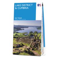
Fietskaart 3 Tour Map Lake District & Cumbria | Ordnance Survey

0
De Ordnance Survey Tour Maps met schaal 1:100.000 zijn uitstekend geschikt om zelf je fietsvakantie te plannen in Engeland. Ze laten alle alle grote en kleinere wegen zien. Bovendien staan de Routes van National Cycle Network ingetekend. Ook erg handig zijn de vermeldingen van campings, jeugdherbergen en andere accommodaties! Kortom de perfecte fi...

Verkopers met dit product

Verkoper
Bezorging
Prijs
DeZwerver.nl logo
DeZwerver.nl
2,95
10,95

Anderen bekeken ook

Wegenkaart - landkaart Visitors map Lake District | A-Z Map Company
Explore the whole region and area extending from Cockermouth and Penrith in the north to Ulverston and Grange-over-Sands in the south and from the M6 in the east to the coast in the west. Published at a clear 2.45 miles to 1 inch scale, this detailed visitors map of the Lake District includes primary route destinations and selected caravan and camping sites. Plus, there is detailed informative text for visitor attractions and places of interest.   There are also 12 town centre street maps of: Ambleside, Cockermouth, Coniston, Grange-over-Sands, Grasmere, Hawkshead, Kendal, Keswick, Penrith, Ulverston, Windermere and Bowness-on-Windermere. Each town centre map includes descriptive text and useful information about its visitor attractions and places of interest. Each town plan also has a separate index, while the main road map index lists towns, villages, hamlets and locations.   The 'Index to Places of Interest' lists tourist sites by feature type. For 2024, there is also now added ele…
12,50
Wandelkaart - Topografische kaart 089 Landranger West Cumbria, (Lake District) | Ordnance Survey
Zeer goede detailkaart met topografische ondergrond. Kleurgebruik is goed over nagedacht: bijzonder goed leesbaar en helder kaartbeeld. Hierop zijn toeristische symbolen van bezienswaardigheden ingetekend, daarnaast staan bijvoorbeeld campings en jeugdherbergen vermeld en - voor wandelaars het belangrijkst - alle right of way paden en Lange afstands Wandelpaden zijn er op te vinden. De ideale kaart voor het wandelen in Engeland, Wales of Schotland. De kaarten zijn te gebruiken met GPS (UTM OSGB36), de legenda is in het Engels, Frans en Duits.    Plaatsen op deze kaart:  Cockermouth, Workington, Flimby, Dovenby, Maryport, Dearham, Crosby, Blindcrake, Bessenthwaite, Uldale, Bothel and Ireby, Eaglesfield, High Lorton, Keswick, Loweswater, Pardshaw, Distington, Lowca, Lamplugh, Whitehaven, Cleator Moor, Ennerdale Bridge, Buttermere, Seathwaite, St Bees, Egremont, Nethertown, Seascale, Calder Bridge, Gosforth, Eskdale Green, Boot.
19,50
Wandelkaart - Topografische kaart 096 Landranger Barrow-in-Furness & South Lakeland Lake District | Ordnance Survey
Zeer goede detailkaart met topografische ondergrond. Kleurgebruik is goed over nagedacht: bijzonder goed leesbaar en helder kaartbeeld. Hierop zijn toeristische symbolen van bezienswaardigheden ingetekend, daarnaast staan bijvoorbeeld campings en jeugdherbergen vermeld en - voor wandelaars het belangrijkst - alle right of way paden en Lange afstands Wandelpaden zijn er op te vinden. De ideale kaart voor het wandelen in Engeland, Wales of Schotland. De kaarten zijn te gebruiken met GPS (UTM OSGB36), de legenda is in het Engels, Frans en Duits.    Plaatsen op deze kaart: Barrow-in-Furness, Dalton-in-Furness, Ireleth, Millom, Silecroft, Kirkby-in-Furness, Broughton in Furness, Ulpha, Bootle, Waberthwaite, Seathwaite, Ravenglass, Newby Bridge, Grange-over-Sands, Flookburgh, Ulverston, Haverthwaite, Spark Bridge, Lakeside, Satterthwaite, Blawith, Torver and Coniston.  
19,50
Fietsgids Cycling in the Lake District | Cicerone
The Fred Whitton Challenge, plus a 5-day cycle tour and 15 challenging day rides through the Lake District. Exploring the beautiful scenery of the national park, the routes are suitable for cyclists with a good level of fitness and are perfect for cycling April through October.   The 179km/112 mile Fred Whitton Challenge ride over seven iconic passes Day routes range from 31 to 68km (19–42 miles), with difficulty from moderate to challenging A 5-day Tour of the Lake District taking in dales, lakes and passes Key centres include Ambleside, Grasmere, Troutbeck, Shap, Penrith, Stainton, Keswick, Cockermouth, Eskdale Green, Ravenglass, Broughton in Furness, Grizedale, Cartmel, Grange-over-Sands, Bassenthwaite and Buttermere 1:100,000 or 1:200,000 mapping and elevation profile included for each route GPX files available to download Detailed information on planning, equipment and facilities
23,50
Wandelkaart - Topografische kaart 097 Landranger Kendal & Morecambe, Windermere & Lancaster (Lake District) | Ordnance Survey
Zeer goede detailkaart met topografische ondergrond. Kleurgebruik is goed over nagedacht: bijzonder goed leesbaar en helder kaartbeeld. Hierop zijn toeristische symbolen van bezienswaardigheden ingetekend, daarnaast staan bijvoorbeeld campings en jeugdherbergen vermeld en - voor wandelaars het belangrijkst - alle right of way paden en Lange afstands Wandelpaden zijn er op te vinden. De ideale kaart voor het wandelen in Engeland, Wales of Schotland. De kaarten zijn te gebruiken met GPS (UTM OSGB36), de legenda is in het Engels, Frans en Duits.    Plaatsen op deze kaart: Kendal, Morecambe, Lancaster, Heysham, Halton, Hornby, Cranforth, Melling, Kirkby Lonsdale, Silverdale, Burton-in-Kendal, Arnside, Milnthorpe, Berbon, Endmoor, Middleshaw, Sedbergh, Grayrigg, Windermere, Burnside, Crosthwaite, Levens, Newby Bridge, Lindale, Grange-over-Sands, Flookburgh, Aldingham, Ulverston, Haverthwaite, Spark Bridge, Lakeside, Blawith, Torver and Coniston.
19,50
Wandelgids Walking in Cumbria's Eden Valley - Lake district | Cicerone
Uitstekende Engelstalige wandelgids van dit prachtige gebied op de grens van Engeland en Schotland. Guidebook to 30 of the best walks in Cumbria's enchanting Eden Valley. The graded routes, which range from 3 to 15 miles, explore the region's diverse landscapes and offer dramatic views, either of the Pennines, the Lake District or the Scottish hills.  The walks, which work well from bases such as Kirkby Steven, Dufton and Appleby, are predominantly circular. Some of the linear routes link with the Settle-Carlisle railway. Map extracts from the 1:50K OS Landranger series accompany route description, and the handy route summary table makes it easy for walkers to compare routes. Invaluable information on transport, accommodation, clothing, equipment and safety is included, as are notes on the region's geology, wildlife and history.   Situated next to the iconic Lake District, the Eden Valley is often overlooked as a walking destination. This works in its favour - it is as quiet as it is …
18,50
Wandelkaart - Topografische kaart 89 Landranger Active West Cumbria | Ordnance Survey
Zeer goede detailkaart met topografische ondergrond. Kleurgebruik is goed over nagedacht: bijzonder goed leesbaar en helder kaartbeeld. Hierop zijn toeristische symbolen van bezienswaardigheden ingetekend, daarnaast staan bijvoorbeeld campings en jeugdherbergen vermeld en - voor wandelaars het belangrijkst - alle right of way paden en Lange afstands Wandelpaden zijn er op te vinden. De ideale kaart voor het wandelen in Engeland, Wales of Schotland. De kaarten zijn te gebruiken met GPS (UTM OSGB36), de legenda is in het Engels, Frans en Duits.    Plaatsen op deze kaart:  Cockermouth, Workington, Flimby, Dovenby, Maryport, Dearham, Crosby, Blindcrake, Bessenthwaite, Uldale, Bothel and Ireby, Eaglesfield, High Lorton, Keswick, Loweswater, Pardshaw, Distington, Lowca, Lamplugh, Whitehaven, Cleator Moor, Ennerdale Bridge, Buttermere, Seathwaite, St Bees, Egremont, Nethertown, Seascale, Calder Bridge, Gosforth, Eskdale Green, Boot.
25,95
Mountainbikegids Mountain Biking in the Lake District | Cicerone
Mountain biking in the Lake District describes 24 routes in the Lakes, offering some of the best MTB riding in the UK. The routes are suitable for all abilities of riders, arranged by difficulty, from Kendal to Cleator Moor in the far north-west and Keswick to Winster in the Lyth Valley.SeasonsAlthough it is recommended that a few of the routes should only be done during periods of good weather, most can be ridden all year round.CentresThrelkeld, Pooley Bridge, Cleator Moor, Muncaster, Torver, Grizedale, Hawkshead, Ambleside, Elterwater, Kendal, Staveley, High Newton, Spark Bridge, WinsterDifficultyRoutes are graded blue (medium), red (hard) and black (very hard). Novice MTBers with reasonable bike-handling skills should be able to complete the blue routes, while experts should be challenged by the red and, more so, the black routes.Must SeeThe dramatic Garburn and Gatesgarth passes; views of Coniston Water, Esthwaite Water, Grasmere, Rydal Water, Elterwater, Ulswater, Derwent Water an…
19,95
Wandelkaart - Topografische kaart 090 Landranger Penrith & Keswick, Ambleside (Lake District) | Ordnance Survey
Zeer goede detailkaart met topografische ondergrond. Kleurgebruik is goed over nagedacht: bijzonder goed leesbaar en helder kaartbeeld. Hierop zijn toeristische symbolen van bezienswaardigheden ingetekend, daarnaast staan bijvoorbeeld campings en jeugdherbergen vermeld en - voor wandelaars het belangrijkst - alle right of way paden en Lange afstands Wandelpaden zijn er op te vinden. De ideale kaart voor het wandelen in Engeland, Wales of Schotland. De kaarten zijn te gebruiken met GPS (UTM OSGB36), de legenda is in het Engels, Frans en Duits.    Plaatsen op deze kaart: Penrith, Keswick, Ambleside, Boot, Chapel Stile, Kentmere, Troutbeck Bridge, Sadgill, Grasmere, Seathwaite, Hartsop, Shap, Bampton, Askham, Martindale, Glenriding, Grange, Buttermere, Matterdale End, Threlkeld, Penruddock, Pooley Bridge, Stainton, Greystoke, Mungrisdale, Hutton Roof, Catterlen, Great Salkeld, Skelton, Lazonby, Lamonby, Caldbeck, Branthwaite, Bessenthwaite, Uldale, Bothel and Ireby.  
19,50

Klanten-reviews van Fietskaart 3 Tour Map Lake District & Cumbria | Ordnance Survey

Er zijn nog geen beoordelingen voor dit productBen jij de eerste die een review plaatst?

Meer over Fietskaart 3 Tour Map Lake District & Cumbria | Ordnance Survey

Productomschrijving

De Ordnance Survey Tour Maps met schaal 1:100.000 zijn uitstekend geschikt om zelf je fietsvakantie te plannen in Engeland. Ze laten alle alle grote en kleinere wegen zien. Bovendien staan de Routes van National Cycle Network ingetekend.

Ook erg handig zijn de vermeldingen van campings, jeugdherbergen en andere accommodaties! Kortom de perfecte fietskaart!

Daarnaast worden op de Tour Maps-serie de Langs Afstands Wandelroutes, Kust Wandel Routes en de National Trails aangegeven. Handig voor het overzicht voor het plannen van een meerdaagse wandelroute.

Met stadsplattegronden van:

Carlisle, Workington, Whitehaven, Barrow-in-Furness, Penrith, Windermere, Kendal, Ambleside, Cockermouth.

Dorpen op de kaart:

Carlisle, Workington, Whitehaven, Barrow-in-Furness, Penrith, Windermere, Kendal, Ambleside, Cockermouth, Maryport, Keswick, Patterdale, Coniston, St. Bees, Silloth, Annan, Gretna, Etheral, Longtown, Langwathby, Alston, Brough, Appleby-in-Westmorland, Kirkby Stephen, Kirkby Lonsdale, Sedbergh, Carnforth, Morecambe, Millom, Broughton-in-Furness, Ravenglass.

Productinformatie

    Verken gerelateerde categorieën

    Webshop.nl maakt gebruik van cookies. Ga je verder op onze website, ga dan akkoord met het plaatsen van cookies en de verwerking van deze data door ons en vermelde partners.