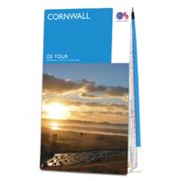
Fietskaart 1 Tour Map Cornwall | Ordnance Survey

0
Overzichtelijke, gedetailleerde kaart met veel toeristische informatie, waaronder campings en jeugdherbergen. Groot voordeel, naast de prima schaal, is dat de routes van het National Cycle Network duidelijk staan ingetekend. De kaarten laten alle grote en kleine wegen zien, wel zijn er ter vereenvoudiging andere - met name topografische details - ...

Verkopers met dit product

Verkoper
Bezorging
Prijs
DeZwerver.nl logo
DeZwerver.nl
2,95
10,95

Anderen bekeken ook

Wegenkaart - landkaart Visitors map Cornwall | A-Z Map Company
Explore the whole county and area extending into Devon as far as Great Torrington, Tavistock and Plymouth. This detailed and up-to-date map contains more than 1,000 places of interest and an index to 3,000 towns and villages. Published at a clear 2.5 miles to 1 inch scale (1.6 kms to 1 cm), a handy road map includes primary route destinations, selected caravan and camping sites, visitor attractions and places of interest.   Town centre street maps of Bodmin, Bude, Falmouth, Fowey, Launceston, Liskeard, Looe, Newquay, Padstow, Penzance,Plymouth, St. Ives and Truro are also included, plus detailed informative text for Bodmin Moor, Land’s End and Isles of Scilly. The perfect map for exploring Cornwall whether you are a local or a tourist.
12,50
Wandelgids Cornwall | Pocket Mountains
Handige compacte wandelgids met 40 dagwandelingen. Deze gids bevat kleine kaartjes en leuke uitgebreide informatie over wat er langs de route te zien is. Goede wandelkaarten zijn echter we noodzakelijk voor deze tochten: de Ordnance Survey explorer maps of Landanger maps zijn zeer geschikt.   With over 400 miles of mainland coastline and an excellent public path network, Cornwall is all about rugged shorelines, gorgeous sandy beaches, turquoise waters, meandering rivers and wide open countryside. Add to the mix a fantastic diversity of flora and fauna, interesting geology, fascinating history and some of the most striking views in the country and you have one of England's best regions to explore on foot. In these 40 walks, all between two and eight miles in length, Keith Fergus leads you through some of the best rambles Cornwall has to offer. Plaatsen in het boek Bedruthan Steps, Bessie’s Cove, Bude, Cambeak, Camel Estuary, Cape Cornwall, Carbis Bay, Cawsand, Charlestown, Crackington …
10,95
Reisgids Devon and Cornwall | Rough Guides
Een kleinere versie in zakformaat van de grotere versies van de Rough Guides. Als altijd weer vol met goede informatie over cultuur en praktische zaken. Achterin een kaart van de stad. Inspirational and informative pocket guide, shining a spotlight on the best of holidaying at home in the UK through clearly laid-out walking and driving itineraries.   Explore the best of Devon & Cornwall with this unique Rough Guide Staycation to Devon & Cornwall, packed full of insider information and stunning images. From making sure you don’t miss out on must-see attractions like the Eden Project, Lynmouth Cliff Railway and Tate St Ives, to discovering hidden gems, including an invigorating hike through Dartmoor, hitting the waves in Newquay and feeling the power of myths at the legendary Tintagel Castle, the easy-to-follow, ready-made walking and driving routes will save you time, help you plan, and enhance your staycation in Devon & Cornwall.   The Rough Guide Staycations to Devon & Cornwall cover…
12,50
Nieuw
Wandelgids The South West Coast Path | Cicerone
Goede wandelgids van het langste gemarkeerde wandelpad van Groot Brittanië; 1015 km! Uit de bekende Cicerone serie, dus met mooie foto's en duidelijke routebeschrijvingen en kaartjes. The South West Coast Path is Britain's longest way-marked trail, measuring a staggering 1015km (630 miles). Written by the well-known outdoor writer, Paddy Dillon, the guide provides a wealth of detailed knowledge to help tackle this immense route with confidence. It describes the way-marked trail from Minehead to Poole along the north Devon, Cornish and south Devon coastline to finish at Poole Harbour. A full introduction provides the route's historical background, advice on accommodation along the route and details on travelling to and around the South West.There is detailed information on how to use this guide to make the most of your walk, whether you choose to walk the whole route in one go or decide to achieve sections at intervals.Day-by-day route summaries accompany the 45-day stages and the fina…
24,95
Reisgids Devon - Cornwall | Rough Guides
Zeer goede reisgids voor zowel de georganiseerde maar vooral voor de zelfstandige reiziger. Boordevol informatie over reizen, slapen, eten, maar ook musea en cultuur. Voor Europese landen meestal completer en beter dan de Lonely Planet ! This Devon & Cornwall guidebook is perfect for independent travellers planning a longer trip. It features all of the must-see sights and a wide range of off-the-beaten-track places. It also provides detailed practical information on preparing for a trip and what to do on the ground. And this Devon & Cornwall travel guidebook is printed on paper from responsible sources, and verified to meet the FSC's strict environmental and social standards.   This Devon & Cornwall guidebook covers: Exeter and mid-Devon, East Devon, South Devon, Dartmoor, Plymouth and around, Exmoor, North Devon and Lundy, Southeast Cornwall, The Lizard and Penwith peninsulas, the Isles of Scilly, Cornwall's Atlantic coast, Bodmin and Bodmin Moor.   Inside this Devon & Cornwall …
24,95
Fietsgids London - Land's End Cycle Route | EOS Cycling Holidays Ltd
The guidebook contains routes from both Dover and Harwich ferry ports to London. This makes it possible to cycle around the English Channel, when also using the Plymouth link. The Dover to London route takes you though the fruit orchards of Kent, historic Canterbury and the Medway estuary with its impressive castles.   The Harwich to London route provides pleasant countryside cycling in Essex and takes you through Roman Colchester. Cycling through the heart of London, our route manages to stay away from busy roads, the occasional busy junction crossing excepted. Most of the cycling takes place on towpaths along the River Thames with spectacular views to enjoy.   You will cycle under the Tower Bridge and you'll pass the London Eye, Big Ben, the Houses of Parliament and Buckingham Palace on the way. Greenwich Park, Hyde Park and Richmond Park all provide superb green traffic-free routes. Heading west you'll cycle by Windsor Park and Windsor Castle before making your way to the Aon & Ken…
41,50
Wandelkaart - Topografische kaart 200 Landranger Newquay & Bodmin, Camelford & St Austell | Ordnance Survey
Zeer goede detailkaart met topografische ondergrond. Kleurgebruik is goed over nagedacht: bijzonder goed leesbaar en helder kaartbeeld. Hierop zijn toeristische symbolen van bezienswaardigheden ingetekend, daarnaast staan bijvoorbeeld campings en jeugdherbergen vermeld en - voor wandelaars het belangrijkst - alle right of way paden en Lange afstands Wandelpaden zijn er op te vinden. De ideale kaart voor het wandelen in Engeland, Wales of Schotland. De kaarten zijn te gebruiken met GPS (UTM OSGB36), de legenda is in het Engels, Frans en Duits.    Plaatsen op deze kaart: Newquay, Bodmin, Camelford, St Austell, Lostwithiel, Padstow, Fowey, Wadebridge, Tintagel, Treknow, Trewassa, Port Isaac, St Teath, Pendoggett, St Mabyn, St Kew, St Minver, St Issey, Trevone, Porthcothan, St Eval, Trenance, Roseannon, Nanstallon, Lanivet, Withiel, St Dennis, Roche, Bugle, Penwithick, Golant, Treviscoe, Polgooth, Ladock, Trispen, Perranporth, Holywell, St Newlyn East, Indian Queens, St Columb Major.   I…
19,50
Wandelkaart - Topografische kaart 204 Landranger Truro & Falmouth, Roseland Peninsula | Ordnance Survey
Zeer goede detailkaart met topografische ondergrond. Kleurgebruik is goed over nagedacht: bijzonder goed leesbaar en helder kaartbeeld. Hierop zijn toeristische symbolen van bezienswaardigheden ingetekend, daarnaast staan bijvoorbeeld campings en jeugdherbergen vermeld en - voor wandelaars het belangrijkst - alle right of way paden en Lange afstands Wandelpaden zijn er op te vinden. De ideale kaart voor het wandelen in Engeland, Wales of Schotland. De kaarten zijn te gebruiken met GPS (UTM OSGB36), de legenda is in het Engels, Frans en Duits.    Plaatsen op deze kaart: Truro, Falmouth, Penryn, St Austell, Fowley, Cadwith, Coverack, Trelan, St Keverne, Helford, Gillan, Constantine, Stithians, Feock, Carharrack, Chacewater, Coldharbour, St Agnes, Trispen, Perraporth, Ladock, Probus, Tresillian, St Clemens, Portloe, St Just in Roseland, St Mawes, Gorran Haven, Mevagissey, Pentewan and Polgooth.   Ingetekende Langeafstandswandelroute South west coast Path  
19,50
Nieuw
Wandelkaart - Topografische kaart 200 Landranger Active Newquay / Bodmin / Camelford | Ordnance Survey
Zeer goede detailkaart met topografische ondergrond. Kleurgebruik is goed over nagedacht: bijzonder goed leesbaar en helder kaartbeeld. Hierop zijn toeristische symbolen van bezienswaardigheden ingetekend, daarnaast staan bijvoorbeeld campings en jeugdherbergen vermeld en - voor wandelaars het belangrijkst - alle right of way paden en Lange afstands Wandelpaden zijn er op te vinden. De ideale kaart voor het wandelen in Engeland, Wales of Schotland. De kaarten zijn te gebruiken met GPS (UTM OSGB36), de legenda is in het Engels, Frans en Duits.    Plaatsen op deze kaart: Newquay, Bodmin, Camelford, St Austell, Lostwithiel, Padstow, Fowey, Wadebridge, Tintagel, Treknow, Trewassa, Port Isaac, St Teath, Pendoggett, St Mabyn, St Kew, St Minver, St Issey, Trevone, Porthcothan, St Eval, Trenance, Roseannon, Nanstallon, Lanivet, Withiel, St Dennis, Roche, Bugle, Penwithick, Golant, Treviscoe, Polgooth, Ladock, Trispen, Perranporth, Holywell, St Newlyn East, Indian Queens, St Columb Major.   In…
25,95
Nieuw
Wandelkaart - Topografische kaart 204 Landranger Active Truro / Falmouth / Roseland | Ordnance Survey
Zeer goede detailkaart met topografische ondergrond. Kleurgebruik is goed over nagedacht: bijzonder goed leesbaar en helder kaartbeeld. Hierop zijn toeristische symbolen van bezienswaardigheden ingetekend, daarnaast staan bijvoorbeeld campings en jeugdherbergen vermeld en - voor wandelaars het belangrijkst - alle right of way paden en Lange afstands Wandelpaden zijn er op te vinden. De ideale kaart voor het wandelen in Engeland, Wales of Schotland. De kaarten zijn te gebruiken met GPS (UTM OSGB36), de legenda is in het Engels, Frans en Duits.    Plaatsen op deze kaart: Truro, Falmouth, Penryn, St Austell, Fowley, Cadwith, Coverack, Trelan, St Keverne, Helford, Gillan, Constantine, Stithians, Feock, Carharrack, Chacewater, Coldharbour, St Agnes, Trispen, Perraporth, Ladock, Probus, Tresillian, St Clemens, Portloe, St Just in Roseland, St Mawes, Gorran Haven, Mevagissey, Pentewan and Polgooth.   Ingetekende Langeafstandswandelroute South west coast Path  
25,95

Klanten-reviews van Fietskaart 1 Tour Map Cornwall | Ordnance Survey

Er zijn nog geen beoordelingen voor dit productBen jij de eerste die een review plaatst?

Meer over Fietskaart 1 Tour Map Cornwall | Ordnance Survey

Productomschrijving

Overzichtelijke, gedetailleerde kaart met veel toeristische informatie, waaronder campings en jeugdherbergen. Groot voordeel, naast de prima schaal, is dat de routes van het National Cycle Network duidelijk staan ingetekend. De kaarten laten alle grote en kleine wegen zien, wel zijn er ter vereenvoudiging andere - met name topografische details - weggelaten. Het is dus kiezen voor een groter gebied (deze kaarten) of een beduidend kleiner gebied met topografische kenmerken zonder ingetekende fietsroutes. (de Landranger 1:50.000 serie).

Touring maps are based on counties or popular tourist areas, and are ideal for helping you to plan the quickest, shortest or most scenic route to your destination. These easy-to-read maps include essential tourist information to help you get the most from your trip.

Met stadsplattegronden van:

Bude, Launceston, Bodmin, Newquay, Truro, St. Austell, Looe, Padstow, Falmouth, Helston, Penzance und Hugh Town (auf den Scilly-Inseln).

Dorpen op de kaart:

Bude, Launceston, Bodmin, Newquay, Truro, Falmouth, Helston, Penzance, Stratton, Wadebridge, St. Austell, Looe, Padstow, St. Ives, St. Agnes, Torpoint, Liskeard, Camelford, Lizard, Port Isaac, Boscastle, Hugh Town (Isles of Scilly / Scilly-Inseln).


Verken gerelateerde categorieën

Webshop.nl maakt gebruik van cookies. Ga je verder op onze website, ga dan akkoord met het plaatsen van cookies en de verwerking van deze data door ons en vermelde partners.