Fietsgids The Ultimate Trans Pennine Trail Guide | Excellent Books

0
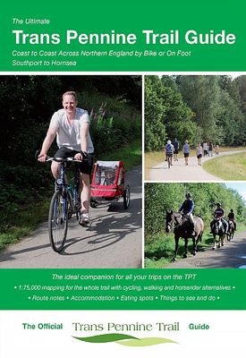
Gidsboek voor de Trans Pennine Trail met spiraalbinding, inclusief kaarten, hoogtegrafieken en verblijfsmogelijkheden. The Trans Pennine Trail guide book covers the hugely popular 370 miles (595km) of trail across the north of England is a big favourite with walkers and cyclists, with many sections available for horse-riders and wheelchair users. ...

Verkopers met dit product

Verkoper
Bezorging
Prijs
DeZwerver.nl logo
DeZwerver.nl
2,95
13,95

Anderen bekeken ook

Fietsgids The Ultimate Trans Pennine Trail Guide | Excellent Books
Gidsboek voor de Trans Pennine Trail met spiraalbinding, inclusief kaarten, hoogtegrafieken en verblijfsmogelijkheden. The Trans Pennine Trail guide book covers the hugely popular 370 miles (595km) of trail across the north of England is a big favourite with walkers and cyclists, with many sections available for horse-riders and wheelchair users.   The trail is suitable for users of all ages and abilities due to its easy gradients and traffic free conditions. This guide is packed with full colour maps, trail info and photos, making it perfect for planning and use along the way.   Plan a scenic walk or bike ride, perhaps through the Pennines themselves, with its many pretty villages, museums and other visitor attractions along the way, very often with the possibility of a train return.   For weekend or longer breaks on the trail you can select something from the wide range of accommodation in the guide, from the simple to the stylish and the quirky to the budget.   Or, plan your l…
13,95
Wandelgids Pennine Way | Trailblazer Guides
Trailblazer British Walking Guide to the Pennine Way, Britain's best-known National Trail that winds for 256 miles through three National Parks - the Peak District, Yorkshire Dales and Northumberland. This superb footpath showcases Britain's finest upland scenery, while touching the literary landscape of the Bronte family and Roman history along Hadrian's Wall. 138 large-scale walking maps - at just under 1:20,000 - showing route times, gradients, where to stay, interesting features.   Guides to 57 towns and villages - along the way. Itineraries for all walkers - whether walking the route in its entirety or sampling the highlights on day walks and short breaks. Practical information for all budgets - Edale to Kirk Yetholm.   Where to stay with reviews - B&Bs, hostels, campsites, pubs and hotels. Where to eat with reviews. What to see, plus detailed town plans.   Public transport information - for all access points on the path. GPS waypoints - also downloadable from the Trailblazer web…
23,50
Fietsgids the Bikepacker's Guide to the World | Lonely Planet
Take your bicycle on the ride of a lifetime with the help of The Bikepackers' Guide to the World. Discover 75 of the most amazing cycling routes in every continent and use the detailed maps, directions, accommodation and practical information to plan your trip. Lonely Planets experts tell you how to prepare, what to take, when and where to go. Bikepacking is the fast-growing adventure activity that gives people the freedom to discover the world in a sustainable and slow-paced fashion on their bicycles. The number of new purpose-built, long-distance cycling routes is increasing all the time and this comprehensive book selects the top 75 to add to your bicycling bucket list. Lonely Planet describes the route in step-by-step detail with a large, accurate map and elevation profile helping cyclists pick a route that suits their experience. The routes are graded from easy to challenging and cover a range of distances from a weekend to a month or more. The rides vary from easy-going rail tra…
34,95
Fietsgids Scottish C2C Guide | Excellent Books
From the creators of the original C2C, this is a new cycle route through the Southern Uplands of Scotland, from coast to coast. This is the complete guide to the Scottish C2C. The guide book includes maps, directions, attractions along the way, accommodation and much more.   Linking Annan on the Solway Firth and South Queensferry on the Firth of Forth near Edinburgh, the Scottish C2C is a 122 mile signed cycle route. It is a mix of country lanes, high quality cycle paths and seaside promenades. There are two challenging climbs, over the classic Devils Beef Tub and through the Moorfoot Hills before opening out onto a panoramic view of the Lothians, Edinburgh Castle, and the Firth of Forth. It finishes under the mighty Forth Bridge.
18,50
Fietsgids C2C Guide Sea to sea by bike | Excellent Books
Fietsgids van de sea-to-sea route, van kust naar kust door het noorden van Engeland. Van Workington/Whitehaven naar Sunderland/Tynemouth. Met deelkaartjes en hoogteprofielen, boordevol praktische informatie van accomodatie tot fietswinkels onderweg. A completely new, fully updated edition of the best selling guide to the UK's premier long distance cycle route - around 140 miles of superb scenery, from the Irish Sea to the North Sea, taking in the Lake District and the Northern Pennines on the way.    As part of Sustrans' National Cycle Network, the C2C uses mainly traffic-free paths and minor roads and is fully signed and waymarked. It is completed by thousands of cyclists every year.   This is the complete guide, including detailed 1:50,000 maps of all route options, directions, what to see and do, accommodation, places to eat and much more. The guidebook covers the route from Whitehaven or Workington to Sunderland or Newcastle.   Author Richard Peace has written and photograph…
15,50
Wandelkaart National Trail Map Pennine Way | Collins
Overzichtskaart op vrij grove schaal van deze LAW Lange Afstands Wandeling in Engeland. Let op: je kunt er niet op lopen. Wel met veel informatie op de kaart, goed ingetekend, een route-schema op de achterzijde en een beschrijving van een aantal bezienswaardigheden.  Perfect guide and map for planning your adventure along the iconic Pennine Way.   Highlights of this Planning Map include:   More than 20 highlighted places of interest with detailed descriptions and attractive photographs, including: Hadrian’s Wall, Tan Hill, and Cauldron Snout A comprehensive index to more than 1000 cities, towns and villages A clear, visible route plotted across the map Advice on safety and security when travelling along the route, as well as the countryside code and the code of conduct The Pennine Way is the oldest of the 16 National Trails and runs along The Pennines, linking the Peak District National Park with the Cheviot Hills. Starting in Edale, Derbyshire, the walk covers 268 miles (431 km) and …
11,50
Wandelgids The Giants' Trail: Alta Via 1 Through the Italian Pennine Alps | Cicerone
Uitstekende wandelgids van een gerenommeerde Engelse uitgever. De tochten zijn met zorg beschreven en voorzien van allerhande nuttige informatie. Italy's Alta Via 1, a 180km hiking trail through the Italian Alps following the northern flank of the Aosta Valley, boasts magnificent views of the Alpine giants: Mont Blanc, the Matterhorn, the Grand Combin and Monte Rosa. Indeed, it is sometimes known as the Giants' Trail and can be combined with a sister-route, the Alta Via 2 (covered in a separate Cicerone guide), which runs along the southern flank of the valley, to form the Tor des Geants. Stretching from Donnas to Courmayeur, the Alta Via 1 offers fantastic alpine walking, with welcoming refuges and small hotels providing overnight accommodation (and great food) along the way. The guide presents the route in two sections, for the advantage of those who can't spare the full fortnight-plus needed to walk the entire AV1. The trail is described in 16 stages, with alternative stages coveri…
23,95
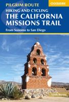
Wandelgids - Fietsgids Hiking and Cycling the California Missions Trail - Californie | Cicerone
Guidebook to hiking or cycling the 800 mile (1289km) California Missions Trail between San Francisco Bay and San Diego. The pilgrimage trail takes in 21 historic Spanish missions and can be completed in 50-60 walking days or 2-3 weeks cycling. With 1:100,000 mapping, route description, and details of accommodation and facilities for each stage. Ancient footpaths became connecting routes between the Spanish missions, pueblos, and presidios in the period 1769 to 1823. Over time these routes became automobile roadways and were marked with bells starting in 1906 to promote and preserve the El Camino Real. Today, the California Missions Trail follows a pedestrian route through urban cities and historic towns, through forest paths and country lanes, to each of the twenty-one historic Spanish missions. The 800-mile California Missions Trail leads walkers and cyclists through some of the most scenic and historic sites of one of America's most beautiful states. The 21 missions, founded 200-250…
26,50
Fietsgids The London Cycling Guide | Inkspire
Written by the author of London's most popular cycling blog and using years of experience and contributions from readers, it offers more than 30 leisurely routes covering both inner and outer London. Each itinerary is described in detail with a series of points of interest also pinpointed on an accompanying route map. Boxed information with each route shows at-a-glance the start point, likely duration, and some suggestions for where to eat and drink along the way.   The book also covers important practical information on cycling, such as choosing the right bike for your style of cycling; tips on urban cycling, social cycling, and cycling with children; and guidance on security and insurance as well as information on accessories and clothing. This best selling guide to cycling in London is completely updated with new routes, maps, and colour photographs. It also includes full details of Santander Cycles, London's public bike sharing scheme.  
18,50
Fietsgids Cycling in the Peak District | Cicerone
Guide to cycling in and around the Peak District National Park, on road or trail bike. 20 day routes and one multi-day cycle tour of the Peak District. All easily accessible from Sheffield and Manchester with routes starting from charming Derbyshire towns such as Ashbourne, Matlock, Bakewell and Buxton. Includes route profiles and 1:100000 mapping. The scenic Peak District boasts an abundance of country lanes, tracks, towpaths and railway trails that are perfect for two-wheeled exploration. This guidebook presents 20 graded day rides in the national park, along with a challenging 250km route, the five-day 'Tour de Peak District'. With a focus on quiet lanes, gratifying downhills and not overly technical bridleways, tracks and trails, the routes are ideal for gravel/adventure bikes (or hybrid/cross), though most can be easily adapted for road bikes.   Each ride features step-by-step route description accompanied by 1:100,000 mapping. Overview stats are provided to aid route selection, …
18,50

Klanten-reviews van Fietsgids The Ultimate Trans Pennine Trail Guide | Excellent Books

Er zijn nog geen beoordelingen voor dit productBen jij de eerste die een review plaatst?

Meer over Fietsgids The Ultimate Trans Pennine Trail Guide | Excellent Books

Productomschrijving

Gidsboek voor de Trans Pennine Trail met spiraalbinding, inclusief kaarten, hoogtegrafieken en verblijfsmogelijkheden.

The Trans Pennine Trail guide book covers the hugely popular 370 miles (595km) of trail across the north of England is a big favourite with walkers and cyclists, with many sections available for horse-riders and wheelchair users.   The trail is suitable for users of all ages and abilities due to its easy gradients and traffic free conditions. This guide is packed with full colour maps, trail info and photos, making it perfect for planning and use along the way.   Plan a scenic walk or bike ride, perhaps through the Pennines themselves, with its many pretty villages, museums and other visitor attractions along the way, very often with the possibility of a train return.   For weekend or longer breaks on the trail you can select something from the wide range of accommodation in the guide, from the simple to the stylish and the quirky to the budget.   Or, plan your leisurely day out with the kids, maybe combining a canal side walk or ride with a visit to a stately home. There’s also the ultimate challenge of a coast to coast walk or cycle ride stretching 215 miles (346km) from Southport to Hornsea. Whatever your choice, the Ultimate Trans Pennine Trail Guide can help.   This brand new guide features: * Detailed full colour 1:75,000 mapping showing route options for cyclists, walkers and horse-riders. * Street-level mapping for main towns and cities along the way, including: Southport, Liverpool, Widnes, Stockport, Penistone, Doncaster, Chesterfield, Sheffield, Leeds, Selby, Hull and Hornsea. * Numerous colour images. * Route navigation notes. * Sleeping, eating and sightseeing suggestions cross-referenced to the mapping.


Productinformatie

    Verken gerelateerde categorieën

    Webshop.nl maakt gebruik van cookies. Ga je verder op onze website, ga dan akkoord met het plaatsen van cookies en de verwerking van deze data door ons en vermelde partners.