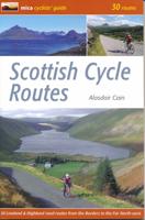
Fietsgids Scottish Cycle Routes | Mica Publishing

0
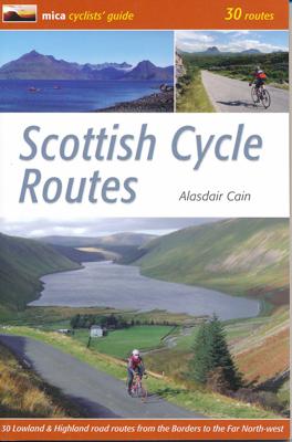
Goede beschrijvingen, redelijke kaarten, soms met hoogteprofielen.   In the cyclists' guide series from Mica publishers, here are 30 circular road cycle routes of 35 miles to 115 miles, exploring the best of Scotland's panoramic back roads from the Far North-West to the Borders. The routes include two Cairngorm crossings and the spectacular Bealac...

Verkopers met dit product

Verkoper
Bezorging
Prijs
DeZwerver.nl logo
DeZwerver.nl
2,95
19,95

Anderen bekeken ook

Fietsgids London - Land's End Cycle Route | EOS Cycling Holidays Ltd
The guidebook contains routes from both Dover and Harwich ferry ports to London. This makes it possible to cycle around the English Channel, when also using the Plymouth link. The Dover to London route takes you though the fruit orchards of Kent, historic Canterbury and the Medway estuary with its impressive castles.   The Harwich to London route provides pleasant countryside cycling in Essex and takes you through Roman Colchester. Cycling through the heart of London, our route manages to stay away from busy roads, the occasional busy junction crossing excepted. Most of the cycling takes place on towpaths along the River Thames with spectacular views to enjoy.   You will cycle under the Tower Bridge and you'll pass the London Eye, Big Ben, the Houses of Parliament and Buckingham Palace on the way. Greenwich Park, Hyde Park and Richmond Park all provide superb green traffic-free routes. Heading west you'll cycle by Windsor Park and Windsor Castle before making your way to the Aon & Ken…
41,50
Fietskaart Reivers Cycle Routes | Northern Heritage Services
The long-distance Reivers Cycle Routes are two intertwining signed / waymarked bi-directional ‘coast to coast’ cycle routes between the North Sea and the Irish Sea.   The original Reivers Cycle Route was created in 1998 eventually becoming NCN Route 10 with interlinking on-road and off-road sections but this soon morphed into a one-size-fits-all route which never worked well. The regenerated re-launched Reivers Cycle Routes are two intertwining route options – one which is as much off-road as possible suitable for gravel and cross bikes, hybrids and mountain bikes and a version designed for capable road cyclists 100% on tarmac.   The routes are bi-directional and continuously reward the rider with beautiful views of the constantly changing terrain, provide many places of interest to pass by or call in and many lovely villages and quiet hamlets to cycle through or stay the night. Most importantly, there is a supply of excellent on route or close-to-route refreshments stops.   The off-r…
16,50
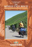
Fietsgids Moesel - The Moselle Cycle Route | Cicerone
This guidebook covers the entirety of the Moselle river’s course, from its source in the Vosges Mountains of eastern France to its confluence with the Rhine at the west German city of Koblenz. The well-waymarked route reaches historic Nancy and Metz, crosses into Luxembourg and continues through the spectacular Mosel gorge, where the river cuts a sinuous path between the Hunsrück and Eifel Mountains.   The great attraction to a cyclist of following a river from its source is that, once you have reached the start, it's all downhill. From the easily reached source near the Col de Bussang, the Moselle cycle route descends over 650m to the Rhine at Koblenz. At Koblenz, the route can be linked with The Rhine Cycle Route.   In addition to the main route, excursions are described to visit Toul on the Boucles de Moselle, Luxembourg Ville in the Duchy of Luxembourg and through the Saar and Rhine gorges.   Accommodation and places to eat and drink en route are plentiful. Mostly off-road and on …
20,95
Wandelgids 083 Pathfinder Guides North Coast 500 and Northern Highlands | Ordnance Survey
Enhance your North Coast 500 tour with the only walking guidebook featuring routes based on or accessible from Scotland’s ultimate road trip. Discover Britain’s remotest sandy beaches, Scotland’s most northerly munro, some of the oldest rocks on Earth and more with 28 breathtaking walks accessed from the North Coast 500 as well as 32 unmissable stop-off-and-stroll recommendations.   Featured North Coast 500 and Northern Highlands walks include:   - Circle Loch Coulin where Beinn Eighe and Liathach are reflected in the still waters - Wander the astounding landscape of Knockan Crag, where some of the oldest rocks on Earth can be seen - Climb Ben Hope, Scotland’s most northerly munro, towering above the Flow Country - See the waterfalls and rocks walls of the Big Burn as you ascend Ben Bhraggie for views over the Dornoch Firth - Explore the landscape and history of the Applecross peninsula with sublime views of Raasay - Take a moorland and clifftop route to the vast golden sands of Sandw…
18,50
Fietskaart Cycling guides Dartmoor - South Devon | Goldeneye
Dartmoor. One of England’s greater National Parks; the Forest of Dartmoor covers 365 square miles and contains the highest ground in England south of the Peak District. On its desolate moorland tracks the wanderer can believe they are further from a public road than anywhere in the country, but on the fringes lush valleys lead down on every side to thick woodland, green vegetation and picturesque villages. Dartmoor is well known for its wildlife - attractive herds of ponies, seemingly wild but in fact individually owned, foxes, badgers and otters - also the occasional adder. Fallow, roe and Sitka deer can often be seen, but the red deer of Exmoor have never penetrated the area. Buzzards, kestrels and various Birds of Prey are frequently seen, as well as the wheatear, while crows, ravens and the skylark are fairly commonplace. The Moor abounds in prehistoric remains. There are also many deserted medieval villages with remains of the traditional ‘longhouse’ buildings. For centuries tin …
12,95
Wandelgids The Swiss Alps | Cicerone
  The Swiss Alps are home to the highest and most spectacular mountains in Western Europe. This stunning guidebook describes each mountain area throughout Switzerland – the peaks, passes, valleys and bases – to help you identify the best destinations to plan your trip.   Questions such as ‘Where to walk, climb or ski?’, ‘What multi-day treks are available’ and ‘Where do they go?’, ‘Where are the mountain huts, what are their facilities, which peaks do they serve?’ And where are the most suitable valley bases?’ – all these and more are addressed in detail in this essential guidebook.   The Swiss Alps does not give detailed route directions but information is given about all the guides and maps available for every region.   The Swiss Alps by Kev Reynolds is the third book in Cicerone’s World Mountain Ranges series, which include The Pyrenees and Scotland.   descriptions of all the Swiss Alps, area-by-area from the Chablais Alps in the south west to the Silvretta in the north east classi…
34,95
Fietsgids Cycling East Anglia | Bradt Travel Guides
Following the same format as Bradt's Cycling in Cornwall & the Isles of Scilly, this new cycling guide to East Anglia offers 21 routes for beginners and 'leisure cyclists', covering Norfolk, Suffolk and Cambridgeshire. Each ride includes comprehensive directions, as well as background features on local history, wildlife and culture. All are linked to OS Explorer maps and relevant National Cycle Network routes (NCN), and include National Grid Reference (NGR) coordinates. In addition, each route has been mapped on route planning and navigation app komoot, where readers can find detailed route insights including an elevation profile and waytype and surface information. Using the komoot app for iOS or Android, readers can also use their smartphones to navigate each route.East Anglia, the snail-like bulge protruding off the back of the United Kingdom's east coast, is a vast flatland of broads, fens and marshes, stretched out under a wide sky. Despite its proximity to London and the Midland…
18,50
Fietsgids Cycling London to Paris | Cicerone
Uitstekende beschrijving van de klassieke fietsroute tussen de twee steden Londen en Parijs: goede routebeschrijving, met hoogteprofielen, belangrijke informatie en uitstekende kaarten. This guidebook describes two long-distance cycle routes between London and Paris: the 'classic route' and the Avenue Verte. The continuing development of national cycle networks in both countries and an increased interest in cycling have further increased the popularity of this journey, both as a cycle tour and for sponsored challenges. Both routes are well within the capabilities of cyclists of moderate fitness and will generally take between five days and a week - meaning that a round trip, including a few days sightseeing in Paris, can easily be accomplished in a fortnight. The classic route is presented in 11 stages; the Avenue Verte in 9. Primary route description for both routes is from London to Paris, but the reverse direction is also described. Each stage includes clear, step-by-step route de…
20,95
Wandelgids Peak Bagging Munros | Vertebrate Publishing
Over 130 years ago, mountaineer Sir Hugh Munro published the first list of Munros ? Scottish mountains with a height over 3,000 feet ? and inspired the hobby of Munro ?bagging?, a pastime which combines rugged adventure on a personal and literal journey around the Scottish Highlands with a nerdy compulsion to maintain a ticklist. Peak Bagging Munros Volume 1 by Nicola Hardy (Munroist number 6,765) features 64 routes designed to link up the 141 most southerly Munros so you can enjoy the challenge of ?compleating? them at your own pace ? over years, months or, in rare cases, even just a few weeks. It presents not only the most efficient routes, but does so in such a way that each route is a fantastic walk or run in its own right.   The featured routes include the iconic Ring of Steall and Ben Nevis via the Carn M?r Dearg Ar?te, alongside classic entry-level walks up the likes of Ben Chonzie, Ben Lomond in Loch Lomond and the Trossachs and Mount Keen in the Cairngorms. To assist you in b…
37,95
Fietskaart 14 Cycling guides Suffolk | Goldeneye
To be confronted with the variety and complexity of the cycling routes, trails and paths in Suffolk can be a bewildering experience.  For it appears that the Suffolk County Council and the three District Councils are all trying hard to promote their areas. This is indeed encouraging for the growth of cycling, but it can be confusing.  Our purpose is to provide clear, easy to use and easy to follow, cycling maps, and to illustrate these in a comprehensive form.    Suffolk must be one of the most charming of counties to explore by bicycle. When Al Churcher delivered his routes to us at Goldeneye we couldn’t keep him quiet, such was his enthusiasm and wonder at Suffolk’s country lanes and byways. He has cycled all over the UK, Canada, Mallorca, New Zealand and Sicily, but Suffolk remained a firm favourite.    The inland scenery is not spectacular for the county’s main glory lies with its attractive villages; the local architecture jealously preserved from modern depredation. There is an …
15,95

Klanten-reviews van Fietsgids Scottish Cycle Routes | Mica Publishing

Er zijn nog geen beoordelingen voor dit productBen jij de eerste die een review plaatst?

Meer over Fietsgids Scottish Cycle Routes | Mica Publishing

Productomschrijving

Goede beschrijvingen, redelijke kaarten, soms met hoogteprofielen.   In the cyclists' guide series from Mica publishers, here are 30 circular road cycle routes of 35 miles to 115 miles, exploring the best of Scotland's panoramic back roads from the Far North-West to the Borders. The routes include two Cairngorm crossings and the spectacular Bealach na Ba in Applecross, some of the toughest and most spectacular challenges in the country, as well as gentler cross-country and coastal routes round the Black Isle, Moray Coast, Ayrshire, Arran and East Lothian.    These day circuits include detailed descriptions and Ordnance Survey mapping, plus variations and extensions to ensure you get the best from your day. Route profiles indicate uphill and downhill sections and the spread of total height gain. There are also route fact files indicating starting point, distance, height gain, maximum gradient and approximate time. There are extensions & variations to shorten and lengthen routes, plus all important cafe stops en route are listed.   Alasdair Cain is a British Mountain Guide based in Scotland and the French Alps. He has cycled most of his life, mainly to keep fit for climbing, but in the last 12 years his main focus has been cycling.

Productinformatie

    Verken gerelateerde categorieën

    Webshop.nl maakt gebruik van cookies. Ga je verder op onze website, ga dan akkoord met het plaatsen van cookies en de verwerking van deze data door ons en vermelde partners.