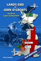
Fietsgids Lands End to John O'Groats (2nd Edition) The Official Cycllist's Challenge Guide | Challenge Publications

0
There are numerous outdoor challenges in life around the UK. Canoeing the Caledonian Canal from one side of the country to the other, walking around Britain on the coastal footpath or completing a marathon. This book looks at another great challenge, cycling from Lands End to John O’Groats. To walk, run or cycle from Lands End, the most south-west...

Verkopers met dit product

Verkoper
Bezorging
Prijs
DeZwerver.nl logo
DeZwerver.nl
niet bekend
12,50

Anderen bekeken ook

Fietsgids Land's End to John o' Groats | Cicerone
A guidebook describing Britain’s famous ‘End to End’ cycle route, a journey of almost 1000 miles from the very tip of southwest England – Land’s End – to the northernmost point of mainland Scotland – John o’ Groats. Divided into 14 day stages, with each stage covering between 53 and 85 miles, the route features some of the best cycling the UK has to offer.    Step-by-step route descriptions are accompanied by 1:250,000 mapping and stage profiles. There are links to GPX mapping of the route for simple GPS navigation as well as a handy equipment list, route summary table, tourist office and cycle shop listings, together with information on health and safety, training and fitness. A listing of accommodation en route is also given.   A quintessential British adventure, the End to End cycle route attracts the attention of thousands of cyclists – men and women, young and old – every year. From charming Cornish villages to the brooding magnificence of the Scottish Highlands, scenery abounds …
20,95
Fietsgids Britain's Best Bike Ride from Land's End to John o' Groats | Inspiring Adventure
There are many ways to cycle between Land’s End and John o’ Groats, but the route specially created for this book, LEJOG1000, is designed to show you the quiet roads, picturesque villages and dramatic landscapes that make the experience memorable. Instead of taking the most direct route, it invites you to explore the best of each region you pass through. You’ll discover stunning beaches and wild ponies on your way along the quiet wild-flower-edged lanes of Cornwall and Devon, follow the meandering River Wye in Wales, wind your way through a post-industrial landscape of canals and mill chimneys in the North West, before moving on to the epic climbs and grand vistas of Scotland.   Carefully crafted to allow you the freedom to create your own ultimate adventure, the route is split into 30 adaptable stages, each finishing in a town or village with suggested places to eat, drink and stay. Create your own bespoke itinerary, or use one of three itinerary options provided: the 2-week classic,…
27,95
Nieuw
Wandelgids Walking The End to End Trail | Cicerone
Een droomroute voor velen: helemaal van het zuidelijkste puntje van Engeland naar het noordelijkste puntje van Schotland, zo'n slordige 1956 km door fabelachtig mooie afwisselende landschappen. Zeer gedetailleerd beschreven met alle noodzakelijke informatie! Kaartmateriaal - zelf gemaakt door de schijver - werkt zeer verhelderend en voldoet uitstekend ter plaatse. Je hebt alle informatie in één boek! This guidebook to UK's ultimate challenge walk, the End to End, describes a 1956km (1215 mile) walking route from Land's End in Cornwall to John o' Groats in Scotland's far north - the two points on mainland Britain that are the furthest apart. The recommended route avoids road walking as much as possible and frequently takes advantage of existing long-distance trails, including the South West Coast Path, Pennine Way and West Highland Way. Passing through remote terrain at times and keeping to the hills where practical, it is intended for experienced hill-walkers.   The guide includes rou…
27,95
Fietskaart 14 Cycling guides Suffolk | Goldeneye
To be confronted with the variety and complexity of the cycling routes, trails and paths in Suffolk can be a bewildering experience.  For it appears that the Suffolk County Council and the three District Councils are all trying hard to promote their areas. This is indeed encouraging for the growth of cycling, but it can be confusing.  Our purpose is to provide clear, easy to use and easy to follow, cycling maps, and to illustrate these in a comprehensive form.    Suffolk must be one of the most charming of counties to explore by bicycle. When Al Churcher delivered his routes to us at Goldeneye we couldn’t keep him quiet, such was his enthusiasm and wonder at Suffolk’s country lanes and byways. He has cycled all over the UK, Canada, Mallorca, New Zealand and Sicily, but Suffolk remained a firm favourite.    The inland scenery is not spectacular for the county’s main glory lies with its attractive villages; the local architecture jealously preserved from modern depredation. There is an …
15,95
Fietsgids London - Land's End Cycle Route | EOS Cycling Holidays Ltd
The guidebook contains routes from both Dover and Harwich ferry ports to London. This makes it possible to cycle around the English Channel, when also using the Plymouth link. The Dover to London route takes you though the fruit orchards of Kent, historic Canterbury and the Medway estuary with its impressive castles.   The Harwich to London route provides pleasant countryside cycling in Essex and takes you through Roman Colchester. Cycling through the heart of London, our route manages to stay away from busy roads, the occasional busy junction crossing excepted. Most of the cycling takes place on towpaths along the River Thames with spectacular views to enjoy.   You will cycle under the Tower Bridge and you'll pass the London Eye, Big Ben, the Houses of Parliament and Buckingham Palace on the way. Greenwich Park, Hyde Park and Richmond Park all provide superb green traffic-free routes. Heading west you'll cycle by Windsor Park and Windsor Castle before making your way to the Aon & Ken…
41,50
Nieuw
Wandelgids Walking the John o' Groats Trail | Cicerone
Guide to the John o' Groats Trail, a 233km walking route linking Inverness with John o' Groats on the northeast tip of mainland Britain. Much of the walking is coastal, with the northern half characterised by its spectacular seacliffs; however, there is some inland walking too, and the scenery is varied, ranging from dunes and deserted sandy beaches to beautiful woodland. With rough ground and some exposed clifftop walking, the route is suited to experienced hikers.   It takes around a fortnight to complete. The route is described in 14 stages, each of which includes: an overview map; step-by-step route description illustrated with custom mapping; details of accommodation, facilities and transport links; and information on local points of interest. While the main route description is from south to north, notes are supplied for southbound walkers.   Also included is a bonus route linking the trail with the Great Glen, for the benefit of walkers undertaking the Land's End to John o' Gro…
23,95
Fietskaart Reivers Cycle Routes | Northern Heritage Services
The long-distance Reivers Cycle Routes are two intertwining signed / waymarked bi-directional ‘coast to coast’ cycle routes between the North Sea and the Irish Sea.   The original Reivers Cycle Route was created in 1998 eventually becoming NCN Route 10 with interlinking on-road and off-road sections but this soon morphed into a one-size-fits-all route which never worked well. The regenerated re-launched Reivers Cycle Routes are two intertwining route options – one which is as much off-road as possible suitable for gravel and cross bikes, hybrids and mountain bikes and a version designed for capable road cyclists 100% on tarmac.   The routes are bi-directional and continuously reward the rider with beautiful views of the constantly changing terrain, provide many places of interest to pass by or call in and many lovely villages and quiet hamlets to cycle through or stay the night. Most importantly, there is a supply of excellent on route or close-to-route refreshments stops.   The off-r…
16,50
Nieuw
Fietsgids Cycling the Camino de Santiago | Cicerone
The Camino de Santiago de Compostela (Camino Francés or Way of St James) is among the world's most famous pilgrimages: Christian pilgrims have travelled to the shrine of St James in Santiago, northern Spain, since the ninth century. This guide provides all the information you need to successfully cycle the Camino. The Camino Francés is the most popular variant of the Camino, linking St Jean-Pied-de-Port on the French-Spanish border with Santiago via Pamplona, Burgos and León. The guide presents the journey in 18 stages. Two versions of the route are described, the first (770km) based closely on the walkers' route and suitable for hybrid or mountain bikes; the second (798km) a 'road route' for road and touring cycles. It can be cycled in around 10-14 days and is very well provisioned. Clear route description and mapping are accompanied by notes on local points of interest, as well as background information on Spanish history and the history of the Camino. The practicalities are also t…
18,95
Fietsgids The Ultimate Trans Pennine Trail Guide | Excellent Books
Gidsboek voor de Trans Pennine Trail met spiraalbinding, inclusief kaarten, hoogtegrafieken en verblijfsmogelijkheden. The Trans Pennine Trail guide book covers the hugely popular 370 miles (595km) of trail across the north of England is a big favourite with walkers and cyclists, with many sections available for horse-riders and wheelchair users.   The trail is suitable for users of all ages and abilities due to its easy gradients and traffic free conditions. This guide is packed with full colour maps, trail info and photos, making it perfect for planning and use along the way.   Plan a scenic walk or bike ride, perhaps through the Pennines themselves, with its many pretty villages, museums and other visitor attractions along the way, very often with the possibility of a train return.   For weekend or longer breaks on the trail you can select something from the wide range of accommodation in the guide, from the simple to the stylish and the quirky to the budget.   Or, plan your l…
13,95
Nieuw
Fietsgids The River Loire Cycle Route | Cicerone
This guide describes a 1061km cycle route that starts at source of the Loire in the Massif Central mountains of central France and finishes at the Atlantic opposite St Nazaire. The route goes through the heart of France as the Loire becomes the royal river, bounded by extravagant châteaux, fields of Charolais cattle and vineyards. It passes through historic cities like Orléans and Tours, continuing past Angers and France's fourth largest city Nantes. The 1061km Loire Cycle Route starts at the source of the River Loire in the Massif Central mountains of central France and finishes at the Atlantic opposite St Nazaire. It descends past extinct volcanoes, crater lakes and deep gorges before joining EuroVelo route 6, followed by the fully waymarked Loire à Vélo, France's most popular cycle trail. Following the river downstream in 26 stages, the route is generally downhill or level, often on dedicated traffic-free cycle tracks.   Packed with a wealth of useful information - from practical p…
23,95

Klanten-reviews van Fietsgids Lands End to John O'Groats (2nd Edition) The Official Cycllist's Challenge Guide | Challenge Publications

Er zijn nog geen beoordelingen voor dit productBen jij de eerste die een review plaatst?

Meer over Fietsgids Lands End to John O'Groats (2nd Edition) The Official Cycllist's Challenge Guide | Challenge Publications

Productomschrijving

There are numerous outdoor challenges in life around the UK. Canoeing the Caledonian Canal from one side of the country to the other, walking around Britain on the coastal footpath or completing a marathon. This book looks at another great challenge, cycling from Lands End to John O’Groats.

To walk, run or cycle from Lands End, the most south-westerly tip of mainland Britain to John O’Groats, the most northerly tip, represents a challenge that people in ever increasing numbers want to take up.

This book describes the main ‘classic’ route that many people have cycled, and what the author feels is the most direct route to cycle virtually 910miles on roads or cycle paths, but not motorways. The planning, training, full route and B&Bs are all included to help you, with many tips to ensure you complete the journey and get as much pleasure from it as the author did.

Following the advice contained in the 2nd edition of this book should enable anyone who is determined enough, to complete this ultimate challenge of 910miles, cycling Lands End to John O’Groats.

Verken gerelateerde categorieën

Webshop.nl maakt gebruik van cookies. Ga je verder op onze website, ga dan akkoord met het plaatsen van cookies en de verwerking van deze data door ons en vermelde partners.