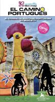
Fietsgids El Camino Portugués | Petirrojo Ediciones

0
Spaantalige fietsgids van deze route! Wel met goede kaarten en een gedetailleerde schaal. Vertaling: Van de routes naar Santiago die de Portugese geografie doorkruisen, is de Caminho Português Central de meest traditionele en ontwikkelde. Het verlaat Lissabon en in Porto is het verdeeld in drie routes, de Central die landinwaarts verder gaat, de C...

Verkopers met dit product

Verkoper
Bezorging
Prijs
DeZwerver.nl logo
DeZwerver.nl
2,95
25,95

Anderen bekeken ook

Fietsgids El Camino Portugués | Petirrojo Ediciones
Spaantalige fietsgids van deze route! Wel met goede kaarten en een gedetailleerde schaal. Vertaling: Van de routes naar Santiago die de Portugese geografie doorkruisen, is de Caminho Português Central de meest traditionele en ontwikkelde. Het verlaat Lissabon en in Porto is het verdeeld in drie routes, de Central die landinwaarts verder gaat, de Caminho da Costa met de Senda Litoral en de Camino de Braga, praktisch in onbruik geraakt. Galicië volgt dezelfde dynamiek en, naast de officiële route, combineren de Spirituele Variant en de Padre Sarmiento-route de essentie van het pad door de zeegezichten van de Rías Baixas. Een netwerk van onderlinge verbindingen verrijkt de meer dan 900 km Portugees-Galicisch gebrabbel. Met de bici:map-gids kunt u uw route kiezen op basis van uw wensen. De gids omvat: gedetailleerde kaarten op 1/75000 635 km route verdeeld in 11 etappes GPS-tracks om te downloaden van de bicimap-website praktische informatie en accommodatie toeristische belangen moeilijkh…
25,95
Fietsgids El Camino del Norte en bicicleta | Petirrojo Ediciones
Dit is een praktische en duidelijke gids voor de pelgrim-fietser/fietsster die de Kustroute wil volgen. Met een totaal van meer dan 13000 m hoogteverschillen, is de Camino de la Costa een veeleisende route. Maar elke pelgrim wordt beloond door de grote verscheidenheid aan landschappen.   De gids verdeelt de 873 km in 16 etappes. De Camino start op de Puente de Santiago tussen Hendaye en Irún, doorkruist de grote badsteden en Bilbao, langs Gijón en Avilés tot Ribadeo. Daar draait de route naar het zuiden, richting Santiago de Compostela. Een korte variante verlengt de kustweg van Ribadeo tot Foz vooraleer zuidelijk te fietsen tot Mondoñedo.   Na de beschrijving van elke etappe volgt een opsomming van de overnachtingsmogelijkheden en de markantste eetgelegenheden. Vele korte varianten staan ingetekend op de kaarten.
24,95
Fietsgids El Camino de Santiago en bicicleta | Petirrojo Ediciones
Van de uitgever:   Er zijn veel gidsen over de Franse Camino de Santiago. Hoe verschilt de bici:map-gids van de andere?:   voornamelijk in de kwaliteit van de cartografie. De schaal 1:75.000 is perfect voor fietsers, en we hebben ons niet alleen beperkt tot het tekenen van de Camino, maar ook de omliggende paden en snelwegen. Soms is het beter om voor een alternatief te kiezen omdat het pelgrimspad niet altijd befietsbaar is. Op de kaart hebben we bepaalde aspecten uitgelicht die de fietser kunnen interesseren, zoals verharde en onverharde stukken, belangrijke beklimmingen (afgezien van het etappeprofiel), steenachtige of gevaarlijke stukken, enz., en ook bezienswaardigheden.   In de etappecommentaren hebben we bevoorrechte specifieke informatie voor bicipilgrims, zowel voor motorrijders (MTB en bikepackers) als voor de rustigere die niet in aubergines willen stappen (bijvoorbeeld proefafdalingen). We belichten ook de hostels die een plek hebben om fietsen te stallen, fietsenwinkels e…
24,95
Fietsgids La Via de la Plata | Petirrojo Ediciones
Handige fietsgids van de Via de la Plata in spiraabinding. Met goede kaarten en hoogteprofielen. Franstalig. 1ère édition de ce trajet en français disponible sur Cartovelo.fr ! En 16 étapes et près de 1000 km, découvrez la partie esapgnole du chemin de Compostelle, allant de Séville à Saint-Jacques-de-Compostelle.   Ce guide vélo contient les informations essentielles pour tirer le meilleur du voyage à vélo : – les commentaires d’étapes (qualité du chemin, distances, points d’eau…) – les profils topographiques de chaque étape (dénivelés) – les informations pratiques des villes traversées ‘où dormir et où manger) – des variantes afin de s’écarter de la route traditionnelle   Le point fort du guide : la cartographie faite sur mesure par et pour des cyclo voyageurs.
22,95
Wandelkaart Picos de Europa National | Adrados Ediciones
Picos de Europa National Park Short and Long-Distance Trails at 1:50,000 on an excellent, contoured and GPS compatible map from Adrados Ediciones highlighting three hiking routes which can be combined into a Tour of the Picos, plus English language descriptions of the routes and lists of mountain huts and refuges.   The map covers the whole of the National Park area and extends north and west beyond its borders to include Potes and other surrounding villages. Very fine cartography provides an excellent presentation of the terrain through contours at 20m intervals enhanced by relief shading and altitude colouring, numerous spot heights, and plenty of names of peaks and other topographic features. Symbols highlight locations of campsites, mountain huts, refuges and hostels, as well as petrol stations on local roads. The map has a 1-km UTM grid.   A special feature of this map is an overprint highlighting three long-distance hiking routes: a circuit of the western massif, a traverse of t…
14,95
Fietsgids Cycling the Camino de Santiago | Cicerone
The Camino de Santiago de Compostela (Camino Francés or Way of St James) is among the world's most famous pilgrimages: Christian pilgrims have travelled to the shrine of St James in Santiago, northern Spain, since the ninth century. This guide provides all the information you need to successfully cycle the Camino. The Camino Francés is the most popular variant of the Camino, linking St Jean-Pied-de-Port on the French-Spanish border with Santiago via Pamplona, Burgos and León. The guide presents the journey in 18 stages. Two versions of the route are described, the first (770km) based closely on the walkers' route and suitable for hybrid or mountain bikes; the second (798km) a 'road route' for road and touring cycles. It can be cycled in around 10-14 days and is very well provisioned. Clear route description and mapping are accompanied by notes on local points of interest, as well as background information on Spanish history and the history of the Camino. The practicalities are also t…
18,95
Wandelatlas - Pelgrimsroute Camino Portugués | Village to Village Press
Prettig lichtgewicht gidsje met alle kaarten van de route op gedetailleerd nivo en de basisinformatie voor de route. Voor de wandelaar een goed alternatief voor de wat zwaardere meer uitgebreide gidsen. Fully updated for 2025! This Village to Village Map Guide to the Camino Portugués is a lightweight minimalist guidebook to walking the Way of Saint James from Lisbon and Porto to Santiago de Compostela on the Camino Portugués. The Camino Portugués traverses Portugal with options to remain inland on the traditional Central Route or explore the coast on the newer Coastal route, including the Variante Espiritual! Let op: de Fatima route is dus alleen digitaal beschikbaar bij de uitgever, dit staat niet in de gids. New for 2025 - information on the Fátima route including free GPS tracks for download. This map guide to the Camino Portugués provides walking information for over 1100km of the Camino Portugués on the Coastal, Central, Senda Litoral, Variante Espiritual and Fátima routes: - Ful…
25,50
Wandelgids - Pelgrimsroute The Camino Portugués | Cicerone
A guidebook to walking the Camino Portugués (Portuguese Way), 620km from Lisbon in Portugal to Santiago in Spain. The book gives stage-by-stage directions for the Central Camino, starting from Lisbon, Porto or Tui, the Coastal Camino between Porto or Vigo, and the Spiritual Variant route from Pontevedra to Redondela. It also describes link routes that can be used to swap from one route to another. Detailed route guidance and maps are accompanied by fascinating information about historic and religious sites passed along the way. It is packed with essential information for pilgrims, with advice on getting there, when to go, where to stay and equipment. An indispensable facilities table showing the availability of accommodation, refreshments, supermarkets, ATMs and pharmacies along the route, and a handy glossary, make this the complete guide to the Camino. Since 1211 Santiago de Compostela has been a place of holy pilgrimage and the Camino Portugues is the second most travelled pilgri…
26,50
Wandelgids Camino Portugués Maps | Camino Guides Brierley
Gids met kaartmateriaal voor de Camino Portugues naar Santiago de Compostela. De wandelkaarten ca. schaal 1:100.000 met begeleidende tekst in Engels, Spaans, Frans, Duits, Portugees, Italiaans, Nederlands en Pools en hoogteprofielen   Spiritual seekers and travellers will find all the resources they need to walk the Way of St. James in this complete set of maps and town plans covering the sacred route from Lisbon, via Porto, to Santiago de Compostella, including the alternate coastal route. The 2022 edition also includes a Spiritual Variant and a Littoral Path.   This newly updated, portable travel companion is light enough to carry while walking long distances each day and contains maps with locations of all pilgrim hostels, the distances between villages, and points of interest, as well as alternative routes and accommodations. The entire guide is provided in five languages: English, Spanish, Portuguese, Italian and German.  
18,50

Klanten-reviews van Fietsgids El Camino Portugués | Petirrojo Ediciones

Er zijn nog geen beoordelingen voor dit productBen jij de eerste die een review plaatst?

Meer over Fietsgids El Camino Portugués | Petirrojo Ediciones

Productomschrijving

Spaantalige fietsgids van deze route! Wel met goede kaarten en een gedetailleerde schaal.

Vertaling: Van de routes naar Santiago die de Portugese geografie doorkruisen, is de Caminho Português Central de meest traditionele en ontwikkelde. Het verlaat Lissabon en in Porto is het verdeeld in drie routes, de Central die landinwaarts verder gaat, de Caminho da Costa met de Senda Litoral en de Camino de Braga, praktisch in onbruik geraakt. Galicië volgt dezelfde dynamiek en, naast de officiële route, combineren de Spirituele Variant en de Padre Sarmiento-route de essentie van het pad door de zeegezichten van de Rías Baixas. Een netwerk van onderlinge verbindingen verrijkt de meer dan 900 km Portugees-Galicisch gebrabbel. Met de bici:map-gids kunt u uw route kiezen op basis van uw wensen.

De gids omvat: gedetailleerde kaarten op 1/75000 635 km route verdeeld in 11 etappes GPS-tracks om te downloaden van de bicimap-website praktische informatie en accommodatie toeristische belangen moeilijkheidsgraden boek spiralen Functies :   Editie: 2023 Spaanse taal Afmeting: 23x13cm Aantal pagina's: 103 Gewicht: 0,220 kg

Productinformatie

    Verken gerelateerde categorieën

    Webshop.nl maakt gebruik van cookies. Ga je verder op onze website, ga dan akkoord met het plaatsen van cookies en de verwerking van deze data door ons en vermelde partners.