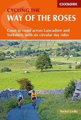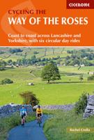
Fietsgids Cycling the Way of the Roses | Cicerone

0
Guidebook to the Way of the Roses, a 170-mile coast-to-coast cycle route across Lancashire and Yorkshire. The three-day journey (alternative two, four and five day itineraries are also outlined) begins in Morecambe and finishes in Bridlington, linking scenic country lanes, minor roads and traffic-free cycle paths. Six excellent day rides, located ...

Verkopers met dit product

Verkoper
Bezorging
Prijs
DeZwerver.nl logo
DeZwerver.nl
2,95
16,50

Anderen bekeken ook

Fietsgids Cycling the Reivers Route | Cicerone
Guidebook to the Reivers Route, a 173 mile (280km) coast-to-coast cycle route across northern England and into Scotland from Tynemouth to Whitehaven. Exploring the rich history of traditional border territory, it is suitable for cyclists of all abilities and most commonly tackled on hybrid or sturdy touring bikes. Road alternatives are available. As the wildest of the northern coast-to-coast cycle routes, the Reivers Route explores the rich Border Reiving history of northern England and the Scottish Borders. Travelling 173 mile (280km) from Whitehaven to Tynemouth, this four-day cycle tour takes in the Cumbrian coast, northern Lake District, Northumberland National Park and North Tynedale, offering memorable off-road cycling through Kershope Forest and around Kielder Water. The route offers both on and off-road cycling, and is suitable for cyclists using touring or hybrid bikes. Places to stay overnight include Carlisle, Bailey Mill and Bellingham.   The guidebook also offers the Bord…
16,50
Fietsgids Cycling in the Hebrides - Schotland | Cicerone
Prachtige fietsgids, zeer inspirerend , van een bijzonder fietsgebied. goede routesuggesties, Veel informatie, met hoogteprofielen en praktische zaken. The 37 day routes and 22 link routes brought together in this guide offer cyclists of all abilities the opportunity to island-hop by bike across the Hebrides, visiting over 20 islands in six sections: Clyde and Kintyre; Colonsay, Islay and Jura; Mull, Coll and Tiree; Skye and Raasay; Barra and the Uists; and Harris and Lewis. From Skye's majestic Cuillin mountains to the palm trees of Bute and the white sands of Tiree and Harris, there is nowhere better to indulge your sense of adventure and experience the thrill of travelling under your own steam in the fresh air. The Hebrides from Islay in the south up to Lewis in the north are all included, along with Arran and its neighbouring islands in the Firth of Clyde, and this comprehensive guide contains all the information you need - from ferry schedules to refreshment stops and bike repair…
22,50
Fietskaart Cycling guides Exmoor - North Devon | Goldeneye
Scheur- en watervast foetskaart van Exmoor en Noord Devon met ingetekende fietsroutes.   Our maps are double-sided, printed on an A2 sheet with a concertina fold. This allows for easy folding and folding, and an ease of access to the mapping. The material is rain and tear-resistant. Our early maps were designed at the scale of 2 miles to 1 inch/1:126,720. The later designs along with digitalisation are 1: 100,000. We were encouraged by the Cycle Touring Club to convert our cartography toward the cycle market (to replace the out-of-print Bartholomew series). As time and the series progressed we have added more data: The National Cycle Network routes, Regional Routes, and Traffic-Free Family Routes, as and when they are developed. These routes are in addition to the Circular Routes Goldeneye Commissioned at the outset of our publishing schedule. We are also adding to new editions; bike shops, cycle hire, and tea rooms, along with the tourist attractions already featured. Our plan is to …
12,95
Fietsgids Cycling in the Peak District | Cicerone
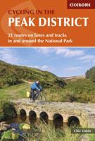
Guide to cycling in and around the Peak District National Park, on road or trail bike. 20 day routes and one multi-day cycle tour of the Peak District. All easily accessible from Sheffield and Manchester with routes starting from charming Derbyshire towns such as Ashbourne, Matlock, Bakewell and Buxton. Includes route profiles and 1:100000 mapping. The scenic Peak District boasts an abundance of country lanes, tracks, towpaths and railway trails that are perfect for two-wheeled exploration. This guidebook presents 20 graded day rides in the national park, along with a challenging 250km route, the five-day 'Tour de Peak District'. With a focus on quiet lanes, gratifying downhills and not overly technical bridleways, tracks and trails, the routes are ideal for gravel/adventure bikes (or hybrid/cross), though most can be easily adapted for road bikes.   Each ride features step-by-step route description accompanied by 1:100,000 mapping. Overview stats are provided to aid route selection, …
18,50
Fietsgids The Elbe Cycle Route - Elbe fietsroute | Cicerone
This 1245km route along one of Europe's great rivers follows the Elbe from its source to the North Sea coast, visiting Prague, Dresden, Magdeburg and Hamburg. 28 day-stages of easy, flat cycling mainly on quiet country roads and dedicated cycle tracks. Here is a guidebook to the Elbe Cycle Route, possibly the easiest long-distance cycle route in Europe, being almost entirely flat or downhill for some 1200km. Cruise alongside one of Europe's great rivers as it flows from its source, through Czechia and Germany to the North Sea. This guidebook describes the route across 29 stages (together with a practical prologue stage), with stages ranging from 21 to 69 kilometres. Suggested schedules include 13, 15, 17 and 19 day options, making this a perfect 2-3 week cycle tour.   Map extracts at a scale of 1:150 accompany clear route description, with gradient profiles provided where they are helpful. Background information on the region's history and natural environment is also provided, as are …
24,95
Fietsgids Hadrian's Cycleway | Cicerone
Hadrian's Cycleway is a 174 mile route from Ravenglass in Cumbria to South Shields. Also known as Route 72, this coast-to-coast route heads north up the Cumbrian coast to reach the Solway AONB before crossing northern England along Hadrian's Wall and into Northumberland. Suitable for cyclists of all abilities, the ride is usually completed over three days from west to east.   The route allows cyclists to explore Hadrian's Wall World Heritage Site, visiting Roman forts including Vindolanda and Housesteads as well as milecastles, abbeys and historic towns. Other highlights include the Cumbrian coast, Tyne Valley and the famous Sycamore Gap.   While the main route is described from west to east over three days, the guide provides plenty of information about other options. Advice is given at the end of each stage about how to complete the route from east to west, as the route can be used in connection with other coast to coast routes to create week-long round trips. Other itineraries incl…
16,50
Fietsgids Cycling in the Cotswolds | Cicerone
Guidebook of 21 half and full-day day cycle routes, and one four-day 200km tour of the Cotswolds. All the routes described are suitable for hybrid or mountain bikes, and most routes have an on-road alternative. The Cotswolds boasts cycle-friendly lanes, rolling countryside, canal paths and bridleways perfect for exploration by bike The Cotswolds is home to pretty honey-hued stone villages set in a landscape of rolling countryside. The dramatic 100-mile limestone escarpment offers breathtaking views, while the network of quiet lanes, cycle-friendly canal paths, tracks and bridleways is perfect for exploration on a bicycle.   All the routes described here are suitable for hybrid or mountain bikes and graded from easy through to challenging, with information on surface, distance and ascent as well as those all-important en route cafés and pubs. Where the main cycle route described goes off-road, and on-road alternative is described for almost every ride. Some exciting off-road sections a…
18,50
Fietsgids The Canal de la Garonne | Cicerone
Een gids voor het fietsen langs het Canal de la Garonne in Frankrijk, met een beschrijving van de 290 km lange fietsroute van Bordeaux naar Toulouse, waar deze verbinding maakt met het Canal du Midi. Beschrijft een 135 km lange excursie naar de Atlantische Oceaan, met omleidingen naar vele historische steden en dorpen langs de route. Met informatie over accommodatie, faciliteiten en fietswinkels op de route.   This guidebook presents a cycle ride along the Canal de la Garonne in the south of France. The 260km route is covered in 7 stages from bustling Bordeaux to the splendid rose city of Toulouse, with a 135km excursion from to Lacanau on the Atlantic coast. Optional side trips explore the countryside and historical towns and villages, including Agen, Moissac, Marmande and Montauban. Mainly flat and easy cycling, including 193km along the main canal towpath, this is an easy route suitable for lone cyclists, families, groups and those using e-bikes. It is perfect for those planning a …
20,95
Wandelgids The Cleveland way and the Yorkshire Wolds way | Cicerone
Uitstekende wandelgids van de Cotswolds Way, waarbij naast alle noodzakelijke informatie ook gebruik gemaakt wordt van de echte topografische kaart. Inclusief gidsje met routekaarten van 1:25000 Guidebook to the Cleveland Way and Yorkshire Wolds Way National Trails, plus the Tabular Hills Walk link route. The guidebook also contains a 1:25,000 scale OS route map booklet of the Cleveland Way.   The Cleveland Way National Trail, described in seven day stages, is a fine 177km (110 miles) walk around the North York Moors National Park from Helmsley to Filey. The Yorkshire Wolds Way is one of the quietest of Britain's National Trails and wanders for 130km (80 miles) through gentle, cultivated and sparsely populated countryside. Described here in nine day stages, from Hessle near Redcar to Filey, it links end-to-end with the Cleveland Way on the coast. Also described is the three-day, 80km (50 mile) Tabular Hills Walk, a Regional Trail that allows walkers to close the loop of the Cleveland …
25,95
Fietskaart Cycling guides Dartmoor - South Devon | Goldeneye
Dartmoor. One of England’s greater National Parks; the Forest of Dartmoor covers 365 square miles and contains the highest ground in England south of the Peak District. On its desolate moorland tracks the wanderer can believe they are further from a public road than anywhere in the country, but on the fringes lush valleys lead down on every side to thick woodland, green vegetation and picturesque villages. Dartmoor is well known for its wildlife - attractive herds of ponies, seemingly wild but in fact individually owned, foxes, badgers and otters - also the occasional adder. Fallow, roe and Sitka deer can often be seen, but the red deer of Exmoor have never penetrated the area. Buzzards, kestrels and various Birds of Prey are frequently seen, as well as the wheatear, while crows, ravens and the skylark are fairly commonplace. The Moor abounds in prehistoric remains. There are also many deserted medieval villages with remains of the traditional ‘longhouse’ buildings. For centuries tin …
12,95

Klanten-reviews van Fietsgids Cycling the Way of the Roses | Cicerone

Er zijn nog geen beoordelingen voor dit productBen jij de eerste die een review plaatst?

Meer over Fietsgids Cycling the Way of the Roses | Cicerone

Productomschrijving

Guidebook to the Way of the Roses, a 170-mile coast-to-coast cycle route across Lancashire and Yorkshire. The three-day journey (alternative two, four and five day itineraries are also outlined) begins in Morecambe and finishes in Bridlington, linking scenic country lanes, minor roads and traffic-free cycle paths. Six excellent day rides, located in the vicinity of the main route, are also described.   Clear and concise route description is accompanied by 1:100K mapping and gradient profiles, guaranteeing problem-free navigating. Also included is handy advice on practicalities such as preparation, equipment, accommodation and travel logistics to and from the start and finish of the route.   A challenge within the reach of cyclists of all abilities and a satisfying traverse across country, the Way of the Roses takes in idyllic villages, castles, cathedrals, abbeys and prehistoric sites, along with stunning natural features such as the Three Peaks, Brimham Rocks and Flamborough Head

Verken gerelateerde categorieën

Webshop.nl maakt gebruik van cookies. Ga je verder op onze website, ga dan akkoord met het plaatsen van cookies en de verwerking van deze data door ons en vermelde partners.