Fietsgids Cols and Passes of the British Isles

0
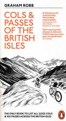
A col is the lowest point on the saddle between two mountains. Graham Robb has spent years uncovering and cataloguing the 2,002 cols and 105 passes scattered across the British Isles. Some of these obscure and magical sites are virgin cols that have never been crossed. Dozens were lost by the Ordnance Survey and are recorded only in ballads or mo...

Verkopers met dit product

Verkoper
Bezorging
Prijs
DeZwerver.nl logo
DeZwerver.nl
2,95
18,50

Anderen bekeken ook

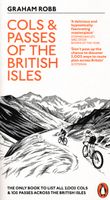
Fietsgids Cols and Passes of the British Isles
A col is the lowest point on the saddle between two mountains. Graham Robb has spent years uncovering and cataloguing the 2,002 cols and 105 passes scattered across the British Isles. Some of these obscure and magical sites are virgin cols that have never been crossed. Dozens were lost by the Ordnance Survey and are recorded only in ballads or monastic charters. The eleven cols of Hadrian's Wall are practically unknown and have never been properly identified. These underappreciated slices of natural beauty provide a new way of looking at British history, and a challenge for cyclists and walkers.
18,50
Reisinspiratieboek Wanderlust British and Irish Isles | Gestalten Verlag
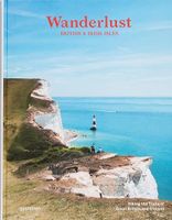
From breathtaking nature to timeless culture, explore the hiking trails and the wonders of the British Isles. The British and Irish Isles are a paradise for hikers. They provide a unique blend of breathtaking nature, fascinating local history, and timeless culture. Stunning photography showcases the diverse natural landscapes and rich national history of the region. The book offers maps, valuable insights on the trails, the best time to hike them, and regional specialties that will help readers make the most of their adventures. Whether you're an avid hiker or an armchair traveler, this new addition to the Wanderlust series will take you from the heart of the Scottish Highlands, to the Lake District, Ireland, and onward to the expansive coastline of the English Riviera. In addition to highlighting the natural and historical monuments of the islands, this book celebrates the best hiking trails and details the best of British and Irish culture, providing readers with some unique spots t…
55,95
Spoorwegenkaart The British Isles by Train and Ferry | Cosmographics
Plan your journey and explore the British Isles by train and ferry. This attractive, detailed map shows how the rail network, along with ferries to the more isolated areas, allows you to travel to places right across the British Isles and take in the beautiful scenery. The map clearly shows National Parks, Areas of Outstanding Natural Beauty, forest and woodland areas and the Heritage Coast in England and Wales, much of which is accessible by train and ferry. The rail network includes seasonal and heritage railways. There is also a more detailed map of the London National Park City, the world’s first National Park City. Designed to be fully inclusive and accessible for everyone, including those with colour vision deficiency (CVD).   Map includes:   Passenger rail network with the majority of stations. Seasonal and heritage railways Ferry routes National Parks Areas of Outstanding Natural Beauty Main forest and woodland areas Heritage coast in England and Wales Formaat:  74.5cm …
19,50
Wandkaart Engeland - British Isles roadplanning wall map | 84 X 119 cm | Maps International
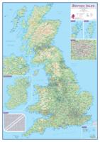
Routeplanner map from Maps International's selection of British Isles maps.   Routeplanning map details: British Isles routeplanning map shows the motorways, major roads and transport hubs such as airports and rail routes in the UK. Routeplanner maps shows the major towns and their approximate population in the British Isles. Routeplanner map also contains useful table of towns and their distance apart. Extremely useful in organising journeys - times and routeplanning.   Map Uses: This British Isles routeplanning map is ideal to display in offices or depots.
75,95
Magneetbord - Wandkaart British Isles - Groot Brittannië en Ierland, 61 x 76 cm | National Geographic
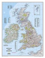
Magneetbord van een wandkaart van Groot Brittannië en Ierland: prachtig kaartbeeld met heel veel details, gemaakt door de gerenommeerde makers van National Geographic. British Isles at 1:1,687,000 on a small wall map, 61 x 76cm (1’11” x 2’5” approx) , from the National Geographic Society showing the constituent parts of the United Kingdom, Irish Republic, Isle of Man and the Channel Islands. Shetland Islands are shown on an inset. The map uses NGS’s classic presentation style of white background plus relief shading to show the topography, with boundaries shown in colour. Within Great Britain, national parks are prominently highlighted. Names of many geographical regions are shown (The Wolds, South Downs, etc.); county boundaries are marked, but county names are indicated only by numbers cross-referenced to lists of counties and unitary authorities in England, with corresponding lists for Scotland, Wales, Northern Ireland and the Irish Republic. Latitude and longitude lines are drawn a…
189,-
Fietsgids Cycling in Cornwall and the Scilly Isles | Bradt Travel Guides
Experienced travel writer and cyclist Huw Hennessy takes you on 21 hand-picked bike rides across Cornwall and the Isles of Scilly. With routes from around an hour up to a full day, Cycling in Cornwall & the Isles of Scilly is ideal for families and leisure cyclists - anyone who wants to get fit and enjoy the fresh air in some of Britain's most beautiful countryside. The rides connect the region's top attractions: beaches, fishing ports, stately homes, nature reserves and heritage sites, including many hidden, lesser-known gems. Several of the routes interlink or follow a circular loop, allowing more ambitious cyclists to build up more challenging rides.Visit world-famous sites such as Land's End, St Michael's Mount, the Eden Project and the Tresco Abbey subtropical gardens. Follow the Camel Trail, two connecting cycle routes on a disused railway line. Career around muddy trails in Cardinham Woods. Ride the off-road Pentewan Trail, visiting the Lost Gardens of Heligan en route. Explore…
18,95
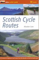
Fietsgids Scottish Cycle Routes | Mica Publishing
Goede beschrijvingen, redelijke kaarten, soms met hoogteprofielen.   In the cyclists' guide series from Mica publishers, here are 30 circular road cycle routes of 35 miles to 115 miles, exploring the best of Scotland's panoramic back roads from the Far North-West to the Borders. The routes include two Cairngorm crossings and the spectacular Bealach na Ba in Applecross, some of the toughest and most spectacular challenges in the country, as well as gentler cross-country and coastal routes round the Black Isle, Moray Coast, Ayrshire, Arran and East Lothian.    These day circuits include detailed descriptions and Ordnance Survey mapping, plus variations and extensions to ensure you get the best from your day. Route profiles indicate uphill and downhill sections and the spread of total height gain. There are also route fact files indicating starting point, distance, height gain, maximum gradient and approximate time. There are extensions & variations to shorten and lengthen routes, plus a…
19,95
Wegenkaart - landkaart 92G Lower Mainland British Columbia - Richmond and New Westminster | ITMB
Goede wegenkaart van British Columbia met topografische uitsnede van Richmond en Westminster. Topographic/Recreation Map 92G&92G2 and G3 - With the 2010 Winter Olympics bearing down on us, this very timely map presents a lovely regional map showing all of the Olympic venues (the Games are being held in Vancouver, Richmond, UBC, Whistler, and the Callaghan Valley – not just in Vancouver). The area of coverage is from Everett (just north of Seattle) in the USA to north of Pemberton, and from Victoria in the west to Chilliwack in the east on the one side, and a detailed 1:50,000 topo map of the Richmond/New Westminster/Surrey/Langley outer urban areas of Metro Vancouver. Both maps are Government of Canada NTS maps, overlaid with touristic and recreational information by ITMB, which holds the copyright on behalf of the Queen (I love being able to say that). The Lower Mainland portion is particularly useful, in that it includes the east coast of Vancouver Island, from Victoria to Nanaimo a…
13,95
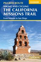
Wandelgids - Fietsgids Hiking and Cycling the California Missions Trail - Californie | Cicerone
Guidebook to hiking or cycling the 800 mile (1289km) California Missions Trail between San Francisco Bay and San Diego. The pilgrimage trail takes in 21 historic Spanish missions and can be completed in 50-60 walking days or 2-3 weeks cycling. With 1:100,000 mapping, route description, and details of accommodation and facilities for each stage. Ancient footpaths became connecting routes between the Spanish missions, pueblos, and presidios in the period 1769 to 1823. Over time these routes became automobile roadways and were marked with bells starting in 1906 to promote and preserve the El Camino Real. Today, the California Missions Trail follows a pedestrian route through urban cities and historic towns, through forest paths and country lanes, to each of the twenty-one historic Spanish missions. The 800-mile California Missions Trail leads walkers and cyclists through some of the most scenic and historic sites of one of America's most beautiful states. The 21 missions, founded 200-250…
26,50
Fietsgids The Wild Atlantic Way and Western Ireland - Ierland | Cicerone
Uitstekende fietsgids van Cicerone over de westkust van Ierland. De routes zijn goed beschreven, met veel praktische informatie. Kaartmateriaal is redelijk, om echt op te fietsen wat summier.  Boasting deserted beaches, towering sea-cliffs and tiny harbours - not to mention rich cultural and historical interest - the west of Ireland has much to entice the visitor, and with many miles of quiet roads, it's a cyclist's paradise. The Wild Atlantic Way is a driving route along Ireland's Atlantic seaboard, covering over 2,350km of coastline and showcasing the region's breathtaking landscapes. This guide adapts the route for cyclists - and throws in a couple of other highlights (such as the Aran Islands and Killarney) for good measure. Since relatively few people are likely to have seven weeks to spare for a full Wild Atlantic Way tour, the book presents six self-contained cycle tours, each offering 7-10 days of riding. For the full Wild Atlantic Way experience, these distinct routes can be…
20,95

Klanten-reviews van Fietsgids Cols and Passes of the British Isles

Er zijn nog geen beoordelingen voor dit productBen jij de eerste die een review plaatst?

Meer over Fietsgids Cols and Passes of the British Isles

Productomschrijving

A col is the lowest point on the saddle between two mountains. Graham Robb has spent years uncovering and cataloguing the 2,002 cols and 105 passes scattered across the British Isles.

Some of these obscure and magical sites are virgin cols that have never been crossed. Dozens were lost by the Ordnance Survey and are recorded only in ballads or monastic charters. The eleven cols of Hadrian's Wall are practically unknown and have never been properly identified.

These underappreciated slices of natural beauty provide a new way of looking at British history, and a challenge for cyclists and walkers.

Productinformatie

    Verken gerelateerde categorieën

    Webshop.nl maakt gebruik van cookies. Ga je verder op onze website, ga dan akkoord met het plaatsen van cookies en de verwerking van deze data door ons en vermelde partners.