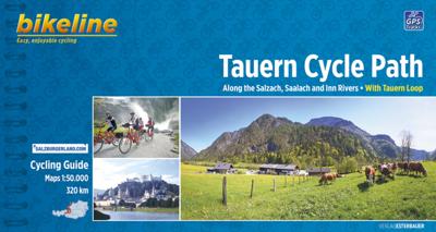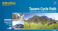
Fietsgids Bikeline Tauern Cycle path | Esterbauer

0
The Tauern Cycle Path takes its name from the impressive Hohen Tauern mountain range. But don't worry, the route takes you through the flat valley of the Salzach River, where you only occasionally have to overcome gradients. On the 320 Kilometre route from the spectacular Krimml Waterfall, through the Salzburger Land and out into the alpine forela...

Verkopers met dit product

Verkoper
Bezorging
Prijs
DeZwerver.nl logo
DeZwerver.nl
2,95
14,50

Anderen bekeken ook

Fietsgids London - Land's End Cycle Route | EOS Cycling Holidays Ltd
The guidebook contains routes from both Dover and Harwich ferry ports to London. This makes it possible to cycle around the English Channel, when also using the Plymouth link. The Dover to London route takes you though the fruit orchards of Kent, historic Canterbury and the Medway estuary with its impressive castles.   The Harwich to London route provides pleasant countryside cycling in Essex and takes you through Roman Colchester. Cycling through the heart of London, our route manages to stay away from busy roads, the occasional busy junction crossing excepted. Most of the cycling takes place on towpaths along the River Thames with spectacular views to enjoy.   You will cycle under the Tower Bridge and you'll pass the London Eye, Big Ben, the Houses of Parliament and Buckingham Palace on the way. Greenwich Park, Hyde Park and Richmond Park all provide superb green traffic-free routes. Heading west you'll cycle by Windsor Park and Windsor Castle before making your way to the Aon & Ken…
41,50
Fietskaart 10 Cycling guides North York Moors | Goldeneye
Scheur- en watervast foetskaart van de North York Moors  met ingetekende fietsroutes.   Our maps are double-sided, printed on an A2 sheet with a concertina fold. This allows for easy folding and folding, and an ease of access to the mapping. The material is rain and tear-resistant. Our early maps were designed at the scale of 2 miles to 1 inch/1:126,720. The later designs along with digitalisation are 1: 100,000. We were encouraged by the Cycle Touring Club to convert our cartography toward the cycle market (to replace the out-of-print Bartholomew series). As time and the series progressed we have added more data: The National Cycle Network routes, Regional Routes, and Traffic-Free Family Routes, as and when they are developed. These routes are in addition to the Circular Routes Goldeneye Commissioned at the outset of our publishing schedule. We are also adding to new editions; bike shops, cycle hire, and tea rooms, along with the tourist attractions already featured. Our plan is to m…
14,95
Fietsgids Bikeline Iron Curtain Trail 3 - German-German Border Trail | Esterbauer
Praktische fietsgids met detailkaarten, ingetekende route, informatie over overnachten en fietsenmakers, zwaarte en hoogteprofiel. In spiraalbinding, Engelstalig   The Iron Curtain ran for about 7,000 km from the Barents Sea in the north straight through Europe to the Black Sea and divided the continent in East and West. Until the Velvet Revolution in Eastern Europe it was a physical and ideological border between two blocks which conceived each other as enemies. Not only were many neighbouring states divided, but Germany itself was divided into east and west. Today there are hardly any reminders that the wall ever existed.   The border in Germany was 1,400 km long. The former death strip was composed of 3.000 km of fences, car-trenches for 730 km, 830 observation towers, the brightly lit roads, walls and bunkers – most of it is gone. Remaining are the vehicle roads with their perforated paving stones and several observation towers. And in a few years the sparse vegetation will be sup…
17,95
Fietsgids Moesel - The Moselle Cycle Route | Cicerone
This guidebook covers the entirety of the Moselle river’s course, from its source in the Vosges Mountains of eastern France to its confluence with the Rhine at the west German city of Koblenz. The well-waymarked route reaches historic Nancy and Metz, crosses into Luxembourg and continues through the spectacular Mosel gorge, where the river cuts a sinuous path between the Hunsrück and Eifel Mountains.   The great attraction to a cyclist of following a river from its source is that, once you have reached the start, it's all downhill. From the easily reached source near the Col de Bussang, the Moselle cycle route descends over 650m to the Rhine at Koblenz. At Koblenz, the route can be linked with The Rhine Cycle Route.   In addition to the main route, excursions are described to visit Toul on the Boucles de Moselle, Luxembourg Ville in the Duchy of Luxembourg and through the Saar and Rhine gorges.   Accommodation and places to eat and drink en route are plentiful. Mostly off-road and on …
20,95
Fietskaart Cycling guides Dartmoor - South Devon | Goldeneye
Dartmoor. One of England’s greater National Parks; the Forest of Dartmoor covers 365 square miles and contains the highest ground in England south of the Peak District. On its desolate moorland tracks the wanderer can believe they are further from a public road than anywhere in the country, but on the fringes lush valleys lead down on every side to thick woodland, green vegetation and picturesque villages. Dartmoor is well known for its wildlife - attractive herds of ponies, seemingly wild but in fact individually owned, foxes, badgers and otters - also the occasional adder. Fallow, roe and Sitka deer can often be seen, but the red deer of Exmoor have never penetrated the area. Buzzards, kestrels and various Birds of Prey are frequently seen, as well as the wheatear, while crows, ravens and the skylark are fairly commonplace. The Moor abounds in prehistoric remains. There are also many deserted medieval villages with remains of the traditional ‘longhouse’ buildings. For centuries tin …
12,95
Fietskaart Cycle Map Pennine Cycleway South | Sustrans
The official route map for the 136-mile (219km) southern part of the Pennine Cycleway on National Cycle Network Route 68 from Derby to Settle.   This linear map shows the route and immediate surrounding area over a series of separate map panels. The full colour map based on Ordnance Survey data shows clearly mapped cycle routes on traffic-free paths, quiet lanes and roads, with easy to read contours, route profiles and mile markers. Also features detailed inset maps for the major towns and cities, tourist info and cycle shop and hire information, and other local routes.   The southern half of the Pennine Cycleway is a beautiful, yet challenging ride which takes you through the dramatic scenery of the Peak District and the South Pennines. The route takes you from the bustling railway city of Derby to the historic town of Settle, taking in the famous spa town of Buxton and the lovely Yorkshire town of Holmfirth, renowned location of the TV classic “Last of the Summer Wine”.   This secti…
13,50
Fietsgids Bikeline Cycling guide Provence | Esterbauer
Provence – The name alone sounds inviting to every traveller. The region’s wonderfully mild climate and many quiet paved roads makes it an ideal destination for bicycle tourists year round. Let yourself be enchanted by ancient towns and historic monasteries, by the scent from fields of rich lavender, the charm of tiny villages and French joie de vivre. Enjoy the contrasts presented by the peaceful expanses of the Camargue, with its glittering blue bays and herds of Camargue horses grazing in a landscape dotted with brilliantly white farmsteads. A refreshing plunge into the Mediterranean is just one of the many highlights of this bicycle tour. This Cycling Guide includes detailed maps of the countryside and of many cities and towns, precise route descriptions, information about historic and cultural sites as well as background information and a comprehensive list of overnight accommodations. The only thing this guide cannot provide is fine cycling weather, but we hope you find nothing …
13,50
Wandelgids Thames Path | Trailblazer Guides
This book follows the Thames Path National Trail from the river's source in Gloucestershire to the Thames Barrier in London. Officially 184 miles (294km) in length (although the actual distance you walk will depend on a number of decisions you make en route), the path meanders, accompanied by its watery muse, through pristine and tranquil countryside, past historic sites and buildings, via pub, lock, weir, and the occasional scattering of waterfowl, to a city, once the fulcrum of an empire, and now the heart of modern day England. The river, responsible for the metropolis' very being, tells tales, inspires artists, accommodates swans, geese, and water voles, reflects the silhouettes of red kites and kingfishers, provides employment, entices adventure, and allows time for carefree pilgrims to procrastinate and think. Following its banks is a grand way to go for a ramble. The path begins, as the river does, in a meadow in the Cotswolds; its upper reaches lonely and wild, the meadows and…
19,95
Fietskaart 14 Cycling guides Suffolk | Goldeneye
To be confronted with the variety and complexity of the cycling routes, trails and paths in Suffolk can be a bewildering experience.  For it appears that the Suffolk County Council and the three District Councils are all trying hard to promote their areas. This is indeed encouraging for the growth of cycling, but it can be confusing.  Our purpose is to provide clear, easy to use and easy to follow, cycling maps, and to illustrate these in a comprehensive form.    Suffolk must be one of the most charming of counties to explore by bicycle. When Al Churcher delivered his routes to us at Goldeneye we couldn’t keep him quiet, such was his enthusiasm and wonder at Suffolk’s country lanes and byways. He has cycled all over the UK, Canada, Mallorca, New Zealand and Sicily, but Suffolk remained a firm favourite.    The inland scenery is not spectacular for the county’s main glory lies with its attractive villages; the local architecture jealously preserved from modern depredation. There is an …
15,95
Fietsgids The Rhine Cycle route | Cicerone
This comprehensive guidebook offers a detailed stage-by-stage description of an epic 1370km route along the Rhine, one of Europe's great rivers, which passes through six countries on its way from Switzerland to the North Sea. The cycling is easy, downhill and along dedicated cycle routes, the countries visited are very cycle-friendly and the waymarking is excellent. The whole trip can be completed in two weeks by a fit cyclist.   The guide includes plenty of information to help you plan your trip, with advice on travel, accommodation and facilities. The full route is then presented in 27 stages of 32-69km, with step-by-step route description, 1:100,000 mapping and notes on local points of interest. A facilities table, glossary and list of useful contacts can be found in the appendices.   On its way, the Rhine Cycle Route passes the remains of Roman cities, medieval towns, castles, cathedrals, palaces, great cities of the industrial revolution and relics of 20th-century warfare – and i…
23,95

Klanten-reviews van Fietsgids Bikeline Tauern Cycle path | Esterbauer

Er zijn nog geen beoordelingen voor dit productBen jij de eerste die een review plaatst?

Meer over Fietsgids Bikeline Tauern Cycle path | Esterbauer

Productomschrijving

The Tauern Cycle Path takes its name from the impressive Hohen Tauern mountain range. But don't worry, the route takes you through the flat valley of the Salzach River, where you only occasionally have to overcome gradients. On the 320 Kilometre route from the spectacular Krimml Waterfall, through the Salzburger Land and out into the alpine foreland, you will descend a total of 750 Metres. While the landscape at the start of the tour is dominated by tall, snow covered mountains, by the time you reach the lower reaches of the Salzach and Inn rivers, the extensive riparian forests come to dominate. The cultural highlight is naturally the city of Salzburg, but almost every town along the Tauern Cycle Path has its own particular charm. 

Productinformatie

    Verken gerelateerde categorieën

    Webshop.nl maakt gebruik van cookies. Ga je verder op onze website, ga dan akkoord met het plaatsen van cookies en de verwerking van deze data door ons en vermelde partners.