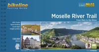
Fietsgids Bikeline Moselle River Trail | Esterbauer

0
Praktische fietsgids met detailkaarten, ingetekende route, informatie over overnachten en fietsenmakers, zwaarte en hoogteprofiel. In spiraalbinding. Engelstalig. Van Metz (Frankrijk) naar Koblenz, lengte 307 km. The vineyard-lined Moselle River valley provides a uniquely inviting setting for an especially enjoyable bicycle tour. Trace some 310 ki...

Verkopers met dit product

Verkoper
Bezorging
Prijs
DeZwerver.nl logo
DeZwerver.nl
2,95
17,50

Anderen bekeken ook

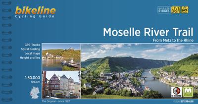
Fietsgids Bikeline Moselle River Trail | Esterbauer
Praktische fietsgids met detailkaarten, ingetekende route, informatie over overnachten en fietsenmakers, zwaarte en hoogteprofiel. In spiraalbinding. Engelstalig. Van Metz (Frankrijk) naar Koblenz, lengte 307 km. The vineyard-lined Moselle River valley provides a uniquely inviting setting for an especially enjoyable bicycle tour. Trace some 310 kilometers of the river’s meandering bends and curves while learning about its rich and varied history. Test whether the light and fruity Moselle wines live up to their reputation, and stroll (or roll) through the ancient narrow lanes and splendid avenues of the river’s charming villages and historic cities.
17,50
Fietsgids Bikeline Mosel radweg | Esterbauer
Praktische fietsgids met detailkaarten, ingetekende route, informatie over overnachten en fietsenmakers, zwaarte en hoogteprofiel. In spiraalbinding. Duitstalig. Van Metz (Frankrijk) naar de Rijn langs de Moezel, lengte 304 km. Die Gesamtlänge des Hauptradweges beträgt rund 307 Kilometer am rechten Moselufer und 314 Kilomter am linken Ufer. Die Varianten und Ausflüge haben eine Länge von rund 125 Kilometern. Das Moseltal bietet alles, was mit einem typischen Weinland assoziiert wird. Der Fluss wird allerorts von steilen Hängen flankiert, die ihrerseits mit unzähligen Weinreben bedeckt sind. Zu dieser attraktiven Landschaft, in der man noch dazu mildes Klima erwarten kann, gesellen sich die urgemütlichen Winzerdörfer. Massive Steinhäuser und zierliche Fachwerkhäuser sind im Moselland keine Seltenheit, sondern vielmehr die Regel. In den meisten dieser Häuser wird Wein gekeltert und ausgeschenkt. „Für einen Schoppen muss immer Zeit sein”, ist das Motto der Moselaner, die den leichten Wei…
17,50
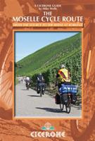
Fietsgids Moesel - The Moselle Cycle Route | Cicerone
This guidebook covers the entirety of the Moselle river’s course, from its source in the Vosges Mountains of eastern France to its confluence with the Rhine at the west German city of Koblenz. The well-waymarked route reaches historic Nancy and Metz, crosses into Luxembourg and continues through the spectacular Mosel gorge, where the river cuts a sinuous path between the Hunsrück and Eifel Mountains.   The great attraction to a cyclist of following a river from its source is that, once you have reached the start, it's all downhill. From the easily reached source near the Col de Bussang, the Moselle cycle route descends over 650m to the Rhine at Koblenz. At Koblenz, the route can be linked with The Rhine Cycle Route.   In addition to the main route, excursions are described to visit Toul on the Boucles de Moselle, Luxembourg Ville in the Duchy of Luxembourg and through the Saar and Rhine gorges.   Accommodation and places to eat and drink en route are plentiful. Mostly off-road and on …
20,95
Fietsgids Bikeline Cycling guide Provence | Esterbauer
Provence – The name alone sounds inviting to every traveller. The region’s wonderfully mild climate and many quiet paved roads makes it an ideal destination for bicycle tourists year round. Let yourself be enchanted by ancient towns and historic monasteries, by the scent from fields of rich lavender, the charm of tiny villages and French joie de vivre. Enjoy the contrasts presented by the peaceful expanses of the Camargue, with its glittering blue bays and herds of Camargue horses grazing in a landscape dotted with brilliantly white farmsteads. A refreshing plunge into the Mediterranean is just one of the many highlights of this bicycle tour. This Cycling Guide includes detailed maps of the countryside and of many cities and towns, precise route descriptions, information about historic and cultural sites as well as background information and a comprehensive list of overnight accommodations. The only thing this guide cannot provide is fine cycling weather, but we hope you find nothing …
13,50
Fietsgids Bikeline Radtourenbuch kompakt Nahe - Hunsrück - Mosel - Radweg | Esterbauer
Een serie van Bikeline waarin wat kortere meerdaagse fietsroutes op dezelfde manier als in de grote gidsen worden beschreven. Praktische fietsgids met detailkaarten, ingetekende route, informatie over overnachten en fietsenmakers, zwaarte en hoogteprofiel. klein vierkant formaat, 12 x 12 centimeter, ideaal klein formaat.  Der rund 200 Kilometer lange Nahe-Hunsrück-Mosel-Radweg mit seiner abwechslungsreichen Streckenführung und teils anspruchsvollen Anstiegen führt von Bingen über Fischbach und Neumagen-Dhron bis nach Trier. Die Route ist auch bei Weinliebhabern beliebt, führt sie doch durch die Weinbauregionen Rhein, Nahe und Mosel. Der erste Teil der Strecke beginnt in der Stadt Bingen, die als UNESCO-Weltkulturerbe ausgezeichnet wurde und einst Ausgangspunkt der römischen Ausoniusstraße nach Trier war. Über eine gleichmäßige Steigung gelangen Sie in südlicher Richtung über die sehenswerten Orte Bad Kreuznach, Bad Münster am Stein-Ebernburg, Bad Sobernheim und Kirn nach Fischbach. Da…
9,50
Fietsgids Bikeline Iron Curtain Trail 3 - German-German Border Trail | Esterbauer
Praktische fietsgids met detailkaarten, ingetekende route, informatie over overnachten en fietsenmakers, zwaarte en hoogteprofiel. In spiraalbinding, Engelstalig   The Iron Curtain ran for about 7,000 km from the Barents Sea in the north straight through Europe to the Black Sea and divided the continent in East and West. Until the Velvet Revolution in Eastern Europe it was a physical and ideological border between two blocks which conceived each other as enemies. Not only were many neighbouring states divided, but Germany itself was divided into east and west. Today there are hardly any reminders that the wall ever existed.   The border in Germany was 1,400 km long. The former death strip was composed of 3.000 km of fences, car-trenches for 730 km, 830 observation towers, the brightly lit roads, walls and bunkers – most of it is gone. Remaining are the vehicle roads with their perforated paving stones and several observation towers. And in a few years the sparse vegetation will be sup…
17,95
Fietsgids Bikeline Danube Bike Trail 3 (Engels - Donau Radweg) | Esterbauer
Praktische fietsgids met detailkaarten, ingetekende route, informatie over overnachten en fietsenmakers, zwaarte en hoogteprofiel. In spiraalbinding, Engelstalig. Scheur- en watervast.   The Danube Bike Trail from Passau to Vienna is the most travelled long-distance cycling route in Europe. Every year, thousands of cyclists explore the varied scenery which the route through Austria has to offer. For most cyclists the journey ends in the capital Vienna (Wien). But the continuation of the Danube Bike Trail through Slovakia and into Hungary, to the city of Budapest, is accordingly quieter and more idyllic. One can endulge the senses while cycling through riverside forests, quiet villages and historic towns where the Iron Curtain once divided Europe in two; all this while crossing two borders without even needing to present a passport.   The total length of the Danube Bike Trail from Vienna to Budapest is 310 kilometers. This does not include side trips and alternative routes.
16,50
Fietsgids Bikeline Iron Curtain Trail 1 Finland - Baltische Staten | Esterbauer
Praktische fietsgids met detailkaarten, ingetekende route, informatie over overnachten en fietsenmakers, zwaarte en hoogteprofiel. In spiraalbinding, Engelstalig.  To properly live, breathe and experience history – that is the goal of the “Iron Curtain Trail”. From the Barents Sea to the Black Sea, this guide takes you along the Western border of the old Warsaw Pact countries, all the way across Europe. The route does not just connect European culture, history and sustainable tourism but it also provides historically interested cyclists with some spectacularly beautiful and varied landscapes and unique habitats that were able to emerge in the former border strip, which is today the European Green Belt. The maps in the revised edition are scaled larger at 1:120,000 from Helsinki to Riga, and from Grense Jakobselv to Vaalimaa it remains at 1:400,000. This volume describes the 4,000-kilometre-long part of the route from the Barents Sea to Riga.
18,50
Fietsgids Bikeline Tauern Cycle path | Esterbauer
The Tauern Cycle Path takes its name from the impressive Hohen Tauern mountain range. But don't worry, the route takes you through the flat valley of the Salzach River, where you only occasionally have to overcome gradients. On the 320 Kilometre route from the spectacular Krimml Waterfall, through the Salzburger Land and out into the alpine foreland, you will descend a total of 750 Metres. While the landscape at the start of the tour is dominated by tall, snow covered mountains, by the time you reach the lower reaches of the Salzach and Inn rivers, the extensive riparian forests come to dominate. The cultural highlight is naturally the city of Salzburg, but almost every town along the Tauern Cycle Path has its own particular charm. 
14,50

Klanten-reviews van Fietsgids Bikeline Moselle River Trail | Esterbauer

Er zijn nog geen beoordelingen voor dit productBen jij de eerste die een review plaatst?

Meer over Fietsgids Bikeline Moselle River Trail | Esterbauer

Productomschrijving

Praktische fietsgids met detailkaarten, ingetekende route, informatie over overnachten en fietsenmakers, zwaarte en hoogteprofiel. In spiraalbinding. Engelstalig. Van Metz (Frankrijk) naar Koblenz, lengte 307 km.

The vineyard-lined Moselle River valley provides a uniquely inviting setting for an especially enjoyable bicycle tour. Trace some 310 kilometers of the river’s meandering bends and curves while learning about its rich and varied history. Test whether the light and fruity Moselle wines live up to their reputation, and stroll (or roll) through the ancient narrow lanes and splendid avenues of the river’s charming villages and historic cities.

Productinformatie

    Verken gerelateerde categorieën

    Webshop.nl maakt gebruik van cookies. Ga je verder op onze website, ga dan akkoord met het plaatsen van cookies en de verwerking van deze data door ons en vermelde partners.