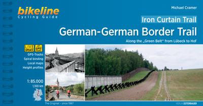
Fietsgids Bikeline Iron Curtain Trail 3 - German-German Border Trail | Esterbauer

0
Praktische fietsgids met detailkaarten, ingetekende route, informatie over overnachten en fietsenmakers, zwaarte en hoogteprofiel. In spiraalbinding, Engelstalig   The Iron Curtain ran for about 7,000 km from the Barents Sea in the north straight through Europe to the Black Sea and divided the continent in East and West. Until the Velvet Revolutio...

Verkopers met dit product

Verkoper
Bezorging
Prijs
DeZwerver.nl logo
DeZwerver.nl
2,95
17,95

Anderen bekeken ook

Nieuw
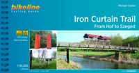
Fietsgids Bikeline Iron Curtain Trail From Hof to Szeged | Esterbauer
Praktische fietsgids met detailkaarten, ingetekende route, informatie over overnachten en fietsenmakers, zwaarte en hoogteprofiel. In spiraalbinding, Engelstalig 1760km van Hof naar Szeged The Iron Curtain divided the continent into East and West and extended from the Barents Sea through Europe to the Black Sea - a distance of 10,000 kilometres. Until the peaceful revolutions in Eastern Europe, it was the physical and ideological border between two mutually hostile blocs. It did not just divide many neighbouring states, but also divided Germany into East and West. Few things remain of the former death strip today. The few relics that are still there remind us of our past but no longer separate us.   Therefore, it is imperative to make the memories visible! We know that there is little in the way of shared memories between the West and the East, that the experiences of Europeans east and west of the border differ, not least because their perspectives were often shaped completely differ…
17,50
Nieuw
Fietsgids Bikeline Danube Bike Trail 3 (Engels - Donau Radweg) | Esterbauer
Praktische fietsgids met detailkaarten, ingetekende route, informatie over overnachten en fietsenmakers, zwaarte en hoogteprofiel. In spiraalbinding, Engelstalig. Scheur- en watervast.   The Danube Bike Trail from Passau to Vienna is the most travelled long-distance cycling route in Europe. Every year, thousands of cyclists explore the varied scenery which the route through Austria has to offer. For most cyclists the journey ends in the capital Vienna (Wien). But the continuation of the Danube Bike Trail through Slovakia and into Hungary, to the city of Budapest, is accordingly quieter and more idyllic. One can endulge the senses while cycling through riverside forests, quiet villages and historic towns where the Iron Curtain once divided Europe in two; all this while crossing two borders without even needing to present a passport.   The total length of the Danube Bike Trail from Vienna to Budapest is 310 kilometers. This does not include side trips and alternative routes.
16,50
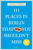
Reisgids 111 places in Places in Berlin That You Shouldn't Miss | Emons
The ultimate insider's guide to Berlin, revised and updated for 2019 Features interesting and unusual places not found in traditional travel guides     In Berlin, the city divided after World War II, everybody knows about the Brandenburg Gate, Hitler's bunker, Kennedy's speech, red and green beer, splendidly broad boulevards, and numerous lakes. But this metropolis, once again the capital of Germany, encompasses many clandestine niches characteristic of a heterogeneous city without a beginning and without an end between its famous backyards, nature parks, and bridges. It is often these miniscule witnesses that tell authentic history. Besides the larger attractions, this unusual guide presents Berlin's other side - such as a tower so ugly that no-one wants to open a restaurant in it; a library offering its books in the trunks of living trees; the monument for the inventor of the currywurst; a residential settlement in a former East German prison; the place where the Nazis concealed the…
19,50
Vogelgids Birds of the Indian Subcontinent | Bloomsbury
This is the second edition of the authors' groundbreaking Birds of the Indian Subcontinent (1998) and covers all the bird species found in India, Pakistian, Sri Lanka, Nepal, Bhutan, Bangladesh and the Maldives. The plates face the descriptions and maps for quick at-a-glance reference. Many of the plates have been repainted for this edition and a number of new species added. This guide also provides tables, summarising identification features of particularly difficult groups such as nightjars, warblers and rosefinches.   "[...] Overall, Birds of the Indian Subcontinent is an excellent piece of work and a very welcome field guide, and I am greatly looking forward to using it on my upcoming trip to Arunachal Pradesh and Assam. Comprehensive and authoritative, this is an indispensable guide for anyone birding anywhere in the Indian Subcontinent." - Frank Lambert (22-02-2012), read the full review at The Birder's Library   "The Indian subcontinent, always exciting for visitors, is no less…
54,95
Vogelgids Centraal Azie - Birds of Central Asia | Bloomsbury
Birds of Central Asia is the first field guide to include the former Soviet republics of Kazakhstan, Kyrgyzstan, Turkmenistan, Uzbekistan and Tajikistan, along with neighbouring Afghanistan. This vast area includes a diverse variety of habitats, and the avifauna is similarly broad, from sandgrouse, ground jays and larks on the vast steppe and semi-desert to a broad range of raptors, and from woodland species such as warblers and nuthatches to a suite of montane species, such as snowcocks, accentors and snowfinches. Birds of Central Asia includes 141 high-quality plates covering every species (and all distinctive races) that occur in the region, along with concise text focusing on identification and accurate colour maps. Important introductory sections introduce the land and its birds. Birds of Central Asia is a must-read for any birder or traveller visting this remote region.   "For a long time, there's been something of a gap in field-guide coverage across the Palearctic. Europe is w…
50,95
Fietskaart 01 Cycling guides Cornwall | Goldeneye
Our maps are double-sided, printed on an A2 sheet with a concertina fold. This allows for easy folding and folding, and an ease of access to the mapping. The material is rain and tear-resistant. Our early maps were designed at the scale of 2 miles to 1 inch/1:126,720. The later designs along with digitalisation are 1: 100,000. We were encouraged by the Cycle Touring Club to convert our cartography toward the cycle market (to replace the out-of-print Bartholomew series). As time and the series progressed we have added more data: The National Cycle Network routes, Regional Routes, and Traffic-Free Family Routes, as and when they are developed. These routes are in addition to the Circular Routes Goldeneye Commissioned at the outset of our publishing schedule. We are also adding to new editions; bike shops, cycle hire, and tea rooms, along with the tourist attractions already featured. Our plan is to make available digital versions for cell phones and tablets and to update, on an annual b…
15,95
Accommodatiegids Namibia Self-Drive Guide | Tracks4Africa
So, what is so special about the Tracks4Africa guide books? These are not guides written by armchair travellers or the personal experience of one person, but the combined experiences of a whole community of travellers. The T4A community travel far and wide – not by luxury bus or safari vehicle but on their own wheels. Sometimes they travel in groups and sometimes as lone rangers, but they always travel by motorbike, sedan or 4WD, therefore this guide is specifically aimed at self-drive travellers.   If you are a self-drive tourist, there are five things that you need to know when you are on the road: 1. Where to sleep. 2. Where to get fuel. 3. What to see and do. 4. Where to buy supplies. 5. Where to go in case of an emergency.   If you have the Tracks4Africa Self-Drive Guide as your travel companion, the answers to all these and many more questions will be at hand. If you are well prepared and well informed, you can really enjoy the unspoilt beauty of Africa! The Tracks4Afr…
52,50
Reisgids Germany | Insight Guides
This Insight Guide is a lavishly illustrated inspirational travel guide to Germany and a beautiful souvenir of your trip. Perfect for travellers looking for a deeper dive into the destination's history and culture, it's ideal to inspire and help you plan your travels. With its great selection of places to see and colourful magazine-style layout, this Germany guidebook is just the tool you need to accompany you before or during your trip.   Whether it's deciding when to go, choosing what to see or creating a travel plan to cover key places like Berlin, Lake Constance and Frankfurt, it will answer all the questions you might have along the way. It will also help guide you while exploring Hamburg or discovering Munich on the ground. Our Germany travel guide was fully-updated post-COVID-19.   The Insight Guide Germany covers: Berlin and the Eastern States, Munich and the deep South, Frankfurt and the seven states, Hamburg and the coast. In this guide book to Germany you will find: IN-DEPT…
23,95
Fietsgids The Ultimate Trans Pennine Trail Guide | Excellent Books
Gidsboek voor de Trans Pennine Trail met spiraalbinding, inclusief kaarten, hoogtegrafieken en verblijfsmogelijkheden. The Trans Pennine Trail guide book covers the hugely popular 370 miles (595km) of trail across the north of England is a big favourite with walkers and cyclists, with many sections available for horse-riders and wheelchair users.   The trail is suitable for users of all ages and abilities due to its easy gradients and traffic free conditions. This guide is packed with full colour maps, trail info and photos, making it perfect for planning and use along the way.   Plan a scenic walk or bike ride, perhaps through the Pennines themselves, with its many pretty villages, museums and other visitor attractions along the way, very often with the possibility of a train return.   For weekend or longer breaks on the trail you can select something from the wide range of accommodation in the guide, from the simple to the stylish and the quirky to the budget.   Or, plan your l…
13,95
Reisgids - Reisverhaal Atlas of Unusual Borders | Zoran Nikolic
The world is not always what we think it is. This book presents unusual borders, enclaves and exclaves, divided or non-existent cities and islands. Numerous conflicts have left countries divided and often shattered. Remnants of countries can by design or accident be left behind as a legal anomaly in this complex world. Most people believe that a country's borders are clearly defined: just lines that separate countries. Everything on one side of the line belongs to one country and everything on the other side belongs to another country. This might be the case most of the time, but there are unusual exceptions to this unwritten rule. Examples include: - Campione d'Italia where Italian residents have to travel 15km through Switzerland to reach the nearest available Italian territory. - Tomb of Suleyman Shah which is a tiny Turkish enclave within Syria which was moved closer to Turkey when Lake Assad was created but still stayed in Syria. - Pheasant Island which for half a year belongs…
21,50

Klanten-reviews van Fietsgids Bikeline Iron Curtain Trail 3 - German-German Border Trail | Esterbauer

Er zijn nog geen beoordelingen voor dit productBen jij de eerste die een review plaatst?

Meer over Fietsgids Bikeline Iron Curtain Trail 3 - German-German Border Trail | Esterbauer

Productomschrijving

Praktische fietsgids met detailkaarten, ingetekende route, informatie over overnachten en fietsenmakers, zwaarte en hoogteprofiel. In spiraalbinding, Engelstalig   The Iron Curtain ran for about 7,000 km from the Barents Sea in the north straight through Europe to the Black Sea and divided the continent in East and West. Until the Velvet Revolution in Eastern Europe it was a physical and ideological border between two blocks which conceived each other as enemies. Not only were many neighbouring states divided, but Germany itself was divided into east and west. Today there are hardly any reminders that the wall ever existed.   The border in Germany was 1,400 km long. The former death strip was composed of 3.000 km of fences, car-trenches for 730 km, 830 observation towers, the brightly lit roads, walls and bunkers – most of it is gone. Remaining are the vehicle roads with their perforated paving stones and several observation towers. And in a few years the sparse vegetation will be supplanted by much more voluptuous green. It is now almost two decades since the wall fell; the Iron Curtain is hardly visible in Europe any more.   After 1989, the question about what to do about the wall occupied many minds. Most people wanted to have the wall disappear completely – for political as well as ethical reasons. A small minority thought beyond that, fought to keep the wall preserved. They were private individuals, representatives of landmarks’ commissions, popular initiatives – they prevented grass from covering up the last traces.   One of those who thought to preserve parts of the wall was Willy Brandt, Lord Mayor of Berlin when the wall was built. Exactly one day after the wall was breached, Brandt, who had been chancellor and had won the Nobel Peace Prize, said to the people in front of the Schöneberger City Hall (city hall to West-Berlin during the time Berlin was divided): “We should save a piece of this horrible structure to remind us of this historic monster. No less than when we discussed in Berlin the pros and cons of letting the Wilhelm Memorial Church stand.”   And the former “Green” Senator for City Planning and Environmental Affairs, Michaele Schreyer – later an EU-commissioner – overrode all objections by her coalition partner SPD and placed the wall segment at the Niederkirchnerstraße on the list of protected landmarks. At the time, almost everybody became her enemy; today they’re all grateful that there is some authentic wall at this site.   The German-German Border Trail Not only was Berlin divided, so was all of Germany, for decades. It was therefore necessary to preserve the memory of this along the 1,400 km former border. For that reason the national caucuses of the SPD and the Greens proposed on June 30th, 2004 to transform the former “death strip” along the German border into a “living space”. According to the proposal it would be developed for “sof” tourism“, and be a part of a European Green Belt along the former “Iron Curtain”. The Bundestag voted for this unanimously in December 2004. The present book describes the German-German Border Trail in the “Green Belt”, which approaches 150 natural parks, 150 flora-and-fauna areas, three biosphere reservations Schaalsee, Elbaue and the Rhoen and the National Park of the Harz Mountains. It takes one from the Baltic to the Czech border, passes countless rivers, streams, and lakes and takes us through the higher parts of the Harz mountains and through the forests of Thuringia. We pass many monuments and border land museums and also several of the remaining observation towers. Of course there are many alternatives to taking this path. One can remain on the western or on the eastern side, one can stay close to the border or bike some distance from it, one can take the former control road with its perforated roadway or one can choose asphalt. The route in this book stays as close as possible to the former border, but stays on as comfortable a path as possible, avoids heavily travelled roads, integrates many historical monuments, crosses the former border at several points and informs about many monuments and museums.
Webshop.nl maakt gebruik van cookies. Ga je verder op onze website, ga dan akkoord met het plaatsen van cookies en de verwerking van deze data door ons en vermelde partners.