webshop.nl
Categorieën
  Sluiten

Meer Esterbauer
Meer Esterbauer in Literatuur boeken

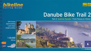
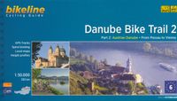
Fietsgids Bikeline Danube Bike Trail 2 (Engels - Donau Radweg) | Ester

Praktische fietsgids met detailkaarten, ingetekende route, informatie over overnachten en fietsenmakers, zwaarte en hoogteprofiel. In spiraalbinding, Engelstalig.   Danube Bike Trail In the last decade the Danube bike trail has emerged as Europe’s most important long-distance bicycle touring route. Its popularity is due primarily to the Danube’s na...
16,50

Webshops met dit product

Webshop
Bezorging
Prijs

Anderen bekeken ook

Fietsgids Bikeline Danube Bike Trail 2 (Engels - Donau Radweg) | Ester
Praktische fietsgids met detailkaarten, ingetekende route, informatie over overnachten en fietsenmakers, zwaarte en hoogteprofiel. In spiraalbinding, Engelstalig.   Danube Bike Trail In the last decade the Danube bike trail has emerged as Europe’s most important long-distance bicycle touring route. Its popularity is due primarily to the Danube’s natural beauty and the wealth of cultural and historical sites that line its banks. But the large numbers of bicycle tourists visiting the Danube would not be possible without well-developed infrastructure and services. The Danube bike route has benefited from well-built posted bike trails and an extensive network of services oriented to meeting the needs of bicycle tourists. The following pages provide a few practical notes about how to use the book, and some tips on getting ready for the tour.   Length The total distance from the start in Passau to the final destination, Vienna, is 320?kilometres. This figure does not include about 160?kilome…
16,50
Fietsgids Bikeline Danube Bike Trail 5 (Engels - Donau Radweg) | Ester
The fifth part of the Danube Bike Trail begins in Belgrade and ends in Romania on the Black Sea. With a total length of 2,845 kilometres, the Danube is Europe’s second longest river (after the Volga with 3,534 kilometres), and the only one on which kilometres are counted in reverse direction, starting with kilometer zero at the mouth and ending upstream at the source.   The total length of Part 5 of the Danube Bicycle Trail is about 1,400 kilometres. This does not include various side trips and alternative routes. The Danube Bike Trail is part of the Eurovelo-Route 6 and to a great extent identical.   This last part of the Danube Bike Trail mostly follows paved main roads and secondary roads, which you share with a variety of other traffic. It is not unusual in some parts of Bulgaria and Romania that you encounter more horse or mule carts, pedestrians or roaming sheep or geese than motorized traffic. In and around the larger cities, however, you can expect heavy traffic and you should …
15,50
Fietsgids Bikeline Danube Bike Trail 1 (Engels - Donau Radweg) | Ester
Praktische fietsgids met detailkaarten, ingetekende route, informatie over overnachten en fietsenmakers, zwaarte en hoogteprofiel. In spiraalbinding, Engelstalig.   Length The Danube cycling route between Donaueschingen and Passau is about 595 kilometers in length, not including alternative routes and excursions.   Surface quality and traffic Most of the route follows quiet country lanes or dedicated cycling paths. Sections with heavier traffic are rare and usually short. With only a few exceptions, the roads and paths have a hard surface. Gravel sections are usually in good condition. Because the route follows the course of the river, it is almost completely flat. It is mostly on the excursions into the surrounding countryside that must expect some steep sections. It is possible that during flooding part of the route is unusable or closed and you need to use alternative routes.   Signage Route markers along the Danube bicycle route are generally reliable and good. Signs are located by…
16,50
Fietsgids Bikeline Danube Bike Trail 5 (Engels - Donau Radweg) | Ester
The fifth part of the Danube Bike Trail begins in Belgrade and ends in Romania on the Black Sea. With a total length of 2,845 kilometres, the Danube is Europe’s second longest river (after the Volga with 3,534 kilometres), and the only one on which kilometres are counted in reverse direction, starting with kilometer zero at the mouth and ending upstream at the source.   The total length of Part 5 of the Danube Bicycle Trail is about 1,400 kilometres. This does not include various side trips and alternative routes. The Danube Bike Trail is part of the Eurovelo-Route 6 and to a great extent identical.   This last part of the Danube Bike Trail mostly follows paved main roads and secondary roads, which you share with a variety of other traffic. It is not unusual in some parts of Bulgaria and Romania that you encounter more horse or mule carts, pedestrians or roaming sheep or geese than motorized traffic. In and around the larger cities, however, you can expect heavy traffic and you should …
15,50
Fietsgids Bikeline Cycling guide Provence | Esterbauer
Provence – The name alone sounds inviting to every traveller. The region’s wonderfully mild climate and many quiet paved roads makes it an ideal destination for bicycle tourists year round. Let yourself be enchanted by ancient towns and historic monasteries, by the scent from fields of rich lavender, the charm of tiny villages and French joie de vivre. Enjoy the contrasts presented by the peaceful expanses of the Camargue, with its glittering blue bays and herds of Camargue horses grazing in a landscape dotted with brilliantly white farmsteads. A refreshing plunge into the Mediterranean is just one of the many highlights of this bicycle tour. This Cycling Guide includes detailed maps of the countryside and of many cities and towns, precise route descriptions, information about historic and cultural sites as well as background information and a comprehensive list of overnight accommodations. The only thing this guide cannot provide is fine cycling weather, but we hope you find nothing b…
13,50
Fietsgids The Danube Cycleway - Donau fietspad | Cicerone
A guidebook to cycling the lower Danube, following the Danube Cycleway, from Budapest to the Black Sea. Covers 1647km through Hungary, Croatia, Serbia (former Yugoslavia) and Romania. The route is presented in 32 stages, averaging 53.5km per stage and is well within the capabilities of most cycle tourists.   No major climbs or descents – predominantly level cycling following off-road stretches along flood dykes and quiet roads A perfect 3 to 4 week cycling adventure Best time of year: late spring (May–June) and early autumn (September–October); it can be very hot during July and August The route ends in the Danube Delta, Europe’s largest area of natural wetland and home to an enormous variety of bird species Companion guidebook to The Danube Cycleway Volume 1 (taking in the upper and middle Danube, from the Black Forest to Budapest)
24,95
Fietsgids the Bikepacker's Guide to the World | Lonely Planet
Take your bicycle on the ride of a lifetime with the help of The Bikepackers' Guide to the World. Discover 75 of the most amazing cycling routes in every continent and use the detailed maps, directions, accommodation and practical information to plan your trip. Lonely Planets experts tell you how to prepare, what to take, when and where to go. Bikepacking is the fast-growing adventure activity that gives people the freedom to discover the world in a sustainable and slow-paced fashion on their bicycles. The number of new purpose-built, long-distance cycling routes is increasing all the time and this comprehensive book selects the top 75 to add to your bicycling bucket list. Lonely Planet describes the route in step-by-step detail with a large, accurate map and elevation profile helping cyclists pick a route that suits their experience. The routes are graded from easy to challenging and cover a range of distances from a weekend to a month or more. The rides vary from easy-going rail trai…
34,95

Klanten-reviews van Fietsgids Bikeline Danube Bike Trail 2 (Engels - Donau Radweg) | Ester

Er zijn nog geen beoordelingen voor dit productBen jij de eerste die een review plaatst?

Meer over Fietsgids Bikeline Danube Bike Trail 2 (Engels - Donau Radweg) | Ester

Productomschrijving

Praktische fietsgids met detailkaarten, ingetekende route, informatie over overnachten en fietsenmakers, zwaarte en hoogteprofiel. In spiraalbinding, Engelstalig.   Danube Bike Trail In the last decade the Danube bike trail has emerged as Europe’s most important long-distance bicycle touring route. Its popularity is due primarily to the Danube’s natural beauty and the wealth of cultural and historical sites that line its banks. But the large numbers of bicycle tourists visiting the Danube would not be possible without well-developed infrastructure and services. The Danube bike route has benefited from well-built posted bike trails and an extensive network of services oriented to meeting the needs of bicycle tourists. The following pages provide a few practical notes about how to use the book, and some tips on getting ready for the tour.   Length The total distance from the start in Passau to the final destination, Vienna, is 320?kilometres. This figure does not include about 160?kilometres of side-trips and alternative routes.   Surface quality and traffic The Danube bicycle route is very comfortable to ride. Virtually the entire distance follows paved bicycle paths or lightly traveled public roads. For most of the distance, a bicycle route is present on both sides of the river.   Signage The Danube bicycle route is thoroughly signposted to show the way. However, it does occasionally happen that signs are missing or turned in the wrong direction. In Austria, rectangular green signs are posted along the route and in most places the route is clearly labelled the “Donau-Radweg.” Other regional bicycle trails branch off from the main route. Excursions and alternative routes often follow their own signs, and are also described in this book.   Planning a tour The descriptions of the 320 kilometer tour follow the river downstream, from west to east. This allows cyclists to take advantage of the prevailing winds and the river’s downward slope (minimal though it may be). The Danube usually has bicycle routes on both sides of the river. All of these routes are marked as part of the Danube bicycle route. Keep in mind when planning your route, that the hills along much of the way cause the south bank to be generally shadier than the north bank during the spring and autumn months. This book describes the routes on both sides of the river: the route on the northern, or left bank is described first, followed by the route on the southern, or right bank. The entire tour is divided into three sections: Passau to Linz, Linz to Melk, and Melk to Vienna. The two sides of the river are identified as the left and the right sides, as seen when looking downstream. To simplify orientation, towns and cities are given with their kilometer number on the Danube (ex. Passau 2226 or Vienna 1929) and the side of the river they occupy (L or R). The Danube’s kilometers are also shown in the maps (|1925). The division of the tour into six sections is intended to aid tourists’ general orientation and does not necessarily suggest one-day stages. If you intend to include museum visits and swimming stops along the way, we recommend planning at least a week for the entire distance. The book also includes descriptions of short side-trips which offer riders opportunities to extend the ride according to their desires. If the tour turns out to take longer than expected, there are taxi companies along the first stage that will transport bicycles if the need arises. The telephone numbers of these companies are listed in the information about individual towns. Rail lines also run along much of the Danube, giving riders the option of boarding a train to complete a stretch.
Productspecificaties

Artikelnummer(s)
Brand
Esterbauer

Verken gerelateerde categorieën

Webshop.nl maakt gebruik van cookies. Ga je verder op onze website, ga dan akkoord met het plaatsen van cookies en de verwerking van deze data door ons en vermelde partners.