webshop.nl
Categorieën
  Sluiten

Meer Esterbauer

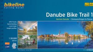
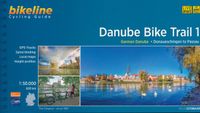
Fietsgids Bikeline Danube Bike Trail 1 (Engels - Donau Radweg) | Ester

Praktische fietsgids met detailkaarten, ingetekende route, informatie over overnachten en fietsenmakers, zwaarte en hoogteprofiel. In spiraalbinding, Engelstalig.   Length The Danube cycling route between Donaueschingen and Passau is about 595 kilometers in length, not including alternative routes and excursions.   Surface quality and traffic Most ...
16,50

Webshops met dit product

Webshop
Bezorging
Prijs

Anderen bekeken ook

Fietsgids Bikeline Danube Bike Trail 1 (Engels - Donau Radweg) | Ester
Praktische fietsgids met detailkaarten, ingetekende route, informatie over overnachten en fietsenmakers, zwaarte en hoogteprofiel. In spiraalbinding, Engelstalig.   Length The Danube cycling route between Donaueschingen and Passau is about 595 kilometers in length, not including alternative routes and excursions.   Surface quality and traffic Most of the route follows quiet country lanes or dedicated cycling paths. Sections with heavier traffic are rare and usually short. With only a few exceptions, the roads and paths have a hard surface. Gravel sections are usually in good condition. Because the route follows the course of the river, it is almost completely flat. It is mostly on the excursions into the surrounding countryside that must expect some steep sections. It is possible that during flooding part of the route is unusable or closed and you need to use alternative routes.   Signage Route markers along the Danube bicycle route are generally reliable and good. Signs are located by…
16,50
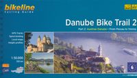
Fietsgids Bikeline Danube Bike Trail 2 (Engels - Donau Radweg) | Ester
Praktische fietsgids met detailkaarten, ingetekende route, informatie over overnachten en fietsenmakers, zwaarte en hoogteprofiel. In spiraalbinding, Engelstalig.   Danube Bike Trail In the last decade the Danube bike trail has emerged as Europe’s most important long-distance bicycle touring route. Its popularity is due primarily to the Danube’s natural beauty and the wealth of cultural and historical sites that line its banks. But the large numbers of bicycle tourists visiting the Danube would not be possible without well-developed infrastructure and services. The Danube bike route has benefited from well-built posted bike trails and an extensive network of services oriented to meeting the needs of bicycle tourists. The following pages provide a few practical notes about how to use the book, and some tips on getting ready for the tour.   Length The total distance from the start in Passau to the final destination, Vienna, is 320?kilometres. This figure does not include about 160?kilome…
16,50
Fietsgids Bikeline Danube Bike Trail 5 (Engels - Donau Radweg) | Ester
The fifth part of the Danube Bike Trail begins in Belgrade and ends in Romania on the Black Sea. With a total length of 2,845 kilometres, the Danube is Europe’s second longest river (after the Volga with 3,534 kilometres), and the only one on which kilometres are counted in reverse direction, starting with kilometer zero at the mouth and ending upstream at the source.   The total length of Part 5 of the Danube Bicycle Trail is about 1,400 kilometres. This does not include various side trips and alternative routes. The Danube Bike Trail is part of the Eurovelo-Route 6 and to a great extent identical.   This last part of the Danube Bike Trail mostly follows paved main roads and secondary roads, which you share with a variety of other traffic. It is not unusual in some parts of Bulgaria and Romania that you encounter more horse or mule carts, pedestrians or roaming sheep or geese than motorized traffic. In and around the larger cities, however, you can expect heavy traffic and you should …
15,50
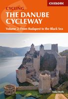
Fietsgids The Danube Cycleway - Donau fietspad | Cicerone
A guidebook to cycling the lower Danube, following the Danube Cycleway, from Budapest to the Black Sea. Covers 1647km through Hungary, Croatia, Serbia (former Yugoslavia) and Romania. The route is presented in 32 stages, averaging 53.5km per stage and is well within the capabilities of most cycle tourists.   No major climbs or descents – predominantly level cycling following off-road stretches along flood dykes and quiet roads A perfect 3 to 4 week cycling adventure Best time of year: late spring (May–June) and early autumn (September–October); it can be very hot during July and August The route ends in the Danube Delta, Europe’s largest area of natural wetland and home to an enormous variety of bird species Companion guidebook to The Danube Cycleway Volume 1 (taking in the upper and middle Danube, from the Black Forest to Budapest)
24,95
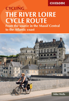
Fietsgids The River Loire Cycle Route | Cicerone
This guide describes a 1061km cycle route that starts at source of the Loire in the Massif Central mountains of central France and finishes at the Atlantic opposite St Nazaire. The route goes through the heart of France as the Loire becomes the royal river, bounded by extravagant châteaux, fields of Charolais cattle and vineyards. It passes through historic cities like Orléans and Tours, continuing past Angers and France's fourth largest city Nantes. The 1061km Loire Cycle Route starts at the source of the River Loire in the Massif Central mountains of central France and finishes at the Atlantic opposite St Nazaire. It descends past extinct volcanoes, crater lakes and deep gorges before joining EuroVelo route 6, followed by the fully waymarked Loire à Vélo, France's most popular cycle trail. Following the river downstream in 26 stages, the route is generally downhill or level, often on dedicated traffic-free cycle tracks.   Packed with a wealth of useful information - from practical pl…
23,95
Fietskaart Reivers Cycle Routes | Northern Heritage Services
The long-distance Reivers Cycle Routes are two intertwining signed / waymarked bi-directional ‘coast to coast’ cycle routes between the North Sea and the Irish Sea.   The original Reivers Cycle Route was created in 1998 eventually becoming NCN Route 10 with interlinking on-road and off-road sections but this soon morphed into a one-size-fits-all route which never worked well. The regenerated re-launched Reivers Cycle Routes are two intertwining route options – one which is as much off-road as possible suitable for gravel and cross bikes, hybrids and mountain bikes and a version designed for capable road cyclists 100% on tarmac.   The routes are bi-directional and continuously reward the rider with beautiful views of the constantly changing terrain, provide many places of interest to pass by or call in and many lovely villages and quiet hamlets to cycle through or stay the night. Most importantly, there is a supply of excellent on route or close-to-route refreshments stops.   The off-ro…
16,50

Klanten-reviews van Fietsgids Bikeline Danube Bike Trail 1 (Engels - Donau Radweg) | Ester

Er zijn nog geen beoordelingen voor dit productBen jij de eerste die een review plaatst?

Meer over Fietsgids Bikeline Danube Bike Trail 1 (Engels - Donau Radweg) | Ester

Productomschrijving

Praktische fietsgids met detailkaarten, ingetekende route, informatie over overnachten en fietsenmakers, zwaarte en hoogteprofiel. In spiraalbinding, Engelstalig.   Length The Danube cycling route between Donaueschingen and Passau is about 595 kilometers in length, not including alternative routes and excursions.   Surface quality and traffic Most of the route follows quiet country lanes or dedicated cycling paths. Sections with heavier traffic are rare and usually short. With only a few exceptions, the roads and paths have a hard surface. Gravel sections are usually in good condition. Because the route follows the course of the river, it is almost completely flat. It is mostly on the excursions into the surrounding countryside that must expect some steep sections. It is possible that during flooding part of the route is unusable or closed and you need to use alternative routes.   Signage Route markers along the Danube bicycle route are generally reliable and good. Signs are located by every change in direction at forks and intersections. From Donaueschingen to Neustadt the signs are yellow with green lettering. Downstream from Neustadt the signs are white with green lettering. After Kelheim the signs also bear the slogan “Tour de Baroque” and the German Danube icon alternates with the lute-player seen on the Tour de Baroque signs.

Productspecificaties

Artikelnummer(s)
Brand
Esterbauer
Webshop.nl maakt gebruik van cookies. Ga je verder op onze website, ga dan akkoord met het plaatsen van cookies en de verwerking van deze data door ons en vermelde partners.