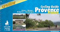
Fietsgids Bikeline Cycling guide Provence | Esterbauer

0
Provence – The name alone sounds inviting to every traveller. The region’s wonderfully mild climate and many quiet paved roads makes it an ideal destination for bicycle tourists year round. Let yourself be enchanted by ancient towns and historic monasteries, by the scent from fields of rich lavender, the charm of tiny villages and French joie de v...

Verkopers met dit product

Verkoper
Bezorging
Prijs
DeZwerver.nl logo
DeZwerver.nl
2,95
13,50

Anderen bekeken ook

Fietsgids Bikeline Cycling guide Provence | Esterbauer
Provence – The name alone sounds inviting to every traveller. The region’s wonderfully mild climate and many quiet paved roads makes it an ideal destination for bicycle tourists year round. Let yourself be enchanted by ancient towns and historic monasteries, by the scent from fields of rich lavender, the charm of tiny villages and French joie de vivre. Enjoy the contrasts presented by the peaceful expanses of the Camargue, with its glittering blue bays and herds of Camargue horses grazing in a landscape dotted with brilliantly white farmsteads. A refreshing plunge into the Mediterranean is just one of the many highlights of this bicycle tour. This Cycling Guide includes detailed maps of the countryside and of many cities and towns, precise route descriptions, information about historic and cultural sites as well as background information and a comprehensive list of overnight accommodations. The only thing this guide cannot provide is fine cycling weather, but we hope you find nothing …
13,50
Fietsgids Bikeline Radregion Provence - Cote d'Azur | Esterbauer
Praktische fietsgids met detailkaarten, ingetekende route, informatie over overnachten en fietsenmakers, zwaarte en hoogteprofiel. In spiraalbinding, Duitstalig.  In den letzten Jahren hat sich in Bezug auf den Fahrradtourismus in der Provence viel getan. Vor allem im Departement Vaucluse gibt es mittlerweile ein umfangreiches Netz an regionalen Radtouren mit dazugehöriger Infrastruktur. Aber auch im südlich davon gelegenen Departement Bouches-du-Rhône wurden einige Rundtouren entwickelt.   Von den konditionellen Anforderungen unterscheiden sich die verschiedenen Touren teilweise stark: Während vor allem in der Nähe des Mont Ventoux und dem Gebirgszug Luberon mit teilweise kräftigen Steigungen zu rechnen ist, verlaufen die Touren in der Nähe der Rhône und vor allem in der Camargue meist steigungsarm.   Lengte: Die Gesamtlänge der 27 Touren in diesem Buch beträgt rund 1.260 Kilometer. Die kürzeste Tour hat eine Länge von knapp 12 Kilometern, die längste ist über 230 Kilometer lang.   W…
16,50
Fietsgids Bikeline Danube Bike Trail 5 (Engels - Donau Radweg) | Esterbauer
The fifth part of the Danube Bike Trail begins in Belgrade and ends in Romania on the Black Sea. With a total length of 2,845 kilometres, the Danube is Europe’s second longest river (after the Volga with 3,534 kilometres), and the only one on which kilometres are counted in reverse direction, starting with kilometer zero at the mouth and ending upstream at the source.   The total length of Part 5 of the Danube Bicycle Trail is about 1,400 kilometres. This does not include various side trips and alternative routes. The Danube Bike Trail is part of the Eurovelo-Route 6 and to a great extent identical.   This last part of the Danube Bike Trail mostly follows paved main roads and secondary roads, which you share with a variety of other traffic. It is not unusual in some parts of Bulgaria and Romania that you encounter more horse or mule carts, pedestrians or roaming sheep or geese than motorized traffic. In and around the larger cities, however, you can expect heavy traffic and you should…
15,50
Fietsgids Bikeline Iron Curtain Trail 3 - German-German Border Trail | Esterbauer
Praktische fietsgids met detailkaarten, ingetekende route, informatie over overnachten en fietsenmakers, zwaarte en hoogteprofiel. In spiraalbinding, Engelstalig   The Iron Curtain ran for about 7,000 km from the Barents Sea in the north straight through Europe to the Black Sea and divided the continent in East and West. Until the Velvet Revolution in Eastern Europe it was a physical and ideological border between two blocks which conceived each other as enemies. Not only were many neighbouring states divided, but Germany itself was divided into east and west. Today there are hardly any reminders that the wall ever existed.   The border in Germany was 1,400 km long. The former death strip was composed of 3.000 km of fences, car-trenches for 730 km, 830 observation towers, the brightly lit roads, walls and bunkers – most of it is gone. Remaining are the vehicle roads with their perforated paving stones and several observation towers. And in a few years the sparse vegetation will be sup…
17,95
Fietsgids Bikeline Baltic Sea Cycle Route - Iron curtain Trail 2 | Esterbauer
Praktische fietsgids voor een gedeelte van de Iron Curtain Trail, van Riga naar Lübeck. Met detailkaarten, ingetekende route, informatie over overnachten en fietsenmakers, zwaarte en hoogteprofiel. In spiraalbinding, Engelstalig.  The cycling guide contains all the information you need for your cycling vacation along the European Iron Curtain Trail between Riga and Lübeck: Precise maps, a detailed description of the route, a comprehensive list of overnight accommodation, numerous detail maps of cities and towns, and information about the most significant sights. And all that information comes with our bikeline pledge: The route described in this book has been tested and evaluated in person by the author! To assure that the book is as up-to-date as possible, we welcome corrections submitted by readers and local officials or businesses. We cannot, however, always check and confirm such changes before deadline. The maps The detail maps are produced in a scale of 1:85,000 (1 centimeter =…
19,50
Fietsgids Bikeline Tauern Cycle path | Esterbauer
The Tauern Cycle Path takes its name from the impressive Hohen Tauern mountain range. But don't worry, the route takes you through the flat valley of the Salzach River, where you only occasionally have to overcome gradients. On the 320 Kilometre route from the spectacular Krimml Waterfall, through the Salzburger Land and out into the alpine foreland, you will descend a total of 750 Metres. While the landscape at the start of the tour is dominated by tall, snow covered mountains, by the time you reach the lower reaches of the Salzach and Inn rivers, the extensive riparian forests come to dominate. The cultural highlight is naturally the city of Salzburg, but almost every town along the Tauern Cycle Path has its own particular charm. 
14,50
Fietsgids Bikeline Moselle River Trail | Esterbauer
Praktische fietsgids met detailkaarten, ingetekende route, informatie over overnachten en fietsenmakers, zwaarte en hoogteprofiel. In spiraalbinding. Engelstalig. Van Metz (Frankrijk) naar Koblenz, lengte 307 km. The vineyard-lined Moselle River valley provides a uniquely inviting setting for an especially enjoyable bicycle tour. Trace some 310 kilometers of the river’s meandering bends and curves while learning about its rich and varied history. Test whether the light and fruity Moselle wines live up to their reputation, and stroll (or roll) through the ancient narrow lanes and splendid avenues of the river’s charming villages and historic cities.
17,50
Fietsgids Bikeline Mur-radweg | Esterbauer
Praktische fietsgids met detailkaarten, ingetekende route, informatie over overnachten en fietsenmakers, zwaarte en hoogteprofiel. In spiraalbinding, Duitstalig. Van de bron naar Bad Radkersburg, lengte 470 km. Der knapp 470 Kilometer lange Radwanderweg entlang der Mur zählt zu den bekanntesten Radtouren im Alpenraum und hat sich weit über die Grenzen von Österreich hinaus einen Namen gemacht. Die Tour beginnt am Mur-Ursprung in der Nationalparkgemeinde Muhr im schönen salzburgischen Lungau. Doch bald schon erobert der Gebirgsfluss die Steiermark und begleitet nun die Steirische Holzstraße, was sich ganz offensichtlich in der waldreichen Umgebung widerspiegelt. Historische Städte und Burgen säumen den Weg entlang des Murufers ebenso wie Zeugen des Industriezeitalters in den Zentren der steirischen Eisenverarbeitung oder das aufregende Dröhnen der Motoren am Red-Bull-Ring bei Zeltweg. Hinter Bruck an der Mur verändert der Flusslauf seine Richtung und strebt nun inmitten eines engen Tal…
16,50
Fietsgids Bikeline Iron Curtain Trail From Hof to Szeged | Esterbauer
Praktische fietsgids met detailkaarten, ingetekende route, informatie over overnachten en fietsenmakers, zwaarte en hoogteprofiel. In spiraalbinding, Engelstalig 1760km van Hof naar Szeged The Iron Curtain divided the continent into East and West and extended from the Barents Sea through Europe to the Black Sea - a distance of 10,000 kilometres. Until the peaceful revolutions in Eastern Europe, it was the physical and ideological border between two mutually hostile blocs. It did not just divide many neighbouring states, but also divided Germany into East and West. Few things remain of the former death strip today. The few relics that are still there remind us of our past but no longer separate us.   Therefore, it is imperative to make the memories visible! We know that there is little in the way of shared memories between the West and the East, that the experiences of Europeans east and west of the border differ, not least because their perspectives were often shaped completely differ…
17,50
Fietsgids Bikeline Via Rhôna | Esterbauer
Let op! Franstalig! Praktische fietsgids met detailkaarten, ingetekende route, informatie over overnachten en fietsenmakers, zwaarte en hoogteprofiel. In spiraalbinding. ViaRhôna, son nom sonne comme une symphonie. Une symphonie aux sonorités éblouissantes et variées, c’est bien ce qui vous attend lors de ce voyage, de la naissance du Rhône dans les Alpes suisses à sa chaleureuse rencontre avec la Méditerranée dans le sud de la France. Des paysages à couper le souffle comme au bord du Léman ou sur la plage Napoléon, des étendues fluviales paisibles au coeur de parcs naturels, des vestiges grandioses de l’époque gallo-romaine comme à Lyon, Orange ou Arles, des villes artistiquement très dynamiques comme Genève ou Avignon, de nombreux endroits pour les sports nautiques et la baignade ou encore des découvertes culinaires avec les vins des Côtes du Rhône, les cuisines lyonnaise et provençale. Tout cela est à découvrir le long de la ViaRhôna. L’itinéraire cyclable se déploie sur d’excellen…
17,50

Klanten-reviews van Fietsgids Bikeline Cycling guide Provence | Esterbauer

Er zijn nog geen beoordelingen voor dit productBen jij de eerste die een review plaatst?

Meer over Fietsgids Bikeline Cycling guide Provence | Esterbauer

Productomschrijving

Provence – The name alone sounds inviting to every traveller. The region’s wonderfully mild climate and many quiet paved roads makes it an ideal destination for bicycle tourists year round. Let yourself be enchanted by ancient towns and historic monasteries, by the scent from fields of rich lavender, the charm of tiny villages and French joie de vivre. Enjoy the contrasts presented by the peaceful expanses of the Camargue, with its glittering blue bays and herds of Camargue horses grazing in a landscape dotted with brilliantly white farmsteads. A refreshing plunge into the Mediterranean is just one of the many highlights of this bicycle tour.

This Cycling Guide includes detailed maps of the countryside and of many cities and towns, precise route descriptions, information about historic and cultural sites as well as background information and a comprehensive list of overnight accommodations. The only thing this guide cannot provide is fine cycling weather, but we hope you find nothing but sunshine and gentle tailwinds.

Located between the river Rhône, the western Alps and the Mediterranean, Provence counts as one of the most delightful regions in Europe. Almost no area outside of Italy can boast as many Roman sites as the land of pink flamingos, wild bulls, white horses and fields of fragrant purple lavender.

For almost five centuries large parts of southern France were a Roman province – the name Provence is but one remnant of that legacy.
No other French region possesses as many ancient Roman structures as the former province Gallia Narbonensis. Among the most impressive buildings are the amphitheatre in Arles, the Pont du Gard, and the theatre at Orange.
The many local and municipal museums also contain a wealth of artworks and artefacts.

Many important artists made their homes in Provence. Vincent van Gogh is closely associated with the city St.-Rémy-de-Provence. Another famous onetime resident of this town is the physician and astronomer Nostradamus, who was born there in the 16th century.

Fontvieille became a popular tourist destination thanks to „Letters from my Mill“, the humorous collection by Alphonse Daudet.
As the Roman Empire declined in the late 2nd century and the 3rd century, Christianity extended its influence into southern France. The many cloisters and abbeys that the traveller finds in Provence testify to Church’s role through the subsequent centuries.

Another common sight a visitor to Provence encounters are the fields of lavender. Strictly speaking, the blue-purple plants are not real lavender, but lavandin, an easily-cultivated and productive hybrid of lavender. Though the demand for lavender is declining due to competition from synthetic scents, the main users of the fragrant plant remain the perfume makers in the nearby city of Grasse.
Before the Rhône reaches the Mediterranean, its fertile valley flattens into a wide delta. This is the Camargue, a photogenic landscape were the little white horses and wild black bulls graze. Cowboys in France are known as „Guardians“, and their work can be dangerous. They use not a lasso, but a long lance with three points called a „trident“.

Another symbol of the Camargue is a much less dangerous animal – the pink flamingo. These long-legged wading birds take their colour from the salt crabs that form a large part of their diet. Flamingos use their distinctive curved beak to filter the crabs, artemia salina, from the water.

That is Provence: Historic, multifaceted, and breathtakingly beautiful. We believe one of the best ways to discover and enjoy this famous corner of France is by bicycle.
We hope you will find this cycling guide to be a useful and reliable companion as you explore the countryside and cultural centres, and get to know the ”savoir-vivre“ of the people who inhabit this region. We wish you a memorable tour, and hope that your experiences in Provence stay with you long after you return to your daily life.


Productinformatie

    Verken gerelateerde categorieën

    Webshop.nl maakt gebruik van cookies. Ga je verder op onze website, ga dan akkoord met het plaatsen van cookies en de verwerking van deze data door ons en vermelde partners.