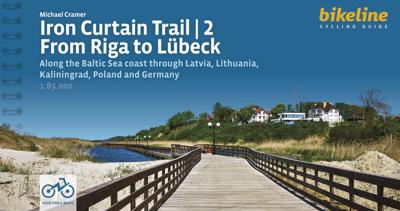
Fietsgids Bikeline Baltic Sea Cycle Route - Iron curtain Trail 2 | Esterbauer

0
Praktische fietsgids voor een gedeelte van de Iron Curtain Trail, van Riga naar Lübeck. Met detailkaarten, ingetekende route, informatie over overnachten en fietsenmakers, zwaarte en hoogteprofiel. In spiraalbinding, Engelstalig.  The cycling guide contains all the information you need for your cycling vacation along the European Iron Curtain Trai...

Verkopers met dit product

Verkoper
Bezorging
Prijs
DeZwerver.nl logo
DeZwerver.nl
2,95
19,50

Anderen bekeken ook

Fietsgids Bikeline Iron Curtain Trail 3 - German-German Border Trail | Esterbauer
Praktische fietsgids met detailkaarten, ingetekende route, informatie over overnachten en fietsenmakers, zwaarte en hoogteprofiel. In spiraalbinding, Engelstalig   The Iron Curtain ran for about 7,000 km from the Barents Sea in the north straight through Europe to the Black Sea and divided the continent in East and West. Until the Velvet Revolution in Eastern Europe it was a physical and ideological border between two blocks which conceived each other as enemies. Not only were many neighbouring states divided, but Germany itself was divided into east and west. Today there are hardly any reminders that the wall ever existed.   The border in Germany was 1,400 km long. The former death strip was composed of 3.000 km of fences, car-trenches for 730 km, 830 observation towers, the brightly lit roads, walls and bunkers – most of it is gone. Remaining are the vehicle roads with their perforated paving stones and several observation towers. And in a few years the sparse vegetation will be sup…
17,95
Nieuw
Fietsgids Bikeline Danube Bike Trail 5 (Engels - Donau Radweg) | Esterbauer
The fifth part of the Danube Bike Trail begins in Belgrade and ends in Romania on the Black Sea. With a total length of 2,845 kilometres, the Danube is Europe’s second longest river (after the Volga with 3,534 kilometres), and the only one on which kilometres are counted in reverse direction, starting with kilometer zero at the mouth and ending upstream at the source.   The total length of Part 5 of the Danube Bicycle Trail is about 1,400 kilometres. This does not include various side trips and alternative routes. The Danube Bike Trail is part of the Eurovelo-Route 6 and to a great extent identical.   This last part of the Danube Bike Trail mostly follows paved main roads and secondary roads, which you share with a variety of other traffic. It is not unusual in some parts of Bulgaria and Romania that you encounter more horse or mule carts, pedestrians or roaming sheep or geese than motorized traffic. In and around the larger cities, however, you can expect heavy traffic and you should…
15,50
Nieuw
Fietsgids The Elbe Cycle Route - Elbe fietsroute | Cicerone
This 1245km route along one of Europe's great rivers follows the Elbe from its source to the North Sea coast, visiting Prague, Dresden, Magdeburg and Hamburg. 28 day-stages of easy, flat cycling mainly on quiet country roads and dedicated cycle tracks. Here is a guidebook to the Elbe Cycle Route, possibly the easiest long-distance cycle route in Europe, being almost entirely flat or downhill for some 1200km. Cruise alongside one of Europe's great rivers as it flows from its source, through Czechia and Germany to the North Sea. This guidebook describes the route across 29 stages (together with a practical prologue stage), with stages ranging from 21 to 69 kilometres. Suggested schedules include 13, 15, 17 and 19 day options, making this a perfect 2-3 week cycle tour.   Map extracts at a scale of 1:150 accompany clear route description, with gradient profiles provided where they are helpful. Background information on the region's history and natural environment is also provided, as are …
24,95
Nieuw
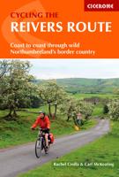
Fietsgids Cycling the Reivers Route | Cicerone
Guidebook to the Reivers Route, a 173 mile (280km) coast-to-coast cycle route across northern England and into Scotland from Tynemouth to Whitehaven. Exploring the rich history of traditional border territory, it is suitable for cyclists of all abilities and most commonly tackled on hybrid or sturdy touring bikes. Road alternatives are available. As the wildest of the northern coast-to-coast cycle routes, the Reivers Route explores the rich Border Reiving history of northern England and the Scottish Borders. Travelling 173 mile (280km) from Whitehaven to Tynemouth, this four-day cycle tour takes in the Cumbrian coast, northern Lake District, Northumberland National Park and North Tynedale, offering memorable off-road cycling through Kershope Forest and around Kielder Water. The route offers both on and off-road cycling, and is suitable for cyclists using touring or hybrid bikes. Places to stay overnight include Carlisle, Bailey Mill and Bellingham.   The guidebook also offers the Bord…
16,50
Nieuw
Fietsgids Bikeline Iron Curtain Trail 1 Finland - Baltische Staten | Esterbauer
Praktische fietsgids met detailkaarten, ingetekende route, informatie over overnachten en fietsenmakers, zwaarte en hoogteprofiel. In spiraalbinding, Engelstalig.  To properly live, breathe and experience history – that is the goal of the “Iron Curtain Trail”. From the Barents Sea to the Black Sea, this guide takes you along the Western border of the old Warsaw Pact countries, all the way across Europe. The route does not just connect European culture, history and sustainable tourism but it also provides historically interested cyclists with some spectacularly beautiful and varied landscapes and unique habitats that were able to emerge in the former border strip, which is today the European Green Belt. The maps in the revised edition are scaled larger at 1:120,000 from Helsinki to Riga, and from Grense Jakobselv to Vaalimaa it remains at 1:400,000. This volume describes the 4,000-kilometre-long part of the route from the Barents Sea to Riga.
18,50
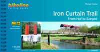
Fietsgids Bikeline Iron Curtain Trail From Hof to Szeged | Esterbauer
Praktische fietsgids met detailkaarten, ingetekende route, informatie over overnachten en fietsenmakers, zwaarte en hoogteprofiel. In spiraalbinding, Engelstalig 1760km van Hof naar Szeged The Iron Curtain divided the continent into East and West and extended from the Barents Sea through Europe to the Black Sea - a distance of 10,000 kilometres. Until the peaceful revolutions in Eastern Europe, it was the physical and ideological border between two mutually hostile blocs. It did not just divide many neighbouring states, but also divided Germany into East and West. Few things remain of the former death strip today. The few relics that are still there remind us of our past but no longer separate us.   Therefore, it is imperative to make the memories visible! We know that there is little in the way of shared memories between the West and the East, that the experiences of Europeans east and west of the border differ, not least because their perspectives were often shaped completely differ…
17,50
Nieuw
Wandelgids Walking in the Thames Valley | Cicerone
Walking in the Thames Valley offers 25 challenging circular walks around the River Thames and River Kennet in the south of England, taking in the Southern Chilterns, the Berkshire and North Hampshire Downs, Southern Oxfordshire and the eastern edge of Wiltshire. All routes are within easy reach of Reading, Newbury, Abingdon and London. While some walks visit Iron Age hill forts, others pass more modern features such as Wilton Windmill and the Kennet and Avon Canal. Some follow sections of the Ridgeway, while others meander along the banks of the Thames. What they all have in common is that they take the keen rambler to some of the best parts of the Thames Valley – a patchwork of open chalk grassland, broadleaved woodland and farmland and home to two Areas of Outstanding Natural Beauty. • walks from 10 to 18 miles, including one 2-day route • shorter, less strenuous alternatives for many of the walks • detailed route descriptions with information on local points of interest, OS mapping…
18,50
Nieuw
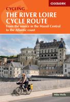
Fietsgids The River Loire Cycle Route | Cicerone
This guide describes a 1061km cycle route that starts at source of the Loire in the Massif Central mountains of central France and finishes at the Atlantic opposite St Nazaire. The route goes through the heart of France as the Loire becomes the royal river, bounded by extravagant châteaux, fields of Charolais cattle and vineyards. It passes through historic cities like Orléans and Tours, continuing past Angers and France's fourth largest city Nantes. The 1061km Loire Cycle Route starts at the source of the River Loire in the Massif Central mountains of central France and finishes at the Atlantic opposite St Nazaire. It descends past extinct volcanoes, crater lakes and deep gorges before joining EuroVelo route 6, followed by the fully waymarked Loire à Vélo, France's most popular cycle trail. Following the river downstream in 26 stages, the route is generally downhill or level, often on dedicated traffic-free cycle tracks.   Packed with a wealth of useful information - from practical p…
23,95
Nieuw
Wandelgids - Fietsgids Hiking and Cycling the California Missions Trail - Californie | Cicerone
Guidebook to hiking or cycling the 800 mile (1289km) California Missions Trail between San Francisco Bay and San Diego. The pilgrimage trail takes in 21 historic Spanish missions and can be completed in 50-60 walking days or 2-3 weeks cycling. With 1:100,000 mapping, route description, and details of accommodation and facilities for each stage. Ancient footpaths became connecting routes between the Spanish missions, pueblos, and presidios in the period 1769 to 1823. Over time these routes became automobile roadways and were marked with bells starting in 1906 to promote and preserve the El Camino Real. Today, the California Missions Trail follows a pedestrian route through urban cities and historic towns, through forest paths and country lanes, to each of the twenty-one historic Spanish missions. The 800-mile California Missions Trail leads walkers and cyclists through some of the most scenic and historic sites of one of America's most beautiful states. The 21 missions, founded 200-250…
26,50
Nieuw
Fietsgids The Rhine Cycle route | Cicerone
This comprehensive guidebook offers a detailed stage-by-stage description of an epic 1370km route along the Rhine, one of Europe's great rivers, which passes through six countries on its way from Switzerland to the North Sea. The cycling is easy, downhill and along dedicated cycle routes, the countries visited are very cycle-friendly and the waymarking is excellent. The whole trip can be completed in two weeks by a fit cyclist.   The guide includes plenty of information to help you plan your trip, with advice on travel, accommodation and facilities. The full route is then presented in 27 stages of 32-69km, with step-by-step route description, 1:100,000 mapping and notes on local points of interest. A facilities table, glossary and list of useful contacts can be found in the appendices.   On its way, the Rhine Cycle Route passes the remains of Roman cities, medieval towns, castles, cathedrals, palaces, great cities of the industrial revolution and relics of 20th-century warfare – and i…
23,95

Klanten-reviews van Fietsgids Bikeline Baltic Sea Cycle Route - Iron curtain Trail 2 | Esterbauer

Er zijn nog geen beoordelingen voor dit productBen jij de eerste die een review plaatst?

Meer over Fietsgids Bikeline Baltic Sea Cycle Route - Iron curtain Trail 2 | Esterbauer

Productomschrijving

Praktische fietsgids voor een gedeelte van de Iron Curtain Trail, van Riga naar Lübeck. Met detailkaarten, ingetekende route, informatie over overnachten en fietsenmakers, zwaarte en hoogteprofiel. In spiraalbinding, Engelstalig. 

The cycling guide contains all the information you need for your cycling vacation along the European Iron Curtain Trail between Riga and Lübeck: Precise maps, a detailed description of the route, a comprehensive list of overnight accommodation, numerous detail maps of cities and towns, and information about the most significant sights. And all that information comes with our bikeline pledge: The route described in this book has been tested and evaluated in person by the author! To assure that the book is as up-to-date as possible, we welcome corrections submitted by readers and local officials or businesses. We cannot, however, always check and confirm such changes before deadline.
The maps The detail maps are produced in a scale of 1:85,000 (1 centimeter = 850 meters). In addition to exactly describing the route, these maps also provide information about roadway quality (paved or unpaved), climbs (gentle or steep), distances, as well as available cultural and culinary highlights. Even with the most precise map, consulting the written description of the route may be necessary at times. Locations where the route is difficult to follow are shown by the #? symbol on the maps, the same symbol can then be found in the written description where the route is explained in detail. Note that the recommended main route is always shown in red or purple; alternative and excursion routes in orange. The individual symbols used in the maps are described in the legend on pages?4 and 5. Route altitude profile The route altitude profile in the introduction provides a graphic depiction of elevations along the route, the total length, and the location of larger towns and cities along the way. Additionally, a detailed altitude profile is provided at the beginning of each section which shows many of the smaller centers along the way as well as the waypoints, giving you a direct reference to the maps and route description. The latitude profiles do not show every individual small hill and dip, but only the major changes in elevation. On the detail maps smaller gradients are shown by arrows that point uphill.
The text The maps are supplemented by a written text that describes the recommended main route. Key phrases about the route description are indicated with the ?#- symbol. The description of the main route is also interrupted by passages describing alternative and excursion routes. These are printed in orange colour. Furthermore, the names of important villages, towns and cities are printed in bold type. If a location or community has important points of interest, addresses, telephone numbers and opening times are listed under the headline with the name of the place. Descriptions of the larger towns and cities, as well as historic, cultural and natural landmarks help round out the travel experience. These paragraphs are printed in italics to distinguish them from the route description.
List of overnight accommodation The last pages of this cycling guide provide a list of convenient hotels and guest houses in virtually every village or town along the route. This list also includes youth hostels and campgrounds.

Verken gerelateerde categorieën

Webshop.nl maakt gebruik van cookies. Ga je verder op onze website, ga dan akkoord met het plaatsen van cookies en de verwerking van deze data door ons en vermelde partners.