webshop.nl
Categorieën
  Sluiten

Meer Esterbauer
Meer Esterbauer in Literatuur boeken

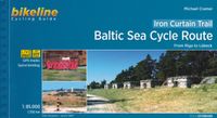
Fietsgids Bikeline Baltic Sea Cycle Route | Esterbauer

0
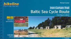
Praktische fietsgids voor een gedeelte van de Iron Curtain Trail, van Riga naar Lübeck. Met detailkaarten, ingetekende route, informatie over overnachten en fietsenmakers, zwaarte en hoogteprofiel. In spiraalbinding, Engelstalig.  The cycling guide contains all the information you need for your cycling vacation along the European Iron Curtain Trail...

Webshops met dit product

Webshop
Bezorging
Prijs

Anderen bekeken ook

Fietsgids Bikeline Baltic Sea Cycle Route | Esterbauer
Praktische fietsgids voor een gedeelte van de Iron Curtain Trail, van Riga naar Lübeck. Met detailkaarten, ingetekende route, informatie over overnachten en fietsenmakers, zwaarte en hoogteprofiel. In spiraalbinding, Engelstalig.  The cycling guide contains all the information you need for your cycling vacation along the European Iron Curtain Trail between Riga and Lübeck: Precise maps, a detailed description of the route, a comprehensive list of overnight accommodation, numerous detail maps of cities and towns, and information about the most significant sights. And all that information comes with our bikeline pledge: The route described in this book has been tested and evaluated in person by the author! To assure that the book is as up-to-date as possible, we welcome corrections submitted by readers and local officials or businesses. We cannot, however, always check and confirm such changes before deadline. The maps The detail maps are produced in a scale of 1:85,000 (1 centimeter = …
17,50
Fietsgids Bikeline Danube Bike Trail 2 (Engels - Donau Radweg) | Ester
Praktische fietsgids met detailkaarten, ingetekende route, informatie over overnachten en fietsenmakers, zwaarte en hoogteprofiel. In spiraalbinding, Engelstalig.   Danube Bike Trail In the last decade the Danube bike trail has emerged as Europe’s most important long-distance bicycle touring route. Its popularity is due primarily to the Danube’s natural beauty and the wealth of cultural and historical sites that line its banks. But the large numbers of bicycle tourists visiting the Danube would not be possible without well-developed infrastructure and services. The Danube bike route has benefited from well-built posted bike trails and an extensive network of services oriented to meeting the needs of bicycle tourists. The following pages provide a few practical notes about how to use the book, and some tips on getting ready for the tour.   Length The total distance from the start in Passau to the final destination, Vienna, is 320?kilometres. This figure does not include about 160?kilome…
16,50
Fietsgids Bikeline Danube Bike Trail 5 (Engels - Donau Radweg) | Ester
The fifth part of the Danube Bike Trail begins in Belgrade and ends in Romania on the Black Sea. With a total length of 2,845 kilometres, the Danube is Europe’s second longest river (after the Volga with 3,534 kilometres), and the only one on which kilometres are counted in reverse direction, starting with kilometer zero at the mouth and ending upstream at the source.   The total length of Part 5 of the Danube Bicycle Trail is about 1,400 kilometres. This does not include various side trips and alternative routes. The Danube Bike Trail is part of the Eurovelo-Route 6 and to a great extent identical.   This last part of the Danube Bike Trail mostly follows paved main roads and secondary roads, which you share with a variety of other traffic. It is not unusual in some parts of Bulgaria and Romania that you encounter more horse or mule carts, pedestrians or roaming sheep or geese than motorized traffic. In and around the larger cities, however, you can expect heavy traffic and you should …
15,50
Fietsgids The Elbe Cycle Route - Elbe fietsroute | Cicerone
This 1245km route along one of Europe's great rivers follows the Elbe from its source to the North Sea coast, visiting Prague, Dresden, Magdeburg and Hamburg. 28 day-stages of easy, flat cycling mainly on quiet country roads and dedicated cycle tracks. Here is a guidebook to the Elbe Cycle Route, possibly the easiest long-distance cycle route in Europe, being almost entirely flat or downhill for some 1200km. Cruise alongside one of Europe's great rivers as it flows from its source, through Czechia and Germany to the North Sea. This guidebook describes the route across 29 stages (together with a practical prologue stage), with stages ranging from 21 to 69 kilometres. Suggested schedules include 13, 15, 17 and 19 day options, making this a perfect 2-3 week cycle tour.   Map extracts at a scale of 1:150 accompany clear route description, with gradient profiles provided where they are helpful. Background information on the region's history and natural environment is also provided, as are p…
24,95
Fietsgids Bikeline Eurovelo 1 - Atlantic Coast Route | Esterbauer
Fantastische route van 11.150 km! For decades, thousands of vacationers have enjoyed cycling tours as the optimal travel method, and their numbers are growing daily. There are countless long-distance routes and regions that inspire carefree cycling. The diversity is incredible! In a great many European countries, you can find bike paths running alongside rivers or the seacoast, following discontinued railway lines, around lakes, hot on the trail of art and culture, or in remote hills. The EuroVelo 1 - Atlantic Coast Route is the perfect guidebook for planning your next long-distance cycling tour. Browse through these pages and dream of so many unique cycling routes travelling from Europe's northernmost cape, the Nordkapp, over the gentle hills and dales in Scotland and Ireland, along rock-bound coasts, and through idyllic landscapes in the Irish, Welsh and English interiors, before pedaling on through France's regional diversity, following pilgrims' paths in Spain and along Portugal's …
18,95
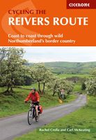
Fietsgids Cycling the Reivers Route | Cicerone
Guidebook to the Reivers Route, a 173 mile (280km) coast-to-coast cycle route across northern England and into Scotland from Tynemouth to Whitehaven. Exploring the rich history of traditional border territory, it is suitable for cyclists of all abilities and most commonly tackled on hybrid or sturdy touring bikes. Road alternatives are available. As the wildest of the northern coast-to-coast cycle routes, the Reivers Route explores the rich Border Reiving history of northern England and the Scottish Borders. Travelling 173 mile (280km) from Whitehaven to Tynemouth, this four-day cycle tour takes in the Cumbrian coast, northern Lake District, Northumberland National Park and North Tynedale, offering memorable off-road cycling through Kershope Forest and around Kielder Water. The route offers both on and off-road cycling, and is suitable for cyclists using touring or hybrid bikes. Places to stay overnight include Carlisle, Bailey Mill and Bellingham.   The guidebook also offers the Borde…
16,50

Klanten-reviews van Fietsgids Bikeline Baltic Sea Cycle Route | Esterbauer

Er zijn nog geen beoordelingen voor dit productBen jij de eerste die een review plaatst?

Meer over Fietsgids Bikeline Baltic Sea Cycle Route | Esterbauer

Productomschrijving

Praktische fietsgids voor een gedeelte van de Iron Curtain Trail, van Riga naar Lübeck. Met detailkaarten, ingetekende route, informatie over overnachten en fietsenmakers, zwaarte en hoogteprofiel. In spiraalbinding, Engelstalig.  The cycling guide contains all the information you need for your cycling vacation along the European Iron Curtain Trail between Riga and Lübeck: Precise maps, a detailed description of the route, a comprehensive list of overnight accommodation, numerous detail maps of cities and towns, and information about the most significant sights. And all that information comes with our bikeline pledge: The route described in this book has been tested and evaluated in person by the author! To assure that the book is as up-to-date as possible, we welcome corrections submitted by readers and local officials or businesses. We cannot, however, always check and confirm such changes before deadline. The maps The detail maps are produced in a scale of 1:85,000 (1 centimeter = 850 meters). In addition to exactly describing the route, these maps also provide information about roadway quality (paved or unpaved), climbs (gentle or steep), distances, as well as available cultural and culinary highlights. Even with the most precise map, consulting the written description of the route may be necessary at times. Locations where the route is difficult to follow are shown by the #? symbol on the maps, the same symbol can then be found in the written description where the route is explained in detail. Note that the recommended main route is always shown in red or purple; alternative and excursion routes in orange. The individual symbols used in the maps are described in the legend on pages?4 and 5. Route altitude profile The route altitude profile in the introduction provides a graphic depiction of elevations along the route, the total length, and the location of larger towns and cities along the way. Additionally, a detailed altitude profile is provided at the beginning of each section which shows many of the smaller centers along the way as well as the waypoints, giving you a direct reference to the maps and route description. The latitude profiles do not show every individual small hill and dip, but only the major changes in elevation. On the detail maps smaller gradients are shown by arrows that point uphill. The text The maps are supplemented by a written text that describes the recommended main route. Key phrases about the route description are indicated with the ?#- symbol. The description of the main route is also interrupted by passages describing alternative and excursion routes. These are printed in orange colour. Furthermore, the names of important villages, towns and cities are printed in bold type. If a location or community has important points of interest, addresses, telephone numbers and opening times are listed under the headline with the name of the place. Descriptions of the larger towns and cities, as well as historic, cultural and natural landmarks help round out the travel experience. These paragraphs are printed in italics to distinguish them from the route description. List of overnight accommodation The last pages of this cycling guide provide a list of convenient hotels and guest houses in virtually every village or town along the route. This list also includes youth hostels and campgrounds.
Productspecificaties

Artikelnummer(s)
Brand
Esterbauer

Verken gerelateerde categorieën

Webshop.nl maakt gebruik van cookies. Ga je verder op onze website, ga dan akkoord met het plaatsen van cookies en de verwerking van deze data door ons en vermelde partners.