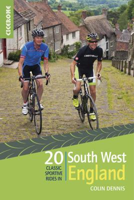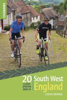
Fietsgids 20 Classic Sportive Rides - South West England | Cicerone

0
Een leuke gids met 20 dagtochten door Zuid west Engeland: pittige tochten met heel wat hoogteverschillen. Per tocht een goede beschrijving met kaarten, hoogteprofielen en veel praktische informatie.    20 sportive cycling routes in the best cycling areas of south west England are uncovered in this guidebook. Ideal for training, or simply spending ...

Verkopers met dit product

Verkoper
Bezorging
Prijs
DeZwerver.nl logo
DeZwerver.nl
2,95
19,95

Anderen bekeken ook

Fietsgids 20 Classic Sportives - South East England | Cicerone
This guidebook offers 20 sportive cycling routes in the best cycling areas of south east England. The training rides range between 60 and 117km (37 to 73 miles) in length, and offer a wide range of challenge, from flat routes for pacing training, to tough, hilly routes to climb.   The 20 sportive routes are found in Buckinghamshire, Berkshire, Oxfordshire, Wiltshire, Hampshire, Kent, Surrey and East Sussex, a collection from near Oxford down to the south coast by Bournemouth and Portsmouth.   From the Surrey and Chiltern Hills to the New Forest and South Downs, there are miles of cycle-friendly roads suitable for sportive training. All 20 routes are graded for difficulty and include timings, ascent, food-stops and access information, as well as annotated route maps and clear route descriptions.   Sportive cycling is a growing sport, and this guide provides routes for experienced riders and those new to this sport. Useful information on bike maintenance and equipment, to travelling aro…
19,95
Fietskaart Cycling guides Dartmoor - South Devon | Goldeneye
Dartmoor. One of England’s greater National Parks; the Forest of Dartmoor covers 365 square miles and contains the highest ground in England south of the Peak District. On its desolate moorland tracks the wanderer can believe they are further from a public road than anywhere in the country, but on the fringes lush valleys lead down on every side to thick woodland, green vegetation and picturesque villages. Dartmoor is well known for its wildlife - attractive herds of ponies, seemingly wild but in fact individually owned, foxes, badgers and otters - also the occasional adder. Fallow, roe and Sitka deer can often be seen, but the red deer of Exmoor have never penetrated the area. Buzzards, kestrels and various Birds of Prey are frequently seen, as well as the wheatear, while crows, ravens and the skylark are fairly commonplace. The Moor abounds in prehistoric remains. There are also many deserted medieval villages with remains of the traditional ‘longhouse’ buildings. For centuries tin …
12,95
Fietsgids Traffic-Free Cycle Trails in South East England | Inspiring Adventure
Leuke gids met mooie routes: bedenk wel dat ze vrij kort zijn.   Traffic-Free Cycle Trails South East England by Nick Cotton and Kathy Rogers features over 100 great cycling routes across the South East, London and into Eastern England. A companion guide to Nick Cotton's much-loved and bestselling Traffic-Free Cycle Trails, this guidebook provides an additional 50 routes to discover across the south-east of England - all away from traffic. As well as more off-road trails for gravel bikes and the latest cycle paths, this book also includes a variety of routes on former railway paths, canal towpaths and forest trails, allowing you to discover previously unknown local trails.   Presented in an easy-to-use format, this guide includes information on public transport, repairs and bike hire, as well as updated refreshments and parking details. From friends looking for a fun-packed day out on the trails to parents planning safe rides with children, let Traffic-Free Cycle Trails South East Eng…
27,95
Fietskaart 10 Cycling guides North York Moors | Goldeneye
Scheur- en watervast foetskaart van de North York Moors  met ingetekende fietsroutes.   Our maps are double-sided, printed on an A2 sheet with a concertina fold. This allows for easy folding and folding, and an ease of access to the mapping. The material is rain and tear-resistant. Our early maps were designed at the scale of 2 miles to 1 inch/1:126,720. The later designs along with digitalisation are 1: 100,000. We were encouraged by the Cycle Touring Club to convert our cartography toward the cycle market (to replace the out-of-print Bartholomew series). As time and the series progressed we have added more data: The National Cycle Network routes, Regional Routes, and Traffic-Free Family Routes, as and when they are developed. These routes are in addition to the Circular Routes Goldeneye Commissioned at the outset of our publishing schedule. We are also adding to new editions; bike shops, cycle hire, and tea rooms, along with the tourist attractions already featured. Our plan is to m…
14,95
Fietsgids Cycling in the Hebrides - Schotland | Cicerone
Prachtige fietsgids, zeer inspirerend , van een bijzonder fietsgebied. goede routesuggesties, Veel informatie, met hoogteprofielen en praktische zaken. The 37 day routes and 22 link routes brought together in this guide offer cyclists of all abilities the opportunity to island-hop by bike across the Hebrides, visiting over 20 islands in six sections: Clyde and Kintyre; Colonsay, Islay and Jura; Mull, Coll and Tiree; Skye and Raasay; Barra and the Uists; and Harris and Lewis. From Skye's majestic Cuillin mountains to the palm trees of Bute and the white sands of Tiree and Harris, there is nowhere better to indulge your sense of adventure and experience the thrill of travelling under your own steam in the fresh air. The Hebrides from Islay in the south up to Lewis in the north are all included, along with Arran and its neighbouring islands in the Firth of Clyde, and this comprehensive guide contains all the information you need - from ferry schedules to refreshment stops and bike repair…
22,50
Fietskaart 14 Cycling guides Suffolk | Goldeneye
To be confronted with the variety and complexity of the cycling routes, trails and paths in Suffolk can be a bewildering experience.  For it appears that the Suffolk County Council and the three District Councils are all trying hard to promote their areas. This is indeed encouraging for the growth of cycling, but it can be confusing.  Our purpose is to provide clear, easy to use and easy to follow, cycling maps, and to illustrate these in a comprehensive form.    Suffolk must be one of the most charming of counties to explore by bicycle. When Al Churcher delivered his routes to us at Goldeneye we couldn’t keep him quiet, such was his enthusiasm and wonder at Suffolk’s country lanes and byways. He has cycled all over the UK, Canada, Mallorca, New Zealand and Sicily, but Suffolk remained a firm favourite.    The inland scenery is not spectacular for the county’s main glory lies with its attractive villages; the local architecture jealously preserved from modern depredation. There is an …
15,95
Wandelgids The high mountains of Crete - Kreta | Cicerone
Guidebook to walking and trekking the high mountains of Crete. The largest of the Greek Islands, Crete's mountains provide breathtaking walking and wilderness to this popular island. The routes in this guidebook are graded for difficulty and range from short, easy strolls to challenging, multi-day treks and summit climbs, so there are options for walkers of all abilities.    All the mountain ranges of Crete feature high plains, gorges and ravines, but in the heart of the Lefka Ori there is something else. High above the treeline snow thaws by July to reveal a great circle of massive barren peaks, interspersed with ‘moonscape’ outcrops, or depressions, of sinkholes in black, grey or red rock. This high desert wilderness is seldom visited but covers some 960sqkm.   In central Crete, where the island is at its widest, the huge mass of Psiloritis (Mount Ida) dominates the whole region. Covering about 560sqkm this massif is different in that a single huge, partly scree-surfaced summit ridg…
26,50
Wandelgids Walking in the Yorkshire Dales: South and West | Cicerone
Veelzijdige wandelgids van een deel van de Yorkshire Dales, goede kaarten en beschrijvingen en veel keuze uit een behoorlijk aantal wandelingen. Part of a two-book set, this guidebook describes 44 walks in the southern and western Yorkshire Dales, including the famous 23 mile Three Peaks circuit over Pen-y-Ghent, Whernside and Ingleborough. The other, mostly circular routes of 3½ to 13 miles cover the scenic region between Sedbergh, Kirkby Lonsdale, Settle, Skipton and Grassington. The Yorkshire Dales need little introduction: their picturesque scenery and hundreds of miles of footpaths, tracks and bridleways have been attracting walkers for decades. Part of a two-volume set, this guidebook presents over 40 routes in the south and west of the National Park, with bases including Sedburgh, Malham, Grassington, Skipton, Settle and Kirkby Lonsdale. The walks cover the valleys of Wharfedale, Littondale, Malhamdale, Ribblesdale and Dentdale – each with its own distinctive landscape and char…
19,95
Reisgids The South West Coast Path | Bloomsbury
Often featuring in lists of the world's best walks, the South West Coast Path is 630 miles long, and passes through two World Heritage Sites. This guide to the path is a modern take on the traditional (turn right at the stile, and follow the footpath to the bridge) guidebook: instead of telling readers where to go step by step, Stephen gives fantastic ideas for what to do as they travel along the path. There are so many amazing adventures and places to visit (some 'secret' and some well known) and this guide highlights 1,000 of them, all situated along the route.   After an Introduction giving a history of the path and the stories of the people who made it (Why is this path the most popular National Trail? Why is it so closely associated with tales of King Arthur? When is the best time to visit?) the bulk of the book focuses on all the amazing things you can do along the path itself. It is divided into regions, with over 70 adventures/highlights per region: West Somerset, North Devon,…
27,95
Wandelgids Karawanken - Slovenie - Walking in the Karavanke | Cicerone
Goede wandelgids met veel dagtochten; redelijk kaartmateriaal en goede praktische informatie. This guidebook offers 23 walking routes set across the magnificent 120km-long Karavanke mountain range, which forms a natural border between Austria and Slovenia. Commonly known as 'the way the Alps used to be', as it is yet to experience the extent of commercial development known by the Western Alps, it is one of the longest ranges in Western Europe but it remains genuinely unspoilt and relatively unvisited by English-speaking hillwalkers. The guide's walks begin in pretty towns and villages, and most of them access the peaks from the relatively more gentle Slovenian side of the range, where forest-clad slopes lead to grassy summits where spectacular views can be enjoyed. Arranged by peak from west to east along the range, most of the summits can be reached by waymarked paths and trails. The guide gives all the practical details you need on transport, accessing the routes, accommodation and …
20,95

Klanten-reviews van Fietsgids 20 Classic Sportive Rides - South West England | Cicerone

Er zijn nog geen beoordelingen voor dit productBen jij de eerste die een review plaatst?

Meer over Fietsgids 20 Classic Sportive Rides - South West England | Cicerone

Productomschrijving

Een leuke gids met 20 dagtochten door Zuid west Engeland: pittige tochten met heel wat hoogteverschillen. Per tocht een goede beschrijving met kaarten, hoogteprofielen en veel praktische informatie.    20 sportive cycling routes in the best cycling areas of south west England are uncovered in this guidebook. Ideal for training, or simply spending some great days on the bike, the rides range between 59 and 119km (36 to 74 miles) in length, and offer a full range of challenges; from long, fast flat routes; perfect for pacing, to tough hill climbs on the Downs and Moors throughout the south west.    The 20 sportive routes are found in Cornwall, Devon, Dorset, Somerset, Wiltshire and Gloucestershire, as for north and east as the Wye Valley and Swindon. The range ensures that there is plenty of riding to be found, throughout the region, not to mention the companion Sportives guidebook to routes in England's south east.   From the Cotswolds, to Dartmoor, Exmoor, Bodmin Moor, into Wales and the south coast, there are miles of of cycle-friendly roads suitable for sportive training. All 20 routes are graded for difficulty and include timings, ascent, food-stops and access information, as well as annotated route maps and clear route descriptions.   Sportive cycling is a growing sport, and this guide provides routes for experienced riders and those new to this sport. Useful information on bike maintenance and equipment, to travelling around the areas with your bike and advice on accommodation is also included. The result is a sportive guidebook that will prepare you for the challenges ahead, and allow you to explore the best cycling the south-east has to offer.

Verken gerelateerde categorieën

Webshop.nl maakt gebruik van cookies. Ga je verder op onze website, ga dan akkoord met het plaatsen van cookies en de verwerking van deze data door ons en vermelde partners.