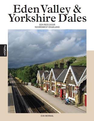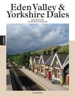
Eden Valley en Yorkshire Dales (Paperback)

0
Dertig jaar geleden was de noordwestelijke Settle-Carlisle Railway nog ten dode opgeschreven. Tegenwoordig vervoert Engelands mooiste spoorlijn ieder jaar duizenden mensen door twee streken: de nog onontdekte Eden Valley met haar glooiende graanvelden, en de ruige, romantische heuvels van de Yorkshire Dales. In dit boek stap je telkens uit op een v...

Verkopers met dit product

Verkoper
Bezorging
Prijs

Anderen bekeken ook

Reisgids PassePartout Eden Valley en Yorkshire Dales | Edicola
Dertig jaar geleden was de noordwestelijke Settle-Carlisle Railway nog ten dode opgeschreven. Tegenwoordig vervoert Engelands mooiste spoorlijn ieder jaar duizenden mensen door twee streken: de nog onontdekte Eden Valley met haar glooiende graanvelden, en de ruige, romantische heuvels van de Yorkshire Dales. In dit boek stap je telkens uit op een van de Victoriaanse stationnetjes, vanwaar je de omliggende omgeving gaat ontdekken. De gebieden zijn meer verbonden dan je op het eerste gezicht zou denken: door hun geschiedenis, hun markante natuur en geologie, en door de alomtegenwoordigheid van schapen. Niet voor niets is het schaap het embleem van het Yorkshire Dales National park, waar ook een groot deel van de Eden Valley onder valt.   Schrijver en historica Eva Moraal bewandelde honderden paden en bezocht vele plekken in de twaalf jaar dat ze de streken bezocht. Inmiddels beschouwt ze deze als haar tweede thuis. Zij vertelt de oude én nieuwe verhalen van de streken, mede aan de hand …
24,50
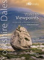
Wandelgids Viewpoints Yorkshire Dales ( | Northern Eye Books
One of eight books in the popular Yorkshire Dales: Top 10 Walks series. Handy, pocket-sized, full colour walking guides written by experts. This attractive and cleverly structured guide gives walkers ten easy, circular walks to the most amazing viewpoints in the Yorkshire Dales National Park in a popular pocketable format.   With clear information, an overview and introduction for each walk, expertly written numbered directions, large scale Ordnance Survey maps, superb eye-grabbing panoramic photographs, and interpretation of points of interest along the way, these guides set a new standard in clarity and ease-of-use. Featured walks include: Crummack Dales, Orton & Beacon Hill, Malham & Watlowes Valley, Trollers Gill & Appletreewick, Twistleton Scars, Upper Wharfesdale, Flasby Fell, Capplestone Gate, Semerwater and Dentdale & Deepdale. Frank Kew is a retired lecturer, author and tour leader with a detailed knowledge of bucolic landscapes, villages, tea shops and pubs of the Yorkshire …
10,95
Wandelgids Yorkshire Dales | Ordnance Survey
Enjoy the magnificent waterfalls, sweeping scenery and cosy Dale pubs with ten short, leisurely walks suitable for all ages and abilities. Discover the Yorkshire Dales with its natural wonders, lush wildlife and quaint villages on accessible, tried-and-tested walks which everyone can go on – no walking experience required.   Yorkshire Dales Short Walks Made Easy include:   - Walk the banks of the River Eden through Westmorland and explore the limestone scenery around Kirkby Stephen - See some of the iconic waterfalls for which the Yorkshire Dales are famous in Upper Swaledale on a walk to East Gill Force and Kisdon Force - Discover Heriot Country around the village of Askrigg, surrounded by wildflower meadows - See the iconic Ribblehead Viaduct on a moorland walk in the shadow of Whernside, Yorkshire’s highest hill - Follow the River Wharfe through wildflower meadows through Grassington - Take in unmissable Malham Cove, one of England’s most spectacular natural features   OS Short Wal…
10,95
Wandelkaart - Topografische kaart OL19 OS Explorer Map | Active Howgill Fells and Upper Eden Valley | Ordnance Survey
Een van de beste detailkaarten die er op de wereld gemaakt worden: zeer gedetailleerd, prachtig helder kleurgebruik, veel topografische aspecten en - zeer belangrijk - allerlei toeristische en recreatieve aspecten zijn ingetekend. De perfecte kaart voor vakantie en vrije tijd: wandelen, fietsen of gewoon de omgeving verkennen. Door de grootte van de kaart, voor- en achterzijde, bestrijkt het een behoorlijk groot gebied! Explore Howgill Fells in the Yorkshire Dales National Park and the North Pennines Area of Outstanding Natural Beauty with the Eden Valley running in between. Visit Sedbergh, a quaint market town at the confluence of four rivers and ancient trade routes, and Appleby-in-Westmorland, home of the famous horse fair since the seventeenth century.   Climb the Howgill Fells for incredible views of the Lake District and Yorkshire Dales and ascend the heights of Wild Boar Fell, High Seat and Cautley Spout, England’s highest waterfall   Follow A Pennine Journey through spect…
28,50
Reisgids Slow Travel Yorkshire Dales | Bradt Travel Guides
Een bijzondere serie van Bradt guides, waarin een gedeelte van Engeland of Schotland uitgebreid beschreven wordt. Met veel aandacht voor kleine details die je niet al gauw elders zult vinden. Naast de beschrijvende informatie vind je ook een schat aan praktische informatie als accommodatie-adressen of leuke pubs. Een aanrader! This new, thoroughly updated third edition of Yorkshire Dales (Slow Travel), part of Bradt’s series of distinctive ‘Slow’ travel guides to local UK regions, remains the most comprehensive guide to the area and covers the whole of the Yorkshire Dales National Park and Nidderdale Area of Outstanding Natural Beauty plus nearby ‘slow’ and historic towns and villages. The Yorkshire Dales could have been invented for modern travel. The region’s cinematic caves, valleys, waterfalls and limestone geology are famous round the world. Within a short walk are filmset-perfect traditional pubs and cafes where you are as likely to chat to shepherds as celebrities.   The Dales …
23,50
Wandelgids The Yorkshire Dales - Walking in the North and East | Cicerone
This guidebook contains 43 circular day walks in the north and east Yorkshire Dales. It explores the dales, hills and moors between Kirkby Stephen and Pateley Bridge. Walking ranges from gentle three-mile strolls to more strenuous day-long rambles across the Howgills, Wensleydale, Swaledale, Nidderdale, Mallerstang and Coverdale   In this guidebook, 43 circular walks, ranging from 3-mile strolls to full-day adventures are explored in the northern and eastern Dales. Few areas in England are as appealing as the Yorkshire Dales and this volume of a two-part guide provides walkers with a comprehensive walking guide to the whole of the region.     Each valley has a character and history of its own and this guide covers the varied fell and dale landscapes of the Howgills, Mallerstang, Swaledale, Wensleydale, Coverdale and Nidderdale. Spectacular waterfalls, dramatic gorges, expansive heather moors, rich woodlands and colourful flower meadows are just some of the natural delights encountered…
19,95
Wandelkaart Settle to Carlisle Way | Harvey Maps
Mooie, duidelijke kaart van de Settle to Carlisle Way in Noord-Engeland. Geplastificeerd met veel extra informatie en uitsnedes van de route. Settle Carlisle Way is a walking route linking the stations of the famous and scenic Settle-Carlisle Railway Line. This map gives you the chance to walk up and ride back on the train, or to hop off at one station and rejoin a later train further on. The route starts in picturesque Settle and passes through the beautiful Yorkshire Dales and the sheltered Eden Valley, ending in central Carlisle. The entire route is on the one map. Tough and 100% waterproof Compact and light - the map itself weighs just 60gms - a third of the weight of a laminated map, and much less bulky. And you can fold or refold it time and again, or stuff it in your pocket and it won't fall to pieces. Shows the entire route on one sheet. Information on finding accommodation, camping, food. Directions to the start. Also Ranger Service contact numbers and enlargements of towns/v…
21,50
Wandelgids Walking in the Yorkshire Dales: South and West | Cicerone
Veelzijdige wandelgids van een deel van de Yorkshire Dales, goede kaarten en beschrijvingen en veel keuze uit een behoorlijk aantal wandelingen. Part of a two-book set, this guidebook describes 44 walks in the southern and western Yorkshire Dales, including the famous 23 mile Three Peaks circuit over Pen-y-Ghent, Whernside and Ingleborough. The other, mostly circular routes of 3½ to 13 miles cover the scenic region between Sedbergh, Kirkby Lonsdale, Settle, Skipton and Grassington. The Yorkshire Dales need little introduction: their picturesque scenery and hundreds of miles of footpaths, tracks and bridleways have been attracting walkers for decades. Part of a two-volume set, this guidebook presents over 40 routes in the south and west of the National Park, with bases including Sedburgh, Malham, Grassington, Skipton, Settle and Kirkby Lonsdale. The walks cover the valleys of Wharfedale, Littondale, Malhamdale, Ribblesdale and Dentdale – each with its own distinctive landscape and char…
19,95
Wandelgids 015 Pathfinder Guides Yorkshire Dales | Ordnance Survey
Wandelgids van een deel van Engeland. Deze gids bevat 28 dagwandelingen, variërend van korte tochten tot pittige dagtochten. De bijbehorende kaarten zijn uitstekend: men heeft de topografische kaarten van Ordnance Survey gebruikt waarop de route is ingetekend. Daarnaast praktische informatie over de wandeling en wat beschrijvingen van het gebied. Met GPS referenties voor de waypoints bij elke route. Met informatie over parkeren, goede pubs en bezienswaardigheden langs de route. A revised Pathfinder walking guide to the Yorkshire Dales, with 28 circular walks that explore the most scenic parts of the Dales. With walks for all ages and abilities this guide covers Swaledale, Ribblesdale and the Yorkshire Dales National Park. All walks have GPS waypoints, Ordnance Survey maps and beautiful photography.
18,50
Fietsgids Cycling in the Yorkshire Dales | Cicerone
This guide describes 23 day routes, graded by a combination of distance, climb and overall gradient, all suitable for road bikes and illustrated by detailed maps and profiles. In addition a six-stage tour takes in all the highlights, including Grassington, Leyburn, Hawes, Kirkby Stephen, Ingleton and Settle. And for those who really want to test themselves, the route of the Stage 1 of the 2014 Tour de France, a 206km loop from Leeds to Harrogate, is also included, with an option to close the loop without adding many extra miles.   Appendices include a route summary table to help you choose your route, lots of information about facilities for cyclists along the routes, taking bikes on public transport and basic bike maintenance.   The Vuelta a Dales takes in the best dales, passes and viewpoints as it passes through Grassington, Leyburn, Hawes, Kirkby Stephen, Sedbergh, Ingleton and Settle. The Yorkshire Dales have always welcomed visitors who enjoy the views. For cyclists, the nationa…
22,95

Klanten-reviews van Eden Valley en Yorkshire Dales (Paperback)

Er zijn nog geen beoordelingen voor dit productBen jij de eerste die een review plaatst?

Meer over Eden Valley en Yorkshire Dales (Paperback)

Productomschrijving

Dertig jaar geleden was de noordwestelijke Settle-Carlisle Railway nog ten dode opgeschreven. Tegenwoordig vervoert Engelands mooiste spoorlijn ieder jaar duizenden mensen door twee streken: de nog onontdekte Eden Valley met haar glooiende graanvelden, en de ruige, romantische heuvels van de Yorkshire Dales. In dit boek stap je telkens uit op een van de Victoriaanse stationnetjes, vanwaar je de omliggende omgeving gaat ontdekken. De gebieden zijn meer verbonden dan je op het eerste gezicht zou denken: door hun geschiedenis, hun markante natuur en geologie, en door de alomtegenwoordigheid van schapen. Niet voor niets is het schaap het embleem van het Yorkshire Dales National park, waar ook een groot deel van de Eden Valley onder valt. Schrijver en historica Eva Moraal bewandelde honderden paden en bezocht vele plekken in de twaalf jaar dat ze de streken bezocht. Inmiddels beschouwt ze deze als haar tweede thuis. Zij vertelt de oude én nieuwe verhalen van de streken, mede aan de hand van

Verken gerelateerde categorieën

Webshop.nl maakt gebruik van cookies. Ga je verder op onze website, ga dan akkoord met het plaatsen van cookies en de verwerking van deze data door ons en vermelde partners.