Meer Stichting Moving Mountains
Meer Stichting Moving Mountains in EBooks

Dutch Mountain Trail (Paperback)

0
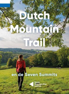
De Seven Summits zijn de zeven steilste bergtoppen van Zuid-Limburg. Beklim ze allemaal in de spannendste rondwandelingen met de meeste bergbeleving! De Dutch Mountain Trail is een ruige wandeltocht van ruim 100 km die de Seven Summits met elkaar verbindt. Loop van station Eygelshoven (Kerkrade) naar station Maastricht over een route waar het echte...

Verkopers met dit product

Verkoper
Bezorging
Prijs

Anderen bekeken ook

Wandelgids Dutch Mountain Trail | Stichting Moving Mountains
The Dutch Mountain Trail: Nederlands Enige echte bergwandeltocht! De Seven Summits zijn de zeven steilste bergtoppen van Zuid-Limburg. Beklim ze allemaal in de spannendste rondwandelingen met de meeste bergbeleving! De Dutch Mountain Trail is een ruige wandeltocht van ruim 100 km die de Seven Summits met elkaar verbindt. Loop van station Eygelshoven (Kerkrade) naar station Maastricht over een route waar het echte berggevoel nooit ver weg is. Alpenweides, snelstromende beken, rots- wanden en natuurlijk spectaculaire vergezichten: ze zullen je uitdagen en in vervoering brengen tijdens deze trail.    
19,95
Wandelgids Dutch Mountain Trail (Engelstalig) | Stichting Moving Mountains
The Dutch Mountain Trail: Nederlands Enige echte bergwandeltocht nu ook in het Engels verkrijgbaar! The Dutch Mountain Trail traverses the southernmost part of the Netherlands, the only region which is not as flat as a pancake. Over 100 km long with several near-mountainous sections, it is a serious hiking trail which also incorporates the Seven Summits. Along the way you will enjoy fast-flowing streams, alpine meadows, picturesque valleys and spectacular vistas and switch back and forth between three different countries. As well as detailed route descriptions for the Trail (with separate ones for the Seven Summits), this guide is packed full of interesting facts and curiosities about the region.  
19,95
Wandelgids 1504 Topographic Map Guide Appalachian Trail - Bailey Gap to Calf Mountain | National Geographic
Wandelgids/wandelatlas met weinig tekst, maar goede kaarten van een gedeelte van de Appalachian Trail. The Bailey Gap to Calf Mountain Topographic Map Guide makes a perfect traveling companion when traversing the central Virginia section of the Appalachian Trail (A.T.). The A.T. in central Virginia falls mostly within National Forest land, traveling through mature forests and over high mountain summits. The trail becomes more difficult as hikers go farther south, traversing the A.T.’s northernmost balds, past interesting rock formations, and over notable peaks, such as the Priest, McAfee Knob, and Dragon’s Tooth.   Scale 1/63 360 (1 cm = 633 m). 1 inch = 1 mile.   This topographic Map Guide is printed on a waterproof, tear-resistant paper. A full UTM grid is printed on the map to aid with GPS navigation.   Each A.T. Topographic Map Guide includes detailed topographic maps at a detail of 1 inch = 1 mile. Each page is centered on the A.T. and overlaps with the adjacent pages so there is…
16,95
Wandelgids Kilimanjaro - A Trekking Guide to Africa's Highest Mountain | Trailblazer Guides
Dat dit boek je met de planning helpt is geen loze kreet. Werkelijk alle facetten van de berg en zijn omgeving komen aan bod. De auteur geeft informatie over hoe je een reis naar de Kili kunt boeken, hoe je er komt, wat je er kunt verwachten en hoe je vervolgens de top kunt bereiken. Maar hij is ook erg duidelijk voor wat betreft het bereiken van die top: doe dat alleen onder begeleiding van een erkende gids en doe het op je gemak. Kilimanjaro is immers niet voor niets de hoogste berg van Afrika en daarmee één van de beruchte 'seven summits'. Practical, best-selling guide to climbing Mount Kilimanjaro, Africa's highest mountain and most popular trek.   Fully updated 6th edition with amendments in 2024.   At 5895m (19,341ft) Kilimanjaro is Africa's highest mountain. Yet with no mountaineering skills necessary to reach the summit, even non-climbers can experience the thrill of climbing one of the world's greatest peaks. Taking you from the dusty plains of East Africa through jungle…
25,95
11 stationswandelingen over de Utrechtse Heuvelrug (Paperback)
Deze wandelgids bevat 7 afwisselende 'lijnwandelingen' van/naar treinstations over en langs de Utrechtse Heuvelrug. Je wandelt van station naar station dit traject: Hilversum - Hollandsche-Rading - Baarn - Den Dolder - Driebergen-Zeist - Maarn - Veenendaal West - Rhenen. Onderweg maak je 4 fraaie rondwandelingen. Dat zijn vanaf station Baarn door het prachtige Landgoed Groeneveld, vanaf station Driebergen-Zeist door de landgoederen Bornia en Heidestein en langs slot Zeist, vanaf station Maarn door het grote romantische Landgoed Huis te Maarn met daarin de 40 meter hoge uitkijktoren De Kaap en vanaf station Rhenen onderlangs en over de Grebbeberg; een van de hoogtepunten van de Utrechtse Heuvelrug. De totale afstand van deze lange-afstand-stationswandeling is inclusief de rondwandelingen ruim 140 kilometer. De afstanden van de etappes liggen tussen de 10 en 16 kilometer en kunnen uitstekend met elkaar gecombineerd worden. Het merendeel van de routes loopt grotendeels over onverharde
17,95
Wandelkaart South Loch Ness Trail | Harvey Maps
Mooie, duidelijke kaart van de South Loch Ness Trail in Schotland. Geplastificeerd met veel extra informatie en uitsnedes van de route.   This map has been produced in association with Destination Loch Ness Ltd.   The South Loch Ness Trail is 28 miles long and is an exciting new trail for all types of users. The Trail of the Seven Lochs at South Loch Ness is 50 miles long and offers stunning views for walkers and riders alike.   This map is your essential piece of equipment. Although the route is waymarked it is never a good idea to walk in remote areas without a map and compass.
16,55
Twaalf Twentse tochten (Paperback)
In twaalf rondwandelingen laat Truus Wijnen Twente 'op z'n best' zien. En wat ze daarmee bedoelt is zichtbaar op de prachtige foto's die ze onderweg maakt en die deze gids tot één grote lofzang op Twente maken. De rondwandelingen zijn verspreid over heel Twente en geven een goed beeld van de vele aspecten van 'het land tussen Regge en Dinkel'. Heidevelden, bergen, beken, glooiende akkers op eeuwenoude essen afgewisseld met statige landgoederen, oude boerderijen en cultuurhistorisch erfgoed. En dan hebben we het nog niet eens gehad over de spreekwoordelijke gastvrijheid van de Tukkers én de vele typisch Twentse café's en restaurants langs de routes. Truus Wijnen laat zien dat een dagje wandelen in dit deel van Nederland goed is voor een hele week gezondheid en goede moed!
17,95
Wandelgids 1509 Topographic Map Guide Appalachian Trail - Schaghticoke Mountain to East Mountain | National Geographic
Wandelgids/wandelatlas met weinig tekst, maar goede kaarten van een gedeelte van de Appalachian Trail Each A.T. Topographic Map Guide includes detailed topographic maps at a detail of 1 inch = 1 mile. Each page is centered on the A.T. and overlaps with the adjacent pages so there is little chance of getting lost. Along the bottom of each page is a trail profile that shows the distance between shelters, camping areas, and trail access points. The map and trail profile provide a step by step visual guide to hiking the trail, mile by rugged mile. The Topographic Map Guide is built for all levels of hiking enthusiasts, from the day tripper to the multi month 'thru-hiker'. The front pages of the printed Topographic Map Guide include resupply information, town inset maps, camping options, and much more. The Schaghticoke Mountain to East Mountain Topographic Map Guide makes a perfect traveling companion when traversing the Connecticut and Massachusetts sections of the Appalachian Trail (A.T.…
16,95
-10%
Walker'S Smokey Mountain Trail Outfitters - Lemax
Walker'S Smokey Mountain Trail Outfitters Kerstdecoratie LEMAX. De afmetingen van dit artikel zijn: 14,5 x 20,5 x 13,2 cm. Het artikel is gemaakt van Porcelain. Dit artikel heeft verlichting. Dit aritkel beweegt niet.Warentuin heeft alles voor huis, tuin, dier & kerst! Walker'S Smokey Mountain Trail Outfitters - Lemax, dit komt uit het assortiment Huisjes Winkels, koop hem gemakkelijk en goedkoop online! Dit product verkopen wij per stuk tenzij anders aangegeven.

54,99

49,49
Wandelgids 1510 Topographic Map Guide Appalachian Trail - East Mountain to Hanover | National Geographic
Wandelgids/wandelatlas met weinig tekst, maar goede kaarten van een gedeelte van de Appalachian Trail.  Each A.T. Topographic Map Guide includes detailed topographic maps at a detail of 1 inch = 1 mile. Each page is centered on the A.T. and overlaps with the adjacent pages so there is little chance of getting lost. Along the bottom of each page is a trail profile that shows the distance between shelters, camping areas, and trail access points. The map and trail profile provide a step by step visual guide to hiking the trail, mile by rugged mile. The Topographic Map Guide is built for all levels of hiking enthusiasts, from the day tripper to the multi month 'thru-hiker'. The front pages of the printed Topographic Map Guide include resupply information, town inset maps, camping options, and much more. The East Mountain to Hanover Topographic Map Guide makes a perfect traveling companion when traversing the Vermont section of the Appalachian Trail (A.T.). The landscape of Vermont is a va…
16,95

Klanten-reviews van Dutch Mountain Trail (Paperback)

Er zijn nog geen beoordelingen voor dit productBen jij de eerste die een review plaatst?

Meer over Dutch Mountain Trail (Paperback)

Productomschrijving

De Seven Summits zijn de zeven steilste bergtoppen van Zuid-Limburg. Beklim ze allemaal in de spannendste rondwandelingen met de meeste bergbeleving! De Dutch Mountain Trail is een ruige wandeltocht van ruim 100 km die de Seven Summits met elkaar verbindt. Loop van station Eygelshoven (Kerkrade) naar station Maastricht over een route waar het echte berggevoel nooit ver weg is. Alpenweides, snelstromende beken, rots- wanden en natuurlijk spectaculaire vergezichten: ze zullen je uitdagen en in vervoering brengen tijdens deze trail.

Productinformatie

    Productspecificaties

    Artikelnummer(s)
    Brand
    Stichting Moving Mountains

    Verken gerelateerde categorieën

    Webshop.nl maakt gebruik van cookies. Ga je verder op onze website, ga dan akkoord met het plaatsen van cookies en de verwerking van deze data door ons en vermelde partners.