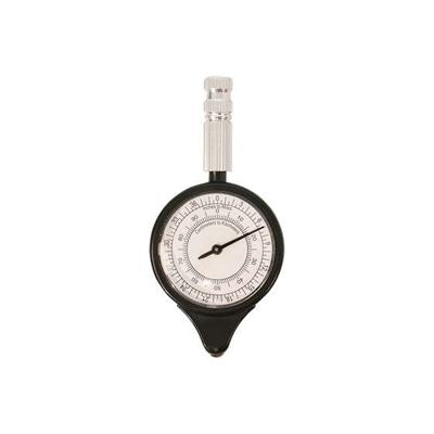
DISTANCE MAP METER SOFTEE SCALE (CURVÍMETER)

0
Analogic navigation instrument with pointer. Choose between the different scales of the map to measure your route. Length: 9,5cm. Diameter: 4,5cm....

Verkopers met dit product

Verkoper
Bezorging
Prijs
echtveelvoorweinig.nl logo
echtveelvoorweinig.nl
2-3 werkdagen
6,99
7,74

Anderen bekeken ook

Wandelatlas 4001 Haute Route Chamonix to Zermatt | National Geographic
- Waterproof - Tear-Resistant - Topographic Map The Haute Route--aka the High Route or Mountaineers' Route--traverses the French and Swiss Alps. It was conceived as a summer mountaineering route in the mid-nineteenth century by members of the English Alpine Club. Though originally called The High-Level Route by members of the Alpine Club, in 1911, a group first successfully established a winter route from Bourg St. Pierre to Zermatt on skis and afterwards the name of the route was translated into French. As a result of their success, the French term stuck, and the journey gained a reputation amid skiers and ski mountaineers as a classic must-do winter/spring tour. There is also a non-technical Walker's Haute Route that has gained in popularity and become a classic in and of itself. This Topographic Map Guide outlines two different variations of the Haute Route from Chamonix, France to Zermatt, Switzerland: one for hikers and one for skiers. The northernmost route or, Walker's Route, d…
16,95
Wandelgids Walk! La Gomera | Discovery Walking Guides
La Gomera is the ultimate get-away-from-it-all island: easy-going, unspoilt, friendly, isolated from the hustle and bustle of modern living, and so laid back it’s virtually supine - even the volcanoes have been dormant for millions of years. The walks, however, are a bit more energetic. For the new 4th edition of Walk! La Gomera Charles Davis has teamed up with Jan Kostura. Jan brings his wide experience and passion for the Canaries, checking, re-walking and revising existing routes, and adding a couple of his own adventures, including a new Top Three Gomeran walk. Two routes have been dropped as having become too dangerous, but the good news is that many of the more harum-scarum walks have been improved through path clearing and the addition of railings to the vertiginous stretches. Other good news is that the devastating forest fires of 2012 have proved not nearly as damaging as we feared, leaving most of our itineraries unscathed. In short, there is every reason to take off and ex…
17,50
Wandelkaart Walker's Haute Route: Chamonix to Zermatt | Knife Edge Outdoor
Een hele goede kaart van én van de grote wandeltochten in de Alpen: Haute Route Chamonix-Zermatt. Deze wandelkaart op scheur- en watervast papier gedrukt geeft de hele route weer op een gedetailleerde schaal. Alle noodzakelijke informatie vind je er op terug.   The best sheet map for the Walker's Haute Route: Chamonix to Zermatt. This is the only map available that displays the entire route and numerous variants on a single sheet: perfect for planning and navigation. 1:40,000 - larger scale and more detail than any other map. 1:10,000: for select areas where navigation is challenging. Made specifically for the Walker's Haute Route by Knife Edge Outdoor Guidebooks:   - English/French/German map key - 1:40,000/1:10,000 - Numerous variants - Includes free GPX downloads for the trail - GPS compatible - Tougher than traditional maps: try to tear me! - More water-resistant than traditional maps - Lighter than traditional maps - Huts/accommodation marked on the map   The Walker's Haute Route…
23,95
Fietskaart Cycle Map The Bay Cycle Way | Sustrans
Het is niet een heel overzichtelijke kaart, het zijn juist blokken van een deel van de route waarop deze staat ingetekend. Daarin juist wel heel goed met handige stedenkaarten en route profielen. Eigenlijk voor de route als zodanig onmisbaar, je mist alleen het overzicht een beetje.   This is the official map for the Bay Cycle Way route, an 81 mile (130km) coastal cycle route around Morecambe Bay in the north west of England, and winner of the Visitor Experience Award - Lancashire Tourism Awards 2015. This relatively flat route hugs the spectacular coastline of Morecambe Bay along quiet roads, greenways, canal towpaths and promenades, offering breath taking scenery from Walney Island near Barrow right round to Glasson Dock south of Lancaster. The route looks out over the Irish Sea and is ideal for spotting terns, curlew, knot, oystercatcher and even grey seals.   This full colour map based on Ordnance Survey data shows clearly mapped cycle routes on traffic-free paths, quiet lanes …
14,95
Wegenkaart - landkaart North Coast Road Trip Map | Destination Earth
This North Coast road trip map is the essential tool that will guide you through the breathtaking landscapes, stunning coastal views, and enchanting villages of the North Coast 500 in Scotland. Designed by travel enthusiasts, for travel enthusiasts, our map is more than just a navigation tool. It's a gateway to adventure, a treasure trove of hidden gems, and a companion that will make your journey even more extraordinary. Featuring a detailed and easy-to-read layout, this Destination NC500 Map will assist you in planning and navigating your way along the 500-mile route. With precise mile markers, highlighted attractions, and recommended stopping points, this map will ensure you don't miss a single sight along the way.   NC500 A1 Map Features:     Exact Locations: All of the exact locations of over 110+ Sights and Attractions, as well as Accommodation, Restaurants, Campervan Water and Waste Facilities, Electric Vehicle Charging Points, Train Stations, Airports, and much more! Must-know…
13,-
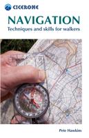
Reishandboek Navigation | Cicerone
Handzaam gidsje met veel praktische informatie voor wandelaars. Met hulp van deze gids leert u ondermeer navigeren met behulp van kaart en kompas en het plannen van eigen routes.   This conveniently sized guide is an invaluable point of reference for all walkers. Written by an author with a wealth of experience teaching navigation skills, it provides a clear and comprehensive guide to the key techniques - giving you the confidence to navigate successfully with map and compass and to plan and execute your own routes.   All topics are clearly referenced and easy to find. Chapters cover scales and grids, map symbols and contours, compasses, bearings, navigation on the hill, route planning and night and bad weather navigation. This new edition also incorporates new content on walking with a GPS device, with notes on how technology can complement map and compass. The text is illustrated with explanatory photos and diagrams as well as extracts from real maps and map keys, and - since the be…
13,50
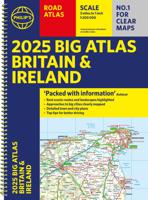
Wegenatlas Big Atlas Britain & Ireland 2025 | A3-Formaat | Ringband | Philip's Maps
Goede gedetailleerde wegenatlas van Groot-Brittannië, schaal 1:200.000 met een overzichtskaart van Ierland, schaal 1:1.000.000. Groot formaat, A3, en in ringband. 'Good balance between detail and clarity with excellent town maps' What Car? PHILIP'S is No. 1 in the UK for clear maps. The latest 2025 Philip's Big Road Atlas of Britain and Ireland, in a supersize large format, has fully updated mapping from the Philip's digital database alongside all the detail and information needed for successful travel.   * Top driving tips for safety and skill including how to parallel park * The best scenic routes, natural features and landscape highlighted for enhanced travelling * Practical 'more to view per page' A3 size * Main scale of maps: 3 miles to 1 inch = 1:200,000 for ease of use * Route-planning section for the easiest navigation * Special wide-vehicle access indicators for rural areas * 64 fully indexed and detailed town and city plans * City approach maps with named roads fo…
22,50
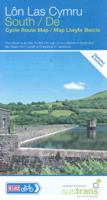
Fietskaart Cycle Route Map Lôn Las Cymru South | Sustrans
Het is niet een heel overzichtelijke kaart, het zijn juist blokken van een deel van de route waarop deze staat ingetekend. Daarin juist wel heel goed met handige stedenkaarten en route profielen. Eigenlijk voor de route als zodanig onmisbaar, je mist alleen het overzicht een beetje. This linear map shows the southern half of the stunning Lon Las Cymru route and surrounding area over a series of separate map panels.   The route connects Llanidloes in the heart of Wales to the attractive finishing points of Cardiff or Chepstow, with two route options via Hay on Wye to Abergavenny and Chepstow via a taste of the Black Mountains, or along the largely traffic-free Taff Trail from Brecon to Cardiff via Merthyr Tydfil.   This full colour map based on Ordnance Survey data shows clearly mapped cycle routes on traffic-free paths, quiet lanes and roads, with easy to read contours and route profiles. Also features detailed inset maps for the major towns and cities and tourist information.   Natio…
16,95
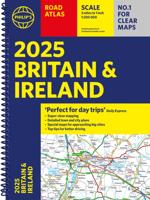
Wegenatlas Road Atlas Britain and Ireland 2025 | Ringband | A4-Formaat | Philip's Maps
Let op! Ierland en een gedeelte van Schotland hebben een andere schaal dan de rest van de atlas.   'Good balance between detail and clarity with excellent town maps' What Car?PHILIP'S - Market leader and No. 1 in the UK for clear maps 2025 Philip's Road Atlas of Britain and Ireland is a top-of-the-range, A4-sized, spiral-bound atlas, featuring fully updated maps from the Philip's digital database. Voted Britain's clearest and most detailed in an independent consumer survey, the mapping is super-clear.   * 160 pages of fully updated super-clear road maps * Top tips for better and safer driving and the easiest way to parallel park * Detailed route-planning maps, to help plan your route in advance * 88 fully indexed and detailed town-centre maps throughout the British Isles * Major city approach maps with named arterial roads including the expanded London ULEZ * Clear road map showing all of Ireland * Mapping at a scale of 3 miles to 1 inch = 1:200,000 for easy use * Handy lie-f…
23,95
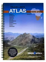
Wegenatlas Traveller's Atlas Southern Africa - Zuidelijk Afrika | A3-Formaat | Ringband | Tracks4Africa
Deze atlas omvat tien landen in zuidelijk Afrika en is speciaal gericht op reizigers die zelf rijden. De betrokken landen zijn: Angola, Botswana, Lesotho, Malawi, Mozambique, Namibië, Zuid-Afrika, Swaziland, Zambia en Zimbabwe.   De Atlas bevat 223 kaartpagina's met hetzelfde vertrouwde kaartdetail waarvoor Tracks4Africa bekend is.   De wegenatlas is afgedrukt in A3 formaat, weegt 2750g, heeft een stevige omslag, spiraal gebonden en de pagina's zijn afgedrukt op dik papier.   Bigger coverage than ever before: 1:4m maps for Southern and Eastern Africa – ideal for macro planning. 1:1m maps for Southern Africa, covering the following countries: Angola, Botswana, eSwatini, Lesotho, Malawi, Mozambique, Namibia, South Africa, Zambia and Zimbabwe. 1:500k maps for South Africa, Malawi, most part of Zambia and the area around Moremi/Chobe in Botswana. Road coverage: This Atlas is designed for overland travel and compiled from the same data used on our famous GPS maps. Use it for trip p…
79,95

Klanten-reviews van DISTANCE MAP METER SOFTEE SCALE (CURVÍMETER)

Er zijn nog geen beoordelingen voor dit productBen jij de eerste die een review plaatst?

Meer over DISTANCE MAP METER SOFTEE SCALE (CURVÍMETER)

Productomschrijving

Analogic navigation instrument with pointer. Choose between the different scales of the map to measure your route. Length: 9,5cm. Diameter: 4,5cm.

Productinformatie

    Webshop.nl maakt gebruik van cookies. Ga je verder op onze website, ga dan akkoord met het plaatsen van cookies en de verwerking van deze data door ons en vermelde partners.