Meer Tu Delft Open
Meer Tu Delft Open in Watertanks

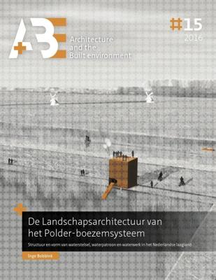
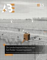
De Landschapsarchitectuur van het Polder-boezemsysteem (Paperback)

0
The Dutch lowlands is an artificial landscape, created as a result of the wish to regulate the water that dominated the topography in the Delta. This 'confined' lowland water, the polder-boezem system12, features an enormously diverse range of water structures and forms, which largely dictates the spatial planning of the lower Netherlands. This dis...

Verkopers met dit product

Verkoper
Bezorging
Prijs

Anderen bekeken ook

Fotoboek De Hondsrug. Een machtig gebied | van Gorcum
In dit nieuwste boek van fotografe Karin Broekhuijsen wordt het machtige gebied De Hondsrug in al zijn rijkdom getoond. 0De Hondsrug heeft een lange geschiedenis die haar weerga niet kent. Het begon allemaal een paar miljoen jaar geleden in de ijstijden toen ijs, wind en water de Hondsrug zijn vorm gaven. En later toen het metersdikke veenmoeras tegen zijn hellingen omhoog kroop. 0In dit fotoboek zie je de mooiste plekken op De Hondsrug, ondersteund met verhalen van Bertus Boivin. Deze verhalen zijn vertaald in het Engels en Duits. Deutsch   Der Hondsrug zieht einen 70 km langen, geraden Strich durch den Nordosten der Niederlande. Eis, Wasser und Wind formten 150.000 Jahre eine Landschaft, die in Europa einzigartig ist.   Dieser Bildband lädt Sie ein, den Hondsrug näher kennenzulernen und die Schönheit dieses besonderen Naturraums zu entdecken. Es erzählt eine abwechslungsreiche Geschichte, die in den Eiszeiten begann. Die Auswirkungen sind bis heute in der Landschaft sichtbar und bes…
25,-
Ruimtelijke transformaties van de steden in het Randstadgebied (12de-20ste eeuw) (Paperback)
In this issue of A+BE (written in Dutch), the transformation of the form of nine cities in the Randstad between 1250 and 1940 in relation to changes in infrastructure is central, namely Utrecht, Dordrecht, Leiden, Haarlem, Delft, Gouda, Amsterdam, Rotterdam and The Hague. Within this time span, three periods of great spatial dynamics are identified, namely the period 1240-1450, 1580-1680 and 1870-1940. Comparing the city maps with each other, they made a development from uniformity to diversification to levelling between 1250 and 1940. Typical for the spatial development was that in the first period urban centres were created in which the various urban functions were concentrated. In the second period, specialization took place, in addition to strengthening the regional market function in the late medieval centres, functions were moved to the city edges. In the third period, the international goods transports continued to be moved out of the late medieval centres. In addition, the
29,95
Land Art Live (Paperback)
For Dutch see below - English - Flevoland has a unique collection of Land Art, including De Groene Kathedraal by Marinus Boezem, Observatorium by Robert Morris and Riff, PD#18245 by Bob Gramsma. These Land Art works once stood in the empty polder, but are now part of a dynamic landscape transformation. Views on art and its social significance have also changed in the five decades this book covers. This raises questions about the preservation of the works and of the collection as a whole. Land Art Live | The Flevoland Collection sheds light on the Land Art in Flevoland. A younger generation of artists was asked to use performances to connect with the original meaning of the Land Art works. In addition, experts in the field of visual art, heritage and landscape provide ideas with which the future of this exceptional collection and the landscape can be shaped. Land Art Live can also be used as a guide when visiting this extraordinary open-air museum. - Dutch - In Flevoland bevindt zich
34,95
Integrated Urban River Corridors (Paperback)
This PhD thesis focuses on Urban River Corridors (URCs) as spaces of social-ecological integration par excellence-that is, spaces where the interaction between the urban systems (carrying the 'social-') and the river system (carrying the '-ecological') is (potentially) the most intense. The general hypothesis is that with an integrated spatial understanding, planning and design of rivers and the urban fabric surrounding them, cities could become more resilient, not just to flood-related disturbances, but to general chronic stresses as well. Hence, the thesis addresses a number of spatial problems arising from the loss of synergy between the natural dynamics of rivers and the spatial configuration and composition of urban areas that they cross, namely: the relationship between fluvial geomorphology and urban morphology weakened by river-taming operations; the physical barrier caused by riverside vehicular traffic; the latent flood risk built up through resistance-based flood-protection
39,95
Robocar and Urban Space Evolution (Paperback)
How can we create more human-centered, resilient, and sustainable cities in the tech age? Can we make use of technology and the opportunities presented rather than resisting its fast-paced evolution? What are the biggest and most likely spatial changes that autonomous vehicles will bring in cities? How can this change in mobility contribute to a better urban environment? To what extent do the spatial opportunities created by automated mobility respond to current urban issues and what is the role of urban design and spatial planning in this debate? Autonomous cars -Robocars- will dramatically change urban environments and the practice of urbanism, potentially making cities less dependent on and less dominated by cars. Driverless and mainly guided by digital infrastructure, Robocars can open up new opportunities for urban development. If guided by sustainable development goals, mobility automation can lead to urban we understand as a shared paradigm shift in mobility and urban design. To
19,95
OMSI 2, The Omnibus Simulator
Experience a new omnibus simulator with OMSI 2 and start discovering Spandau . OMSI 2 is the successor of the well-known and awarded omnibus simulator "OMSI - The Bus Simulator". OMSI 2 not only offers the routes and buses available in the original OMSI, but adds lots of exciting new features. In OMSI 2 you can drive the first ever articulated bus in the OMSI history, the MAN NG272. Explore the new omnibus line 5 covering a total distance of 12 km from the subway station Ruhleben to the psychiatric clinic Spandau. Thanks to the newly added chronology function you are not only able to drive through Spandau in 1986, but also to relive the changes taking place in Spandau between 1986 and 1994.Enjoy the charm of the 80s and 90s and experience the period after the fall of the Berlin Wall - all at the wheel of a double-decker or articulated bus.New features in OMSI 2:- The articulated bus MAN NG272 with the exact physical and visual recreation of the joint kinematics as well as corresponding…
28,95
Changing Values on Water in Delta Cities (Paperback)
The thesis develops an empirically tested analytical framework which links value theory with planning and design practices to investigate context-specific spatial transformations as a result of individual and collective value judgements. Four key aspects of water values including flood safety, as well as economic, social and environmental values, are studied, and their interrelationships are discussed. Morphological analyses and value assessments are conducted to explore in what sense spatial changes can be considered an expression of the changing values and what we can learn from it to deal with complex spatial situations. The empirical studies are based on the long-term spatial development of Guangzhou as representative of a historical and rapidly growing delta city in China. Three development stages are illustrated to show different patterns of water-city interactions, the waterways city (before the 1920s) that was mainly structured by natural forces including natural waterways, the
29,95
Fotoboek - Reisgids National Parks of America | Lonely Planet
Hardcover fotoboek met reisinformatie van alle 59 nationale parken van Amerika. Perfect ter inspiratie voor de volgende reis. To celebrate America's amazing national parks, Lonely Planet, the world's leading travel publisher, takes you on an informative and gorgeous tour of all 59 parks with our lavishly finished hardcover gift guide packed with detailed itineraries and practical tips on what to do and see in each park to get you started planning your next adventure. America's national parks are full of timeless marvels that still rejuvenate the soul: the world's largest trees in Sequoia; its most spectacular geothermal site in Yellowstone; the grandest canyon. Perhaps the movement's most eloquent description that is still resonates came from national parks advocate John Muir: 'Thousands of tired, nerve-shaken, over-civilized people are beginning to find out that going to the mountains is going home; that wildness is a necessity...' Fortunately for the nerve-shaken, over-civilized peo…
27,95
Wandelkaart Tour & Trail Lanzarote | Discovery Walking Guides
De Lanzarote Tour & Trail Super-Durable wandelkaart (4de editie) beslaat dit grote eiland op een schaal van 1: 40.000 wat resulteert in de meest gedetailleerde en sterkste kaart van Lanzarote die u kunt kopen.   For your best adventures, use the best map. Water-proof, split-proof, tear-proof, adventure-proof. Lanzarote Tour & Trail Super-Durable Map is simply the toughest, most accurate, easy to read, easy to use multipurpose map that you can get. A large 960mm by 694mm double sided map sheet covers Lanzarote and its neighbouring island La Graciosa at 1:40,000 scale. A generous overlap and an extra mini-map reduce the need of turning the map in use. Whether you plan to walk, or discover the island by car or the bus, this is the map for you. New for the 6th edition is a summary of Lanzarote bus system, with overview of bus lines and actual bus routes highlighted in the map. Also new is a summary and a mini-guide to main tourist attractions of Lanzarote, with tips for a successful…
18,95
Campinggids - Campergids Northern California Camping | Moon Travel Guides
De Amerikaanse uitgever Moon is een vergelijkbare gids met uitgever Lonely Planet > veel praktische informatie met veel diepgang! Het feit dat het een Amerikaanse uitgever is, maken deze gidsen zeer aantrekkelijk voor de staten en nabije landen afzonderlijk. De Lonely Planet haalt dat nivo niet! Whether you're camping among towering redwoods, along rugged coastline, or in the High Sierra, you'll always find your perfect campsite with Moon Northern California Camping. *A Campsite for Everyone: Pick the right tent or motorhome site with options ranging from secluded Sierra hike-ins to convenient roadside stopovers, including dog-friendly, family-friendly, and wheelchair accessible options, and strategic lists of the best campgrounds for hiking, swimming, and more*Ratings and Essentials: All campgrounds are rated on a scenic scale and marked with amenities like restrooms, trailhead access, picnic areas, laundry, piped water, showers, and playgrounds*Recreation Highlights: Discover nearby…
22,50

Klanten-reviews van De Landschapsarchitectuur van het Polder-boezemsysteem (Paperback)

Er zijn nog geen beoordelingen voor dit productBen jij de eerste die een review plaatst?

Meer over De Landschapsarchitectuur van het Polder-boezemsysteem (Paperback)

Productomschrijving

The Dutch lowlands is an artificial landscape, created as a result of the wish to regulate the water that dominated the topography in the Delta. This 'confined' lowland water, the polder-boezem system12, features an enormously diverse range of water structures and forms, which largely dictates the spatial planning of the lower Netherlands. This dissertation concerns the polder-boezem system, a water system that was created by trial-anderror, has been adapted continually and now needs to be expanded to cope with the effects of climate change. The research focuses on answering the following question: What potential does the current polder-boezem system have, with the help of landscape architectonic design, to define (or redefine) the spatial identity of the lowlands?

Productspecificaties

Artikelnummer(s)
Brand
Tu Delft Open

Verken gerelateerde categorieën

Webshop.nl maakt gebruik van cookies. Ga je verder op onze website, ga dan akkoord met het plaatsen van cookies en de verwerking van deze data door ons en vermelde partners.