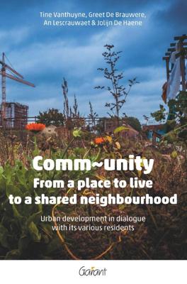
Comm~unity (Paperback)

0
This publication is about neighbourhoods undergoing change where there is a lot of movement, construction and alteration, including through urban development projects. All these changes affect life and living together in these neighbourhoods. This is an issue not just in the planning phase, but also when projects are carried out, especially when ne...

Verkopers met dit product

Verkoper
Bezorging
Prijs

Anderen bekeken ook

Nieuw
Wegenkaart - landkaart 92G Lower Mainland British Columbia - Richmond and New Westminster | ITMB
Goede wegenkaart van British Columbia met topografische uitsnede van Richmond en Westminster. Topographic/Recreation Map 92G&92G2 and G3 - With the 2010 Winter Olympics bearing down on us, this very timely map presents a lovely regional map showing all of the Olympic venues (the Games are being held in Vancouver, Richmond, UBC, Whistler, and the Callaghan Valley – not just in Vancouver). The area of coverage is from Everett (just north of Seattle) in the USA to north of Pemberton, and from Victoria in the west to Chilliwack in the east on the one side, and a detailed 1:50,000 topo map of the Richmond/New Westminster/Surrey/Langley outer urban areas of Metro Vancouver. Both maps are Government of Canada NTS maps, overlaid with touristic and recreational information by ITMB, which holds the copyright on behalf of the Queen (I love being able to say that). The Lower Mainland portion is particularly useful, in that it includes the east coast of Vancouver Island, from Victoria to Nanaimo a…
13,95
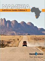
Accommodatiegids Namibia Self-Drive Guide | Tracks4Africa
So, what is so special about the Tracks4Africa guide books? These are not guides written by armchair travellers or the personal experience of one person, but the combined experiences of a whole community of travellers. The T4A community travel far and wide – not by luxury bus or safari vehicle but on their own wheels. Sometimes they travel in groups and sometimes as lone rangers, but they always travel by motorbike, sedan or 4WD, therefore this guide is specifically aimed at self-drive travellers.   If you are a self-drive tourist, there are five things that you need to know when you are on the road: 1. Where to sleep. 2. Where to get fuel. 3. What to see and do. 4. Where to buy supplies. 5. Where to go in case of an emergency.   If you have the Tracks4Africa Self-Drive Guide as your travel companion, the answers to all these and many more questions will be at hand. If you are well prepared and well informed, you can really enjoy the unspoilt beauty of Africa! The Tracks4Afr…
52,50
Nieuw
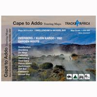
Wegenkaart - landkaart SC3-SC4 Swellendam to Mossel Bay | Tracks4Africa
The Cape to Addo map series covers the southern parts of the Western Cape of South Africa in a series of eight highly detailed maps, printed on four sheets of A1 durable paper.   We start in Cape Town in the west and move along the southern coast through the Overberg, Winelands, Garden Route, Klein Karoo R62, Baviaanskloof to eventually arrive in the Addo National Park up to Gqeberha (Port Elizabeth) in the east.   The maps are highly detailed and well researched. Our map scale is 1:200 000 which allows us to show a lot of detail including minor gravel roads, hiking trails, farm boundaries and points of interest which are relevant to self-drive tourists.   The size of the paper is kept small enough to allow this to be the perfect road tripping map. We use Duraflex paper and print two maps per sheet of A1 paper, making this a four-sheet series. Each map sheet is individually packed in a plastic protective sleeve.   The maps are perfect for day drives, overlanding or just doing road tri…
29,95
Nieuw
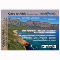
Wegenkaart - landkaart SC1-SC2 Cape Town to Montagu | Tracks4Africa
We start in Cape Town in the west and move along the southern coast through the Overberg, Winelands, Garden Route, Klein Karoo R62, Baviaanskloof to eventually arrive in the Addo National Park up to Gqeberha (Port Elizabeth) in the east.   The maps are highly detailed and well researched. Our map scale is 1:200 000 which allows us to show a lot of detail including minor gravel roads, hiking trails, farm boundaries and points of interest which are relevant to self-drive tourists.   The size of the paper is kept small enough to allow this to be the perfect road tripping map. We use Duraflex paper and print two maps per sheet of A1 paper, making this a four-sheet series. Each map sheet is individually packed in a plastic protective sleeve.   The maps are perfect for day drives, overlanding or just doing road trips in your sedan, 4WD or motorbike along our beautiful southern coast, Klein Karoo and parts of the proper Karoo. Mountain passes form a prominent feature in this area, and these …
29,95
Nieuw
Stedebouwkundig(e) ontwerpen in woorden (Paperback)
The realisation of an urban design involves many players, such as designers, critics, politicians, journalists, public relations specialists and residents. In order to consult with each other they make use of drawings, but also frequently of words, to be able to interpret the drawn objects in the plans. But are these urbanistic notions used by everyone in the same way? And have there been noticeable changes in their usage or meaning over time? This urbanistic and linguistic doctoral research addresses these questions. To define the scope of the research, words have been selected that refer to concrete, physical design phenomena in three so-called semantic fields: the structure of the city plan (for example, stad [city] and buurt [neighbourhood]), types of public spaces (for example, straat [street] and park [park]) and types of buildings (for example, huis [house] and winkel [shop]). As a further restriction, the use of such words has been investigated in texts written by five types of
39,95
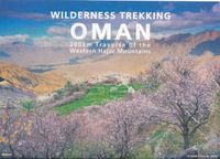
Wandelkaart Wilderness Trekking Oman | Gilgamesh
This map is a practical addition to the guide for hiking in the Western Hajar, which is the western portion of the main mountain range in the Sultanate of Oman. The best walking weather in Oman is from mid-November to March. The traverse follows the spine of the mountains in a point-to-point walk taking sixteen days.   It consists of eight one-day walks, two two-day walks and one four-day walk. There is a road intersection with a village or hotel between each of these eleven sections making it practical to walk sections rather than the full traverse. The track climbs to the highest accessible peak in the country at 2999m and finishes in remote dry valleys, called wadis, where impregnable cliffs have precluded road construction and electricity transmission.   This has preserved the Arabian mountain lifestyle that has existed for centuries. This traverse is for hikers who are competent with GPS navigation, as only six of the sixteen day tracks are marked. There are two shorter options, …
19,50
Nieuw
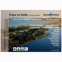
Wegenkaart - landkaart SC5-SC6 George to Kareedouw | Tracks4Africa
The Cape to Addo map series covers the southern parts of the Western Cape of South Africa in a series of eight highly detailed maps, printed on four sheets of A1 durable paper.   We start in Cape Town in the west and move along the southern coast through the Overberg, Winelands, Garden Route, Klein Karoo R62, Baviaanskloof to eventually arrive in the Addo National Park up to Gqeberha (Port Elizabeth) in the east.   The maps are highly detailed and well researched. Our map scale is 1:200 000 which allows us to show a lot of detail including minor gravel roads, hiking trails, farm boundaries and points of interest which are relevant to self-drive tourists.   The size of the paper is kept small enough to allow this to be the perfect road tripping map. We use Duraflex paper and print two maps per sheet of A1 paper, making this a four-sheet series. Each map sheet is individually packed in a plastic protective sleeve.   The maps are perfect for day drives, overlanding or just doing road tri…
29,95
Nieuw
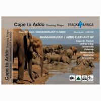
Wegenkaart - landkaart SC7-SC8 Baviaanskloof to Addo | Tracks4Africa
The Cape to Addo map series covers the southern parts of the Western Cape of South Africa in a series of eight highly detailed maps, printed on four sheets of A1 durable paper.   We start in Cape Town in the west and move along the southern coast through the Overberg, Winelands, Garden Route, Klein Karoo R62, Baviaanskloof to eventually arrive in the Addo National Park up to Gqeberha (Port Elizabeth) in the east.   The maps are highly detailed and well researched. Our map scale is 1:200 000 which allows us to show a lot of detail including minor gravel roads, hiking trails, farm boundaries and points of interest which are relevant to self-drive tourists.   The size of the paper is kept small enough to allow this to be the perfect road tripping map. We use Duraflex paper and print two maps per sheet of A1 paper, making this a four-sheet series. Each map sheet is individually packed in a plastic protective sleeve.   The maps are perfect for day drives, overlanding or just doing road tri…
29,95
Vogelgids Birds of the Indian Subcontinent | Bloomsbury
This is the second edition of the authors' groundbreaking Birds of the Indian Subcontinent (1998) and covers all the bird species found in India, Pakistian, Sri Lanka, Nepal, Bhutan, Bangladesh and the Maldives. The plates face the descriptions and maps for quick at-a-glance reference. Many of the plates have been repainted for this edition and a number of new species added. This guide also provides tables, summarising identification features of particularly difficult groups such as nightjars, warblers and rosefinches.   "[...] Overall, Birds of the Indian Subcontinent is an excellent piece of work and a very welcome field guide, and I am greatly looking forward to using it on my upcoming trip to Arunachal Pradesh and Assam. Comprehensive and authoritative, this is an indispensable guide for anyone birding anywhere in the Indian Subcontinent." - Frank Lambert (22-02-2012), read the full review at The Birder's Library   "The Indian subcontinent, always exciting for visitors, is no less…
54,95
Nieuw
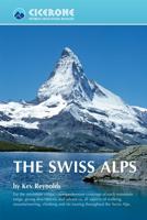
Wandelgids The Swiss Alps | Cicerone
  The Swiss Alps are home to the highest and most spectacular mountains in Western Europe. This stunning guidebook describes each mountain area throughout Switzerland – the peaks, passes, valleys and bases – to help you identify the best destinations to plan your trip.   Questions such as ‘Where to walk, climb or ski?’, ‘What multi-day treks are available’ and ‘Where do they go?’, ‘Where are the mountain huts, what are their facilities, which peaks do they serve?’ And where are the most suitable valley bases?’ – all these and more are addressed in detail in this essential guidebook.   The Swiss Alps does not give detailed route directions but information is given about all the guides and maps available for every region.   The Swiss Alps by Kev Reynolds is the third book in Cicerone’s World Mountain Ranges series, which include The Pyrenees and Scotland.   descriptions of all the Swiss Alps, area-by-area from the Chablais Alps in the south west to the Silvretta in the north east classi…
34,95

Klanten-reviews van Comm~unity (Paperback)

Er zijn nog geen beoordelingen voor dit productBen jij de eerste die een review plaatst?

Meer over Comm~unity (Paperback)

Productomschrijving

This publication is about neighbourhoods undergoing change where there is a lot of movement, construction and alteration, including through urban development projects. All these changes affect life and living together in these neighbourhoods. This is an issue not just in the planning phase, but also when projects are carried out, especially when new residents move in. Working on living together in a changing neighbourhood is central to this publication. We propose a number of methods and actions, interspersed with our own experiences in a specific neighbourhood in Ghent. In collaboration with residents and other parties involved, the meanings, histories and future possibilities of a neighbourhood are described and - by entering into a dialogue - influenced. These methodologies are fed by conceptual frameworks on urbanisation and living together, explained in this book. They are linked to strategies that have taken shape in the methodologies. The book 'From place to shared

Verken gerelateerde categorieën

Webshop.nl maakt gebruik van cookies. Ga je verder op onze website, ga dan akkoord met het plaatsen van cookies en de verwerking van deze data door ons en vermelde partners.