webshop.nl
Categorieën
  Sluiten

Meer lily-graham
Meer lily-graham in Boeken

Christmas at Hope Cottage

In the little village of Whistling, with its butterscotch cottages and rolling green hills, snow is beginning to fall. Christmas is coming, and Emma Halloway is on her way home......
11,99

Webshops met dit product

Webshop
Bezorging
Prijs

Anderen bekeken ook

Marvel Art Scale Statue 1/10 X-Men´97 Storm 22 cm
Levitating with the winds and manipulating beams of electromagnetic energy, a mutant, a hero, a goddess, and a leader, she's all this and much more. Her powers are controlled by her emotions and, because of that, it's essential that she maintains her serenity. Iron Studios present the statue Storm - X-Men' 97 - Art Scale 1/10, presenting innovation in the painting in the form of a specific shading that highlights all the figures from this new collection as if the characters were coming out of the TV to the real world, Iron Studios present the statues from their new X-Men '97 line, over a themed base shaped as the X of the logo of the super group of mutant heroes.In a small village next to Mount Kilimanjaro in Africa, Ororo Munroe was born a mutant with the ability to control and manipulate the forces of nature with a wide range of weathers, such as making whirlwinds travel pointing lengthwise in any direction, flash-freezing objects and people, summoning wind currents strong enough to …
189,95
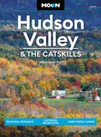
Reisgids Hudson Valley - the Catskills | Moon Travel Guides
De Amerikaanse uitgever Moon is een vergelijkbare gids met uitgever Lonely Planet > veel praktische informatie met veel diepgang! Het feit dat het een Amerikaanse uitgever is, maken deze gidsen zeer aantrekkelijk voor de staten en nabije landen afzonderlijk. De Lonely Planet haalt dat nivo niet! The Hudson Valley is a breath of fresh air: explore historic estates, hike wild mountain terrain, and bask in small-town charm with Moon Hudson Valley & the Catskills. Inside you'll find:*Strategic, flexible itineraries, from day trips from New York City to week-long road trips and a 6-day cycling tour, designed for outdoor adventurers, history buffs, art-lovers, foodies, and more*Must-see highlights and unique experiences: Cycle along rolling hills and quiet country roads, hike to rushing waterfalls, hit the slopes in the winter, or discover the best spots to see the striking fall foliage. Take a tour of Washington Irving's romantic home, admire the historic Rockefeller Estate, go antiquing in…
19,95
Wandelgids Walking in the Thames Valley | Cicerone
Walking in the Thames Valley offers 25 challenging circular walks around the River Thames and River Kennet in the south of England, taking in the Southern Chilterns, the Berkshire and North Hampshire Downs, Southern Oxfordshire and the eastern edge of Wiltshire. All routes are within easy reach of Reading, Newbury, Abingdon and London. While some walks visit Iron Age hill forts, others pass more modern features such as Wilton Windmill and the Kennet and Avon Canal. Some follow sections of the Ridgeway, while others meander along the banks of the Thames. What they all have in common is that they take the keen rambler to some of the best parts of the Thames Valley – a patchwork of open chalk grassland, broadleaved woodland and farmland and home to two Areas of Outstanding Natural Beauty. • walks from 10 to 18 miles, including one 2-day route • shorter, less strenuous alternatives for many of the walks • detailed route descriptions with information on local points of interest, OS mapping …
18,50
Fietskaart 10 Cycling guides North York Moors | Goldeneye
Scheur- en watervast foetskaart van de North York Moors  met ingetekende fietsroutes.   Our maps are double-sided, printed on an A2 sheet with a concertina fold. This allows for easy folding and folding, and an ease of access to the mapping. The material is rain and tear-resistant. Our early maps were designed at the scale of 2 miles to 1 inch/1:126,720. The later designs along with digitalisation are 1: 100,000. We were encouraged by the Cycle Touring Club to convert our cartography toward the cycle market (to replace the out-of-print Bartholomew series). As time and the series progressed we have added more data: The National Cycle Network routes, Regional Routes, and Traffic-Free Family Routes, as and when they are developed. These routes are in addition to the Circular Routes Goldeneye Commissioned at the outset of our publishing schedule. We are also adding to new editions; bike shops, cycle hire, and tea rooms, along with the tourist attractions already featured. Our plan is to ma…
14,95
Wandelgids 74 Pathfinder Guides The Malverns to Warwickshire | Ordnance Survey
Discover 28 beautiful walks across The Malverns to Warwickshire with the OS Pathfinder Guidebooks, graded by length and ranging from 3 to 9 miles - ideal for both holidaymakers and locals.   The area covered by this guide is characterised by gently rolling hills, verdant river valleys, wooded tracts, small market towns, and an abundance of attractive villages with thatched cottages, medieval churches, and fine old pubs.   Each walk includes a detailed description, an OS map, GPS waypoints and notes of key features and things to see. Routes include the Warwickshire Beacon, the oddly-named Lickey Hills, and Charlecote Park - allegedly where Shakespeare was once caught poaching.   Printed with weather-resistant covers featuring durable rounded corners, they are the perfect companion for country walking throughout Britain.
18,50
Wandelgids South Downs Way | Trailblazer Guides
The South Downs Way is a 100-mile footpath which follows the line of chalk hills stretching from Winchester to Eastbourne. Walking the length of the Downs is the best way to experience this beautiful landscape with its mixture of rolling hills, steep hanging woodland and windswept fields. You'll also pass through picture-postcard villages with welcoming pubs, thatched cottages and country gardens. 1. Unique mapping features - In many walking guides the reader has to read a route description then try to relate it to the map. Our guides are easier to use because walking directions, tricky junctions, places to stay and eat, points of interest and walking times are all written onto the maps themselves in the places to which they apply. With their uncluttered clarity, these are not general-purpose maps but fully-edited maps drawn by walkers for walkers. Downloadable GPS waypoints also included. 2. The largest scale walking maps available - At just under 1:20,000 (8cm or 31/8 inches to 1 mil…
20,95
Wandelgids Camino Finisterre | Village to Village Press
The Camino Finisterre is a walking route from Santiago de Compostela to Finisterre and Muxía on the coast of Galicia in Spain. This route highlights the best of Galicia — the wild coast, misty forests, rolling green hills, and myths and legends of this enigmatic land. The Celtic and pagan roots of the region meld with Saint James lore on this path well trodden by seekers and pilgrims. An excellent 3-5 day standalone experience or epilogue to a longer Camino pilgrimage. The Village to Village Guide provides comprehensive planning information, detailed maps and route descriptions, as well as lodging and services along the way. Lace up your boots, and keep walking to “the end of the earth.” Full-color detailed topographical stage maps of each day’s walk with free GPS files online Detailed accommodations listings for pilgrim and private lodging including contact information, amenities and approximate prices Detailed stage, city and town maps and elevation profiles including town ameniti…
20,95
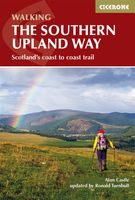
Wandelgids The Southern Upland Way | Cicerone
Uitstekende wandelgids van de Southern Upland Way, waarbij naast alle noodzakelijke informatie ook gebruik gemaakt wordt van de echte topografische kaart.   The Southern Upland Way is Scotland's coast-to-coast walk and the longest of the nation's Great Trails. 215 miles long, it links the pretty harbour village of Portpatrick on the west coast with Cockburnspath, a little south of Dunbar, in the east. The walk is at times a strenuous one, crossing the remote high moorland of the Galloway Hills, Carsphairn range, Lowthers, Ettrick Hills and Lammermuirs, calling for competence, fitness and self-reliance.    This guide presents advice on how best to plan and tackle this challenging but highly rewarding journey. The waymarked trail is presented in fourteen stages of 9–19 miles and suggestions for a rest day exploring Moffat and its environs are also included. It is possible either to backpack, taking advantage of five bothies and unlimited wild camping possibilities, or to stay in towns…
20,95
Fietskaart Cycling guides Dartmoor - South Devon | Goldeneye
Dartmoor. One of England’s greater National Parks; the Forest of Dartmoor covers 365 square miles and contains the highest ground in England south of the Peak District. On its desolate moorland tracks the wanderer can believe they are further from a public road than anywhere in the country, but on the fringes lush valleys lead down on every side to thick woodland, green vegetation and picturesque villages. Dartmoor is well known for its wildlife - attractive herds of ponies, seemingly wild but in fact individually owned, foxes, badgers and otters - also the occasional adder. Fallow, roe and Sitka deer can often be seen, but the red deer of Exmoor have never penetrated the area. Buzzards, kestrels and various Birds of Prey are frequently seen, as well as the wheatear, while crows, ravens and the skylark are fairly commonplace. The Moor abounds in prehistoric remains. There are also many deserted medieval villages with remains of the traditional ‘longhouse’ buildings. For centuries tin m…
12,95
Pelgrimsroute - Wandelgids Camino Finisterre | Camino Guides Brierley
Camino Finisterre: Pilgrims who continue to the ‘End of the Earth’ Finis Terrae often refer to this as a highlight in their journeying. In the fi rst edition it was described as the road less travelled but that acclaim has now passed to Muxía which has become the ideal extension for those seeking space for rest and reflection before returning home. The paths to Finisterre and Muxía are uniquely beautiful, full of the flavours of Galicia and her deliciously authentic culture. The spirit of St. James is alive in the deep river valleys and rolling hills that make up her Landscape Temple. Come and experience her untamed beauty and the purity of the light that has attracted spiritual seekers for countless millennia. The light, while obscured, lies hidden in our memory. It is no coincidence that the path to the end of the world ends at a lighthouse and the Ara Solis.   This guidebook describes the only camino that departs from Santiago. However, in recent years it has been recognised for a…
17,50

Klanten-reviews van Christmas at Hope Cottage

Er zijn nog geen beoordelingen voor dit productBen jij de eerste die een review plaatst?

Meer over Christmas at Hope Cottage

Productomschrijving

In the little village of Whistling, with its butterscotch cottages and rolling green hills, snow is beginning to fall. Christmas is coming, and Emma Halloway is on her way home...

Productspecificaties

Artikelnummer(s)
EAN
9788728277775
Brand
lily-graham
Webshop.nl maakt gebruik van cookies. Ga je verder op onze website, ga dan akkoord met het plaatsen van cookies en de verwerking van deze data door ons en vermelde partners.