Campinggids Camping by the Waterside | Bloomsbury

0
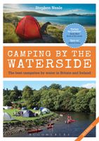
This stylish and inspiring book contains all the information campers need to make the most of the wonderful waterside locations throughout the UK and Ireland. Covering all kinds of camping (caravan, campsite and wild), the book starts by showing how to plan your trip, what gear to take and how to get stuck into all the fantastic water-based activi...

Verkopers met dit product

Verkoper
Bezorging
Prijs
DeZwerver.nl logo
DeZwerver.nl
niet bekend
20,95

Anderen bekeken ook

Wandelkaart A06 Siniscola | Abies
Siniscola area at 1:25,000 in a series of contoured maps from Ed. Abies. Overprint highlights campsites and agriturismo accommodation, climbing sites, wild sheep and bird watching sites and archaeological remains. This title has no UTM grid. Main series at 1:60,000 (Nos. 1 to 12) The maps have contours at 100m intervals and colouring for woodlands and maquis shrubland. Local trails are highlighted, with additional overprint for selected hiking, mountain bike and kayaking routes listed on the reverse of the maps with brief notes and grading for the degree of difficulty. All the maps have a UTM grid for GPS users. Very extensive range of symbols highlight numerous places of interest and tourist facilities, including campsites and caravan parks, beaches, sport and recreational sites, archaeological remains and nuraghi, etc. The maps also indicate places where typical local products can be purchased. On the reverse each title has descriptions of its main places of interest, beaches, etc…
12,95
Wandelgids Wales | Uitgeverij Elmar
De Rother wandelgids Wales beschrijft de 50 mooiste kust- en bergwandelingen in het westen van het Verenigd Koninkrijk - van Pembrokeshire tot Anglesey, van de Ierse Zee tot de grens met Engeland, in de bergachtige regio's, het binnenland en langs de kust.   * Betrouwbare routebeschrijvingen * Gedetailleerde wandelkaarten * Informatieve hoogteprofielen * Downloadbare GPS Tracks   Aanbevolen wandelkaarten bij deze gids:   The Gower + directe omgeving Wandelkaart - Topografische kaart 164 Explorer Gower, Gwyr | Ordnance Survey 1:25.000 Wandelkaart - Topografische kaart 178 Explorer Llanelli, Ammanford, Rhydaman | Ordnance Survey 1:25.000   Pembrokeshire Wandelkaart - Topografische kaart OL35 Explorer Pembrokeshire North - Gogledd Sir Benfro | Ordnance Survey 1:25.000 Wandelkaart - Topografische kaart OL36 Explorer South Pembrokeshire - De Sir Benfro | Ordnance Survey 1:25.000 Wandelkaart - Topografische kaart 198 Explorer Cardigan, New Quay | Ordnance Survey 1:25.000 Wandelkaart - Topog…
19,99
Wandelkaart A15 Sarrabus da Costa Rei a Porto Corallo | Abies
Sarrabus is a territory that is not known by everybody yet. Here lies its charm and this has made possible to keep this environmental area out of big building speculations and also out of history. In fact it preserves little traces of the past, and paradoxically the remains from the prehistoric age are more meaningful than those back to more recent times. We can find traces from the most remote past not far from the State Road SS125, that from Muravera goes to Costa Rei, by visiting the nuraghe Murtas, the nuraghe S’Aqua Secis and the megalithic complexes of Scalas and Cuili Piras. They are about ten menhirs, almost fully intact, arranged in groups and fixed in the ground in the original orthostatic position. They have been put in relation with the position of the sun and the moon, at dawn and at sunset. In fact they were used as a very precise astronomic calendar but also for religious purposes since they represented both the masculine divinity and the fertility according to the wors…
12,95
Wandelkaart - Topografische kaart OL62 OS Explorer Map Coreen Hills & Glenlivet | Ordnance Survey
Met zijn 4cm voor 1 km (2 ½ cm voor 1 mijl) schaal, is de OS Explorer kaartenserie de ideale en meest gedetailleerde kaartenreeks voor mensen die graag outdoor-activiteiten zoals fietsen, wandelen, paardrijden, klimmen en watersporten. Deze kaart is nog gedetailleerder dan de 'gewone' Landranger maps. Voor- en achterzijde bedrukt! Zeker op de moors en andere natuurgebieden van onschatbare waarden met echt alle aspecten van het landschap op de kaart ingetekend. Zeer goede detailkaart met topografische ondergrond. Hierop zijn toeristische symbolen van bezienswaardigheden ingetekend, daarnaast staan bijvoorbeeld campings en jeugdherbergen vermeld en - voor wandelaars het belangrijkst - alle right of way paden en Lange afstands Wandelpaden zijn er op te vinden. De ideale kaart voor het wandelen in Engeland, Wales of Schotland. Map sheet OL 62 covers Correen Hills and Glenlivet. Highlights include Cairngorms National Park, Gordon Way and Badingair Hill. Also includes Water of Bogie, Rhynie…
19,50
Fietskaart 02 De Sterkste van de Regio Friesland | Buijten & Schipperheijn
De actueelste Nederlandkaart met fietsknooppunten! Een vrijwel onverwoestbare kaart bovendien, met handige informatie over campings, veerdiensten etc. Regio Friesland. Duidelijk kaartbeeld met royale letter Compleet netwerk van fietspaden en kleine wegen Alle bewegwijzerde fietsknoppunten Landelijke wandelroutes en streekwandelingen Webadressen van alle bed-and-breakfastlocaties en veerdiensten Precieze locaties van monumenten Groot formaat Groot schaal Compact gevouwen Zeer klein opgevouwen formaat van water- en scheurvast papier. Handig voor op de racefiets! An up-to-date cycle map, with wayfinding points clearly marked. This map is virtually indestructible, waterproof and tear-proof. Complete with useful information about camp sites, ferry locations, and long-distance bike routes, this map is a must-have for long and short distance cycling. Its handy pocket size means that it  can fold easily into a handlebar bag. A complete network of bicycle paths and small roads Bicy…
11,90
Fietskaart 07 De Sterkste van de Regio Veluwe | Buijten & Schipperheijn
De actueelste Nederlandkaart met fietsknooppunten! Een vrijwel onverwoestbare kaart bovendien, met handige informatie over campings, veerdiensten etc. Regio Veluwe. Duidelijk kaartbeeld met royale letter Compleet netwerk van fietspaden en kleine wegen Alle bewegwijzerde fietsknoppunten Landelijke wandelroutes en streekwandelingen Webadressen van alle bed-and-breakfastlocaties en veerdiensten Precieze locaties van monumenten Groot formaat Groot schaal Compact gevouwen Zeer klein opgevouwen formaat van water- en scheurvast papier. Handig voor op de racefiets! An up-to-date cycle map, with wayfinding points clearly marked. This map is virtually indestructible, waterproof and tear-proof. Complete with useful information about camp sites, ferry locations, and long-distance bike routes, this map is a must-have for long and short distance cycling. Its handy pocket size means that it  can fold easily into a handlebar bag. A complete network of bicycle paths and small roads Bicyc…
12,90
Fietskaart 04 De Sterkste van de Regio Drenthe | Buijten & Schipperheijn
De actueelste Nederlandkaart met fietsknooppunten! Een vrijwel onverwoestbare kaart bovendien, met handige informatie over campings, veerdiensten etc. Regio Drenthe. Duidelijk kaartbeeld met royale letter Compleet netwerk van fietspaden en kleine wegen Alle bewegwijzerde fietsknoppunten Landelijke wandelroutes en streekwandelingen Webadressen van alle bed-and-breakfastlocaties en veerdiensten Precieze locaties van monumenten Groot formaat Groot schaal Compact gevouwen   Zeer klein opgevouwen formaat van water- en scheurvast papier. Handig voor op de racefiets!     An up-to-date cycle map, with wayfinding points clearly marked. This map is virtually indestructible, waterproof and tear-proof. Complete with useful information about camp sites, ferry locations, and long-distance bike routes, this map is a must-have for long and short distance cycling. Its handy pocket size means that it  can fold easily into a handlebar bag. A complete network of bicycle paths and small roads …
12,90
Wandelkaart - Topografische kaart 147 OS Explorer Map Sevenoaks and Tonbridge | Ordnance Survey
Met zijn 4cm voor 1 km (2 ½ cm voor 1 mijl) schaal, is de OS Explorer kaartenserie de ideale en meest gedetailleerde kaartenreeks voor mensen die graag outdoor-activiteiten zoals fietsen, wandelen, paardrijden, klimmen en watersporten. Deze kaart is nog gedetailleerder dan de 'gewone' Landranger maps. Voor- en achterzijde bedrukt! Zeker op de moors en andere natuurgebieden van onschatbare waarden met echt alle aspecten van het landschap op de kaart ingetekend. Zeer goede detailkaart met topografische ondergrond. Hierop zijn toeristische symbolen van bezienswaardigheden ingetekend, daarnaast staan bijvoorbeeld campings en jeugdherbergen vermeld en - voor wandelaars het belangrijkst - alle right of way paden en Lange afstands Wandelpaden zijn er op te vinden. De ideale kaart voor het wandelen in Engeland, Wales of Schotland.   These highly detailed maps show all the administrative boundaries, settlements as small as isolated farms, the road network down to unfenced roads and country tra…
19,50
Reisgids Western USA - West USA | Lonely Planet
De perfecte reisgids voor zowel de georganiseerde als de zelfstandige reiziger. Naast een algemene inleiding van het land / streek vol met praktische informatie over hoe je er het beste kunt reizen: slapen, eten, vervoer, excursies ... alles kun je er in vinden. Engelstalig. Lonely Planet   Lonely Planet’s Western USA is your passport to the most relevant, up-to-date advice on what to see and skip, and what hidden discoveries await you. Cruise down coastal highways, soak up Seattle’s culture, or be awestruck by the Grand Canyon; all with your trusted travel companion. Get to the heart of Western USA and begin your journey now!   Inside Lonely Planet’s Western USA Travel Guide:   Up-to-date information - all businesses were rechecked before publication to ensure they are still open after   2020’s COVID-19 outbreak NEW top experiences feature - a visually inspiring collection of [destination’s] best experiences and where to have them Improved planning tools for family traveler…
22,50
Wandkaart Zuid Amerika, politiek, 91 x 117 cm | National Geographic
Staatkundige  kaart van Zuid-Amerika (in kleur). De kaart wordt verzonden in een koker.  This classic map of South America shows political boundaries, place names, airports, major roads and highways, and other geographic features for the entire continent. 36 x 46 inches (approx). Scale size: 1:7,105,000. Founded in 1915 as the Cartographic Group, the first division of the National Geographic Society, National Geographic Maps has been responsible for illustrating the world around us through the art and science of mapmaking. Today, National Geographic Maps continues this mission by creating the world s best wall maps, recreation maps, atlases, and globes which inspire people to care about and explore their world. All proceeds from the sale of National Geographic maps go to support the Society s non-profit mission to increase global understanding and promote conservation of our planet through exploration, research, and education.
49,95

Klanten-reviews van Campinggids Camping by the Waterside | Bloomsbury

Er zijn nog geen beoordelingen voor dit productBen jij de eerste die een review plaatst?

Meer over Campinggids Camping by the Waterside | Bloomsbury

Productomschrijving

This stylish and inspiring book contains all the information campers need to make the most of the wonderful waterside locations throughout the UK and Ireland. Covering all kinds of camping (caravan, campsite and wild), the book starts by showing how to plan your trip, what gear to take and how to get stuck into all the fantastic water-based activities on offer, such as sailing, kayaking, angling, surfing and wild swimming. Tip boxes, top 10 features and gorgeous photos combine to give readers all the knowledge and inspiration they need to get out there, whether they're on their own, part of a family or with a group of friends.

The main part of the guide is organised by region, but also searchable by activity. Each region has an overview, and within it the best sites to visit, with useful information (best times of year to go, activities on offer, facilities, cost), advice on most attractive pitches, contact details and photos. There is a huge variety of sites here, all with something unique to offer, and helpful maps plot each one clearly.

With a Foreword by One Man and his Campervan's Martin Dorey, this is the essential guidebook for all campers, showing how it really is possible to pitch up in paradise.

This 2nd edition is thoroughly updated throughout, featuring new campsites and photography.

Verken gerelateerde categorieën

Webshop.nl maakt gebruik van cookies. Ga je verder op onze website, ga dan akkoord met het plaatsen van cookies en de verwerking van deze data door ons en vermelde partners.