webshop.nl
Categorieën
  Sluiten

Meer Vicarious Books

Campergids All the Aires France South | Vicarious Books

Due to the increased number of Aires entries, All the Aires France is now divided into two volumes: North and South. You are currently looking at the South guide which lists the Aires in southern France only. These books can be purchased individually or as a double deal together.   As the name suggests, All the Aires France South maps and details 1...
20,95

Webshops met dit product

Webshop
Bezorging
Prijs

Anderen bekeken ook

Campergids All the Aires France South | Vicarious Books
Due to the increased number of Aires entries, All the Aires France is now divided into two volumes: North and South. You are currently looking at the South guide which lists the Aires in southern France only. These books can be purchased individually or as a double deal together.   As the name suggests, All the Aires France South maps and details 1801 dedicated motorhome stopovers in France. It is the only complete French Aires de services guide book available in English. The guidebook enables you to make an informed choice about where to stop and where to stay overnight on your travels in your motorhome or campervan throughout southern France.   All the Aires France South has been revised and updated into its most user-friendly format. All the nearby Aires fall on the same page. This makes it easier to cross reference and select an Aire within an area. Closed Aires are now marked with an X on the maps and are found in a list at the rear of the book. Motorway Aires are marked with a le…
20,95
Spoorwegenkaart France South Rail and Bike | ITMB
This is a brand new title for ITMB and an attempt to portray a changing travel landscape in a mapping format. Eco-tourism is a rapidly growing activity, with enormous potential. At the same time, governments are seeking to reduce carbon pollution by encouraging train travel, so ITMB is climbing aboard the movement by publishing a map encouraging train travel while still retaining the road network and noting all the long-distance bike routes in southern France by designated number. This is, by its scale, a generalized map of that portion of France south of Poitiers or Lyon to the Mediterranean, so is more of a regional map showing biking opportunities than a detailed trail map. Nevertheless, it is an excellent map on waterproof paper showing cycling routes and tertiary roads that are suitable for recreational exploration. Naturally, motorways and main highways are shown as well.   Legend Includes: Roads by classification, Rivers and Lakes, National Park, Airports, Points of Interests, M…
13,95
Wegenkaart - landkaart Buenos Aires | Borch
Borch Buenos Aires is een duidelijke, geplastificeerde plattegrond van het centrum met informatie over openbaar vervoer en bezienswaardigheden. Inclusief straatnamenregister.   Our soft-laminated folded map of Buenos Aires in the 7th edition shows: Buenos Aires Centre 1:15 000, Isla Martín Garcia 1:18 000, Núnez 1:15 000, Boca 1:15 000, Buenos Aires 1:75 000, Greater Buenos Aires 1:530 000, Argentina Central 1:3 000 000, Public Transport Buenos Aires, Argentina administrative and time zones, Top 30 Sights. Borch Maps are easy to fold, durable and water-repellent with a wipeable surface. Borch Maps show hotels, museums, monuments, markets, public transport, top sights and points of interest, useful statistics, conversion charts for temperatures, weights and measurements, climate charts showing temperatures, sunshine hours, precipitation and humidity, overview maps, time zones, and much more...   Buenos Aires, located on the Rio de la Plata inlet on the southeastern side of the South Ame…
10,25
Spoorwegenkaart France North Rail & Bike Travel - Noord Frankrijk | IT
The northern half of France is fairly flat, making it an ideal area for biking. However, it is also a rather large area, covering several provinces of France, so we have combined rail access with biking. All the motorways and main highways are also shown, so this map is ideal for someone wanting to drive to, say, Brittany, and bike during their stay in the Breton peninsula. Side 1 covers Normandy, Brittany, the Loire, and the Poitou region west of Paris. Side 2 covers all of northern France from Calais to Strasbourg and south to Lyon. Small adjacent portions of Switzerland and Italy are included. A Top 9 Attractions list is included. France South was published a little while ago, so the entire country is now available in detail. The map is printed on waterproof stone paper for durability. Legend Includes: Roads by classification, Rivers and Lakes, National Park, Airports, Points of Interests, Highways, Main Roads, Zoos, Fishing, and much more...
13,95
Wegenkaart - landkaart Kgalagadi - Tourist Map of Kgalagadi Transfront
Zeer bijzondere landkaart van het grensgebied van Botswana en Zuid Afrika. Uitermate handig zijn de GPS coordinaten van de meest belangrijke punten als campings of uitzichtpunten. De kaart is gebaseerd op een luchtfoto, waarbij alle details zijn ingetekend. The map: The map consists of a large map of the entire Park on the front of the map. On the back is enlargements of six maps - the South African side, Mabuasehube, Swart Pan area, Gemsbok Wilderness Trail, Mabuasehube Wilderness Trail and of the Kaa Kalahari Concession. Satellite images were used and the roads were tracked by GPS. There are 168 GPS coordinates on this map. Establishment of a Transfrontier Park: On the 7 th of April 1999 Botswana and South Africa signed a bilateral agreement in which they agreed to manage their adjacent national parks, Gemsbok National Park in Botswana and Kalahari Gemsbok National Park in South Africa, as a single ecological unit – the Kgalagadi Transfrontier Park. It is the first formally declared …
17,50
Wandelgids Pembrokeshire | Northern Eye Books
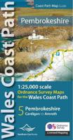
OS Map Books: Wales Coast Path: Pembrokeshire Coast Path Map Atlas | Ordnance Survey ‘Explorer’ Large-scale 1:25,000 maps for the Pembrokeshire Coast in compact book format | Pocket Atlas | Walking Wales | UK Long-Distance Trails | Hiking | Adventure   One of seven handy Ordnance Survey Map Books covering the entire 870 mile/1400 kilometre-long, world-class Wales Coast Path — from Chester in the north to Chepstow in the south.   Enjoy enhanced, large scale (1:25,000) Ordnance Survey Explorer mapping in compact atlas format with all the detailed mapping you need to walk the Pembrokeshire Coast section of the Wales Coast Path.   Continuous, full colour OS mapping covering the Wales Coast Path between Cardigan and Amroth. Contains extracts from large scale Explorer maps OL 35 and OL 36. The enhanced OS 1:25,000 maps are accurate, up-to-date and reliable. Additional map symbols show tea shops, cafes, extra parking, and public toilets.   A brief introduction to Pembrokeshire Coast includes …
17,50

Klanten-reviews van Campergids All the Aires France South | Vicarious Books

Er zijn nog geen beoordelingen voor dit productBen jij de eerste die een review plaatst?

Meer over Campergids All the Aires France South | Vicarious Books

Productomschrijving

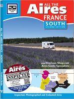
Due to the increased number of Aires entries, All the Aires France is now divided into two volumes: North and South. You are currently looking at the South guide which lists the Aires in southern France only. These books can be purchased individually or as a double deal together.   As the name suggests, All the Aires France South maps and details 1801 dedicated motorhome stopovers in France. It is the only complete French Aires de services guide book available in English. The guidebook enables you to make an informed choice about where to stop and where to stay overnight on your travels in your motorhome or campervan throughout southern France.   All the Aires France South has been revised and updated into its most user-friendly format. All the nearby Aires fall on the same page. This makes it easier to cross reference and select an Aire within an area. Closed Aires are now marked with an X on the maps and are found in a list at the rear of the book. Motorway Aires are marked with a letter on the Aires map and are found in a list at the rear of the book. 440 LPG stations are also listed at the rear of the book.   Included with the book is an All the Aires France fold out route planning map. There are great advantages in having this map because you can see half of France on each side, thus making route planning and French Aires selection easy. The Locator Map has colour-coded regions and all of the Aires in the regions are numbered from 1. The motorway service are also marked on the planning map.   All the Aires France has been researched and published by Vicarious Media.   This is not a translation but is in fact inspected and written by Vicarious Media and is the most comprehensive and up to date Aires guide for France available in any language. Don't be misled by claims on the covers of other French Aires guides that include campsites and France Passion sites in their figures. Vicarious Media is the only company in the world to have inspected every Aire in France. Each inspected French Aire has two accompanying colour images, concise directions with road names, numbers and postcodes, and GPS co-ordinates (POIs) in format: N51°04.896' E001°10.977' that were taken onsite. To assist you in choosing the right Aire in France, service points and parking areas are described, and there are comments about desirability and local amenities including information on: distances to nearby towns, shops and restaurants, green spaces for exercising dogs and children, opportunities for fishing, walking, cycling, and local places of interest.
Productspecificaties

Artikelnummer(s)
Brand
Vicarious Books
Webshop.nl maakt gebruik van cookies. Ga je verder op onze website, ga dan akkoord met het plaatsen van cookies en de verwerking van deze data door ons en vermelde partners.